Home › Navigation

 US
US
 DEde-DE
 CHde-CHUSen-US
 NLnl
NLnl FRfr-FR
 GBen-GB
 AUen-AU
 ATde-DE
 BEen-GB
 CAen-CA
 ZAen-GB
 ITit
ITit PLen-GB
 ESes-ES
 NZen-AU
 RUru
RUru SEsv
SEsv DKen-GB
 SIen-GB
 JPja
JPja NOen-GB
 HKzh-Hant-HK
 HRen-GB
 SKen-GB
 CNzh-Hans-CN
 FIen-GB
 PTpt-PT
 ROen-GB
 BGen-GB
 CZen-GB
 GRen-GB
 IDen-GB
 ILen-GB
 LUen-GB
 HUen-GB
 THen-GB
 TRen-GB
 UAen-GB
 ISen-GB
 KEen-GB
 KRko
KRko LAen-GB
 MDen-GB
 PHen-GB
 SGen-GB
 TZen-GB
 AEen-GB
 AFen-GB
 ALen-GB
 AMen-GB
 AZen-GB
 BAen-GB
 BHen-GB
 BMen-GB
 BNen-GB
 BOes-MX
 BTen-GB
 BWen-GB
 BYen-GB
 CYen-GB
 EEen-GB
 EGen-GB
 FJen-GB
 FMen-GB
 GEen-GB
 GHen-GB
 GWen-GB
 IEen-GB
 INen-GB
 IQen-GB
 JOen-GB
 KGen-GB
 KHen-GB
 KWen-GB
 KZen-GB
 LBen-GB
 LKen-GB
 LTen-GB
 LVen-GB
 LYen-GB
 MAen-GB
 MEen-GB
 MKen-GB
 MMen-GB
 MNen-GB
 MOzh-Hant-HK
 MRen-GB
 MSen-GB
 MTen-GB
 MVen-GB
 MYen-GB
 NGen-GB
 NPen-GB
 NRen-GB
 OMen-GB
 PGen-GB
 PKen-GB
 PWen-GB
 PYes-MX
 QAen-GB
 RSen-GB
 SAen-GB
 SBen-GB
 SZen-GB
 TCen-GB
 TJen-GB
 TMen-GB
 TNen-GB
 TOen-GB
 TTen-GB
 TWzh-Hant-TW
 UGen-GB
 UYen-GB
 UZen-GB
 VGen-GB
 VNen-GB
 VUen-GB
 XKen-GB
 YEen-GB
119 of 119 storefronts
Content in en-US
Content in en-US
Information
Preview 2 platforms
iPhone 6 images




iPad 6 images




What’s New Version 3.4.13
- fixed bug in dashboard
Description
“MapOut saves the day with its intuitive interface for drawing routes and viewing elevation profiles. I’m genuinely impressed by its powerful features!” – Alee, cyclingabout.com
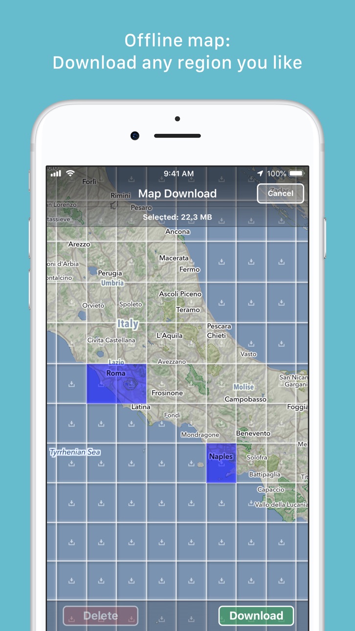
Offline maps covering the entire globe, optimized for iPhone and iPad. As beautiful as a traditional paper map—but far more versatile.
Perfectly tailored for:
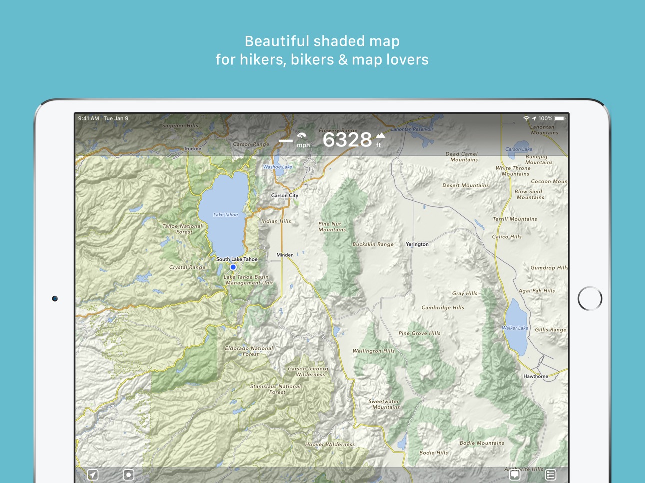
- Hikers: Clear, detailed terrain maps accessible even in the most remote locations, without an internet connection.
- Cyclists: Extensive cycling route network with real-time speed and distance tracking.
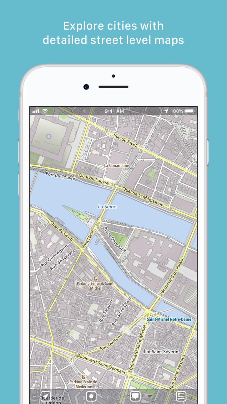
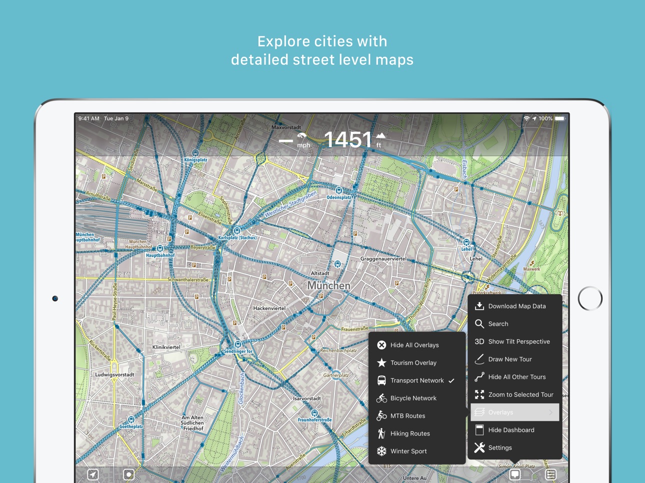
- City Travelers: Detailed city maps complete with essential tourist information.
- Map Enthusiasts: Simply elegant maps that are a pleasure to view.
Innovative 3D Tilt View
- Tilt your device in any direction to vividly explore terrain details. Learn more at [mapout.app](https://mapout.app).
Powerful Offline Search
- Easily find places, streets, mountains, and more—no internet needed.
High-Quality Map Data
- Built upon the OpenStreetMap project, the "Wikipedia of Maps". Contribute your own corrections and additions at OpenStreetMap.org.
- Regularly updated offline maps available for your selected regions.
Effortless Tour Planning
- Draw: Easily create custom routes and waypoints directly on your map. Adjust existing tours or imported GPX files effortlessly.
- Import: Transfer routes to your device via email using a free "MapOut.me" account. Discover countless GPX and KML route files online, ideal for hiking or biking (e.g., gpsies.com).
- Record: Capture your adventures and easily share them with friends.
- Insights: Quickly see vital information for every tour—distance, elevation changes, route profile, and map details.
Superior Map Viewing Experience
- Rapid, hardware-accelerated rendering for smooth navigation.
- Continuous zoom with impeccable clarity at every level.
- Detailed topographical views featuring contour lines and shading.
- Versatile overlays include biking, hiking, skiing routes, sightseeing locations, and public transport networks.
Find comprehensive support and answers in our user manual: https://mapout.app/manual
Map data © OpenStreetMap contributors https://www.openstreetmap.org/copyright
Accessibility
ipadiphonemacrealityDevicetvoswatch
Version history 25 versions
Build 875109791v3.4.132025-05-27 20:24:29
- fixed bug in dashboard
Build 862061805v3.4.122023-12-09 06:07:30
- various bug fixes
Build 853299846v3.4.112022-11-18 16:09:43
- various bug fixes
- iOS 16 adaptations
Build 849759346v3.4.102022-06-03 12:10:56
- various bug fixes
- added new icons for your waypoint markers
Build 843949456v3.4.92021-09-04 12:06:02
- various bug fixes
Build 842132343v3.4.82021-05-09 09:14:47
- various bug fixes
Build 840377204v3.4.72021-02-12 08:54:30
- We have added house numbers (this requires updating the map data on the device)
- various bug fixes
Build 838558596v3.4.62020-11-29 19:48:20
- various bug fixes
- adaptation for new iPhone devices
Build 838247434v3.4.52020-10-17 14:38:46
- various bug fixes (sharing tours, missing elements on map)
Build 837811860v3.4.42020-09-17 10:34:16
- Plan your tour even better: The dashboard now displays estimated walking and cycling times for selected routes in real time
- Tour organizer: For all your tours, walking and cycling times are given. With a tap on the times you can switch between: walking, cycling or the recorded time
- Map improvements and bug fixes
Build 837477588v3.4.32020-08-23 20:17:15
- fixed a crash on some devices during startup
Build 837372226v3.4.22020-08-15 11:32:03
- Optimized manual map rotation behavior
- Added setting to disable manual map rotation altogether
- Minor bug fixes
Build 837181504v3.4.12020-08-03 20:20:52
- fixes some new bugs
3.4:
- Rotate the map freely in any direction you like
- Search has been completely revised: better, search-as-you-type results, distance display and the possibility to add waypoints from the search results
- Improved map style
- Many reported bugs fixed (e.g. export of ZIP files with special characters, dashboard problems and more)
Build 837030693v3.42020-07-29 21:46:36
- Rotate the map freely in any direction you like
- Search has been completely revised: better, search-as-you-type results, distance display and the possibility to add waypoints from the search results
- Improved map style
- Many reported bugs fixed (e.g. export of ZIP files with special characters, dashboard problems and more)
Build 834501518v3.3.62020-01-28 17:27:47
- minor bug fixes
Build 834101117v3.3.52019-12-23 21:44:46
- minor bug fixes
Build 833910650v3.3.42019-12-07 14:12:28
- fixed some altitude display related bugs
Build 833828601v3.3.32019-12-04 19:47:07
- improved ascent/descent calculation
- improved recording of tours
- fixed some bugs
Build 833339085v3.3.22019-10-25 23:48:24
- Various bug fixes
Build 832956084v3.3.12019-09-28 10:44:47
- Various bug fixes
Build 832819138v3.32019-09-19 16:07:46
By popular request: In the tour organizer you can now make a multi-selection of tours and share, edit or move several elements in one go
- Added icons for mines, quarries and springs
- Improvements in the mountain bike overlay, supplemented by a dot pattern to indicate difficulty
- Enhancements to contour lines and text labels
- iOS 13 adjustments
Build 832413460v3.2.42019-08-16 23:35:54
- Added icons for fireplaces and playgrounds
- Bug fixes (mostly in export / backup)
Build 832242041v3.2.32019-08-03 19:40:26
- Bulk export / backup of all tours (Settings – Tour Organizer – Backup Tours)
- Minor bug fixes
Build 831963161v3.2.22019-07-11 12:48:47
- Improvements for Dutch cyclists
- Workaround for Garmin Connect interoperability
- New round of bug fixes
Build 831913591v3.2.12019-07-06 20:04:18
- Many reported bugs have been fixed
- Added new setting to permanently display map scale
Version 3.2
- Colors! Select different colors for your waypoints and tours
- Choose unique icons for your waypoints
- Drawing/routing tours has been enhanced: You can now choose between different routing options (hiking, biking, shortest and freeform) and select the street width and elevation preference
- Many improvements to our map style: We now added much more icons for rural areas to find drinking water, picnic sites, shelters/huts, caves, etc.
- Overlays are now selectable directly on the main menu
Price history by region
Currency
Show
Columns
Search
Availability 119 of 119 storefronts
| Region | Language | Price | Ratings | Avg | Version |
|---|---|---|---|---|---|
| DE | de-DE | EUR 5.99 | 778 | 4.8 | 3.4.13 |
| CH | de-CH | CHF 5 | 516 | 4.9 | 3.4.13 |
| US | en-US | USD 4.99 | 136 | 4.9 | 3.4.13 |
| NL | nl | EUR 5.99 | 108 | 4.9 | 3.4.13 |
| FR | fr-FR | EUR 5.99 | 105 | 4.9 | 3.4.13 |
| GB | en-GB | GBP 4.99 | 104 | 4.9 | 3.4.13 |
| AU | en-AU | AUD 7.99 | 70 | 4.6 | 3.4.13 |
| AT | de-DE | EUR 5.99 | 50 | 4.9 | 3.4.13 |
| BE | en-GB | EUR 5.99 | 39 | 5.0 | 3.4.13 |
| CA | en-CA | CAD 6.99 | 32 | 5.0 | 3.4.13 |
| ZA | en-GB | ZAR 99.99 | 17 | 4.6 | 3.4.13 |
| IT | it | EUR 5.99 | 16 | 4.6 | 3.4.13 |
| PL | en-GB | PLN 24.99 | 16 | 4.6 | 3.4.13 |
| ES | es-ES | EUR 5.99 | 15 | 4.7 | 3.4.13 |
| NZ | en-AU | NZD 9.99 | 14 | 4.9 | 3.4.13 |
| RU | ru | RUB 449 | 10 | 4.9 | 3.4.13 |
| SE | sv | SEK 69 | 9 | 5.0 | 3.4.13 |
| DK | en-GB | DKK 39 | 7 | 4.6 | 3.4.13 |
| SI | en-GB | EUR 5.99 | 7 | 5.0 | 3.4.13 |
| JP | ja | JPY 800 | 6 | 5.0 | 3.4.13 |
| NO | en-GB | NOK 59 | 6 | 5.0 | 3.4.13 |
| HK | zh-Hant-HK | HKD 38 | 5 | 5.0 | 3.4.13 |
| HR | en-GB | EUR 5.99 | 5 | 5.0 | 3.4.13 |
| SK | en-GB | EUR 5.99 | 5 | 4.8 | 3.4.13 |
| CN | zh-Hans-CN | CNY 38 | 4 | 5.0 | 3.4.13 |
| FI | en-GB | EUR 5.99 | 4 | 5.0 | 3.4.13 |
| PT | pt-PT | EUR 5.99 | 4 | 5.0 | 3.4.13 |
| RO | en-GB | RON 29.99 | 4 | 5.0 | 3.4.13 |
| BG | en-GB | EUR 5.99 | 3 | 5.0 | 3.4.13 |
| CZ | en-GB | CZK 129 | 3 | 5.0 | 3.4.13 |
| GR | en-GB | EUR 5.99 | 3 | 5.0 | 3.4.13 |
| ID | en-GB | IDR 89000 | 3 | 4.7 | 3.4.13 |
| IL | en-GB | ILS 17.9 | 3 | 4.7 | 3.4.13 |
| LU | en-GB | EUR 5.99 | 3 | 5.0 | 3.4.13 |
| HU | en-GB | HUF 1990 | 2 | 5.0 | 3.4.13 |
| TH | en-GB | THB 199 | 2 | 5.0 | 3.4.13 |
| TR | en-GB | TRY 249.99 | 2 | 3.0 | 3.4.13 |
| UA | en-GB | USD 5.99 | 2 | 5.0 | 3.4.13 |
| IS | en-GB | USD 5.99 | 1 | 5.0 | 3.4.13 |
| KE | en-GB | USD 5.99 | 1 | 5.0 | 3.4.13 |
| KR | ko | KRW 7700 | 1 | 5.0 | 3.4.13 |
| LA | en-GB | USD 4.99 | 1 | 4.0 | 3.4.13 |
| MD | en-GB | USD 5.99 | 1 | 5.0 | 3.4.13 |
| PH | en-GB | PHP 299 | 1 | 5.0 | 3.4.13 |
| SG | en-GB | SGD 6.98 | 1 | 4.0 | 3.4.13 |
| TZ | en-GB | TZS 14900 | 1 | 5.0 | 3.4.13 |
| AE | en-GB | AED 19.99 | 0 | — | 3.4.13 |
| AF | en-GB | USD 4.99 | 0 | — | 3.4.13 |
| AL | en-GB | USD 5.99 | 0 | — | 3.4.13 |
| AM | en-GB | USD 5.99 | 0 | — | 3.4.13 |
| AZ | en-GB | USD 5.99 | 0 | — | 3.4.13 |
| BA | en-GB | EUR 5.99 | 0 | — | 3.4.13 |
| BH | en-GB | USD 4.99 | 0 | — | 3.4.13 |
| BM | en-GB | USD 4.99 | 0 | — | 3.4.13 |
| BN | en-GB | USD 4.99 | 0 | — | 3.4.13 |
| BO | es-MX | USD 4.99 | 0 | — | 3.4.13 |
| BT | en-GB | USD 4.99 | 0 | — | 3.4.13 |
| BW | en-GB | USD 4.99 | 0 | — | 3.4.13 |
| BY | en-GB | USD 5.99 | 0 | — | 3.4.13 |
| CY | en-GB | EUR 5.99 | 0 | — | 3.4.13 |
| EE | en-GB | EUR 5.99 | 0 | — | 3.4.13 |
| EG | en-GB | EGP 249.99 | 0 | — | 3.4.13 |
| FJ | en-GB | USD 4.99 | 0 | — | 3.4.13 |
| FM | en-GB | USD 4.99 | 0 | — | 3.4.13 |
| GE | en-GB | USD 5.99 | 0 | — | 3.4.13 |
| GH | en-GB | USD 5.99 | 0 | — | 3.4.13 |
| GW | en-GB | USD 4.99 | 0 | — | 3.4.13 |
| IE | en-GB | EUR 5.99 | 0 | — | 3.4.13 |
| IN | en-GB | INR 499 | 0 | — | 3.4.13 |
| IQ | en-GB | USD 4.99 | 0 | — | 3.4.13 |
| JO | en-GB | USD 4.99 | 0 | — | 3.4.13 |
| KG | en-GB | USD 4.99 | 0 | — | 3.4.13 |
| KH | en-GB | USD 4.99 | 0 | — | 3.4.13 |
| KW | en-GB | USD 4.99 | 0 | — | 3.4.13 |
| KZ | en-GB | KZT 2990 | 0 | — | 3.4.13 |
| LB | en-GB | USD 4.99 | 0 | — | 3.4.13 |
| LK | en-GB | USD 4.99 | 0 | — | 3.4.13 |
| LT | en-GB | EUR 5.99 | 0 | — | 3.4.13 |
| LV | en-GB | EUR 5.99 | 0 | — | 3.4.13 |
| LY | en-GB | USD 4.99 | 0 | — | 3.4.13 |
| MA | en-GB | USD 4.99 | 0 | — | 3.4.13 |
| ME | en-GB | EUR 4.99 | 0 | — | 3.4.13 |
| MK | en-GB | USD 4.99 | 0 | — | 3.4.13 |
| MM | en-GB | USD 4.99 | 0 | — | 3.4.13 |
| MN | en-GB | USD 4.99 | 0 | — | 3.4.13 |
| MO | zh-Hant-HK | USD 4.99 | 0 | — | 3.4.13 |
| MR | en-GB | USD 4.99 | 0 | — | 3.4.13 |
| MS | en-GB | USD 4.99 | 0 | — | 3.4.13 |
| MT | en-GB | EUR 5.99 | 0 | — | 3.4.13 |
| MV | en-GB | USD 4.99 | 0 | — | 3.4.13 |
| MY | en-GB | MYR 22.9 | 0 | — | 3.4.13 |
| NG | en-GB | NGN 7900 | 0 | — | 3.4.13 |
| NP | en-GB | USD 5.99 | 0 | — | 3.4.13 |
| NR | en-GB | USD 4.99 | 0 | — | 3.4.13 |
| OM | en-GB | USD 4.99 | 0 | — | 3.4.13 |
| PG | en-GB | USD 4.99 | 0 | — | 3.4.13 |
| PK | en-GB | PKR 1300 | 0 | — | 3.4.13 |
| PW | en-GB | USD 4.99 | 0 | — | 3.4.13 |
| PY | es-MX | USD 4.99 | 0 | — | 3.4.13 |
| QA | en-GB | QAR 19.99 | 0 | — | 3.4.13 |
| RS | en-GB | EUR 5.99 | 0 | — | 3.4.13 |
| SA | en-GB | SAR 19.99 | 0 | — | 3.4.13 |
| SB | en-GB | USD 4.99 | 0 | — | 3.4.13 |
| SZ | en-GB | USD 4.99 | 0 | — | 3.4.13 |
| TC | en-GB | USD 4.99 | 0 | — | 3.4.13 |
| TJ | en-GB | USD 4.99 | 0 | — | 3.4.13 |
| TM | en-GB | USD 4.99 | 0 | — | 3.4.13 |
| TN | en-GB | USD 4.99 | 0 | — | 3.4.13 |
| TO | en-GB | USD 4.99 | 0 | — | 3.4.13 |
| TT | en-GB | USD 4.99 | 0 | — | 3.4.13 |
| TW | zh-Hant-TW | TWD 150 | 0 | — | 3.4.13 |
| UG | en-GB | USD 5.99 | 0 | — | 3.4.13 |
| UY | en-GB | USD 4.99 | 0 | — | 3.4.13 |
| UZ | en-GB | USD 4.99 | 0 | — | 3.4.13 |
| VG | en-GB | USD 4.99 | 0 | — | 3.4.13 |
| VN | en-GB | VND 149000 | 0 | — | 3.4.13 |
| VU | en-GB | USD 4.99 | 0 | — | 3.4.13 |
| XK | en-GB | EUR 5.99 | 0 | — | 3.4.13 |
| YE | en-GB | USD 4.99 | 0 | — | 3.4.13 |
Reviews 30 reviews · US
★★★★★
Best offline map
I love this app for hiking and such, I just wish there was a dark mode.
𝕕𝕣𝕠𝕟𝕖2026-05-05
★★★★★
The best
This app got me through a year and a half of motorcycling through Latin America. I was recommended it by a bicyclist on a similar trip, and now I recommend it to everyone I can!
ggiesa2026-03-21
★★★★★
MapOUT
Map out doesn’t drain the battery rapidly like other navigation programs awesome app
CajunBiker0012026-02-01
★★★★★
Best mapping app
I am so happy to have purchased this app. It is the most perfect hiking/biking mapping app i’ve found. No subscriptions. Great Offline support. It has everything you need and nothing you don’t.
SpoonlessCorey2025-10-19
★★★★★
Great app
This is just what I was looking for, planning scout hikes is so much easier and encourages the kids to use navigation on paper maps.
Cobraman5022025-10-18
★★★★★
Goto app
I love this app… it’s my goto route planning software as it is so intuitive to use. I mainly use it to plan bicycle routes and to some extent motorcycle routes. I would love to see a car/motorcycle route option that would keep me on the main roads rather than divert me on to side roads.
Thanks again for a great product.
Trigeek002025-08-31
★★★★★
Great app!
Great app for building hiking, biking or off-road motorcycle routes. Intuitive and easy to learn. Love it!
MelyssaT!2025-08-19
★★★★★
Great for hiking, could be better for cycling
I always use MapOut for planning for hiking routes. It's great at showing all the hiking trails and the recommended hiking routes. Its elevation estimation is quite accurate. I sometimes consult books and other sources for hiking route suggestions and it's a breeze to create a tour in MapOut. A one-time purchase is so much better than other subscription-based apps since I only hike ~20 times per year.
Using MapOut for cycling is a bit of a worse experience. Well for one road cyclists need paved roads, gravel cyclists can tolerate some unpaved roads, but I couldn't find a way for MapOut to di
WannabeUXConnoisseur2025-07-18
★★★★★
Only app I use for hiking!
Why pay for pointless subscriptions like AllTrails for features you don’t even need and a glitchy, clunky app? I love that you buy this one time and it just has the functionality you need, with quick loading and easy area downloads. Used this app exclusively to navigate the sawtooth wilderness loop, glacier north circle, and Uinta Highline trails, as well as numerous shorter trips and day hikes. Truly excellent app.
Unpleased2025-07-09
★★★★★
Incredible for cycle touring
While it takes some time to learn all the controls, this app makes my unplanned cycle tours so much easier! I draw routes into the app and export to the Coros app and then to my cycle computer. If I had one request, it would be to search for places by their icon. For example, search for water (water droplet) or camping sites (tent icon).
Will47462025-07-05
★★★★★
Best program ever
Worth getting an iPhone for. Beautiful, readable maps. Visually superior to anything since the days of printed maps. Can be used offline. Indispensable when cell phone service is weak. Better than pricey subscription services or free ad-supported maps.
Amazing!
pait2025-05-27
★★★★★
Great little app
Best app investment in a long time. This just works and is simple to use. Good to have such a good alternative to subscription based map services
Gaetmuche2025-05-22
★★★★★
Doesn’t work, map won’t load if you zoom in too far
Not only does this app have a horrible user interface, you can only zoom into the map so far. It’s too zoomed out to make a route, even if you think you’re using the tool incorrectly there’s no instructions. I found a YouTube video but the sound doesn’t work, it doesn’t show any type of trail, even if you wanted to create your own trail, 1: there no where to save it, and 2: it’s so zoomed out that your just making a random path on a mountain. It’s completely useless😅 you may as well toss 5 bucks down your toilet, it’s a complete scam. Kind of smart on their part, good way to make a quick buck
Streamline Connections2025-03-27
★★★★★
Amazing off-grid mapping app!
MapOut is certainly one of the best mapping apps out there. I recommend it to all of my friends. If I were and android person, I would buy an iPhone just to get MapOut - it is that good. I’ve been using it for years, and use it every day because we adventure all the time.
Best features? You can draw a route off line by dragging your finger. This feature works well, and you can choose different ways to route (straight line, bike, walk, etc). Also, you can measure along a route. Just highlight the route and it will show distance between point a and b ALONG the route. I haven’t seen other app
JMLCMark2025-03-21
★★★★★
Perfect
I’ve tried several GPS apps over the last 15 years for bike, hike, backpacking and backcountry snowboarding and this is the best designed app by far!
ceepod042024-12-19
★★★★★
Excellent offline mapping
Best app we’ve found for offline mapping when hiking or cycling outside of cellular coverage. Using Open Street Maps as the mapping source results in very efficient map storage and no ongoing subscription costs.
This is a great alternative for those of us who have been driven away from Gaia Maps by ever increasing subscription costs and renewal policies.
Leann M2024-10-25
★★★★★
Out of town
This app is perfect for traveling. Especially if you have 0 cell service. Also good for camping and everything else. I tend to use it in Honduras when I visit.
Prboyce2024-10-06
★★★★★
I never review anything
Seriously. This is the best bike touring and hike mapping app ever. I regularly meet tourists on the road that show me whatever mapping thing they use, and it’s never even close to as good. MapOut would be amazing at any price. At this price it’s just a steal. I’d 100% pay again for a Mac version so I could do all my route planning in it.
GuyUnsuallyQuiet2024-07-25
★★★★★
Must have for any adventurer
I don’t know why this app is so hidden. If you hike, bike or paddle, this app is a must.
phaskins2024-06-16
★★★★★
Stable and reliable map app.
I’ve been using this app for 5 years +. I travel world wide and can download a map for any location for offline use or where cell roaming is costly. It’s GPS reliability is stable and speed and elevation are accurate. I trail hike a lot and it is invaluable in low cell reception areas. Its maps are world coverage. Absolutely must need for all map uses. GREAT!!
VGD602024-06-09
★★★★★
Great app. Needs Watch support
This app does amazing stuff. I finally purchased it after friends described it. My only gripe is that it doesn’t support the Apple Watch. Am I the only one who thinks this would be terrific? A tap on the wrist when approaching a waypoint or junction. Or when you wander off the route. Or when your heart rate exceeds a set point. How far to the top of the hill? How steep is this trail I am hiking? So much info to be had without having to hold your phone in your hand.
disappointed mapper2024-05-30
★★★★★
Almost perfect
I do a lot of driving on backroads, and this is the best app I’ve used for downloading offline maps, and recording tracks. Simple and clean user experience. Would be perfect (5 stars) if it had CarPlay support.
dcmmngs2023-12-13
★★★★★
Outstanding app
This app is outstanding. The best map app I have…. Nothing else comes close.
Jeffrobo2023-09-22
★★★★★
Best app on my phone
I have been using MapOut for years to track hikes and paddle trips. It helps me find alternate routes, track mileage, and keep track of where I’ve already been when exploring an area repeatedly. I love being able to use it offline without eating network or battery. The only tiny complaint is that if you’re somewhere very steep, like the Alps, it has a hard time holding a steady GPS perspective and then draws a zigzag, increasing your recorded mileage. But this is a tiny thing relative to overall great value without a subscription.
AP949412023-05-18
★★★★★
Pretty good
This app seems to hit a load of points that are important to me - distance, elevation. It has a pretty cool 3d option to look at the terrain.
It is relatively easy to use and I found it downloads the Maps I need relatively fast and big enough area that it is easy to nab the maps before going off the network.
I am still slightly stumped when the app will be able to select a trail- it doesn’t seem to work unless one is currently on the trail, but that sometimes does seem to work either 🤷♂️
A few things I would like:
Be able to enter some coordinates and go to that spot.
And
One thing th
dougXN2022-10-31
★★★★★
Could this be the best ever
been using ride with GPS for 4 years , but so far this blows that away, and I haven’t seemed to scratch the surface of it’s intuitive interface. Thankyou
Glooser2022-10-01
★★★★★
Brilliant!
I think after 10 years of using iOS, this is the first app I have reviewed. I have several tools I use for navigating while hiking and biking, but there are several standout features of MapOut.
First, offline maps are a must, and the OpenStreetMaps are pretty good, and include topography and many trails/paths in addition to roads. Second, .GPX import works very well, and routes are easily named and organized. Graphs for elevation of the route are clear. Third, the method of creating new routes is genius. Double clicking sets the start point, and then you drag over map features (roads, trails,
Thew32022-07-03
★★★★★
Really great offline features
I purchased this because nothing else really worked well for areas where there is spotty cell reception. I do a lot of backcountry trail runs and typically use something like Strava or Google Maps in offline mode for general geolocation. Strava doesn’t work without a cell signal, and frequently tries to close the app that I’ve had open, at which point the route is gone is cell signal is unavailable. Google Maps offline is just not really very good at all, not detailed enough, though it does show your spot on a map.
MapOut is 100% offline downloadable with detailed trails and extra abilities
Lolfhdhrff362021-10-12
★★★★★
Absolutely love MapOut
Though my iPad plus protective case weighs a couple or pounds, MapOut is always in my backpack. The ability to zoom in down to a foot accuracy (it seems) makes it easy to avoid going down a wrong path. Accurate distance and elevation data during a hike is also great to have. I color code all my hikes by year to see when and where I did a hike on the map.
BloodySushiTheGreat2021-07-30
Change log 29 changes · US
✎
releaseNotes updated
- fixed bug in dashboard
✎
description updated
“MapOut saves the day with its intuitive interface for drawing routes and viewing elevation profiles. I’m genuinely impressed by its powerful features!” – Alee,
✎
subtitle updated
Beautiful hiking & cycling map
✎
name updated
MapOut
◆
Version 3.4.13 released
- fixed bug in dashboard
◆
Version 3.4.12 released
- various bug fixes
◆
Version 3.4.11 released
- various bug fixes
- iOS 16 adaptations
◆
Version 3.4.10 released
- various bug fixes
- added new icons for your waypoint markers
◆
Version 3.4.9 released
- various bug fixes
◆
Version 3.4.8 released
- various bug fixes
◆
Version 3.4.7 released
- We have added house numbers (this requires updating the map data on the device)
- various bug fixes
◆
Version 3.4.6 released
- various bug fixes
- adaptation for new iPhone devices
◆
Version 3.4.5 released
- various bug fixes (sharing tours, missing elements on map)
◆
Version 3.4.4 released
- Plan your tour even better: The dashboard now displays estimated walking and cycling times for selected routes in real time
- Tour organizer: For all your tours, walking and cycling times are given. With a tap on the times you can switch
◆
Version 3.4.3 released
- fixed a crash on some devices during startup
◆
Version 3.4.2 released
- Optimized manual map rotation behavior
- Added setting to disable manual map rotation altogether
- Minor bug fixes
◆
Version 3.4.1 released
- fixes some new bugs
3.4:
- Rotate the map freely in any direction you like
- Search has been completely revised: better, search-as-you-type results, distance display and the possibility to add waypoints from the search results
- Improved
◆
Version 3.4 released
- Rotate the map freely in any direction you like
- Search has been completely revised: better, search-as-you-type results, distance display and the possibility to add waypoints from the search results
- Improved map style
- Many reported b
◆
Version 3.3.6 released
- minor bug fixes
◆
Version 3.3.5 released
- minor bug fixes
◆
Version 3.3.4 released
- fixed some altitude display related bugs
◆
Version 3.3.3 released
- improved ascent/descent calculation
- improved recording of tours
- fixed some bugs
◆
Version 3.3.2 released
- Various bug fixes
◆
Version 3.3.1 released
- Various bug fixes
◆
Version 3.3 released
By popular request: In the tour organizer you can now make a multi-selection of tours and share, edit or move several elements in one go
- Added icons for mines, quarries and springs
- Improvements in the mountain bike overlay, supplemented
◆
Version 3.2.4 released
- Added icons for fireplaces and playgrounds
- Bug fixes (mostly in export / backup)
◆
Version 3.2.3 released
- Bulk export / backup of all tours (Settings – Tour Organizer – Backup Tours)
- Minor bug fixes
◆
Version 3.2.2 released
- Improvements for Dutch cyclists
- Workaround for Garmin Connect interoperability
- New round of bug fixes
◆
Version 3.2.1 released
- Many reported bugs have been fixed
- Added new setting to permanently display map scale
Version 3.2
- Colors! Select different colors for your waypoints and tours
- Choose unique icons for your waypoints
- Drawing/routing tours has been