Home › Navigation

 TR
TR
 RUru
RUru EEen-GB
 SEsv
SEsv THen-GB
 USen-US
 AUen-AU
 LUen-GB
 LVen-GB
 AFen-GB
 AGen-GB
 ALen-GB
 AOen-GB
 ARes-MX
 AZen-GB
 BAen-GB
 BBen-GB
 BFen-GB
 BGen-GB
 BJen-GB
 BMen-GB
 BOes-MX
 BRpt-BR
 BSen-GB
 BWen-GB
 BYen-GB
 CDen-GB
 CGen-GB
 CIfr-FR
 CLes-MX
 CMfr-FR
 COes-MX
 CRes-MX
 CVen-GB
 CYen-GB
 DKen-GB
 DMen-GB
 DOes-MX
 DZen-GB
 ECes-MX
 EGen-GB
 ESes-ES
 FJen-GB
 GAfr-FR
 GDen-GB
 GEen-GB
 GHen-GB
 GMen-GB
 GRen-GB
 GTes-MX
 GWen-GB
 GYen-GB
 HNes-MX
 HRen-GB
 IDen-GB
 IEen-GB
 INen-GB
 JMen-GB
 KEen-GB
 KRko
KRko KYen-GB
 LCen-GB
 LKen-GB
 LRen-GB
 LTen-GB
 LYen-GB
 MAen-GB
 MDen-GB
 MEen-GB
 MGen-GB
 MKen-GB
 MLen-GB
 MOzh-Hant-HK
 MRen-GB
 MSen-GB
 MTen-GB
 MUen-GB
 MWen-GB
 MXes-MX
 MYen-GB
 MZen-GB
 NAen-GB
 NEen-GB
 NGen-GB
 NIes-MX
 NPen-GB
 NZen-AU
 PAes-MX
 PEes-MX
 PHen-GB
 PKen-GB
 PYes-MX
 RSen-GB
 SGen-GB
 SIen-GB
 SLen-GB
 SNen-GB
 SRen-GB
 STen-GB
 SVes-MX
 SZen-GB
 TCen-GB
 TNen-GBTRen-GB
 TTen-GB
 TWzh-Hant-TW
 TZen-GB
 UAen-GB
 UGen-GB
 UYen-GB
 VCen-GB
 VEes-MX
 VGen-GB
 VNen-GB
 XKen-GB
 ZMen-GB
 ZWen-GB
116 of 116 storefronts
Content in en-US
Content in en-US
Information
Preview 2 platforms
iPhone 5 images



iPad 6 images



What’s New Version 5.0.2
Lokimaps 5.0.2 continues the transition from Topo maps - Finland to Lokimaps, with improved branding and polish throughout the App Store experience.
This update fixes World Topo predownloads, so areas using that map can be saved for offline use again.
This update also keeps the big 5.0 improvements:
- Same trusted app, now with the Lokimaps name.
- Choose one included base map for Finland, Sweden or Norway.
- Lokimaps PRO unlocks all other maps, layers and PRO features with one subscription.
- Multi-map mode lets you show several base maps together, especially useful around Nordic border regions.
- Finnish property borders are now a separate layer, so they can be used on top of any map.
Description
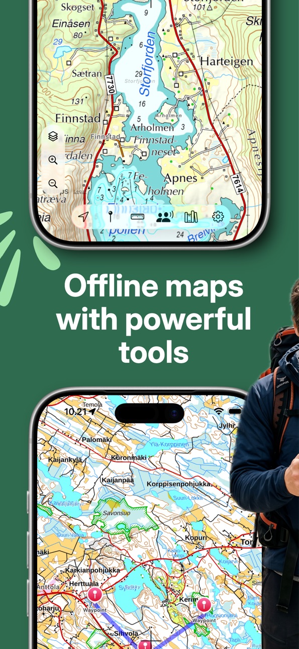
Lokimaps is a Nordic topo map app for trips where a road map is not enough. Use it for hiking, hunting, fishing, paddling, skiing, cycling, cabin life and route planning across Finland, Sweden and Norway.
Start with one included official topographic base map: Finland, Sweden or Norway. Lokimaps PRO unlocks the full map catalog, offline downloads, custom map layers and location sharing.
Maps and layers
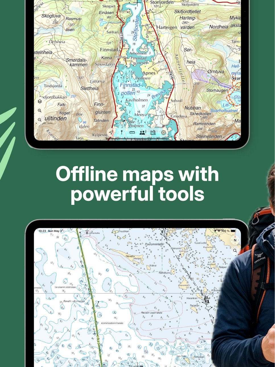
- Official topographic maps for Finland, Sweden and Norway in one app
- Multi-map mode for showing several base maps at once, useful near borders and during mixed-map planning
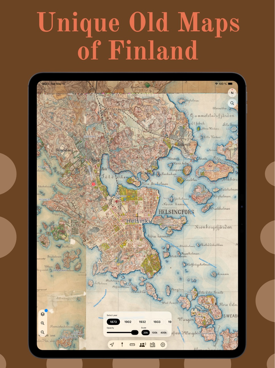
- Finnish aerial imagery, historical maps from 1863-2020, property borders and nautical charts
- Norwegian nautical chart raster data for coastal planning
- Worldwide Thunderforest Outdoor maps based on OpenStreetMap
- Your own compatible WMS/WMTS base maps and WMS/WMTS/WFS overlay layers
- AI Agent support for finding compatible map services
Field tools
- Offline downloads for supported maps, so planned areas stay available without mobile coverage
- Tracks, routes and waypoints with GPX import and export
- Folders for organizing trips, routes and saved places
- Ruler for measuring distance directly on the map
- Base camp and point-to-point navigation back to saved places
- Address, place and coordinate search with recents and autocomplete
- Coordinate display, copy and search in WGS84 DD/DDM/DMS, ETRS-TM35FIN, MGRS, UTM/ETRS89, SWEREF 99 TM and ETRS-GK
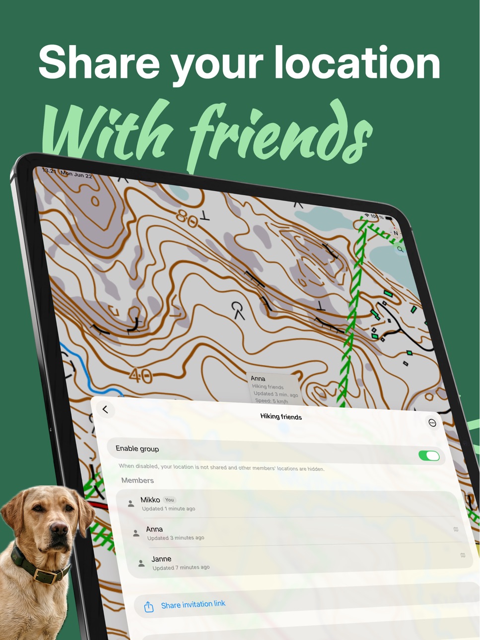
- Location sharing with trip companions
- Oma riista hunting areas in Finland as offline map layers
Notes
Some maps, layers and tools require Lokimaps PRO. Continued GPS tracking in the background can reduce battery life. Nautical chart layers are provided for planning and reference only, not for navigational use.
Terms of Use: https://www.lokimaps.com/terms
In-App Purchases TR pricing
Historic maps - Finland Subscription
Historic maps Finland · Yearly—
Nautical chart - Finland Subscription
Yearly—
PRO Subscription
Yearly—
Monthly—
Topo maps - Norway Subscription
Topo maps Norway · Yearly—
Topo maps - Sweden Subscription
Yearly—
Topo maps - World Subscription
Yearly—
Topo maps with premise - Finland Subscription
Topo maps with premise · Yearly—
Capabilities
In-App Purchases
Accessibility
ipadiphonemacrealityDevicetvoswatch
Version history 25 versions
Build 887520906v5.0.22026-07-04 05:18:12
Lokimaps 5.0.2 continues the transition from Topo maps - Finland to Lokimaps, with improved branding and polish throughout the App Store experience.
This update fixes World Topo predownloads, so areas using that map can be saved for offline use again.
This update also keeps the big 5.0 improvements:
- Same trusted app, now with the Lokimaps name.
- Choose one included base map for Finland, Sweden or Norway.
- Lokimaps PRO unlocks all other maps, layers and PRO features with one subscription.
- Multi-map mode lets you show several base maps together, especially useful around Nordic border regions.
- Finnish property borders are now a separate layer, so they can be used on top of any map.
Build 887421762v5.0.12026-06-26 22:54:06
Lokimaps 5.0.1 continues the transition from Topo maps - Finland to Lokimaps, with improved branding and polish throughout the App Store experience.
This update also keeps the big 5.0 improvements:
- Same trusted app, now with the Lokimaps name.
- Choose one included base map for Finland, Sweden or Norway.
- Lokimaps PRO unlocks all other maps, layers and PRO features with one subscription.
- Multi-map mode lets you show several base maps together, especially useful around Nordic border regions.
- Finnish property borders are now a separate layer, so they can be used on top of any map.
Build 886353114v5.0.02026-06-24 19:04:28
New in this update:
- A clearer map structure: choose one included base map for Finland, Sweden or Norway.
- Lokimaps PRO now unlocks all other maps, layers and PRO features with one subscription.
- Multi-map mode lets you show several base maps together, especially useful around Nordic border regions.
- The Sweden topo map is more detailed, with two additional supported zoom levels.
- Finnish property borders are now a separate layer, so they can be used on top of any map.
Build 886030729v4.3.02026-05-31 18:18:22
New in this update:
- Multi-map mode: show several maps at the same time. This is especially useful in Nordic border regions, where Finland, Sweden, and Norway topo maps can now be used together.
- The Sweden base map is more detailed, with two additional supported zoom levels.
- Finnish property borders are now a separate layer, so they can be used on top of any map instead of only the Finnish topo map.
Build 885819449v4.2.02026-05-20 23:18:54
Recent updates include:
- Historic maps of Finland (Vanhat kartat - Suomi), with old map layers from across Finland.
- New coordinate systems for the map and coordinate search: MGRS, UTM / ETRS89, SWEREF 99 TM, and ETRS-GK.
- Live Activity support for track recording.
- Sorting for bookmarks.
Build 885283113v4.1.02026-05-12 23:05:06
New: Historic maps for Finland.
More than 30,000 historic maps from 1863-2020 can now be shown on top of the current map. Pick a year, adjust opacity, and compare how the landscape has changed right on the map.
Build 884774071v4.0.02026-05-03 19:11:58
Maastokartta is back, this time properly rebuilt.
This update took a while, and we're sorry for the wait. The app has been rebuilt in large part: the familiar maps and tools are still here, but the experience is now clearer and faster on modern devices.
A few visible changes:
- Offline map downloads now have their own screen, making progress easier to follow
- Completely rebuilt GPX import and export
- Track, navigation, and ruler distances now follow your unit settings
- Search has been reworked with autocomplete and recent searches
- The Details button for tracks now opens the correct detail view
- New feature: location sharing between trip companions, now even safer with end-to-end encryption
Build 875791967v3.7.22025-06-22 22:27:49
Fixed a bug that caused map of Sweden not to load correctly
Build 875544180v3.7.12025-06-12 20:16:42
Fixed a bug that prevented the loading of maps for Norway.
Build 871140744v3.7.02024-12-15 04:59:00
- Norway topo map fixed
- Location sharing removed because it didn't work reliably anymore
Build 863684731v3.6.82024-02-10 19:55:09
Minor updates
Build 848160937v3.6.72022-07-06 23:54:27
Minor improvements
Build 846273262v3.6.62021-12-30 13:42:30
Finland ocean map fixed
Build 842042228v3.6.52021-05-23 19:04:15
All 3rd party analytics removed
Build 839752407v3.6.42020-12-22 01:39:44
Finland ocean maps fixed
Build 838786527v3.6.32020-11-12 18:03:43
Minor improvements
Build 837029695v3.6.22020-07-28 18:24:37
- Finnish ocean maps loads faster
Build 837007805v3.6.12020-07-26 19:59:45
- Faster map loading
- Heading arrow
- iPad bug fixes
Build 836963742v3.6.02020-07-23 20:37:25
- Improved GPX handling
- Basecamp feature improvements
- Better compatibilty with dark mode
Build 836058120v3.5.12020-05-22 19:09:09
Ruler improvements
Build 835502665v3.5.02020-05-03 18:01:43
- Ruler and pointer tool usability improved
- Several under the hood improvements for future features
Build 835363270v3.4.02020-04-04 17:58:38
Topo maps available now for the whole world powered by Thunderforest outdoor map!
Build 835311397v3.3.62020-03-30 02:46:56
Minor improvements
Build 835301044v3.3.52020-03-28 15:53:04
Minor improvements
Build 835009979v3.3.42020-03-23 22:18:07
Pointer shows elevation of the place again!
Price history by region
Currency
Show
Columns
Search
Availability 116 of 116 storefronts
| Region | Language | Price | Ratings | Avg | Version |
|---|---|---|---|---|---|
| RU | ru | RUB 249 | 5 | 4.6 | 5.0.2 |
| EE | en-GB | EUR 2.99 | 3 | 5.0 | 5.0.2 |
| SE | sv | SEK 39 | 2 | 4.5 | 5.0.2 |
| TH | en-GB | THB 99 | 2 | 5.0 | 5.0.2 |
| US | en-US | USD 2.99 | 2 | 4.5 | 5.0.2 |
| AU | en-AU | AUD 4.99 | 1 | 2.0 | 5.0.2 |
| LU | en-GB | EUR 2.99 | 1 | 4.0 | 5.0.2 |
| LV | en-GB | EUR 2.99 | 1 | 5.0 | 5.0.2 |
| AF | en-GB | USD 2.99 | 0 | — | 5.0.2 |
| AG | en-GB | USD 2.99 | 0 | — | 5.0.2 |
| AL | en-GB | USD 3.99 | 0 | — | 5.0.2 |
| AO | en-GB | USD 2.99 | 0 | — | 5.0.2 |
| AR | es-MX | USD 2.99 | 0 | — | 5.0.2 |
| AZ | en-GB | USD 3.99 | 0 | — | 5.0.2 |
| BA | en-GB | EUR 2.99 | 0 | — | 5.0.2 |
| BB | en-GB | USD 3.99 | 0 | — | 5.0.2 |
| BF | en-GB | USD 2.99 | 0 | — | 5.0.2 |
| BG | en-GB | EUR 2.99 | 0 | — | 5.0.2 |
| BJ | en-GB | USD 3.99 | 0 | — | 5.0.2 |
| BM | en-GB | USD 2.99 | 0 | — | 5.0.2 |
| BO | es-MX | USD 2.99 | 0 | — | 5.0.2 |
| BR | pt-BR | BRL 19.9 | 0 | — | 5.0.2 |
| BS | en-GB | USD 2.99 | 0 | — | 5.0.2 |
| BW | en-GB | USD 2.99 | 0 | — | 5.0.2 |
| BY | en-GB | USD 3.99 | 0 | — | 5.0.2 |
| CD | en-GB | USD 2.99 | 0 | — | 5.0.2 |
| CG | en-GB | USD 2.99 | 0 | — | 5.0.2 |
| CI | fr-FR | USD 3.99 | 0 | — | 5.0.2 |
| CL | es-MX | CLP 2990 | 0 | — | 5.0.2 |
| CM | fr-FR | USD 3.99 | 0 | — | 5.0.2 |
| CO | es-MX | COP 14900 | 0 | — | 5.0.2 |
| CR | es-MX | USD 2.99 | 0 | — | 5.0.2 |
| CV | en-GB | USD 2.99 | 0 | — | 5.0.2 |
| CY | en-GB | EUR 2.99 | 0 | — | 5.0.2 |
| DK | en-GB | DKK 29 | 0 | — | 5.0.2 |
| DM | en-GB | USD 2.99 | 0 | — | 5.0.2 |
| DO | es-MX | USD 2.99 | 0 | — | 5.0.2 |
| DZ | en-GB | USD 2.99 | 0 | — | 5.0.2 |
| EC | es-MX | USD 2.99 | 0 | — | 5.0.2 |
| EG | en-GB | EGP 149.99 | 0 | — | 5.0.2 |
| ES | es-ES | EUR 2.99 | 0 | — | 5.0.2 |
| FJ | en-GB | USD 2.99 | 0 | — | 5.0.2 |
| GA | fr-FR | USD 2.99 | 0 | — | 5.0.2 |
| GD | en-GB | USD 2.99 | 0 | — | 5.0.2 |
| GE | en-GB | USD 3.99 | 0 | — | 5.0.2 |
| GH | en-GB | USD 3.99 | 0 | — | 5.0.2 |
| GM | en-GB | USD 2.99 | 0 | — | 5.0.2 |
| GR | en-GB | EUR 2.99 | 0 | — | 5.0.2 |
| GT | es-MX | USD 2.99 | 0 | — | 5.0.2 |
| GW | en-GB | USD 2.99 | 0 | — | 5.0.2 |
| GY | en-GB | USD 2.99 | 0 | — | 5.0.2 |
| HN | es-MX | USD 2.99 | 0 | — | 5.0.2 |
| HR | en-GB | EUR 2.99 | 0 | — | 5.0.2 |
| ID | en-GB | IDR 49000 | 0 | — | 5.0.2 |
| IE | en-GB | EUR 2.99 | 0 | — | 5.0.2 |
| IN | en-GB | INR 299 | 0 | — | 5.0.2 |
| JM | en-GB | USD 2.99 | 0 | — | 5.0.2 |
| KE | en-GB | USD 3.99 | 0 | — | 5.0.2 |
| KR | ko | KRW 4400 | 0 | — | 5.0.2 |
| KY | en-GB | USD 2.99 | 0 | — | 5.0.2 |
| LC | en-GB | USD 2.99 | 0 | — | 5.0.2 |
| LK | en-GB | USD 2.99 | 0 | — | 5.0.2 |
| LR | en-GB | USD 2.99 | 0 | — | 5.0.2 |
| LT | en-GB | EUR 2.99 | 0 | — | 5.0.2 |
| LY | en-GB | USD 2.99 | 0 | — | 5.0.2 |
| MA | en-GB | USD 2.99 | 0 | — | 5.0.2 |
| MD | en-GB | USD 3.99 | 0 | — | 5.0.2 |
| ME | en-GB | EUR 2.99 | 0 | — | 5.0.2 |
| MG | en-GB | USD 2.99 | 0 | — | 5.0.2 |
| MK | en-GB | USD 2.99 | 0 | — | 5.0.2 |
| ML | en-GB | USD 2.99 | 0 | — | 5.0.2 |
| MO | zh-Hant-HK | USD 2.99 | 0 | — | 5.0.2 |
| MR | en-GB | USD 2.99 | 0 | — | 5.0.2 |
| MS | en-GB | USD 2.99 | 0 | — | 5.0.2 |
| MT | en-GB | EUR 2.99 | 0 | — | 5.0.2 |
| MU | en-GB | USD 3.99 | 0 | — | 5.0.2 |
| MW | en-GB | USD 2.99 | 0 | — | 5.0.2 |
| MX | es-MX | MXN 69 | 0 | — | 5.0.2 |
| MY | en-GB | MYR 14.9 | 0 | — | 5.0.2 |
| MZ | en-GB | USD 2.99 | 0 | — | 5.0.2 |
| NA | en-GB | USD 2.99 | 0 | — | 5.0.2 |
| NE | en-GB | USD 2.99 | 0 | — | 5.0.2 |
| NG | en-GB | NGN 4900 | 0 | — | 5.0.2 |
| NI | es-MX | USD 2.99 | 0 | — | 5.0.2 |
| NP | en-GB | USD 3.99 | 0 | — | 5.0.2 |
| NZ | en-AU | NZD 4.99 | 0 | — | 5.0.2 |
| PA | es-MX | USD 2.99 | 0 | — | 5.0.2 |
| PE | es-MX | PEN 12.9 | 0 | — | 5.0.2 |
| PH | en-GB | PHP 199 | 0 | — | 5.0.2 |
| PK | en-GB | PKR 900 | 0 | — | 5.0.2 |
| PY | es-MX | USD 2.99 | 0 | — | 5.0.2 |
| RS | en-GB | EUR 2.99 | 0 | — | 5.0.2 |
| SG | en-GB | SGD 3.98 | 0 | — | 5.0.2 |
| SI | en-GB | EUR 2.99 | 0 | — | 5.0.2 |
| SL | en-GB | USD 2.99 | 0 | — | 5.0.2 |
| SN | en-GB | USD 3.99 | 0 | — | 5.0.2 |
| SR | en-GB | USD 2.99 | 0 | — | 5.0.2 |
| ST | en-GB | USD 2.99 | 0 | — | 5.0.2 |
| SV | es-MX | USD 2.99 | 0 | — | 5.0.2 |
| SZ | en-GB | USD 2.99 | 0 | — | 5.0.2 |
| TC | en-GB | USD 2.99 | 0 | — | 5.0.2 |
| TN | en-GB | USD 2.99 | 0 | — | 5.0.2 |
| TR | en-GB | TRY 149.99 | 0 | — | 5.0.2 |
| TT | en-GB | USD 2.99 | 0 | — | 5.0.2 |
| TW | zh-Hant-TW | TWD 90 | 0 | — | 5.0.2 |
| TZ | en-GB | TZS 9900 | 0 | — | 5.0.2 |
| UA | en-GB | USD 3.99 | 0 | — | 5.0.2 |
| UG | en-GB | USD 3.99 | 0 | — | 5.0.2 |
| UY | en-GB | USD 2.99 | 0 | — | 5.0.2 |
| VC | en-GB | USD 2.99 | 0 | — | 5.0.2 |
| VE | es-MX | USD 2.99 | 0 | — | 5.0.2 |
| VG | en-GB | USD 2.99 | 0 | — | 5.0.2 |
| VN | en-GB | VND 99000 | 0 | — | 5.0.2 |
| XK | en-GB | EUR 2.99 | 0 | — | 5.0.2 |
| ZM | en-GB | USD 3.99 | 0 | — | 5.0.2 |
| ZW | en-GB | USD 3.99 | 0 | — | 5.0.2 |
Change log 29 changes · TR
✎
releaseNotes updated
Lokimaps 5.0.2 continues the transition from Topo maps - Finland to Lokimaps, with improved branding and polish throughout the App Store experience.
This updat
✎
description updated
Lokimaps is a Nordic topo map app for trips where a road map is not enough. Use it for hiking, hunting, fishing, paddling, skiing, cycling, cabin life and route
✎
subtitle updated
Offline Nordic topo maps
✎
name updated
Lokimaps
◆
Version 5.0.2 released
Lokimaps 5.0.2 continues the transition from Topo maps - Finland to Lokimaps, with improved branding and polish throughout the App Store experience.
This update fixes World Topo predownloads, so areas using that map can be saved for offlin
◆
Version 5.0.1 released
Lokimaps 5.0.1 continues the transition from Topo maps - Finland to Lokimaps, with improved branding and polish throughout the App Store experience.
This update also keeps the big 5.0 improvements:
- Same trusted app, now with the Lokimaps
◆
Version 5.0.0 released
New in this update:
- A clearer map structure: choose one included base map for Finland, Sweden or Norway.
- Lokimaps PRO now unlocks all other maps, layers and PRO features with one subscription.
- Multi-map mode lets you show several base
◆
Version 4.3.0 released
New in this update:
- Multi-map mode: show several maps at the same time. This is especially useful in Nordic border regions, where Finland, Sweden, and Norway topo maps can now be used together.
- The Sweden base map is more detailed, with
◆
Version 4.2.0 released
Recent updates include:
- Historic maps of Finland (Vanhat kartat - Suomi), with old map layers from across Finland.
- New coordinate systems for the map and coordinate search: MGRS, UTM / ETRS89, SWEREF 99 TM, and ETRS-GK.
- Live Activity
◆
Version 4.1.0 released
New: Historic maps for Finland.
More than 30,000 historic maps from 1863-2020 can now be shown on top of the current map. Pick a year, adjust opacity, and compare how the landscape has changed right on the map.
◆
Version 4.0.0 released
Maastokartta is back, this time properly rebuilt.
This update took a while, and we're sorry for the wait. The app has been rebuilt in large part: the familiar maps and tools are still here, but the experience is now clearer and faster on m
◆
Version 3.7.2 released
Fixed a bug that caused map of Sweden not to load correctly
◆
Version 3.7.1 released
Fixed a bug that prevented the loading of maps for Norway.
◆
Version 3.7.0 released
- Norway topo map fixed
- Location sharing removed because it didn't work reliably anymore
◆
Version 3.6.8 released
Minor updates
◆
Version 3.6.7 released
Minor improvements
◆
Version 3.6.6 released
Finland ocean map fixed
◆
Version 3.6.5 released
All 3rd party analytics removed
◆
Version 3.6.4 released
Finland ocean maps fixed
◆
Version 3.6.3 released
Minor improvements
◆
Version 3.6.2 released
- Finnish ocean maps loads faster
◆
Version 3.6.1 released
- Faster map loading
- Heading arrow
- iPad bug fixes
◆
Version 3.6.0 released
- Improved GPX handling
- Basecamp feature improvements
- Better compatibilty with dark mode
◆
Version 3.5.1 released
Ruler improvements
◆
Version 3.5.0 released
- Ruler and pointer tool usability improved
- Several under the hood improvements for future features
◆
Version 3.4.0 released
Topo maps available now for the whole world powered by Thunderforest outdoor map!
◆
Version 3.3.6 released
Minor improvements
◆
Version 3.3.5 released
Minor improvements
◆
Version 3.3.4 released
Pointer shows elevation of the place again!