Home › Navigation

 PG
PG
 DEde-DE
 USen-US
 FRfr-FR
 GBen-GB
 CAen-CA
 CHde-CH
 NLnl
NLnl ATde-DE
 ESes-ES
 PLen-GB
 RUru
RUru AUen-AU
 SEsv
SEsv BEen-GB
 JPja
JPja DKen-GB
 INen-GB
 UAen-GB
 ITit
ITit ROen-GB
 CZen-GB
 HUen-GB
 PTpt-PT
 SKen-GB
 BRpt-BR
 FIen-GB
 TRen-GB
 BYen-GB
 LTen-GB
 NOen-GB
 VNen-GB
 AEen-GB
 ARes-MX
 CYen-GB
 ILen-GB
 THen-GB
 TWzh-Hant-TW
 ALen-GB
 AMen-GB
 BGen-GB
 CLes-MX
 CNzh-Hans-CN
 EEen-GB
 GHen-GB
 HKzh-Hant-HK
 LVen-GB
 MXes-MX
 MYen-GB
 NZen-AU
 OMen-GB
 PAes-MX
 SGen-GB
 VEes-MX
 AFen-GB
 AGen-GB
 AIen-GB
 AOen-GB
 AZen-GB
 BAen-GB
 BBen-GB
 BFen-GB
 BHen-GB
 BJen-GB
 BMen-GB
 BNen-GB
 BOes-MX
 BSen-GB
 BTen-GB
 BWen-GB
 BZen-GB
 CDen-GB
 CGen-GB
 CIfr-FR
 CMfr-FR
 COes-MX
 CRes-MX
 CVen-GB
 DMen-GB
 DOes-MX
 DZen-GB
 ECes-MX
 EGen-GB
 FJen-GB
 FMen-GB
 GAfr-FR
 GDen-GB
 GEen-GB
 GMen-GB
 GRen-GB
 GTes-MX
 GWen-GB
 GYen-GB
 HNes-MX
 HRen-GB
 IDen-GB
 IEen-GB
 IQen-GB
 ISen-GB
 JMen-GB
 JOen-GB
 KEen-GB
 KGen-GB
 KHen-GB
 KNen-GB
 KRko
KRko KWen-GB
 KYen-GB
 KZen-GB
 LAen-GB
 LBen-GB
 LCen-GB
 LKen-GB
 LRen-GB
 LUen-GB
 LYen-GB
 MAen-GB
 MDen-GB
 MEen-GB
 MGen-GB
 MKen-GB
 MLen-GB
 MMen-GB
 MNen-GB
 MOzh-Hant-HK
 MRen-GB
 MSen-GB
 MTen-GB
 MUen-GB
 MVen-GB
 MWen-GB
 MZen-GB
 NAen-GB
 NEen-GB
 NGen-GB
 NIes-MX
 NPen-GB
 NRen-GB
 PEes-MXPGen-GB
 PHen-GB
 PKen-GB
 PWen-GB
 PYes-MX
 QAen-GB
 RSen-GB
 RWen-GB
 SAen-GB
 SBen-GB
 SCen-GB
 SIen-GB
 SLen-GB
 SNen-GB
 SRen-GB
 STen-GB
 SVes-MX
 SZen-GB
 TCen-GB
 TDen-GB
 TJen-GB
 TMen-GB
 TNen-GB
 TOen-GB
 TTen-GB
 TZen-GB
 UGen-GB
 UYen-GB
 UZen-GB
 VCen-GB
 VGen-GB
 VUen-GB
 XKen-GB
 YEen-GB
 ZAen-GB
 ZMen-GB
 ZWen-GB
175 of 175 storefronts
Content in en-US
Content in en-US
Information
Preview 2 platforms
iPhone 3 images

iPad 2 images

What’s New Version 2026.06.05
• OpenStreetMap data as of June 3 and further weekly updates via "Check for updates" button in the download screen
• Better "Check for updates" button styling; display map dates, error and other messages
• Added organic options availability info for POIs like restaurants and supermarkets
• OSM Editor: added recent categories history
• Subway layer additions: Kiev, Charleroi, Nantes light rail and Paris Transilien network
Description
A community-led free & open source maps app based on OpenStreetMap data and reinforced with commitment to transparency, privacy and being not-for-profit.
‣ Simple and Polished: essential easy to use features that just work.
‣ Offline-focused: Plan and navigate your trip abroad without the need for cellular service, search waypoints while on a distant hike, etc. All app functions are designed to work offline.
‣ Respecting Privacy: The app is designed with privacy in mind - does not identify people, does not track, and does not collect personal information. Ads-free.
‣ Saves Your Battery and Space: Doesn’t drain your battery like other navigation apps. Compact maps save precious space on your phone.
‣ Free and Built by the Community: People like you helped build the app by adding places to OpenStreetMap, testing and giving feedback on features and contributing their development skills and money.
‣ Open and Transparent Decision-making and Financials, Not-for-profit and Fully Open Source.
Main Features:
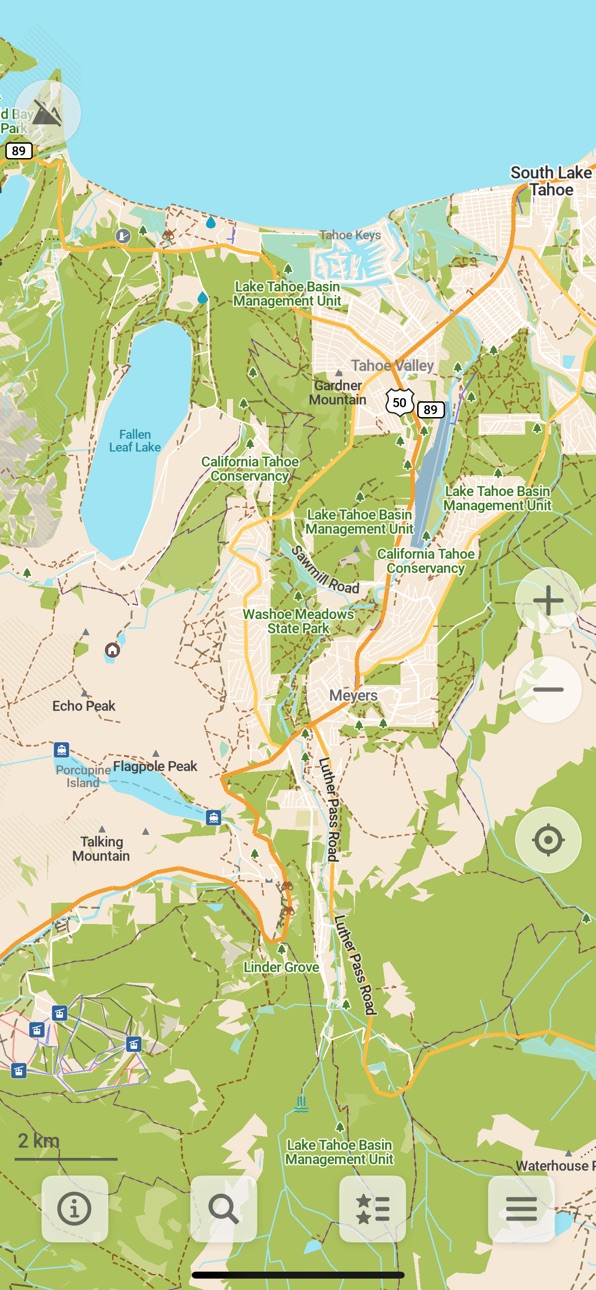
• Downloadable detailed maps with places which are not available in many commercial maps
• Outdoor mode with highlighted hiking trails, campsites, water sources, peaks, contour lines, etc
• Walking paths and cycleways
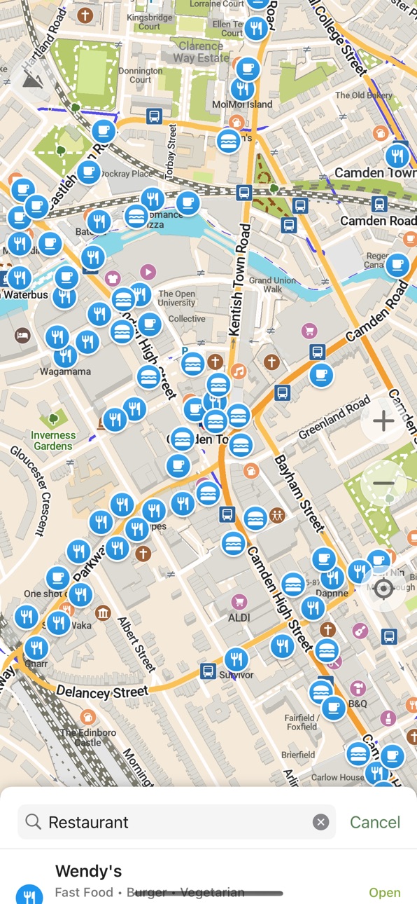
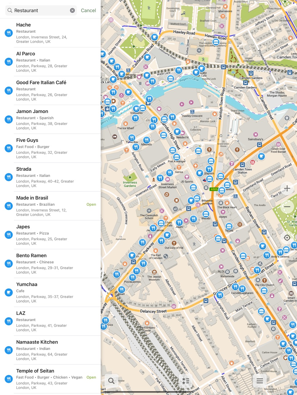
• Points of interest like restaurants, gas stations, hotels, shops, sightseeings and many more
• Search by name or an address or by point of interest category
• Navigation with voice announcements for walking, cycling, or driving
• Bookmark your favorite places with a single tap
• iCloud sync for your bookmarks and tracks
• Offline Wikipedia articles
• Subway transit layer and directions
• Track recording
• Export and import bookmarks and tracks in KML, KMZ, GPX formats
• A dark mode to use during the night
• Improve map data for everyone using a basic built-in editor
• CarPlay support
Freedom Is Here
Discover your journey, navigate the world with privacy and community at the forefront!
Accessibility
ipadiphonemacrealityDevicetvoswatch
Version history 22 versions
Build 886592576v2026.06.052026-06-09 16:38:00
• OpenStreetMap data as of June 3 and further weekly updates via "Check for updates" button in the download screen
• Better "Check for updates" button styling; display map dates, error and other messages
• Added organic options availability info for POIs like restaurants and supermarkets
• OSM Editor: added recent categories history
• Subway layer additions: Kiev, Charleroi, Nantes light rail and Paris Transilien network
Build 885329327v2026.05.062026-05-07 16:52:42
• OpenStreetMap data as of May 4
• "Check for updates" button in the download screen to get new maps without updating the app (weekly map updates are planned)
• When navigating show in-route traffic lights only, but with bigger icons
• Added track recording button in navigation mode drawer
• Added Slovenia specific road shields
• Added Indonesian Wikipedia articles
• OSM editor: fixed categories search in regional languages e.g. Brazilian Portuguese or Australian English
Build 884853480v2026.04.232026-04-27 09:51:18
• OpenStreetMap data as of April 21
• More contrast water labels in light mode
• Outdoor style: removed not useful footway borders at overview zoom levels
Build 884242581v2026.04.072026-04-08 19:06:38
• OpenStreetMap data as of April 5
• Outdoor style: more prominent roads with contrast borders
• Added pickleball
• Increased visibility of tree rows and trees in outdoor style
• Added road shields specific to Argentina, Uruguay and Bolivia and removed duplicate shields
• Fixed several intermittent crashes
Build 883682201v2026.03.232026-03-26 19:40:57
• OpenStreetMap data as of March 21
• Added sports: four square and boules
• Updated POI info card icons
• Prevent secondary name from appearing for e.g. streets in multi-language regions
• Support maxspeed definitions for more road types in different countries
Build 883192426v2026.03.092026-03-11 19:24:50
- OpenStreetMap data as of March 7
- Show charge amounts for usage of facilities
- Fixed subways display and routing in several cities
- Improved OSM contribution section in POI info card
- Re-structured settings and added icons
- Show population of cities, towns, etc.
- Carplay: adjust position of location arrow during navigation
- Allow zooming with external input devices
- Added drinking water shops
- Fixed display language of Wikipedia articles
- Don't add trailing whitespace for category searches and search history
Build 882701446v2026.02.232026-02-24 18:20:54
- OpenStreetMap data as of February 21
- Displaying the number of rooms for certain places
- Added tree rows and youth centres
- Added Croatian, Italian, Dutch and Polish Wikipedia articles
- Fixed transliteration and some other inconsistencies with map languages
- Enabled searching for letters äö
- Show multi-line titles in favorites lists
Build 882299818v2026.02.092026-02-10 20:37:07
- OpenStreetMap data as of February 7
- Allows choosing CoMaps as the default maps app
- Disabled 3D buildings in CarPlay navigation mode
- More clear setting for alternative map languages
- Added marina fuel docks
- Show favorites and search icons above subway lines
- Show house numbers later
- Enabled searching for Scandinavian letters æøå
- OSM editor: automatically update last date when POI existence was checked
Build 881809279v2026.01.242026-01-25 19:17:41
- OpenStreetMap data as of January 22
- Added subtle dark borders to roads
- Renamed "Bookmarks & Tracks" to "Favorites" and "Bookmarks" to "Places"
- Added tactile information maps, railway turntables and emergency disaster help points
- Always use light map appearance by default
- Added position mode toggle for CarPlay
- Use native languages for world overview map
- Remember location mode between sessions
- Fixed routing crashing on some devices
- Removed decimals in current speed
- Removed unused compass calibration setting
Build 881326320v2026.01.082026-01-09 13:42:25
- OpenStreetMap data as of January 6
- Added some complicated POI types with multiple tags to the editor
- Added miniature railways and wastewater treatment plants
- Fixed CarPlay crash when changing speed camera settings
- Removed fictional speed limits for link roads
- Less sensitive long tap for hiding the map buttons
Build 881053916v2025.12.282026-01-04 17:27:27
This is a maps-only update just to keep your maps fresh!
- OpenStreetMap data as of December 27
Build 880856778v2025.12.192025-12-21 10:15:14
- OpenStreetMap data as of December 17
- Avoid using parking aisles for routing
- Improved French search synonyms
- Added irrigation hydrants
- OSM editor: check length limit for OSM tags in value validation
Build 880559796v2025.12.112025-12-12 15:31:17
- OpenStreetMap data as of December 9
- Improved search results ranking
- Enabled Lithuanian and Latvian in voice announcements
- Base zoom level on distance to next turn
- Fixed voice directions pronouncing weird symbols in the beginning when Announce Street Names feature is enabled
Build 879875911v2025.11.192025-11-20 21:28:19
- OpenStreetMap data as of November 16
- Added trees
- Added several seamarks
- Added many other new POIs like lifebuoys, emergency access points, soup kitchens, food banks, food sharing, car pooling spaces, boat rentals, indoor play centres or day spas
- Show sand areas on the map
- Made adjustments to road shields in several European countries
- Made bus stop icons smaller and show up earlier
- Added option to avoid paved roads
- Added icons to routing options
- Fixed duplicate note uploads to OSM
- Fixed some CarPlay issues
Build 879594761v2025.11.072025-11-08 09:35:20
- OpenStreetMap data as of November 4
- Recategorized map icons including some new colors for entertainment, sports and other businesses
- Added icons for different sport centres, event venues, massage salons, guest houses and some disused businesses
- Added bandstands, backless benches and loungers
- Added specific icon for light rail
- Multiple search improvements
- Showing public transport stop references
- Display navigation voice and change instructions in settings
Build 879021113v2025.10.162025-10-17 19:22:46
- Added option to avoid steps
- Added specific icon for bus stations
- Fixed hang on launch in certain rare conditions
- Improved search in multiple languages
- CarPlay and other small fixes (via OM project)
Build 878625621v2025.10.022025-10-08 09:40:41
- OpenStreetMap data as of September 6
- Adjustments for iOS 26
- Branch information
- Turn penalties for bicycle routing
- Updated icons for towers, nightclubs, chemists, flagpoles
- Save bookmark color to GPX exports (via OM project)
- Color fill pedestrian parts of squares
- Fix somes bugs on iOS and Carplay
Build 877737514v2025.08.312025-09-02 16:58:31
- CarPlay is finally available!
- OpenStreetMap data as of August 22nd
- Improved dark map style
- Colored place labels
- Routing takes turns, traffic lights etc. into account
- Double tap to zoom improved
- Display the date when a place's existence or opening hours were last confirmed
- Using yellow color for opening hours, if the place opens in the next 15 minutes
- Added animal shelters, wicket gates and generic non-specified barrier lines
- Add standalone addresses via OSM editor
- Render ladder lines and routing through them (via the OM project)
Build 877231419v2025.08.132025-08-14 17:00:08
- OpenStreetMap data as of August 4
- Added a setting for map language
- Now respecting the language order set in the system for map items
- Improved map colors for water, forests, scrubs, various amenities, pedestrian areas etc.
- Added ranger stations, covered bicycle parkings, escape games, luggage lockers, post office partners
- Upgraded altitude contour lines to 20m step for some popular hiking regions
- Support for more search abbreviations and aliases
- Added search and bookmark icons for fast food, bicycle and charging stations
Build 876637636v2025.07.232025-07-24 07:54:28
Introducing the CoMaps logo!
- OpenStreetMap data as of July 13
- Reassignable left main button
- Added setting to change map appearance separately from general interface appearance
- Panoramax Pictures links can now be displayed for POIs
- Altitude contour lines for many regions have been upgraded to 20 or 50 meters steps and improved generally
- Wetlands are now split into several distinct types
- Added color fills to more features and displaying the fills earlier for existing ones
- Updated vegetation and other map colors and icons
- Switched the settings and help areas to using more modern technologies
- Multiple other adjustments of interface icons and colors
Build 876015158v2025.06.302025-07-01 12:50:26
- OpenStreetMap data as of June 22
- Updated transit station icons
- Matched parking color in navigation mode to the normal map style
- Now actually ending a search when a route starts
- Made sure the whole location button is visible during routing
- Removed a thin black line, that appeared on the app icon on some devices
Build 875533477v2025.06.252025-06-28 08:42:32
No pricing data captured yet — comparisons appear once the app has paid storefronts or in-app purchases.
Availability 175 of 175 storefronts
| Region | Language | Price | Ratings | Avg | Version |
|---|---|---|---|---|---|
| DE | de-DE | Free | 188 | 4.8 | 2026.06.05 |
| US | en-US | Free | 104 | 4.7 | 2026.06.05 |
| FR | fr-FR | Free | 53 | 4.6 | 2026.06.05 |
| GB | en-GB | Free | 30 | 4.8 | 2026.06.05 |
| CA | en-CA | Free | 23 | 4.8 | 2026.06.05 |
| CH | de-CH | Free | 22 | 5.0 | 2026.06.05 |
| NL | nl | Free | 19 | 4.7 | 2026.06.05 |
| AT | de-DE | Free | 16 | 4.6 | 2026.06.05 |
| ES | es-ES | Free | 15 | 4.5 | 2026.06.05 |
| PL | en-GB | Free | 14 | 4.9 | 2026.06.05 |
| RU | ru | Free | 14 | 4.8 | 2026.06.05 |
| AU | en-AU | Free | 12 | 5.0 | 2026.06.05 |
| SE | sv | Free | 12 | 4.8 | 2026.06.05 |
| BE | en-GB | Free | 10 | 4.9 | 2026.06.05 |
| JP | ja | Free | 10 | 4.4 | 2026.06.05 |
| DK | en-GB | Free | 9 | 4.0 | 2026.06.05 |
| IN | en-GB | Free | 7 | 5.0 | 2026.06.05 |
| UA | en-GB | Free | 7 | 5.0 | 2026.06.05 |
| IT | it | Free | 6 | 4.7 | 2026.06.05 |
| RO | en-GB | Free | 6 | 5.0 | 2026.06.05 |
| CZ | en-GB | Free | 5 | 5.0 | 2026.06.05 |
| HU | en-GB | Free | 5 | 5.0 | 2026.06.05 |
| PT | pt-PT | Free | 5 | 4.4 | 2026.06.05 |
| SK | en-GB | Free | 5 | 5.0 | 2026.06.05 |
| BR | pt-BR | Free | 4 | 4.8 | 2026.06.05 |
| FI | en-GB | Free | 4 | 5.0 | 2026.06.05 |
| TR | en-GB | Free | 4 | 5.0 | 2026.06.05 |
| BY | en-GB | Free | 3 | 5.0 | 2026.06.05 |
| LT | en-GB | Free | 3 | 5.0 | 2026.06.05 |
| NO | en-GB | Free | 3 | 5.0 | 2026.06.05 |
| VN | en-GB | Free | 3 | 5.0 | 2026.06.05 |
| AE | en-GB | Free | 2 | 5.0 | 2026.06.05 |
| AR | es-MX | Free | 2 | 5.0 | 2026.06.05 |
| CY | en-GB | Free | 2 | 5.0 | 2026.06.05 |
| IL | en-GB | Free | 2 | 5.0 | 2026.06.05 |
| TH | en-GB | Free | 2 | 5.0 | 2026.06.05 |
| TW | zh-Hant-TW | Free | 2 | 5.0 | 2026.06.05 |
| AL | en-GB | Free | 1 | 5.0 | 2026.06.05 |
| AM | en-GB | Free | 1 | 5.0 | 2026.06.05 |
| BG | en-GB | Free | 1 | 5.0 | 2026.06.05 |
| CL | es-MX | Free | 1 | 5.0 | 2026.06.05 |
| CN | zh-Hans-CN | Free | 1 | 5.0 | 2026.06.05 |
| EE | en-GB | Free | 1 | 5.0 | 2026.06.05 |
| GH | en-GB | Free | 1 | 5.0 | 2026.06.05 |
| HK | zh-Hant-HK | Free | 1 | 5.0 | 2026.06.05 |
| LV | en-GB | Free | 1 | 5.0 | 2026.06.05 |
| MX | es-MX | Free | 1 | 5.0 | 2026.06.05 |
| MY | en-GB | Free | 1 | 5.0 | 2026.06.05 |
| NZ | en-AU | Free | 1 | 5.0 | 2026.06.05 |
| OM | en-GB | Free | 1 | 5.0 | 2026.06.05 |
| PA | es-MX | Free | 1 | 5.0 | 2026.06.05 |
| SG | en-GB | Free | 1 | 5.0 | 2026.06.05 |
| VE | es-MX | Free | 1 | 5.0 | 2026.06.05 |
| AF | en-GB | Free | 0 | — | 2026.06.05 |
| AG | en-GB | Free | 0 | — | 2026.06.05 |
| AI | en-GB | Free | 0 | — | 2026.06.05 |
| AO | en-GB | Free | 0 | — | 2026.06.05 |
| AZ | en-GB | Free | 0 | — | 2026.06.05 |
| BA | en-GB | Free | 0 | — | 2026.06.05 |
| BB | en-GB | Free | 0 | — | 2026.06.05 |
| BF | en-GB | Free | 0 | — | 2026.06.05 |
| BH | en-GB | Free | 0 | — | 2026.06.05 |
| BJ | en-GB | Free | 0 | — | 2026.06.05 |
| BM | en-GB | Free | 0 | — | 2026.06.05 |
| BN | en-GB | Free | 0 | — | 2026.06.05 |
| BO | es-MX | Free | 0 | — | 2026.06.05 |
| BS | en-GB | Free | 0 | — | 2026.06.05 |
| BT | en-GB | Free | 0 | — | 2026.06.05 |
| BW | en-GB | Free | 0 | — | 2026.06.05 |
| BZ | en-GB | Free | 0 | — | 2026.06.05 |
| CD | en-GB | Free | 0 | — | 2026.06.05 |
| CG | en-GB | Free | 0 | — | 2026.06.05 |
| CI | fr-FR | Free | 0 | — | 2026.06.05 |
| CM | fr-FR | Free | 0 | — | 2026.06.05 |
| CO | es-MX | Free | 0 | — | 2026.06.05 |
| CR | es-MX | Free | 0 | — | 2026.06.05 |
| CV | en-GB | Free | 0 | — | 2026.06.05 |
| DM | en-GB | Free | 0 | — | 2026.06.05 |
| DO | es-MX | Free | 0 | — | 2026.06.05 |
| DZ | en-GB | Free | 0 | — | 2026.06.05 |
| EC | es-MX | Free | 0 | — | 2026.06.05 |
| EG | en-GB | Free | 0 | — | 2026.06.05 |
| FJ | en-GB | Free | 0 | — | 2026.06.05 |
| FM | en-GB | Free | 0 | — | 2026.06.05 |
| GA | fr-FR | Free | 0 | — | 2026.06.05 |
| GD | en-GB | Free | 0 | — | 2026.06.05 |
| GE | en-GB | Free | 0 | — | 2026.06.05 |
| GM | en-GB | Free | 0 | — | 2026.06.05 |
| GR | en-GB | Free | 0 | — | 2026.06.05 |
| GT | es-MX | Free | 0 | — | 2026.06.05 |
| GW | en-GB | Free | 0 | — | 2026.06.05 |
| GY | en-GB | Free | 0 | — | 2026.06.05 |
| HN | es-MX | Free | 0 | — | 2026.06.05 |
| HR | en-GB | Free | 0 | — | 2026.06.05 |
| ID | en-GB | Free | 0 | — | 2026.06.05 |
| IE | en-GB | Free | 0 | — | 2026.06.05 |
| IQ | en-GB | Free | 0 | — | 2026.06.05 |
| IS | en-GB | Free | 0 | — | 2026.06.05 |
| JM | en-GB | Free | 0 | — | 2026.06.05 |
| JO | en-GB | Free | 0 | — | 2026.06.05 |
| KE | en-GB | Free | 0 | — | 2026.06.05 |
| KG | en-GB | Free | 0 | — | 2026.06.05 |
| KH | en-GB | Free | 0 | — | 2026.06.05 |
| KN | en-GB | Free | 0 | — | 2026.06.05 |
| KR | ko | Free | 0 | — | 2026.06.05 |
| KW | en-GB | Free | 0 | — | 2026.06.05 |
| KY | en-GB | Free | 0 | — | 2026.06.05 |
| KZ | en-GB | Free | 0 | — | 2026.06.05 |
| LA | en-GB | Free | 0 | — | 2026.06.05 |
| LB | en-GB | Free | 0 | — | 2026.06.05 |
| LC | en-GB | Free | 0 | — | 2026.06.05 |
| LK | en-GB | Free | 0 | — | 2026.06.05 |
| LR | en-GB | Free | 0 | — | 2026.06.05 |
| LU | en-GB | Free | 0 | — | 2026.06.05 |
| LY | en-GB | Free | 0 | — | 2026.06.05 |
| MA | en-GB | Free | 0 | — | 2026.06.05 |
| MD | en-GB | Free | 0 | — | 2026.06.05 |
| ME | en-GB | Free | 0 | — | 2026.06.05 |
| MG | en-GB | Free | 0 | — | 2026.06.05 |
| MK | en-GB | Free | 0 | — | 2026.06.05 |
| ML | en-GB | Free | 0 | — | 2026.06.05 |
| MM | en-GB | Free | 0 | — | 2026.06.05 |
| MN | en-GB | Free | 0 | — | 2026.06.05 |
| MO | zh-Hant-HK | Free | 0 | — | 2026.06.05 |
| MR | en-GB | Free | 0 | — | 2026.06.05 |
| MS | en-GB | Free | 0 | — | 2026.06.05 |
| MT | en-GB | Free | 0 | — | 2026.06.05 |
| MU | en-GB | Free | 0 | — | 2026.06.05 |
| MV | en-GB | Free | 0 | — | 2026.06.05 |
| MW | en-GB | Free | 0 | — | 2026.06.05 |
| MZ | en-GB | Free | 0 | — | 2026.06.05 |
| NA | en-GB | Free | 0 | — | 2026.06.05 |
| NE | en-GB | Free | 0 | — | 2026.06.05 |
| NG | en-GB | Free | 0 | — | 2026.06.05 |
| NI | es-MX | Free | 0 | — | 2026.06.05 |
| NP | en-GB | Free | 0 | — | 2026.06.05 |
| NR | en-GB | Free | 0 | — | 2026.06.05 |
| PE | es-MX | Free | 0 | — | 2026.06.05 |
| PG | en-GB | Free | 0 | — | 2026.06.05 |
| PH | en-GB | Free | 0 | — | 2026.06.05 |
| PK | en-GB | Free | 0 | — | 2026.06.05 |
| PW | en-GB | Free | 0 | — | 2026.06.05 |
| PY | es-MX | Free | 0 | — | 2026.06.05 |
| QA | en-GB | Free | 0 | — | 2026.06.05 |
| RS | en-GB | Free | 0 | — | 2026.06.05 |
| RW | en-GB | Free | 0 | — | 2026.06.05 |
| SA | en-GB | Free | 0 | — | 2026.06.05 |
| SB | en-GB | Free | 0 | — | 2026.06.05 |
| SC | en-GB | Free | 0 | — | 2026.06.05 |
| SI | en-GB | Free | 0 | — | 2026.06.05 |
| SL | en-GB | Free | 0 | — | 2026.06.05 |
| SN | en-GB | Free | 0 | — | 2026.06.05 |
| SR | en-GB | Free | 0 | — | 2026.06.05 |
| ST | en-GB | Free | 0 | — | 2026.06.05 |
| SV | es-MX | Free | 0 | — | 2026.06.05 |
| SZ | en-GB | Free | 0 | — | 2026.06.05 |
| TC | en-GB | Free | 0 | — | 2026.06.05 |
| TD | en-GB | Free | 0 | — | 2026.06.05 |
| TJ | en-GB | Free | 0 | — | 2026.06.05 |
| TM | en-GB | Free | 0 | — | 2026.06.05 |
| TN | en-GB | Free | 0 | — | 2026.06.05 |
| TO | en-GB | Free | 0 | — | 2026.06.05 |
| TT | en-GB | Free | 0 | — | 2026.06.05 |
| TZ | en-GB | Free | 0 | — | 2026.06.05 |
| UG | en-GB | Free | 0 | — | 2026.06.05 |
| UY | en-GB | Free | 0 | — | 2026.06.05 |
| UZ | en-GB | Free | 0 | — | 2026.06.05 |
| VC | en-GB | Free | 0 | — | 2026.06.05 |
| VG | en-GB | Free | 0 | — | 2026.06.05 |
| VU | en-GB | Free | 0 | — | 2026.06.05 |
| XK | en-GB | Free | 0 | — | 2026.06.05 |
| YE | en-GB | Free | 0 | — | 2026.06.05 |
| ZA | en-GB | Free | 0 | — | 2026.06.05 |
| ZM | en-GB | Free | 0 | — | 2026.06.05 |
| ZW | en-GB | Free | 0 | — | 2026.06.05 |
Change log 26 changes · PG
✎
releaseNotes updated
• OpenStreetMap data as of June 3 and further weekly updates via "Check for updates" button in the download screen
• Better "Check for updates" button styling;
✎
description updated
A community-led free & open source maps app based on OpenStreetMap data and reinforced with commitment to transparency, privacy and being not-for-profit.
‣ Sim
✎
subtitle updated
Navigate with Privacy
✎
name updated
CoMaps
◆
Version 2026.06.05 released
• OpenStreetMap data as of June 3 and further weekly updates via "Check for updates" button in the download screen
• Better "Check for updates" button styling; display map dates, error and other messages
• Added organic options availability
◆
Version 2026.05.06 released
• OpenStreetMap data as of May 4
• "Check for updates" button in the download screen to get new maps without updating the app (weekly map updates are planned)
• When navigating show in-route traffic lights only, but with bigger icons
• Adde
◆
Version 2026.04.23 released
• OpenStreetMap data as of April 21
• More contrast water labels in light mode
• Outdoor style: removed not useful footway borders at overview zoom levels
◆
Version 2026.04.07 released
• OpenStreetMap data as of April 5
• Outdoor style: more prominent roads with contrast borders
• Added pickleball
• Increased visibility of tree rows and trees in outdoor style
• Added road shields specific to Argentina, Uruguay and Bolivia
◆
Version 2026.03.23 released
• OpenStreetMap data as of March 21
• Added sports: four square and boules
• Updated POI info card icons
• Prevent secondary name from appearing for e.g. streets in multi-language regions
• Support maxspeed definitions for more road types i
◆
Version 2026.03.09 released
- OpenStreetMap data as of March 7
- Show charge amounts for usage of facilities
- Fixed subways display and routing in several cities
- Improved OSM contribution section in POI info card
- Re-structured settings and added icons
- Show popu
◆
Version 2026.02.23 released
- OpenStreetMap data as of February 21
- Displaying the number of rooms for certain places
- Added tree rows and youth centres
- Added Croatian, Italian, Dutch and Polish Wikipedia articles
- Fixed transliteration and some other inconsisten
◆
Version 2026.02.09 released
- OpenStreetMap data as of February 7
- Allows choosing CoMaps as the default maps app
- Disabled 3D buildings in CarPlay navigation mode
- More clear setting for alternative map languages
- Added marina fuel docks
- Show favorites and sear
◆
Version 2026.01.24 released
- OpenStreetMap data as of January 22
- Added subtle dark borders to roads
- Renamed "Bookmarks & Tracks" to "Favorites" and "Bookmarks" to "Places"
- Added tactile information maps, railway turntables and emergency disaster help points
- A
◆
Version 2026.01.08 released
- OpenStreetMap data as of January 6
- Added some complicated POI types with multiple tags to the editor
- Added miniature railways and wastewater treatment plants
- Fixed CarPlay crash when changing speed camera settings
- Removed fictiona
◆
Version 2025.12.28 released
This is a maps-only update just to keep your maps fresh!
- OpenStreetMap data as of December 27
◆
Version 2025.12.19 released
- OpenStreetMap data as of December 17
- Avoid using parking aisles for routing
- Improved French search synonyms
- Added irrigation hydrants
- OSM editor: check length limit for OSM tags in value validation
◆
Version 2025.12.11 released
- OpenStreetMap data as of December 9
- Improved search results ranking
- Enabled Lithuanian and Latvian in voice announcements
- Base zoom level on distance to next turn
- Fixed voice directions pronouncing weird symbols in the beginning w
◆
Version 2025.11.19 released
- OpenStreetMap data as of November 16
- Added trees
- Added several seamarks
- Added many other new POIs like lifebuoys, emergency access points, soup kitchens, food banks, food sharing, car pooling spaces, boat rentals, indoor play centre
◆
Version 2025.11.07 released
- OpenStreetMap data as of November 4
- Recategorized map icons including some new colors for entertainment, sports and other businesses
- Added icons for different sport centres, event venues, massage salons, guest houses and some disused
◆
Version 2025.10.16 released
- Added option to avoid steps
- Added specific icon for bus stations
- Fixed hang on launch in certain rare conditions
- Improved search in multiple languages
- CarPlay and other small fixes (via OM project)
◆
Version 2025.10.02 released
- OpenStreetMap data as of September 6
- Adjustments for iOS 26
- Branch information
- Turn penalties for bicycle routing
- Updated icons for towers, nightclubs, chemists, flagpoles
- Save bookmark color to GPX exports (via OM project)
- Co
◆
Version 2025.08.31 released
- CarPlay is finally available!
- OpenStreetMap data as of August 22nd
- Improved dark map style
- Colored place labels
- Routing takes turns, traffic lights etc. into account
- Double tap to zoom improved
- Display the date when a place's
◆
Version 2025.08.13 released
- OpenStreetMap data as of August 4
- Added a setting for map language
- Now respecting the language order set in the system for map items
- Improved map colors for water, forests, scrubs, various amenities, pedestrian areas etc.
- Added ra
◆
Version 2025.07.23 released
Introducing the CoMaps logo!
- OpenStreetMap data as of July 13
- Reassignable left main button
- Added setting to change map appearance separately from general interface appearance
- Panoramax Pictures links can now be displayed for POIs
-
◆
Version 2025.06.30 released
- OpenStreetMap data as of June 22
- Updated transit station icons
- Matched parking color in navigation mode to the normal map style
- Now actually ending a search when a route starts
- Made sure the whole location button is visible during
◆
Version 2025.06.25 released