Home › Productivity

 BB
BB
 BRpt-BR
 AGen-GB
 AIen-GB
 AMen-GB
 AOen-GB
 ARes-MX
 AUen-AU
 AZen-GBBBen-GB
 BFen-GB
 BHen-GB
 BJen-GB
 BNen-GB
 BOes-MX
 BSen-GB
 BWen-GB
 BZen-GB
 CDen-GB
 CGen-GB
 CIfr-FR
 CLes-MX
 CMfr-FR
 COes-MX
 CRes-MX
 CVen-GB
 DMen-GB
 DOes-MX
 DZen-GB
 ECes-MX
 GAfr-FR
 GDen-GB
 GHen-GB
 GMen-GB
 GTes-MX
 GWen-GB
 GYen-GB
 HKzh-Hant-HK
 HNes-MX
 JMen-GB
 JOen-GB
 JPja
JPja KEen-GB
 KGen-GB
 KHen-GB
 KNen-GB
 KYen-GB
 LCen-GB
 LRen-GB
 LYen-GB
 MAen-GB
 MGen-GB
 MLen-GB
 MOzh-Hant-HK
 MSen-GB
 MUen-GB
 MWen-GB
 MXes-MX
 MZen-GB
 NAen-GB
 NEen-GB
 NGen-GB
 NIes-MX
 NPen-GB
 NZen-AU
 OMen-GB
 PAes-MX
 PEes-MX
 PHen-GB
 PWen-GB
 PYes-MX
 RWen-GB
 SBen-GB
 SCen-GB
 SGen-GB
 SLen-GB
 SNen-GB
 SRen-GB
 STen-GB
 SVes-MX
 SZen-GB
 TCen-GB
 TDen-GB
 THen-GB
 TMen-GB
 TNen-GB
 TOen-GB
 TTen-GB
 TWzh-Hant-TW
 TZen-GB
 UGen-GB
 UYen-GB
 VCen-GB
 VEes-MX
 VGen-GB
 YEen-GB
 ZMen-GB
 ZWen-GB
 BANot Available
 BGNot Available
 CANot Available
 CHNot Available
 CZNot Available
 DENot Available
 ESNot Available
 FRNot Available
 GBNot Available
 GRNot Available
 HRNot Available
 HUNot Available
 IENot Available
 ISNot Available
 ITNot Available
 LUNot Available
 PLNot Available
 PTNot Available
 RSNot Available
 RUNot Available
 SINot Available
 SKNot Available
 XKNot Available
97 of 120 storefronts
Content in en-US
Content in en-US
Information
Preview 1 platform
iPhone 8 images



What’s New Version 1.0.106
The field and plot lists now support bulk selection with checkboxes, per-item and batch export, and a single actions menu. We also added field deletion with confirmation and isolated field and plot geometries so they no longer share the same perimeter records. In addition, the app now supports configurable export file name patterns for fields and plots, with options such as name, producer, property, season, and area.
Description
Soil Sampling is a complete app for managing agricultural areas and supporting field decision-making. With it, you can register growers, properties, crop seasons, fields, plots, depths, and laboratories; draw and adjust field boundaries with map and GPS support; create grid-based sampling plans and organize collection points; track sample collection by depth; and generate labels and PDF reports.
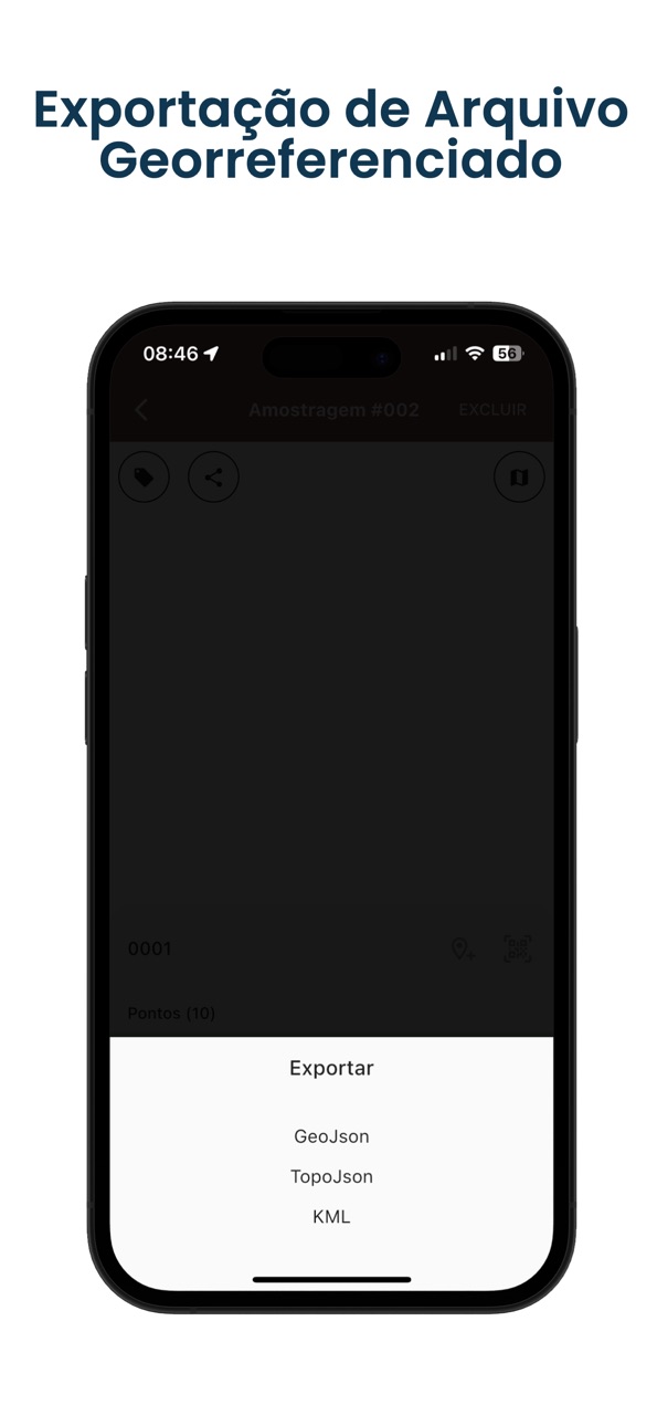
The app also lets you import and enter laboratory reports, including AI-assisted document reading, record attribute values, and compare results using geospatial analysis. Visualize heat maps, configure display settings, customize reports, export data in CSV, KML, SHP, GeoJSON, TopoJSON, and ZIP formats, and back up or restore your data.
Ideal for anyone looking for more precision, speed, and control in soil sampling from start to finish.
Terms of Use (EULA):
https://www.apple.com/legal/internet-services/itunes/dev/stdeula/
In-App Purchases BB pricing
Premium Subscription
Mensal PRO · Monthly—
Anual PRO · Yearly—
Capabilities
In-App Purchases
Accessibility
ipadiphonemacrealityDevicetvoswatch
Version history 22 versions
Build 886923319v1.0.1062026-06-14 03:41:43
The field and plot lists now support bulk selection with checkboxes, per-item and batch export, and a single actions menu. We also added field deletion with confirmation and isolated field and plot geometries so they no longer share the same perimeter records. In addition, the app now supports configurable export file name patterns for fields and plots, with options such as name, producer, property, season, and area.
Build 886739697v1.0.1052026-06-10 13:57:08
The app now supports field perimeter import in both KML and KMZ, including bulk field creation from a single file. We also added a new map-based workflow to group imported polygons, choose which areas belong to each field, rename groups, and handle fields with multiple polygons. In the field map, you can now quickly display the latest sampling from all fields at once. And in the field list, we added new perimeter export options in KML, SHP, GeoJSON, and TopoJSON, both per field and in batch.
Build 885502585v1.0.1012026-05-11 18:39:42
Ads UX improvements: a single global banner with stable fallback, interstitials focused on high-value actions (exports/reports), and content unlocked only after ad completion. We also improved the New Multi-Sampling flow to create a sampling directly in the selected field when no records exist.
Build 885140344v1.0.1002026-05-01 00:02:44
Ads UX improvements: a single global banner with stable fallback, interstitials focused on high-value actions (exports/reports), and content unlocked only after ad completion. We also improved the New Multi-Sampling flow to create a sampling directly in the selected field when no records exist.
Build 884520872v1.0.992026-04-15 03:58:36
New data import/export center for Fields, with batch import via CSV/XLSX/SQLite and CSV export.
Build 884346816v1.0.972026-04-10 14:58:52
Fixed KML point import and improved grid reconstruction. When the grid is inconsistent, only points are shown.
Build 883992154v1.0.942026-04-01 04:23:54
This update improves the encrypted backup flow with more stable export and import operations, including iOS sharing fixes. We also refined confirmation and warning copy on the backup screen for clearer communication.
Build 883440804v1.0.93 (93)2026-03-17 17:20:05
Adjustments to CSV file import;
Build 883398639v1.0.912026-03-16 17:40:32
This update improves geospatial heat maps. Clipping now respects productive and non-productive areas, with better consistency between Android and iOS rendering. We also updated reports with a new page layout, interval-based table legend, and corrected area-per-range calculations to match the field net area. In addition, we delivered visual refinements and stability improvements in the map viewing flow.
Build 883352565v1.0.902026-03-15 00:47:32
This update improves app performance and stability. We refined geospatial analysis flows and made sampling/report selection clearer with visual preview. We also improved CSV import with automatic field mapping, reusable mapping configuration, and stronger numeric value validation. The app now accepts only standardized CSV files and shows a warning when the format is invalid.
Build 883319690v1.0.80 (80)2026-03-13 17:06:54
Melhorias nos laudos e nas análises geoespaciais, trazendo mais precisão e organização na visualização e interpretação dos dados.
Build 883137199v1.0.74 (74)2026-03-11 16:15:44
Adiciona coleta múltipla.
Novo layout de coleta
Build 882622953v1.0.70 (70)2026-03-04 09:04:18
Novas funcionalidades e melhoria de desempenho.
Build 883030219v1.0.72 (72)2026-03-04 21:33:18
Ajustes na geração de arquivos SHP e KML
Build 882422402v1.0.63 (63)2026-02-14 00:24:57
Novas funcionalidades implementadas:
• Marcação de área via GPS
• Cadastro de áreas não úteis, não cultiváveis
• Cadastro de áreas úteis, cultiváveis
• Configuração dos mapas
• Melhorias de desempenho e otimização geral
Build 882459042v1.0.66 (66)2026-02-14 22:45:59
Ajustes nas configurações;
Ajustes nos mapas.
Build 882058664v1.0.61 (61)2026-02-02 04:28:21
Adiciona configuração de tamanho mínimo e máximo do grid, oferecendo mais controle sobre o tamanho.
Inclui filtragem de campos e amostragens, facilitando a visualização e análise dos dados.
Build 878732084v1.0.54 (54)2025-10-08 07:36:02
Importação de arquivos KML.
Edição de amostragens.
Build 876572045v1.0.42 (42)2025-07-21 13:39:20
Ajustes nas assinaturas
Correções e melhorias
Build 876536881v1.0.39 (39)2025-07-20 10:36:15
Assinaturas no app.
Build 873314034v1.0.14 (14)2025-06-07 20:17:18
Otimização da geração de mapas.
Build 873068299v1.0.12 (12)2025-03-17 18:50:30
Price history by region
Currency
Show
Columns
Search
Availability 97 of 120 storefronts
| Region | Language | Price | Ratings | Avg | Version |
|---|---|---|---|---|---|
| BR | pt-BR | Free | 2 | 3.0 | 1.0.106 |
| AG | en-GB | Free | 0 | — | 1.0.106 |
| AI | en-GB | Free | 0 | — | 1.0.106 |
| AM | en-GB | Free | 0 | — | 1.0.106 |
| AO | en-GB | Free | 0 | — | 1.0.106 |
| AR | es-MX | Free | 0 | — | 1.0.106 |
| AU | en-AU | Free | 0 | — | 1.0.106 |
| AZ | en-GB | Free | 0 | — | 1.0.106 |
| BB | en-GB | Free | 0 | — | 1.0.106 |
| BF | en-GB | Free | 0 | — | 1.0.106 |
| BH | en-GB | Free | 0 | — | 1.0.106 |
| BJ | en-GB | Free | 0 | — | 1.0.106 |
| BN | en-GB | Free | 0 | — | 1.0.106 |
| BO | es-MX | Free | 0 | — | 1.0.106 |
| BS | en-GB | Free | 0 | — | 1.0.106 |
| BW | en-GB | Free | 0 | — | 1.0.106 |
| BZ | en-GB | Free | 0 | — | 1.0.106 |
| CD | en-GB | Free | 0 | — | 1.0.106 |
| CG | en-GB | Free | 0 | — | 1.0.106 |
| CI | fr-FR | Free | 0 | — | 1.0.106 |
| CL | es-MX | Free | 0 | — | 1.0.106 |
| CM | fr-FR | Free | 0 | — | 1.0.106 |
| CO | es-MX | Free | 0 | — | 1.0.106 |
| CR | es-MX | Free | 0 | — | 1.0.106 |
| CV | en-GB | Free | 0 | — | 1.0.106 |
| DM | en-GB | Free | 0 | — | 1.0.106 |
| DO | es-MX | Free | 0 | — | 1.0.106 |
| DZ | en-GB | Free | 0 | — | 1.0.106 |
| EC | es-MX | Free | 0 | — | 1.0.106 |
| GA | fr-FR | Free | 0 | — | 1.0.106 |
| GD | en-GB | Free | 0 | — | 1.0.106 |
| GH | en-GB | Free | 0 | — | 1.0.106 |
| GM | en-GB | Free | 0 | — | 1.0.106 |
| GT | es-MX | Free | 0 | — | 1.0.106 |
| GW | en-GB | Free | 0 | — | 1.0.106 |
| GY | en-GB | Free | 0 | — | 1.0.106 |
| HK | zh-Hant-HK | Free | 0 | — | 1.0.106 |
| HN | es-MX | Free | 0 | — | 1.0.106 |
| JM | en-GB | Free | 0 | — | 1.0.106 |
| JO | en-GB | Free | 0 | — | 1.0.106 |
| JP | ja | Free | 0 | — | 1.0.106 |
| KE | en-GB | Free | 0 | — | 1.0.106 |
| KG | en-GB | Free | 0 | — | 1.0.106 |
| KH | en-GB | Free | 0 | — | 1.0.106 |
| KN | en-GB | Free | 0 | — | 1.0.106 |
| KY | en-GB | Free | 0 | — | 1.0.106 |
| LC | en-GB | Free | 0 | — | 1.0.106 |
| LR | en-GB | Free | 0 | — | 1.0.106 |
| LY | en-GB | Free | 0 | — | 1.0.106 |
| MA | en-GB | Free | 0 | — | 1.0.106 |
| MG | en-GB | Free | 0 | — | 1.0.106 |
| ML | en-GB | Free | 0 | — | 1.0.106 |
| MO | zh-Hant-HK | Free | 0 | — | 1.0.106 |
| MS | en-GB | Free | 0 | — | 1.0.106 |
| MU | en-GB | Free | 0 | — | 1.0.106 |
| MW | en-GB | Free | 0 | — | 1.0.106 |
| MX | es-MX | Free | 0 | — | 1.0.106 |
| MZ | en-GB | Free | 0 | — | 1.0.106 |
| NA | en-GB | Free | 0 | — | 1.0.106 |
| NE | en-GB | Free | 0 | — | 1.0.106 |
| NG | en-GB | Free | 0 | — | 1.0.106 |
| NI | es-MX | Free | 0 | — | 1.0.106 |
| NP | en-GB | Free | 0 | — | 1.0.106 |
| NZ | en-AU | Free | 0 | — | 1.0.106 |
| OM | en-GB | Free | 0 | — | 1.0.106 |
| PA | es-MX | Free | 0 | — | 1.0.106 |
| PE | es-MX | Free | 0 | — | 1.0.106 |
| PH | en-GB | Free | 0 | — | 1.0.106 |
| PW | en-GB | Free | 0 | — | 1.0.106 |
| PY | es-MX | Free | 0 | — | 1.0.106 |
| RW | en-GB | Free | 0 | — | 1.0.106 |
| SB | en-GB | Free | 0 | — | 1.0.106 |
| SC | en-GB | Free | 0 | — | 1.0.106 |
| SG | en-GB | Free | 0 | — | 1.0.106 |
| SL | en-GB | Free | 0 | — | 1.0.106 |
| SN | en-GB | Free | 0 | — | 1.0.106 |
| SR | en-GB | Free | 0 | — | 1.0.106 |
| ST | en-GB | Free | 0 | — | 1.0.106 |
| SV | es-MX | Free | 0 | — | 1.0.106 |
| SZ | en-GB | Free | 0 | — | 1.0.106 |
| TC | en-GB | Free | 0 | — | 1.0.106 |
| TD | en-GB | Free | 0 | — | 1.0.106 |
| TH | en-GB | Free | 0 | — | 1.0.106 |
| TM | en-GB | Free | 0 | — | 1.0.106 |
| TN | en-GB | Free | 0 | — | 1.0.106 |
| TO | en-GB | Free | 0 | — | 1.0.106 |
| TT | en-GB | Free | 0 | — | 1.0.106 |
| TW | zh-Hant-TW | Free | 0 | — | 1.0.106 |
| TZ | en-GB | Free | 0 | — | 1.0.106 |
| UG | en-GB | Free | 0 | — | 1.0.106 |
| UY | en-GB | Free | 0 | — | 1.0.106 |
| VC | en-GB | Free | 0 | — | 1.0.106 |
| VE | es-MX | Free | 0 | — | 1.0.106 |
| VG | en-GB | Free | 0 | — | 1.0.106 |
| YE | en-GB | Free | 0 | — | 1.0.106 |
| ZM | en-GB | Free | 0 | — | 1.0.106 |
| ZW | en-GB | Free | 0 | — | 1.0.106 |
Not available in: BA, BG, CA, CH, CZ, DE, ES, FR, GB, GR, HR, HU, IE, IS, IT, LU, PL, PT, RS, RU, SI, SK, XK
Change log 26 changes · BB
✎
releaseNotes updated
The field and plot lists now support bulk selection with checkboxes, per-item and batch export, and a single actions menu. We also added field deletion with con
✎
description updated
Soil Sampling is a complete app for managing agricultural areas and supporting field decision-making. With it, you can register growers, properties, crop season
✎
subtitle updated
Gere mapas de amostragem
✎
name updated
Amostragem de Solo
◆
Version 1.0.106 released
The field and plot lists now support bulk selection with checkboxes, per-item and batch export, and a single actions menu. We also added field deletion with confirmation and isolated field and plot geometries so they no longer share the sam
◆
Version 1.0.105 released
The app now supports field perimeter import in both KML and KMZ, including bulk field creation from a single file. We also added a new map-based workflow to group imported polygons, choose which areas belong to each field, rename groups, an
◆
Version 1.0.101 released
Ads UX improvements: a single global banner with stable fallback, interstitials focused on high-value actions (exports/reports), and content unlocked only after ad completion. We also improved the New Multi-Sampling flow to create a samplin
◆
Version 1.0.100 released
Ads UX improvements: a single global banner with stable fallback, interstitials focused on high-value actions (exports/reports), and content unlocked only after ad completion. We also improved the New Multi-Sampling flow to create a samplin
◆
Version 1.0.99 released
New data import/export center for Fields, with batch import via CSV/XLSX/SQLite and CSV export.
◆
Version 1.0.97 released
Fixed KML point import and improved grid reconstruction. When the grid is inconsistent, only points are shown.
◆
Version 1.0.94 released
This update improves the encrypted backup flow with more stable export and import operations, including iOS sharing fixes. We also refined confirmation and warning copy on the backup screen for clearer communication.
◆
Version 1.0.93 (93) released
Adjustments to CSV file import;
◆
Version 1.0.91 released
This update improves geospatial heat maps. Clipping now respects productive and non-productive areas, with better consistency between Android and iOS rendering. We also updated reports with a new page layout, interval-based table legend, an
◆
Version 1.0.90 released
This update improves app performance and stability. We refined geospatial analysis flows and made sampling/report selection clearer with visual preview. We also improved CSV import with automatic field mapping, reusable mapping configuratio
◆
Version 1.0.80 (80) released
Melhorias nos laudos e nas análises geoespaciais, trazendo mais precisão e organização na visualização e interpretação dos dados.
◆
Version 1.0.74 (74) released
Adiciona coleta múltipla.
Novo layout de coleta
◆
Version 1.0.72 (72) released
Ajustes na geração de arquivos SHP e KML
◆
Version 1.0.70 (70) released
Novas funcionalidades e melhoria de desempenho.
◆
Version 1.0.66 (66) released
Ajustes nas configurações;
Ajustes nos mapas.
◆
Version 1.0.63 (63) released
Novas funcionalidades implementadas:
• Marcação de área via GPS
• Cadastro de áreas não úteis, não cultiváveis
• Cadastro de áreas úteis, cultiváveis
• Configuração dos mapas
• Melhorias de desempenho e otimização geral
◆
Version 1.0.61 (61) released
Adiciona configuração de tamanho mínimo e máximo do grid, oferecendo mais controle sobre o tamanho.
Inclui filtragem de campos e amostragens, facilitando a visualização e análise dos dados.
◆
Version 1.0.54 (54) released
Importação de arquivos KML.
Edição de amostragens.
◆
Version 1.0.42 (42) released
Ajustes nas assinaturas
Correções e melhorias
◆
Version 1.0.39 (39) released
Assinaturas no app.
◆
Version 1.0.14 (14) released
Otimização da geração de mapas.
◆
Version 1.0.12 (12) released