Home › Navigation

 ZM
ZM
 NZen-AU
 AUen-AU
 USen-US
 CAen-CA
 DEde-DE
 GBen-GB
 NLnl
NLnl AEen-GB
 AGen-GB
 AIen-GB
 ALen-GB
 AOen-GB
 ARes-MX
 ATde-DE
 AZen-GB
 BAen-GB
 BBen-GB
 BEen-GB
 BFen-GB
 BGen-GB
 BJen-GB
 BOes-MX
 BRpt-BR
 BSen-GB
 BWen-GB
 BYen-GB
 BZen-GB
 CDen-GB
 CGen-GB
 CHde-CH
 CIfr-FR
 CLes-MX
 CMfr-FR
 COes-MX
 CRes-MX
 CVen-GB
 CYen-GB
 CZen-GB
 DKen-GB
 DMen-GB
 DOes-MX
 DZen-GB
 ECes-MX
 EEen-GB
 EGen-GB
 ESes-ES
 FIen-GB
 FRfr-FR
 GAfr-FR
 GDen-GB
 GHen-GB
 GMen-GB
 GRen-GB
 GTes-MX
 GWen-GB
 GYen-GB
 HKzh-Hant-HK
 HNes-MX
 HRen-GB
 HUen-GB
 IEen-GB
 ILen-GB
 ISen-GB
 ITit
ITit JMen-GB
 KEen-GB
 KNen-GB
 KWen-GB
 KYen-GB
 LCen-GB
 LRen-GB
 LTen-GB
 LUen-GB
 LVen-GB
 LYen-GB
 MAen-GB
 MDen-GB
 MEen-GB
 MGen-GB
 MKen-GB
 MLen-GB
 MSen-GB
 MTen-GB
 MUen-GB
 MWen-GB
 MXes-MX
 MZen-GB
 NAen-GB
 NEen-GB
 NGen-GB
 NIes-MX
 NOen-GB
 NRen-GB
 PAes-MX
 PEes-MX
 PLen-GB
 PTpt-PT
 PYes-MX
 QAen-GB
 ROen-GB
 RSen-GB
 RUru
RUru RWen-GB
 SAen-GB
 SCen-GB
 SEsv
SEsv SIen-GB
 SKen-GB
 SLen-GB
 SNen-GB
 SRen-GB
 STen-GB
 SVes-MX
 SZen-GB
 TCen-GB
 TDen-GB
 TNen-GB
 TRen-GB
 TTen-GB
 TWzh-Hant-TW
 TZen-GB
 UAen-GB
 UGen-GB
 UYen-GB
 VCen-GB
 VEes-MX
 VGen-GB
 XKen-GBZMen-GB
 ZWen-GB
130 of 130 storefronts
Content in en-US
Content in en-US
Information
Preview 2 platforms
iPhone 8 images



iPad 1 image

What’s New Version 6.04.02
Vector map. Updates to location sharing settings. Another level of aerial image detail added.
Description
This app provides complete offline topographic map coverage of the North Island of New Zealand from the LINZ Topo50 1:50k scale map series. The maps are all contained in the installation so there is no additional need for downloads, no need for phone or wifi signal, no slow server issues, no account signups, no missing tiles, and no additional map fees. Just install for seamless off-line zooming and panning across the whole island down to 1:50k scale. The app also includes built in 1:50k resolution satellite images and elevation data. Additional aerial imagery and vector map can be downloaded.
Other integrated data includes DOC hunting permit boundaries, DOC huts, campgrounds, and tracks, Te Araroa trails, Public Conservation Land boundaries, selected public road parcels, and many others.
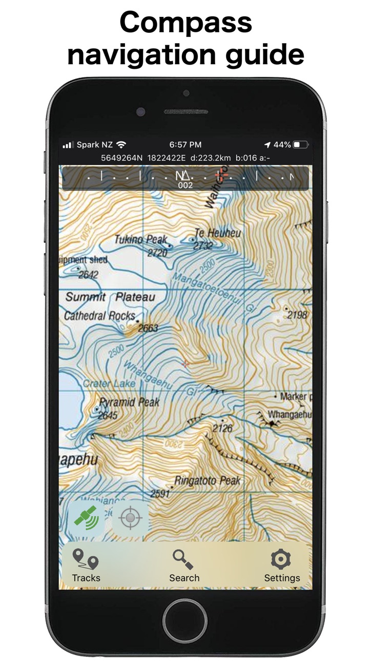
The app has a full suite of navigation functions including GPS location, compass orientation, distance to map locations, track recording and graphing, route creation and following, slope angle and hillshade overlays, import/export of gpx and kml files, search functions for named places and user data. Add and edit your own locations and routes and plot elevation profiles. Set proximity alarms. Share your location. Use your camera view to identify surrounding peaks and match with local topography. Uses an intuitive simple interface with one-touch access to all functions.
LINZ TOPO250 series maps are used at lower zoom levels for easier navigation.
Perfect for outback use out of cell phone range. GPS and maps function fully without phone coverage. No need to cache files in advance either as they are all fully installed with the app. Popular with trampers, hikers, runners, bikers, search and rescue (SAR), hunters, boaters, flying, paragliding, as well as survey applications.
Note that continuous use of GPS will run down the battery faster than when not using the GPS. The NZTopo50 app gives you full control over when GPS is used. The map can be used without GPS, intermittently with GPS for spot checking of location, continuously for logging while the app is open, or for continuous background logging when the phone is off.
Check our website for links to user guides and useful tips and tricks.
The in-app purchases are for an optional contribution to ongoing app development, or for selected additional third party data sets. They don't affect the functionality of the app or the availability of updates.
Feel free to get in touch with any suggestions.
In-App Purchases ZM pricing
One-Time Purchases
Product Support—
Product Support—
Capabilities
In-App Purchases
Accessibility
ipadiphonemacrealityDevicetvoswatch
Version history 25 versions
Build 887240730v6.04.022026-07-01 22:59:36
Vector map. Updates to location sharing settings. Another level of aerial image detail added.
Build 885450129v6.03.032026-05-10 20:31:46
Bug fixes
Build 885229013v6.03.022026-05-04 20:13:29
Minor UI changes and function updates.
Build 884005332v6.03.012026-04-18 20:19:07
New quick links for turning data layers on/off
Location sharing and live tracking, including support for Satellite networks
Set proximity and departure notifications
Import/Export dialog boxes to give more options over formatting
Full uncompressed topographic map images can be downloaded for improved map clarity
More options for editing routes - long press to add points, tap to join together with existing tracks
Other UI improvements to graphs and information
Build 882057206v6.02.022026-02-09 18:44:52
Updated map tiles.
Stop/Pause confirmation for track recording.
Build 880224771v6.01.072025-12-02 01:05:00
Import filter fix
Build 879845405v6.01.052025-11-19 19:15:03
Fixes for file imports and track display
Build 879437170v6.01.042025-11-04 01:28:24
iOS 26 layout updates
Track recording improvements
Build 879036222v6.01.032025-10-20 18:35:18
Hillshade and slope angle overlay
Higher resolution altitude model
Improved peak finder display
Air pressure readings
Improved track graph display
New icons
Max speed added to track details
Selectable grid reference text for easy copy/paste
Changes to GPX schema used
Build 876821971v6.00.052025-08-02 22:31:16
UI and other improvements.
Build 875592922v6.00.032025-06-15 14:51:27
Support for live updates of add on layers
Tweaks to satellite image downloading
Show peak finder view for any location
More coordinate options
Bug fixes
Build 874348172v6.00.022025-06-03 03:41:01
Support for live updates of add on layers
Tweaks to satellite image downloading
Show peak finder view for any location
More coordinate options
Build 868249204v5.90.032024-09-01 02:20:39
Streaming and caching of additional aerial imagery
NZ Map Sheet and degrees decimal minute references supported
Touchscreen lock option to avoid accidental changes
Option to override screen lock while the app is in use
New one-touch convenience options for creating routes and recording
Additional waypoint icons
Build 862277114v5.80.052024-01-30 03:59:13
Updated maps and data
Support for custom map images
New scrolling interface - more info where you need it
Duplicate tracks easily
Map alignment with course option
Dedicated fullscreen button
Other improvements
Build 857115595v5.80.012023-08-09 22:10:51
DOC restricted permit boundaries are back
Automatic backup option for your waypoints and tracks (turn it on in the settings)
New 'category' property for objects so that you can group them together by category name
Current position relative to an existing route is displayed on the elevation profile
Sunset/sunrise times are displayed in the track details
Build 856784536v5.70.122023-05-02 00:57:00
Improved peak finder overlay with landscape profile
DOC restricted permit hunting boundaries are back
Nautical Mile units
Other improvements
Build 853700304v5.70.032023-03-03 21:38:22
New data layers including public conservation land boundaries, selected road parcels, DOC mountain biking tracks
Basic identification of nearby peaks in camera view
Naismith walking times calculated for routes and tracks
Dedicated fullscreen button
Dedicated pause button for track recording
UI changes and other improvements
Build 847680244v5.612022-03-25 21:40:29
New options for adjusting GPS state on startup, opacity of overlays, transition between 1:250k and 1:50 maps.
Improvements to grouping and processing of user data, import/export, and background recording.
Build 845413962v5.62021-11-19 21:53:57
Integrated altitude data for building elevation profiles
Search radius projection around waypoints
Filter and edit tracks by group
Full colour icons
Improved track editing - split, continue recording, create regions
Navigate by course or compass bearing
Other UI improvements
Build 843715421v5.52021-11-06 01:26:18
Integrated altitude data for building elevation profiles
Search radius projection around waypoints
Filter and edit tracks by group
Full colour icons
Improved track editing - split, continue recording, create regions
Navigate by course or compass bearing
Other UI improvements
Build 840652792v5.32021-03-05 19:27:24
'Show All' option added
Startup sequence streamlined for quick start
Apostrophe's accommodated in search terms
Hunting block names displayed on screen
Build 839354343v5.22021-01-15 19:18:19
New built in data: DOC huts, tracks, and campsites; Te Araroa; Fish and Game access points
Quick link for entering grid references and offsets
Some UI changes for easier legibility and use
Build 837572386v5.12020-09-23 18:46:42
True/Magnetic compass options
Satellite image layer
Add photos or images to waypoints and tracks
Icon size control, and new icon design
More details added to track information page
Enter an offset from a waypoint or map position
Build 835690964v5.02020-05-01 05:13:10
New icons, map rotation, route plotting and following, GPX import/export, updated map images, sharper details - and slightly larger overall app size
Build 834485587v4.812020-01-25 17:33:21
Bug fix.
Price history by region
Currency
Show
Columns
Search
Availability 130 of 130 storefronts
| Region | Language | Price | Ratings | Avg | Version |
|---|---|---|---|---|---|
| NZ | en-AU | NZD 6.99 | 160 | 4.4 | 6.04.02 |
| AU | en-AU | AUD 5.99 | 5 | 5.0 | 6.04.02 |
| US | en-US | USD 3.99 | 2 | 5.0 | 6.04.02 |
| CA | en-CA | CAD 4.99 | 1 | 5.0 | 6.04.02 |
| DE | de-DE | EUR 3.99 | 1 | 5.0 | 6.04.02 |
| GB | en-GB | GBP 3.99 | 1 | 5.0 | 6.04.02 |
| NL | nl | EUR 3.99 | 1 | 5.0 | 6.04.02 |
| AE | en-GB | AED 14.99 | 0 | — | 6.04.02 |
| AG | en-GB | USD 3.99 | 0 | — | 6.04.02 |
| AI | en-GB | USD 3.99 | 0 | — | 6.04.02 |
| AL | en-GB | USD 4.99 | 0 | — | 6.04.02 |
| AO | en-GB | USD 3.99 | 0 | — | 6.04.02 |
| AR | es-MX | USD 3.99 | 0 | — | 6.04.02 |
| AT | de-DE | EUR 3.99 | 0 | — | 6.04.02 |
| AZ | en-GB | USD 4.99 | 0 | — | 6.04.02 |
| BA | en-GB | EUR 3.99 | 0 | — | 6.04.02 |
| BB | en-GB | USD 4.99 | 0 | — | 6.04.02 |
| BE | en-GB | EUR 3.99 | 0 | — | 6.04.02 |
| BF | en-GB | USD 3.99 | 0 | — | 6.04.02 |
| BG | en-GB | EUR 3.99 | 0 | — | 6.04.02 |
| BJ | en-GB | USD 4.99 | 0 | — | 6.04.02 |
| BO | es-MX | USD 3.99 | 0 | — | 6.04.02 |
| BR | pt-BR | BRL 24.9 | 0 | — | 6.04.02 |
| BS | en-GB | USD 3.99 | 0 | — | 6.04.02 |
| BW | en-GB | USD 3.99 | 0 | — | 6.04.02 |
| BY | en-GB | USD 4.99 | 0 | — | 6.04.02 |
| BZ | en-GB | USD 3.99 | 0 | — | 6.04.02 |
| CD | en-GB | USD 3.99 | 0 | — | 6.04.02 |
| CG | en-GB | USD 3.99 | 0 | — | 6.04.02 |
| CH | de-CH | CHF 3 | 0 | — | 6.04.02 |
| CI | fr-FR | USD 4.99 | 0 | — | 6.04.02 |
| CL | es-MX | CLP 4990 | 0 | — | 6.04.02 |
| CM | fr-FR | USD 4.99 | 0 | — | 6.04.02 |
| CO | es-MX | COP 19900 | 0 | — | 6.04.02 |
| CR | es-MX | USD 3.99 | 0 | — | 6.04.02 |
| CV | en-GB | USD 3.99 | 0 | — | 6.04.02 |
| CY | en-GB | EUR 3.99 | 0 | — | 6.04.02 |
| CZ | en-GB | CZK 99 | 0 | — | 6.04.02 |
| DK | en-GB | DKK 39 | 0 | — | 6.04.02 |
| DM | en-GB | USD 3.99 | 0 | — | 6.04.02 |
| DO | es-MX | USD 3.99 | 0 | — | 6.04.02 |
| DZ | en-GB | USD 3.99 | 0 | — | 6.04.02 |
| EC | es-MX | USD 3.99 | 0 | — | 6.04.02 |
| EE | en-GB | EUR 3.99 | 0 | — | 6.04.02 |
| EG | en-GB | EGP 199.99 | 0 | — | 6.04.02 |
| ES | es-ES | EUR 3.99 | 0 | — | 6.04.02 |
| FI | en-GB | EUR 3.99 | 0 | — | 6.04.02 |
| FR | fr-FR | EUR 3.99 | 0 | — | 6.04.02 |
| GA | fr-FR | USD 3.99 | 0 | — | 6.04.02 |
| GD | en-GB | USD 3.99 | 0 | — | 6.04.02 |
| GH | en-GB | USD 4.99 | 0 | — | 6.04.02 |
| GM | en-GB | USD 3.99 | 0 | — | 6.04.02 |
| GR | en-GB | EUR 3.99 | 0 | — | 6.04.02 |
| GT | es-MX | USD 3.99 | 0 | — | 6.04.02 |
| GW | en-GB | USD 3.99 | 0 | — | 6.04.02 |
| GY | en-GB | USD 3.99 | 0 | — | 6.04.02 |
| HK | zh-Hant-HK | HKD 32 | 0 | — | 6.04.02 |
| HN | es-MX | USD 3.99 | 0 | — | 6.04.02 |
| HR | en-GB | EUR 3.99 | 0 | — | 6.04.02 |
| HU | en-GB | HUF 1790 | 0 | — | 6.04.02 |
| IE | en-GB | EUR 3.99 | 0 | — | 6.04.02 |
| IL | en-GB | ILS 14.9 | 0 | — | 6.04.02 |
| IS | en-GB | USD 4.99 | 0 | — | 6.04.02 |
| IT | it | EUR 3.99 | 0 | — | 6.04.02 |
| JM | en-GB | USD 3.99 | 0 | — | 6.04.02 |
| KE | en-GB | USD 4.99 | 0 | — | 6.04.02 |
| KN | en-GB | USD 3.99 | 0 | — | 6.04.02 |
| KW | en-GB | USD 3.99 | 0 | — | 6.04.02 |
| KY | en-GB | USD 3.99 | 0 | — | 6.04.02 |
| LC | en-GB | USD 3.99 | 0 | — | 6.04.02 |
| LR | en-GB | USD 3.99 | 0 | — | 6.04.02 |
| LT | en-GB | EUR 3.99 | 0 | — | 6.04.02 |
| LU | en-GB | EUR 3.99 | 0 | — | 6.04.02 |
| LV | en-GB | EUR 3.99 | 0 | — | 6.04.02 |
| LY | en-GB | USD 3.99 | 0 | — | 6.04.02 |
| MA | en-GB | USD 3.99 | 0 | — | 6.04.02 |
| MD | en-GB | USD 4.99 | 0 | — | 6.04.02 |
| ME | en-GB | EUR 3.99 | 0 | — | 6.04.02 |
| MG | en-GB | USD 3.99 | 0 | — | 6.04.02 |
| MK | en-GB | USD 3.99 | 0 | — | 6.04.02 |
| ML | en-GB | USD 3.99 | 0 | — | 6.04.02 |
| MS | en-GB | USD 3.99 | 0 | — | 6.04.02 |
| MT | en-GB | EUR 3.99 | 0 | — | 6.04.02 |
| MU | en-GB | USD 4.99 | 0 | — | 6.04.02 |
| MW | en-GB | USD 3.99 | 0 | — | 6.04.02 |
| MX | es-MX | MXN 89 | 0 | — | 6.04.02 |
| MZ | en-GB | USD 3.99 | 0 | — | 6.04.02 |
| NA | en-GB | USD 3.99 | 0 | — | 6.04.02 |
| NE | en-GB | USD 3.99 | 0 | — | 6.04.02 |
| NG | en-GB | NGN 6900 | 0 | — | 6.04.02 |
| NI | es-MX | USD 3.99 | 0 | — | 6.04.02 |
| NO | en-GB | NOK 49 | 0 | — | 6.04.02 |
| NR | en-GB | USD 3.99 | 0 | — | 6.04.02 |
| PA | es-MX | USD 3.99 | 0 | — | 6.04.02 |
| PE | es-MX | PEN 17.9 | 0 | — | 6.04.02 |
| PL | en-GB | PLN 19.99 | 0 | — | 6.04.02 |
| PT | pt-PT | EUR 3.99 | 0 | — | 6.04.02 |
| PY | es-MX | USD 3.99 | 0 | — | 6.04.02 |
| QA | en-GB | QAR 14.99 | 0 | — | 6.04.02 |
| RO | en-GB | RON 19.99 | 0 | — | 6.04.02 |
| RS | en-GB | EUR 3.99 | 0 | — | 6.04.02 |
| RU | ru | RUB 349 | 0 | — | 6.04.02 |
| RW | en-GB | USD 3.99 | 0 | — | 6.04.02 |
| SA | en-GB | SAR 17.99 | 0 | — | 6.04.02 |
| SC | en-GB | USD 3.99 | 0 | — | 6.04.02 |
| SE | sv | SEK 49 | 0 | — | 6.04.02 |
| SI | en-GB | EUR 3.99 | 0 | — | 6.04.02 |
| SK | en-GB | EUR 3.99 | 0 | — | 6.04.02 |
| SL | en-GB | USD 3.99 | 0 | — | 6.04.02 |
| SN | en-GB | USD 4.99 | 0 | — | 6.04.02 |
| SR | en-GB | USD 3.99 | 0 | — | 6.04.02 |
| ST | en-GB | USD 3.99 | 0 | — | 6.04.02 |
| SV | es-MX | USD 3.99 | 0 | — | 6.04.02 |
| SZ | en-GB | USD 3.99 | 0 | — | 6.04.02 |
| TC | en-GB | USD 3.99 | 0 | — | 6.04.02 |
| TD | en-GB | USD 3.99 | 0 | — | 6.04.02 |
| TN | en-GB | USD 3.99 | 0 | — | 6.04.02 |
| TR | en-GB | TRY 199.99 | 0 | — | 6.04.02 |
| TT | en-GB | USD 3.99 | 0 | — | 6.04.02 |
| TW | zh-Hant-TW | TWD 120 | 0 | — | 6.04.02 |
| TZ | en-GB | TZS 11900 | 0 | — | 6.04.02 |
| UA | en-GB | USD 4.99 | 0 | — | 6.04.02 |
| UG | en-GB | USD 4.99 | 0 | — | 6.04.02 |
| UY | en-GB | USD 3.99 | 0 | — | 6.04.02 |
| VC | en-GB | USD 3.99 | 0 | — | 6.04.02 |
| VE | es-MX | USD 3.99 | 0 | — | 6.04.02 |
| VG | en-GB | USD 3.99 | 0 | — | 6.04.02 |
| XK | en-GB | EUR 3.99 | 0 | — | 6.04.02 |
| ZM | en-GB | USD 4.99 | 0 | — | 6.04.02 |
| ZW | en-GB | USD 4.99 | 0 | — | 6.04.02 |
Change log 29 changes · ZM
✎
releaseNotes updated
Vector map. Updates to location sharing settings. Another level of aerial image detail added.
✎
description updated
This app provides complete offline topographic map coverage of the North Island of New Zealand from the LINZ Topo50 1:50k scale map series. The maps are all co
✎
subtitle updated
Complete offline 1:50k topomap
✎
name updated
NZ Topo50 North Island
◆
Version 6.04.02 released
Vector map. Updates to location sharing settings. Another level of aerial image detail added.
◆
Version 6.03.03 released
Bug fixes
◆
Version 6.03.02 released
Minor UI changes and function updates.
◆
Version 6.03.01 released
New quick links for turning data layers on/off
Location sharing and live tracking, including support for Satellite networks
Set proximity and departure notifications
Import/Export dialog boxes to give more options over formatting
Full uncom
◆
Version 6.02.02 released
Updated map tiles.
Stop/Pause confirmation for track recording.
◆
Version 6.01.07 released
Import filter fix
◆
Version 6.01.05 released
Fixes for file imports and track display
◆
Version 6.01.04 released
iOS 26 layout updates
Track recording improvements
◆
Version 6.01.03 released
Hillshade and slope angle overlay
Higher resolution altitude model
Improved peak finder display
Air pressure readings
Improved track graph display
New icons
Max speed added to track details
Selectable grid reference text for easy copy/paste
◆
Version 6.00.05 released
UI and other improvements.
◆
Version 6.00.03 released
Support for live updates of add on layers
Tweaks to satellite image downloading
Show peak finder view for any location
More coordinate options
Bug fixes
◆
Version 6.00.02 released
Support for live updates of add on layers
Tweaks to satellite image downloading
Show peak finder view for any location
More coordinate options
◆
Version 5.90.03 released
Streaming and caching of additional aerial imagery
NZ Map Sheet and degrees decimal minute references supported
Touchscreen lock option to avoid accidental changes
Option to override screen lock while the app is in use
New one-touch conveni
◆
Version 5.80.05 released
Updated maps and data
Support for custom map images
New scrolling interface - more info where you need it
Duplicate tracks easily
Map alignment with course option
Dedicated fullscreen button
Other improvements
◆
Version 5.80.01 released
DOC restricted permit boundaries are back
Automatic backup option for your waypoints and tracks (turn it on in the settings)
New 'category' property for objects so that you can group them together by category name
Current position relative
◆
Version 5.70.12 released
Improved peak finder overlay with landscape profile
DOC restricted permit hunting boundaries are back
Nautical Mile units
Other improvements
◆
Version 5.70.03 released
New data layers including public conservation land boundaries, selected road parcels, DOC mountain biking tracks
Basic identification of nearby peaks in camera view
Naismith walking times calculated for routes and tracks
Dedicated fullsc
◆
Version 5.61 released
New options for adjusting GPS state on startup, opacity of overlays, transition between 1:250k and 1:50 maps.
Improvements to grouping and processing of user data, import/export, and background recording.
◆
Version 5.6 released
Integrated altitude data for building elevation profiles
Search radius projection around waypoints
Filter and edit tracks by group
Full colour icons
Improved track editing - split, continue recording, create regions
Navigate by course or co
◆
Version 5.5 released
Integrated altitude data for building elevation profiles
Search radius projection around waypoints
Filter and edit tracks by group
Full colour icons
Improved track editing - split, continue recording, create regions
Navigate by course or co
◆
Version 5.3 released
'Show All' option added
Startup sequence streamlined for quick start
Apostrophe's accommodated in search terms
Hunting block names displayed on screen
◆
Version 5.2 released
New built in data: DOC huts, tracks, and campsites; Te Araroa; Fish and Game access points
Quick link for entering grid references and offsets
Some UI changes for easier legibility and use
◆
Version 5.1 released
True/Magnetic compass options
Satellite image layer
Add photos or images to waypoints and tracks
Icon size control, and new icon design
More details added to track information page
Enter an offset from a waypoint or map position
◆
Version 5.0 released
New icons, map rotation, route plotting and following, GPX import/export, updated map images, sharper details - and slightly larger overall app size
◆
Version 4.81 released
Bug fix.