Home › Navigation

Velocímetro 55 Pro. Kit GPS.
Seguimiento GPS, Offline Mapa.
 CL
CL
 USen-US
 AUen-AU
 JPja
JPja CAen-CA
 GBen-GB
 DEde-DE
 FRfr-FR
 RUru
RUru ESes-ES
 MXes-MX
 CHde-CH
 AEen-GB
 NZen-AU
 BRpt-BR
 SAen-GB
 ZAen-GBCLes-MX
 NOen-GB
 VNen-GB
 NLnl
NLnl COes-MX
 INen-GB
 CNzh-Hans-CN
 ARes-MX
 ATde-DE
 THen-GB
 DKen-GB
 TRen-GB
 UAen-GB
 IEen-GB
 ITit
ITit ECes-MX
 CZen-GB
 HUen-GB
 PEes-MX
 PHen-GB
 PLen-GB
 GRen-GB
 PTpt-PT
 HKzh-Hant-HK
 SEsv
SEsv TWzh-Hant-TW
 BEen-GB
 FIen-GB
 IDen-GB
 KRko
KRko MYen-GB
 ROen-GB
 SGen-GB
 EEen-GB
 HRen-GB
 QAen-GB
 BGen-GB
 BYen-GB
 KWen-GB
 LTen-GB
 LUen-GB
 DOes-MX
 ILen-GB
 MTen-GB
 SKen-GB
 TZen-GB
 CRes-MX
 EGen-GB
 JOen-GB
 KHen-GB
 KZen-GB
 MUen-GB
 NGen-GB
 OMen-GB
 BHen-GB
 BOes-MX
 LBen-GB
 LVen-GB
 MDen-GB
 PKen-GB
 PYes-MX
 RSen-GB
 SIen-GB
 UYen-GB
 AMen-GB
 BMen-GB
 CYen-GB
 GEen-GB
 GHen-GB
 GTes-MX
 ISen-GB
 JMen-GB
 KEen-GB
 KGen-GB
 MAen-GB
 MOzh-Hant-HK
 MZen-GB
 PAes-MX
 RWen-GB
 TTen-GB
 ZWen-GB
 AFen-GB
 AGen-GB
 AIen-GB
 ALen-GB
 AOen-GB
 AZen-GB
 BAen-GB
 BBen-GB
 BFen-GB
 BJen-GB
 BNen-GB
 BSen-GB
 BTen-GB
 BWen-GB
 BZen-GB
 CDen-GB
 CGen-GB
 CIfr-FR
 CMfr-FR
 CVen-GB
 DMen-GB
 DZen-GB
 FJen-GB
 FMen-GB
 GAfr-FR
 GDen-GB
 GMen-GB
 GWen-GB
 GYen-GB
 HNes-MX
 IQen-GB
 KNen-GB
 KYen-GB
 LAen-GB
 LCen-GB
 LKen-GB
 LRen-GB
 LYen-GB
 MEen-GB
 MGen-GB
 MKen-GB
 MLen-GB
 MMen-GB
 MNen-GB
 MRen-GB
 MSen-GB
 MVen-GB
 MWen-GB
 NAen-GB
 NEen-GB
 NIes-MX
 NPen-GB
 NRen-GB
 PGen-GB
 PWen-GB
 SBen-GB
 SCen-GB
 SLen-GB
 SNen-GB
 SRen-GB
 STen-GB
 SVes-MX
 SZen-GB
 TCen-GB
 TDen-GB
 TJen-GB
 TMen-GB
 TNen-GB
 TOen-GB
 UGen-GB
 UZen-GB
 VCen-GB
 VEes-MX
 VGen-GB
 VUen-GB
 XKen-GB
 YEen-GB
 ZMen-GB
175 of 175 storefronts
Content in es-MX
Content in es-MX
Information
Preview 2 platforms
iPhone 10 images


iPad 10 images






What’s New Version 6.2
■ Etiquetas de puntos a tu gusto
‣ Los nombres de puntos ahora se pueden mostrar como etiquetas de mapa compactas o más grandes, con el fondo relleno actual o con un estilo limpio sin fondo que usa el color del punto para el texto.
‣ Los puntos con fotos adjuntas pueden mostrar una miniatura justo encima del nombre en el mapa, para reconocer mejor los puntos con foto sin abrir primero el punto.
‣ Para configurarlo, abre Ajustes de mapa > Ajustes comunes > Etiquetas de puntos. Tamaño de etiqueta, Miniatura de foto y Fondo de etiqueta son controles separados y visibles.
Description
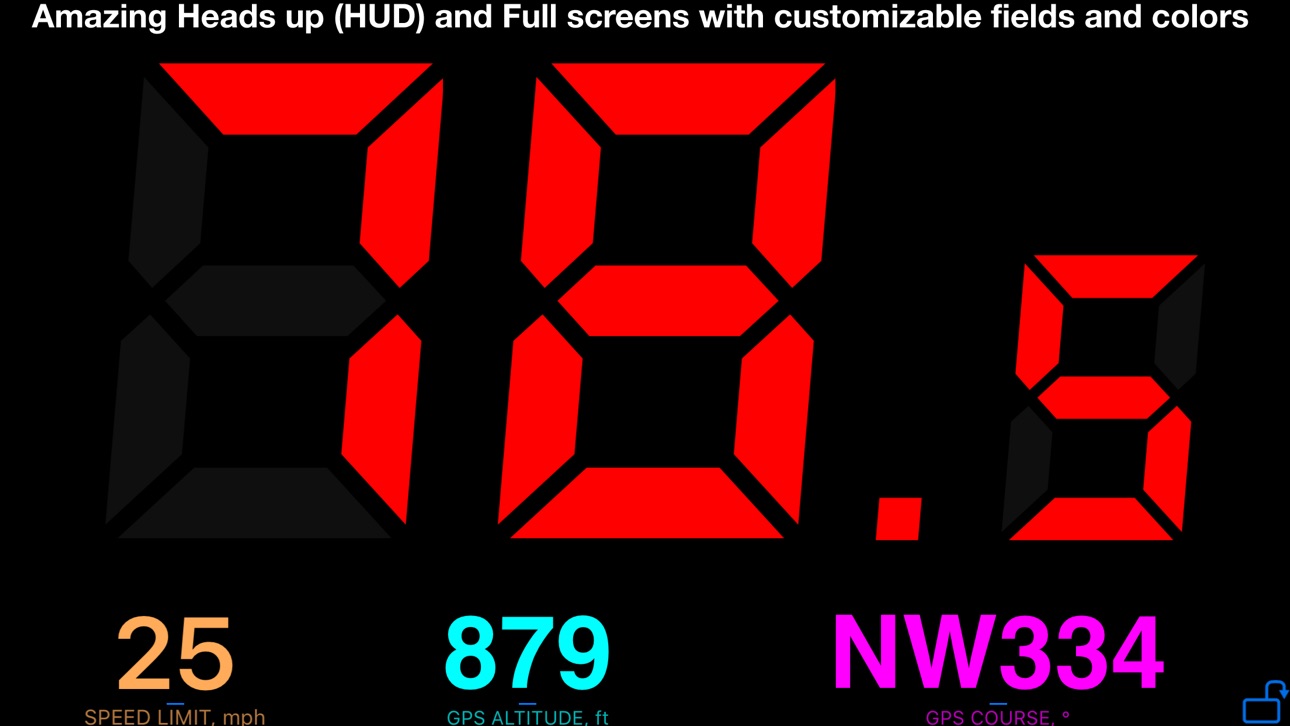
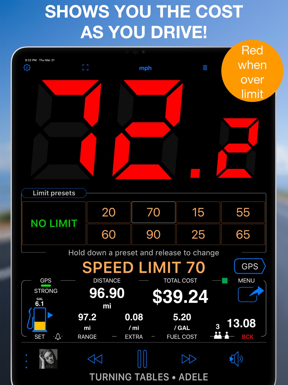
Un indicador de velocidad de alta calidad y el monitor del costo del viaje. Cuando usted pasa de un límite de velocidad preestablecido, los grandes dígitos cambian de color de verde a rojo y el dispositivo emite un fuerte sonido para avisarle! El monitor del costo muestra el actual costo del viaje mientras usted conduce y le dice la participación de cada pasajero.
‣ EL MONITOR DEL COSTO
Alguna vez se preguntó cuál es el costo de conducir al trabajo o a la tienda cercana? El monitor del costo le dirá!
Basado en el precio del gas por un galón o litro, MPG o litros a los 100 km le dirá cuál es el costo mientras usted conduce. Usted puede agregar un costo adicional por kilómetro o milla y esto también será incluido!
‣ FÁCIL DE AJUSTAR LOS LÍMITES DE VELOCIDAD
Establece los límites de velocidad con 4-8 presets rápidos y configurables. Presets sólo necesitan un solo toque y son la forma más segura de ajustar los límites!
‣ GRABAR PISTAS DE GPS.
Ver en el mapa con un gráfico de velocidad o altitud, o estadísticas.
Categorizar como personal o comercial. Exportación por devolución de impuestos o remuneración.
‣ INFORMES DE MILLAJE EN PDF
Convierta su kilometraje/pistas en informes personalizables de reembolso de kilometraje.
¡Puede firmar y anotar el informe antes de enviarlo!
‣ MAPAS
Google, Apple, mapa en blanco, mapas sin conexión. Callejero, satélite, mapas topográficos.
Importe o cree sus propios dibujos en el mapa (superposiciones de imágenes terrestres) y compártalos con amigos a través de kmz.
‣ (LLAMADA DE SOCORRO) S.O.S NEUMÁTICO PLANO O PEOR?
El velocímetro muestra su ubicación actual y se puede compartir fácilmente (sms / texto, correo electrónico) con la ayuda de automóviles, ambulancias o los amigos.
‣ BARO VSI
Indicador de velocidad vertical barométrica.
‣ ALTÍMETRO BAROMÉTRICO. QFE + QNH.
‣ ENTRENADOR DE VOZ
Cuando esté habilitado y configurado, el entrenador de voz le indicará la distancia y duración de la pista activa, así como la velocidad y la altitud actuales.
‣ ATAJOS DE SIRI
Pista nueva, Detener pista, Límite de velocidad.
‣‣ MODOS
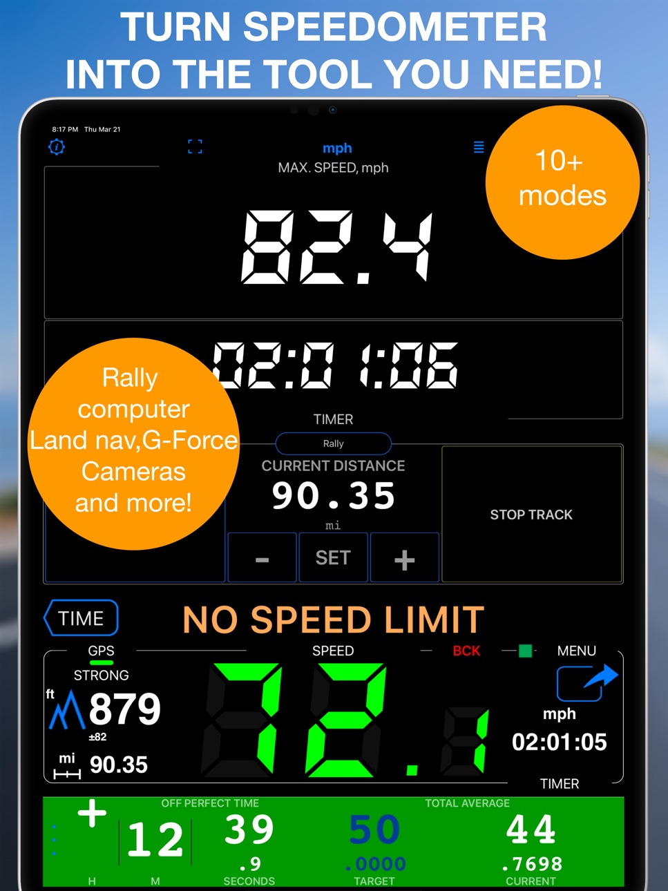
¡Use MENÚ>MODOS para convertir la aplicación en una computadora de Rally, un monitor G-Force, una alerta de cámara, un taxímetro, un parapente, una flecha hacia un destino! Actualmente hay 12+ modos disponibles.
‣ REGISTRO AUTOMÁTICO DE ACTIVIDADES AUTOMOTRICES. OPCIONAL.
Permite grabar actividades automotrices/de conducción automáticamente, sin necesidad de iniciar y detener manualmente la grabación de la pista. No es necesario mantener la aplicación en ejecución. Configúrelo una vez y deje que la aplicación rastree el kilometraje del automóvil por usted, para reembolso de impuestos o remuneración.
Como esta función tiene costos recurrentes para mantener y probar, se proporcionan 50 seguimientos automáticos gratuitos cada mes dentro del precio único de la aplicación. Si necesita más grabaciones de seguimiento automático por mes, puede actualizar a la cantidad ilimitada de seguimientos automáticos.
∙ UNIVERSAL APP. Velocímetro para el iPhone y iPads celulares.
∙ 000-999 VELOCIDAD Y GAMA LIMIT. MPH, NUDOS y KM/H. Máxima, velocidad media distancia recorrida.
∙ Modo del fondo disponible! Velocímetro funcionara en segundo plano si le dije y todavía le avisará con alerta sonora cuando usted supere el límite de velocidad preestablecido. Puede utilizar otras aplicaciónes mientras que el velocímetro y el monitor del costo hace su trabajo en el fondo!
! Usted puede utilizar esta aplicación en su iPhone y iPads celulares.
! Tenga en cuenta que al igual que con todas las aplicaciones de GPS, el uso continuado del GPS en el fondo puede disminuir dramáticamente la vida de la batería.
¡Descarga y conduce con tranquilidad! ¡Mantenga el registro y evite pagar esas multas por exceso de velocidad! ¡Nuestro velocímetro es el compañero ideal sin importar el viaje que realice!
Condiciones de uso: https://www.apple.com/legal/internet-services/itunes/dev/stdeula/
In-App Purchases CL pricing
Automatic mileage tracking Subscription
Rastreo automático ilimitado · Monthly$1.990
Capabilities
In-App Purchases
Accessibility
ipadiphonemacrealityDevicetvoswatch
Version history 25 versions
Build 886769995v6.22026-07-05 05:23:12
■ Waypoint labels, your way
‣ Waypoint names can now be shown as compact or larger map labels, with either the current filled background or a clean no-background style using the waypoint color for the text.
‣ Waypoints with attached photos can show a thumbnail right above the name on the map, making photo points easier to recognize without opening the waypoint first.
‣ To set it up, open Map Settings > Common settings > Waypoint labels. Label size, Photo thumbnail, and Label background are separate visible controls.
Build 885924243v6.12026-06-08 18:21:53
■ Pitch & Roll
‣ Pitch & Roll panels now include motorcycle and airplane image options. Choose them from the panel settings.
■ Map and Track Improvements
‣ Active track line width is now configurable in Map Settings. The thinnest line is now the default for better map visibility.
‣ The purple tail is now called Location breadcrumb. It is hidden from the map menu while recording, and now starts off by default to avoid confusion.
■ Channels replace GPS Beacons
‣ Channels are the new way to share live location while tracking. Share by private web link with optional password protection, or use a shared group channel where members can follow each other in the app or on the web.
‣ Channels are off by default. Your location is shared only when you turn sharing on for an active or joined channel while track recording is running and not paused.
‣ Channels do not require an account or registration. They expire automatically after idling, and the creator can delete them at any time.
■ Voice Coach and Navigation Hints
‣ Voice Coach and navigation hints now work together in one clearer setup. Configure regular coach announcements, on-course guidance, spoken target distance and bearing, and relative or absolute spoken bearings from the same place.
‣ Voice Coach can now include target navigation guidance in regular time or distance interval announcements, telling distance and bearing to the current target when one is active.
‣ New absolute spoken bearing guidance lets you keep the iPhone in your pocket and navigate by voice hints while holding a magnetic compass in your hand.
‣ Huge thanks to Steve for suggesting absolute bearing voice guidance and testing it in the wild.
■ Fixes and Compatibility
‣ Improved KML and KMZ export/import compatibility, including more reliable fallback handling for waypoint descriptions and notes.
‣ General Sound Settings now include a new option to explicitly select which device voice is used for voice guidance and announcements.
‣ Fixed issues with the course line after returning from background, the export file name pattern editor on iOS 17, and a rare Trips & Tracks filter crash on iOS 15.
Build 884471138v6.02026-05-16 09:54:53
■ Mileage and Cost Calculator
‣ Add intermediate stops to your estimates, making them more precise and useful for cost planning, reimbursement records, and tax reporting.
■ More Natural Voice Guidance
‣ Navigation hints, voice coach announcements, and waypoint proximity alerts now use the best available voice automatically, with improved handling of plurals, decimals, numbers, and time or duration announcements across all supported languages.
■ Trip Tracks and Offline Maps
‣ Fixed track numbers not being shown on the map when viewing all tracks for a trip. Start and end markers now match the track numbers from the trip track list.
‣ Pinned tracks can now be shown on the offline map download screen, giving better spatial awareness when choosing which region to download.
■ Drawing Tools for GPS Camera and Ground Overlays
‣ GPS Camera drawing tools received a major update with text, dimension, and selection tools.
‣ The new drawing tools and options can now also be used when editing ground map image overlays.
‣ Drawings are no longer hardcoded into photos or ground image overlays on save, so they can be edited later.
■ Import Fixes
‣ Improved error handling when importing incomplete or corrupted trip archives.
‣ Fixed GPX import so the import options page closes correctly after import, and the Cancel button works as expected.
Build 882374487v5.92026-04-03 05:25:40
■ Pitch & Roll Mode
New central and micro panels help improve spatial awareness and safety for off-road driving, motorhome balancing, and more. Includes customizable alerts for unsafe angles and for returning back to safe ranges.
■ Reworked Trip Editor
Initial mileage setup is now simpler, and trip counter management is more flexible. Set or reset both total and current counters directly from the trip editor.
■ EV Support
Added electric vehicle support for cost, consumption, and driving range. Track cost is now calculated using the cost parameters saved with the track when it was completed, not the current settings.
■ Pinned Tracks Upgraded
Pin multiple tracks on the map at the same time, customize their color and line width, save pinned track sets as presets, and apply them whenever needed. Open Manage pinned tracks from the live map (press and hold to open the map menu), from the track list (... > Pinned tracks), by swiping a track row and using Pin to live map, or from the Pinned tracks section in Common Map Settings.
■ Online Map Cache
Tiles from online map sources are now cached to improve map browsing, reduce mobile data usage, and lower load on map providers. You can review cache usage from the maps list and reset the cache from the online map source settings.
■ G-Force Mode Reworked
The central panel now includes the G-Bowl alongside the G-Force graph. Set customizable alerts for overloads on any axis and monitor your limits more clearly.
Build 880517269v5.82026-02-10 10:25:08
■ Custom Track Category Names
Personalize your track categories! Rename any of the five built-in categories (Business, Personal, Medical, Charity, Other) with custom names and abbreviations that match your workflow. Your custom names appear everywhere—category picker, filters, and PDF mileage reports. Access from Settings > Advanced settings > GPS Tracking > Customize category names.
■ Per-Category Mileage Rates
PDF mileage reports now support different reimbursement rates for each category. Set a rate for Business trips, another for Personal, etc.—the report calculates totals accordingly and displays the rates used.
■ Reworked Numeric Keyboard
Dedicated numeric input keyboard (used for UTM, MGRS coordinates, etc.) now works properly and looks modern across all iOS versions 15-26. Fixed iPadOS 26 showing its own floating numeric pad alongside ours, and iOS 26 keyboard dismiss button losing proper placement after screen rotation.
Build 879495359v5.7.32025-11-06 18:16:31
• Fixed an issue where bottom toolbar buttons were difficult to see on iOS 26.1.
• Fixed an issue where exporting multiple collections failed on smaller devices like iPhone 12 mini running iOS 26.
Build 879016192v5.7.22025-10-19 09:59:43
• Fixed an issue where the Filter button and the Trips/Tracks switch were not displayed on iOS 15–18 in the trips and tracks list. Huge thanks to Peter for reporting it!
Build 878731371v5.7.12025-10-09 06:21:20
• Fixed search button not being shown in some cases in waypoints list.
• Fixed a rare crash that could occur on iOS 26 when exporting large offline maps.
Build 876616724v5.72025-09-29 10:19:12
■ Updates and optimizations for iOS 26 and beyond:
• Reworked toolbars for the waypoints list, waypoint collections list, and tracks/trips list — ensuring a consistent user experience from iOS 15 through iOS 26.
• Reworked search implementation in waypoints list.
◆ Camera tool:
• Significantly faster camera startup.
• Reworked the toolbar for image annotation.
• Optimized photo stamping for higher speed and improved compatibility with iOS 15 and older devices (e.g., iPhone 6S).
• Fixed an issue on older devices where the camera might not appear when opened from the Point Editor.
Build 875227534v5.62025-07-10 16:36:51
◆ Added the 'Mark tank as full' Siri/Shortcuts command, allowing you to integrate it into your Siri and Shortcuts automation workflows. Huge thanks to Steven for suggesting it and testing it as part of his advanced automation setup.
◆ Batch Export of Collections: Export multiple point/photo collections at once as a single KMZ file.
◆ Batch Enable/Disable Collections: Easily enable or disable several point/photo collections in one go.
→ To use: tap the new 'more' button (left of the '+' in the collections list), choose Select, pick collections, then choose an action from the bottom toolbar.
◆ Enhanced KMZ Import: Now supports KMZ archives with multiple subfolders and multiple KML files.
→ Import via the 'more' button on the points/photos list or the 'Open In' system option on iPhone/iPad.
◆ New drawing tools for annotating photos taken by the camera tool and ground image overlays:
+ Arrow, Rectangle, Circle, Cross pointer.
+ You can also adjust the line width.
◆ Other Improvements:
+ Added info message at the bottom of the points/photos list to indicate when collections are disabled and their items are hidden.
+ When exporting all tracks of a trip to a single KMZ file (for Google Earth), the app now uses the gx:Track format to preserve timestamp information for each track point. The previously used Geometry format was losing that valuable time data.
+ Various fixes and performance improvements.
Build 874716834v5.52025-05-28 12:44:13
◆ Map collections:
Map collections let you prepare a map setup tailored to your mission.:
+ Choose a base map: Apple (street, satellite, hybrid), any online map source, or a downloaded/imported offline map.
+ Add map overlays (online map sources, downloaded/offline map) with adjustable transparency.
+ Add ground image overlays.
+ Switch between preconfigured map collections with a single tap.
◆ Ground Image Overlays:
+ Import KMZ ground image overlays directly from the map list screen.
+ Improved performance when displaying large ground image overlays in the maps list by using pre-cached thumbnail previews.
Build 873791483v5.42025-04-10 08:52:12
■ Google Maps Update (v9.4.0):
+ Major update from Google! The map now includes more detailed visuals like crosswalks, road lanes, and tiny directional arrows at intersections.
+ These enhanced details are also available in Hybrid mode.
+ Bonus: the long-standing stuttering issue with Google Maps is finally fixed!
It’s clear someone at Google was having fun — and now we get to enjoy the results!
■ Optimizations:
+ Improved internal database handling results in faster performance when reading and writing data. Just note: to share or back up full trip data, you’ll need to stop the current track or make another trip active first.
+ The 'Focus on a map region' function and offline map previews now zoom to a reasonable level instead of starting fully zoomed out. Much easier to see your offline map now!
Build 871969871v5.32025-04-02 08:48:28
◆ Offline maps:
+ Open/Import Offline Maps from Disk/Files Directly in the App. To open or import a map directly in the app, use the '+' button on the map settings (list) screen and select the new option: Import offline map
+ Export/Share Offline Maps. To share or export a map, tap the 'Action' button on the offline map details screen.
◆ Mileage calculator:
+ Added 'Recents' to the address search in the Mileage Calculator. It now remembers the last 20 searched addresses for quick reuse with one tap.
+ Fixed an issue in the Mileage Calculator where some addresses couldn’t be found in the address search. Now, any address you can find in Apple Maps should also be found in the Mileage Calculator.
◆ Automatic tracking:
+ Option to postpone automatic driving track termination during periods of walking or running (e.g., while delivering packages). Settings > Advanced settings > GPS tracking > Automatic tracking > Detection > Location & Motion.
◆ Import:
+ Waypoints and photos can now be imported from files directly within the app. Supported formats: KMZ, KML, GPX, CSV, and TXT. Use the ‘More’ button on the Waypoints screen.
+ Tracks and trips can now be imported directly from files within the app. Supported formats: KMZ, KML, GPX, and TRK. Use the ‘More’ button on the Tracks or Trips screen.
◆ Fixes:
+ Fixed a crash when opening the trips filter on the trips list screen.
+ Fixed a crash when trimming a track in the track editor if the same track was still displayed on the main map.
Build 871142526v5.22025-01-18 19:45:50
◆ Updated the World Magnetic Model for 2025–2029 to ensure accurate declination data between true north and magnetic north.
The World Magnetic Model (WMM) is utilized in the following areas of the app:
• Magnetic Declination on the Map: You can enable magnetic declination to be visible in the map browse/edit mode. It is displayed with a δ symbol for any point at the center of the map (indicated by the red arrow). "MENU > Settings > Compass & Course > Show magnetic declination δ."
• Importing Points: When importing points that specify only a true or magnetic direction, the missing counterpart (true or magnetic) is calculated using the WMM.
• Off-Road Navigation: During off-road navigation, the app may use declination data provided for the current location by Apple/iOS.
Except for the last point, credit for the model goes to the United States’ National Geospatial-Intelligence Agency (NGA) and the United Kingdom’s Defence Geographic Centre (DGC).
◆ Fixed the issue with imported offline map files not being deleted when you delete the map in the app.
+ Option added to MENU > Settings > Maintenance > Find and delete orphaned offline maps. Turns out that imported offline map files (.sqlitedb or .mbtiles) were not deleted when you delete the map in the app. Thus large files might have stayed in the app. If you have ever imported and deleted the offline maps, please check if some of the files are not left over.
◆ The currently recorded track is no longer displayed when viewing a previously saved track in the track view/editor.
This ensures the saved track view is not obscured. This change applies only to Apple Maps, as Google Maps did not display the current track in the saved track view.
Build 870085238v5.12024-11-08 07:30:28
◆ Evolution of Siri Shortcuts:
• Pre-made Siri shortcuts/commands are now available for speed limits, track control, and waypoint creation.
• New background shortcuts let you apply and reset speed limits without needing to open the app or disrupt your current activity.
• No more need to "donate" shortcuts to Siri in the app. Just use the pre-made shortcuts as templates in the Shortcuts app to easily add your own for unlimited speed limits and enhanced voice control for tracking and waypoints.
Build 869567332v5.0.12024-10-11 08:40:02
◆ More updates for iOS 18:
• The search text for points, places, and addresses is now properly displayed in black on iOS 18 devices.
• Applying a speed limit via "Hey Siri" now correctly sets the speed limit only once on iOS 18 devices. For more information on using Siri to set speed limits, please refer to the documentation.
• Fixed an issue where the new coordinates converter was not displayed in the point editor. This issue was not related to iOS 18 but was caused by the new development tools, affecting all devices from iOS 15 to 18.
Build 868555693v5.02024-10-07 18:43:38
◆ Optimizations for iOS 18. Supported versions of iOS are now 15-18.
Build 867892652v4.92024-08-21 18:35:16
◆ Added a new text input-based coordinates converter. You'll find it in several places:
- In the point editor, to the left of the Done button or in the Latitude/Longitude, UTM, MGRS rows.
- On the map, in the map search > Coordinates.
• The new coordinates converter also supports the OSGB and SK 42 coordinate systems, in addition to the current Latitude/Longitude, UTM, and MGRS formats.
• This is part of our ongoing effort to bring support for the majority of EPSG coordinate systems to the app. We hope the new coordinates converter proves to be a useful tool.
• Please let us know via a review or at support@blocoware.com if you'd like to see your preferred coordinate system added.
◆ Fixed a bug where the HUD/Full screen would not update the speed when the app with the active HUD/Full screen was brought back to the foreground after being in the background for a very long time.
Build 867331473v4.8.12024-07-09 20:59:06
Quick fix version 4.8.1:
◆ Quick-fix for the recent work on an iPod section. Fixed song title and artist not being refreshed for some users when song is switched in the Apple music app or in the app itself.
Major version 4.8:
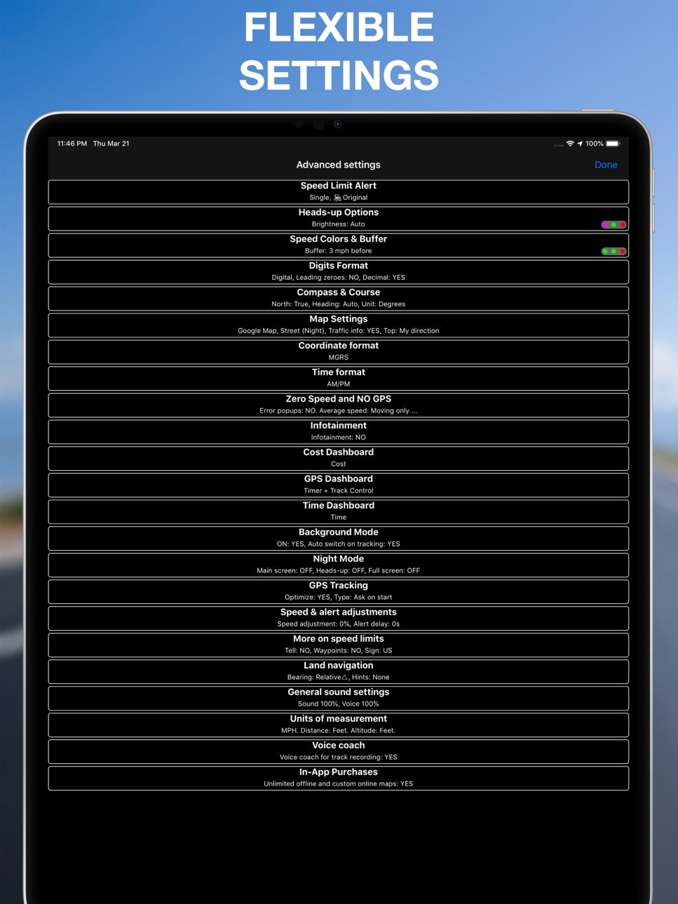
◆ You can now change the color of buttons in the app. This should provide more options for improved visibility of buttons in bright sunlight and potentially assist in cases involving color vision deficiencies. Settings > Advanced settings > Button colors.
◆ Google maps updated to version 9.0.0.
Bug fixes and optimizations:
‣ Performance and memory related updates to the built-in iPod player so it works properly and consistently across iOS 15-17 versions.
‣ Fixed intermittent crash when asking for confirmation if you want to stop the offline map download screen on closing the download screen while download is in progress when the choice was to continue with the download.
‣ Fixed rare crash when opening the map settings.
Build 866080046v4.82024-07-04 18:36:49
◆ You can now change the color of buttons in the app. This should provide more options for improved visibility of buttons in bright sunlight and potentially assist in cases involving color vision deficiencies.) Settings > Advanced settings > Button colors.
◆ Google maps updated to version 9.0.0.
Bug fixes and optimizations:
‣ Performance and memory related updates to the built-in iPod player so it works properly and consistently across iOS 15-17 versions.
‣ Fixed intermittent crash when asking for confirmation if you want to stop the offline map download screen on closing the download screen while download is in progress when the choice was to continue with the download.
‣ Fixed rare crash when opening the map settings.
Build 862923052v4.72024-05-19 16:08:02
◆ Mileage calculator adds 'My location' button to pre-populate start or end address with your current location.
◆ Rally computer advancements. (MENU > MODES Rally mode):
‣ Top trip master panel now shows 4 customizable fields.
‣ You can select background color and measurement type for each field.
‣ Rally can run as a session, recording tracks for each split/segment and allowing the app to run in the background until you finish the rally session.
‣ When rally session is active you can adjust all of the rally counters. Use ± button to enter the adjustment mode.
‣ You can configure segments for your rally and split between these segments. If you set distance or target average speed for segments, the app will give you hints on distance left in the segment and will apply the target average speed automatically.
‣ Rally settings, including segments, can be shared or backed up for later restoration, when you need to return to this particular rally.
◆ Google maps updated to version 8.4.0.
◆ From iOS 17.5, barometer related functions require access to 'Motion & Fitness'. The app now provides visual hints to enable the access, where required.
Build 862324138v4.62024-01-13 12:57:17
◆ Track list improvements. MENU > Tracks:
‣ Added option to search/filter by text.
‣ Top-right 'More' button now offers options to add a calculated track (via mileage calculator) or show/hide a note field in the tracks list.
‣ When track note is shown in the tracks list, you can tap on a note button to edit track fields: name, note, start/end address, category.
◆ Track view improvements:
‣ Sharing/export, pin to live map, move to another trip, selecting a view mode - all these options moved to the top-right 'More' button/menu.
‣ There is now a separate button for trimming the track at its end.
‣ Added distance to the data shown as you scrub through the track.
◆ Track fields editor improvements:
‣ Track fields editor now includes section to set categories. 'Not assigned' is included as an option for setting the category.
Build 860376153v4.52023-12-17 16:37:44
◆ Optimized for iOS 17.2.
◆ Google maps updated to version 8.2.0.
◆ First iteration on integration with bluetooth sensors:
‣ Heart rate
‣ Cycling speed
‣ Cycling cadence
- Can be useful for cyclists or custom bike/vehicle builders.
- Completely optional. Available for iOS 17 and higher.
- If you want to connect bluetooth sensors, swipe through on the bottom (in portrait) or left (in landscape) panel until you see the new bluetooth sensors panel. Or use ⋮ button in the bottom or left panel to show the new bluetooth panel.
Build 858135735v4.42023-09-23 19:11:57
◆ Optimized for iOS 17.
◆ Removed support for iOS 12-14. Supported iOS versions are now 15, 16, 17. You can still install older app versions on the devices with older iOS versions.
◆ Improvements for land navigation:
‣ Both Estimated Time En Route (ETE) and Estimated Time of Arrival (ETA) are now supported for land/air navigation targets. Tap on ETE display to switch to ETA and vice versa.
◆ Camera tool:
‣ When you open photo from the points list, the app now provides controls to navigate through the adjacent photos in the points list, without the need to return to the list. You can swipe through or use left/right arrows.
Build 857248489v4.32023-06-28 13:13:02
◆ Overzoom and underzoom for offline maps:
‣ Allows to show the offline map for zoom levels that are not downloaded or imported.
‣ With overzoom you can download zoom level 2-16 and let the map upscale from zoom level 16 to 17-19 as you zoom in.
‣ Overzoom and underzoom is applied automatically, no need to set up anything.
‣ For the best experience with offline or custom/blank maps on iOS 16, please be sure to have iOS 16.4 or later.
◆ Work hours schedule for automatic driving tracking:
‣ Allows to set up a different track category for work hours and non-work hours.
‣ Allows to forbid recording automatic tracks outside of work hours. Part of 'Automatic tracking. Unlimited.' upgrade.
◆ Improvements for land navigation:
‣ New automatic check-in option that allows to check-in by simply entering the circle around the target.
‣ Settings button in the 'Set Target' menu now opens the land navigation settings screen.
‣ 'Set Target' menu now shows information on navigation settings.
◆ Bug fixes and optimizations:
‣ Optimized for iOS 16.5.
‣ Improved time zone handling for the Mileage calculator(MENU > Mileage/cost/fuel calculator).
Price history by region
Currency
Show
Columns
Search
Availability 175 of 175 storefronts
| Region | Language | Price | Ratings | Avg | Version |
|---|---|---|---|---|---|
| US | en-US | USD 3.99 | 2.7k | 4.7 | 6.2 |
| AU | en-AU | AUD 5.99 | 940 | 4.6 | 6.2 |
| JP | ja | JPY 600 | 855 | 4.5 | 6.2 |
| CA | en-CA | CAD 5.99 | 399 | 4.6 | 6.2 |
| GB | en-GB | GBP 3.99 | 371 | 4.8 | 6.2 |
| DE | de-DE | EUR 4.99 | 337 | 4.7 | 6.2 |
| FR | fr-FR | EUR 4.99 | 205 | 4.7 | 6.2 |
| RU | ru | RUB 399 | 175 | 4.8 | 6.2 |
| ES | es-ES | EUR 4.99 | 111 | 4.7 | 6.2 |
| MX | es-MX | MXN 89 | 97 | 4.8 | 6.2 |
| CH | de-CH | CHF 4 | 90 | 4.6 | 6.2 |
| AE | en-GB | AED 14.99 | 80 | 4.6 | 6.2 |
| NZ | en-AU | NZD 6.99 | 56 | 4.9 | 6.2 |
| BR | pt-BR | BRL 24.9 | 48 | 4.8 | 6.2 |
| SA | en-GB | SAR 17.99 | 42 | 4.8 | 6.2 |
| ZA | en-GB | ZAR 79.99 | 26 | 4.8 | 6.2 |
| CL | es-MX | CLP 4990 | 22 | 4.5 | 6.2 |
| NO | en-GB | NOK 49 | 22 | 4.7 | 6.2 |
| VN | en-GB | VND 119000 | 22 | 4.9 | 6.2 |
| NL | nl | EUR 4.99 | 21 | 4.8 | 6.2 |
| CO | es-MX | COP 19900 | 20 | 4.5 | 6.2 |
| IN | en-GB | INR 399 | 20 | 4.6 | 6.2 |
| CN | zh-Hans-CN | CNY 28 | 19 | 4.7 | 6.2 |
| AR | es-MX | USD 3.99 | 18 | 4.8 | 6.2 |
| AT | de-DE | EUR 4.99 | 18 | 4.5 | 6.2 |
| TH | en-GB | THB 149 | 18 | 4.9 | 6.2 |
| DK | en-GB | DKK 39 | 16 | 4.8 | 6.2 |
| TR | en-GB | TRY 99.99 | 16 | 4.3 | 6.2 |
| UA | en-GB | USD 3.99 | 16 | 4.7 | 6.2 |
| IE | en-GB | EUR 4.99 | 15 | 4.7 | 6.2 |
| IT | it | EUR 4.99 | 15 | 4.8 | 6.2 |
| EC | es-MX | USD 3.99 | 14 | 4.9 | 6.2 |
| CZ | en-GB | CZK 99 | 13 | 4.5 | 6.2 |
| HU | en-GB | HUF 1790 | 12 | 4.8 | 6.2 |
| PE | es-MX | PEN 17.9 | 12 | 4.5 | 6.2 |
| PH | en-GB | PHP 249 | 12 | 4.8 | 6.2 |
| PL | en-GB | PLN 19.99 | 12 | 4.9 | 6.2 |
| GR | en-GB | EUR 4.99 | 10 | 5.0 | 6.2 |
| PT | pt-PT | EUR 4.99 | 10 | 4.7 | 6.2 |
| HK | zh-Hant-HK | HKD 32 | 9 | 4.8 | 6.2 |
| SE | sv | SEK 49 | 9 | 4.9 | 6.2 |
| TW | zh-Hant-TW | TWD 120 | 9 | 5.0 | 6.2 |
| BE | en-GB | EUR 4.99 | 8 | 4.6 | 6.2 |
| FI | en-GB | EUR 4.99 | 8 | 4.9 | 6.2 |
| ID | en-GB | IDR 69000 | 8 | 4.9 | 6.2 |
| KR | ko | KRW 6600 | 8 | 5.0 | 6.2 |
| MY | en-GB | MYR 19.9 | 8 | 4.5 | 6.2 |
| RO | en-GB | RON 19.99 | 7 | 4.4 | 6.2 |
| SG | en-GB | SGD 5.98 | 7 | 5.0 | 6.2 |
| EE | en-GB | EUR 4.99 | 6 | 5.0 | 6.2 |
| HR | en-GB | EUR 4.99 | 6 | 5.0 | 6.2 |
| QA | en-GB | QAR 14.99 | 6 | 5.0 | 6.2 |
| BG | en-GB | EUR 4.49 | 5 | 5.0 | 6.2 |
| BY | en-GB | USD 3.99 | 5 | 5.0 | 6.2 |
| KW | en-GB | USD 3.99 | 5 | 5.0 | 6.2 |
| LT | en-GB | EUR 4.99 | 5 | 5.0 | 6.2 |
| LU | en-GB | EUR 4.99 | 5 | 4.4 | 6.2 |
| DO | es-MX | USD 3.99 | 4 | 4.5 | 6.2 |
| IL | en-GB | ILS 14.9 | 4 | 5.0 | 6.2 |
| MT | en-GB | EUR 4.99 | 4 | 5.0 | 6.2 |
| SK | en-GB | EUR 4.99 | 4 | 5.0 | 6.2 |
| TZ | en-GB | TZS 11900 | 4 | 5.0 | 6.2 |
| CR | es-MX | USD 3.99 | 3 | 5.0 | 6.2 |
| EG | en-GB | EGP 199.99 | 3 | 4.7 | 6.2 |
| JO | en-GB | USD 3.99 | 3 | 5.0 | 6.2 |
| KH | en-GB | USD 3.99 | 3 | 4.3 | 6.2 |
| KZ | en-GB | KZT 2490 | 3 | 5.0 | 6.2 |
| MU | en-GB | USD 4.99 | 3 | 5.0 | 6.2 |
| NG | en-GB | NGN 6900 | 3 | 5.0 | 6.2 |
| OM | en-GB | USD 3.99 | 3 | 5.0 | 6.2 |
| BH | en-GB | USD 3.99 | 2 | 5.0 | 6.2 |
| BO | es-MX | USD 3.99 | 2 | 5.0 | 6.2 |
| LB | en-GB | USD 3.99 | 2 | 5.0 | 6.2 |
| LV | en-GB | EUR 4.99 | 2 | 5.0 | 6.2 |
| MD | en-GB | USD 4.99 | 2 | 5.0 | 6.2 |
| PK | en-GB | PKR 1100 | 2 | 5.0 | 6.2 |
| PY | es-MX | USD 3.99 | 2 | 5.0 | 6.2 |
| RS | en-GB | EUR 4.99 | 2 | 5.0 | 6.2 |
| SI | en-GB | EUR 4.99 | 2 | 5.0 | 6.2 |
| UY | en-GB | USD 3.99 | 2 | 5.0 | 6.2 |
| AM | en-GB | USD 4.99 | 1 | 5.0 | 6.2 |
| BM | en-GB | USD 3.99 | 1 | 5.0 | 6.2 |
| CY | en-GB | EUR 4.99 | 1 | 5.0 | 6.2 |
| GE | en-GB | USD 4.99 | 1 | 5.0 | 6.2 |
| GH | en-GB | USD 4.99 | 1 | 4.0 | 6.2 |
| GT | es-MX | USD 3.99 | 1 | 5.0 | 6.2 |
| IS | en-GB | USD 4.99 | 1 | 5.0 | 6.2 |
| JM | en-GB | USD 3.99 | 1 | 5.0 | 6.2 |
| KE | en-GB | USD 4.99 | 1 | 4.0 | 6.2 |
| KG | en-GB | USD 3.99 | 1 | 5.0 | 6.2 |
| MA | en-GB | USD 3.99 | 1 | 4.0 | 6.2 |
| MO | zh-Hant-HK | USD 3.99 | 1 | 4.0 | 6.2 |
| MZ | en-GB | USD 3.99 | 1 | 4.0 | 6.2 |
| PA | es-MX | USD 3.99 | 1 | 5.0 | 6.2 |
| RW | en-GB | USD 3.99 | 1 | 4.0 | 6.2 |
| TT | en-GB | USD 3.99 | 1 | 5.0 | 6.2 |
| ZW | en-GB | USD 4.99 | 1 | 4.0 | 6.2 |
| AF | en-GB | USD 3.99 | 0 | — | 6.2 |
| AG | en-GB | USD 3.99 | 0 | — | 6.2 |
| AI | en-GB | USD 3.99 | 0 | — | 6.2 |
| AL | en-GB | USD 4.99 | 0 | — | 6.2 |
| AO | en-GB | USD 3.99 | 0 | — | 6.2 |
| AZ | en-GB | USD 4.99 | 0 | — | 6.2 |
| BA | en-GB | EUR 4.99 | 0 | — | 6.2 |
| BB | en-GB | USD 4.99 | 0 | — | 6.2 |
| BF | en-GB | USD 3.99 | 0 | — | 6.2 |
| BJ | en-GB | USD 4.99 | 0 | — | 6.2 |
| BN | en-GB | USD 3.99 | 0 | — | 6.2 |
| BS | en-GB | USD 3.99 | 0 | — | 6.2 |
| BT | en-GB | USD 3.99 | 0 | — | 6.2 |
| BW | en-GB | USD 3.99 | 0 | — | 6.2 |
| BZ | en-GB | USD 3.99 | 0 | — | 6.2 |
| CD | en-GB | USD 3.99 | 0 | — | 6.2 |
| CG | en-GB | USD 3.99 | 0 | — | 6.2 |
| CI | fr-FR | USD 4.99 | 0 | — | 6.2 |
| CM | fr-FR | USD 4.99 | 0 | — | 6.2 |
| CV | en-GB | USD 3.99 | 0 | — | 6.2 |
| DM | en-GB | USD 3.99 | 0 | — | 6.2 |
| DZ | en-GB | USD 3.99 | 0 | — | 6.2 |
| FJ | en-GB | USD 3.99 | 0 | — | 6.2 |
| FM | en-GB | USD 3.99 | 0 | — | 6.2 |
| GA | fr-FR | USD 3.99 | 0 | — | 6.2 |
| GD | en-GB | USD 3.99 | 0 | — | 6.2 |
| GM | en-GB | USD 3.99 | 0 | — | 6.2 |
| GW | en-GB | USD 3.99 | 0 | — | 6.2 |
| GY | en-GB | USD 3.99 | 0 | — | 6.2 |
| HN | es-MX | USD 3.99 | 0 | — | 6.2 |
| IQ | en-GB | USD 3.99 | 0 | — | 6.2 |
| KN | en-GB | USD 3.99 | 0 | — | 6.2 |
| KY | en-GB | USD 3.99 | 0 | — | 6.2 |
| LA | en-GB | USD 3.99 | 0 | — | 6.2 |
| LC | en-GB | USD 3.99 | 0 | — | 6.2 |
| LK | en-GB | USD 3.99 | 0 | — | 6.2 |
| LR | en-GB | USD 3.99 | 0 | — | 6.2 |
| LY | en-GB | USD 3.99 | 0 | — | 6.2 |
| ME | en-GB | EUR 3.99 | 0 | — | 6.2 |
| MG | en-GB | USD 3.99 | 0 | — | 6.2 |
| MK | en-GB | USD 3.99 | 0 | — | 6.2 |
| ML | en-GB | USD 3.99 | 0 | — | 6.2 |
| MM | en-GB | USD 3.99 | 0 | — | 6.2 |
| MN | en-GB | USD 3.99 | 0 | — | 6.2 |
| MR | en-GB | USD 3.99 | 0 | — | 6.2 |
| MS | en-GB | USD 3.99 | 0 | — | 6.2 |
| MV | en-GB | USD 3.99 | 0 | — | 6.2 |
| MW | en-GB | USD 3.99 | 0 | — | 6.2 |
| NA | en-GB | USD 3.99 | 0 | — | 6.2 |
| NE | en-GB | USD 3.99 | 0 | — | 6.2 |
| NI | es-MX | USD 3.99 | 0 | — | 6.2 |
| NP | en-GB | USD 4.99 | 0 | — | 6.2 |
| NR | en-GB | USD 3.99 | 0 | — | 6.2 |
| PG | en-GB | USD 3.99 | 0 | — | 6.2 |
| PW | en-GB | USD 3.99 | 0 | — | 6.2 |
| SB | en-GB | USD 3.99 | 0 | — | 6.2 |
| SC | en-GB | USD 3.99 | 0 | — | 6.2 |
| SL | en-GB | USD 3.99 | 0 | — | 6.2 |
| SN | en-GB | USD 4.99 | 0 | — | 6.2 |
| SR | en-GB | USD 3.99 | 0 | — | 6.2 |
| ST | en-GB | USD 3.99 | 0 | — | 6.2 |
| SV | es-MX | USD 3.99 | 0 | — | 6.2 |
| SZ | en-GB | USD 3.99 | 0 | — | 6.2 |
| TC | en-GB | USD 3.99 | 0 | — | 6.2 |
| TD | en-GB | USD 3.99 | 0 | — | 6.2 |
| TJ | en-GB | USD 3.99 | 0 | — | 6.2 |
| TM | en-GB | USD 3.99 | 0 | — | 6.2 |
| TN | en-GB | USD 3.99 | 0 | — | 6.2 |
| TO | en-GB | USD 3.99 | 0 | — | 6.2 |
| UG | en-GB | USD 4.99 | 0 | — | 6.2 |
| UZ | en-GB | USD 3.99 | 0 | — | 6.2 |
| VC | en-GB | USD 3.99 | 0 | — | 6.2 |
| VE | es-MX | USD 3.99 | 0 | — | 6.2 |
| VG | en-GB | USD 3.99 | 0 | — | 6.2 |
| VU | en-GB | USD 3.99 | 0 | — | 6.2 |
| XK | en-GB | EUR 4.99 | 0 | — | 6.2 |
| YE | en-GB | USD 3.99 | 0 | — | 6.2 |
| ZM | en-GB | USD 4.99 | 0 | — | 6.2 |
Reviews 7 reviews · CL
★★★★★
Muy buena app
Con algunos ajustes pude sacar el consumo de combustible y el valor que salia cada recorrido en mi dia a dia. Ademas esta confirmado que los gps miden la veñocidad real y la del tacometro tiene un rango de error de hasta 10km dependiendo del neumatico entre otros factores. Por lo que esta app es una maravilla y la he usado en viajes y trayectos al trabajo y nunca me he arrepentido de haberla comprado. Es una maravilla ❤️
sammiller18222024-01-29
★★★★★
Problemas en iPhone
Hola
Compré la versión pro pero no detecta el gps d mi iPhone 6.
Necesita alguna configuración extra?, no entiendo
pincelsonoro2019-06-10
★★★★★
Espero me solucionen el problema.
Compré la aplicación Pro solo porque podía dejar registro de la ruta que hago a diario, pero tiene problema o errores. Se salta la línea y cuando vuelve a partir no marca las últimas calles por las que e circulado. Espero reparen la falla.
bastianAaj2019-04-30
★★★★★
Excelente app
Viajo mucho vía terrestre. Estable, arroja la información en tiempo de real y la alarma sonora se activa cuando se supera el límite de velocidad fijado. Terminado el viaje se puede acceder a un mapa con el camino recorrido y las zonas de color rojo con los límites de velocidad excedidos. Esto me permite controlar a los conductores con los que viajo.
Chrisjav Cam2017-04-20
★★★★★
Recomendable!!!!
Excelente aplicación. Sobre todo el reflejo en el vidrio...es genial!!
Estebancitoooo2015-08-08
Change log 29 changes · CL
✎
releaseNotes updated
■ Waypoint labels, your way
‣ Waypoint names can now be shown as compact or larger map labels, with either the current filled background or a clean no-backgroun
✎
description updated
A premium speedometer, GPS tracker, and trip cost monitor for iPhone and cellular iPad. Stay informed and in control while you drive. When you exceed a preset s
✎
subtitle updated
Trip, Cost, Mileage Tracker
✎
name updated
Speedometer 55 Pro. GPS kit.
◆
Version 6.2 released
■ Waypoint labels, your way
‣ Waypoint names can now be shown as compact or larger map labels, with either the current filled background or a clean no-background style using the waypoint color for the text.
‣ Waypoints with attached photos
◆
Version 6.1 released
■ Pitch & Roll
‣ Pitch & Roll panels now include motorcycle and airplane image options. Choose them from the panel settings.
■ Map and Track Improvements
‣ Active track line width is now configurable in Map Settings. The thinnest line is no
◆
Version 6.0 released
■ Mileage and Cost Calculator
‣ Add intermediate stops to your estimates, making them more precise and useful for cost planning, reimbursement records, and tax reporting.
■ More Natural Voice Guidance
‣ Navigation hints, voice coach announc
◆
Version 5.9 released
■ Pitch & Roll Mode
New central and micro panels help improve spatial awareness and safety for off-road driving, motorhome balancing, and more. Includes customizable alerts for unsafe angles and for returning back to safe ranges.
■ Reworked
◆
Version 5.8 released
■ Custom Track Category Names
Personalize your track categories! Rename any of the five built-in categories (Business, Personal, Medical, Charity, Other) with custom names and abbreviations that match your workflow. Your custom names appear
◆
Version 5.7.3 released
• Fixed an issue where bottom toolbar buttons were difficult to see on iOS 26.1.
• Fixed an issue where exporting multiple collections failed on smaller devices like iPhone 12 mini running iOS 26.
◆
Version 5.7.2 released
• Fixed an issue where the Filter button and the Trips/Tracks switch were not displayed on iOS 15–18 in the trips and tracks list. Huge thanks to Peter for reporting it!
◆
Version 5.7.1 released
• Fixed search button not being shown in some cases in waypoints list.
• Fixed a rare crash that could occur on iOS 26 when exporting large offline maps.
◆
Version 5.7 released
■ Updates and optimizations for iOS 26 and beyond:
• Reworked toolbars for the waypoints list, waypoint collections list, and tracks/trips list — ensuring a consistent user experience from iOS 15 through iOS 26.
• Reworked search implementa
◆
Version 5.6 released
◆ Added the 'Mark tank as full' Siri/Shortcuts command, allowing you to integrate it into your Siri and Shortcuts automation workflows. Huge thanks to Steven for suggesting it and testing it as part of his advanced automation setup.
◆ Batc
◆
Version 5.5 released
◆ Map collections:
Map collections let you prepare a map setup tailored to your mission.:
+ Choose a base map: Apple (street, satellite, hybrid), any online map source, or a downloaded/imported offline map.
+ Add map overlays (online map
◆
Version 5.4 released
■ Google Maps Update (v9.4.0):
+ Major update from Google! The map now includes more detailed visuals like crosswalks, road lanes, and tiny directional arrows at intersections.
+ These enhanced details are also available in Hybrid mode.
◆
Version 5.3 released
◆ Offline maps:
+ Open/Import Offline Maps from Disk/Files Directly in the App. To open or import a map directly in the app, use the '+' button on the map settings (list) screen and select the new option: Import offline map
+ Export/Share
◆
Version 5.2 released
◆ Updated the World Magnetic Model for 2025–2029 to ensure accurate declination data between true north and magnetic north.
The World Magnetic Model (WMM) is utilized in the following areas of the app:
• Magnetic Declination on the
◆
Version 5.1 released
◆ Evolution of Siri Shortcuts:
• Pre-made Siri shortcuts/commands are now available for speed limits, track control, and waypoint creation.
• New background shortcuts let you apply and reset speed limits without needing to open the app or
◆
Version 5.0.1 released
◆ More updates for iOS 18:
• The search text for points, places, and addresses is now properly displayed in black on iOS 18 devices.
• Applying a speed limit via "Hey Siri" now correctly sets the speed limit only once on iOS 18 devices. For
◆
Version 5.0 released
◆ Optimizations for iOS 18. Supported versions of iOS are now 15-18.
◆
Version 4.9 released
◆ Added a new text input-based coordinates converter. You'll find it in several places:
- In the point editor, to the left of the Done button or in the Latitude/Longitude, UTM, MGRS rows.
- On the map, in the map search > Coordina
◆
Version 4.8.1 released
Quick fix version 4.8.1:
◆ Quick-fix for the recent work on an iPod section. Fixed song title and artist not being refreshed for some users when song is switched in the Apple music app or in the app itself.
Major version 4.8:
◆ You can n
◆
Version 4.8 released
◆ You can now change the color of buttons in the app. This should provide more options for improved visibility of buttons in bright sunlight and potentially assist in cases involving color vision deficiencies.) Settings > Advanced settings
◆
Version 4.7 released
◆ Mileage calculator adds 'My location' button to pre-populate start or end address with your current location.
◆ Rally computer advancements. (MENU > MODES Rally mode):
‣ Top trip master panel now shows 4 customizable fields.
‣ You
◆
Version 4.6 released
◆ Track list improvements. MENU > Tracks:
‣ Added option to search/filter by text.
‣ Top-right 'More' button now offers options to add a calculated track (via mileage calculator) or show/hide a note field in the tracks list.
◆
Version 4.5 released
◆ Optimized for iOS 17.2.
◆ Google maps updated to version 8.2.0.
◆ First iteration on integration with bluetooth sensors:
‣ Heart rate
‣ Cycling speed
‣ Cycling cadence
- Can be useful for cyclists or custom bike/vehi
◆
Version 4.4 released
◆ Optimized for iOS 17.
◆ Removed support for iOS 12-14. Supported iOS versions are now 15, 16, 17. You can still install older app versions on the devices with older iOS versions.
◆ Improvements for land navigation:
‣ Both Estimated
◆
Version 4.3 released
◆ Overzoom and underzoom for offline maps:
‣ Allows to show the offline map for zoom levels that are not downloaded or imported.
‣ With overzoom you can download zoom level 2-16 and let the map upscale from zoom level 16 to 17-19 as