Home › Utilities

 CD
CD
 USen-US
 BRpt-BR
 COes-MX
 BOes-MX
 CLes-MX
 DOes-MX
 ECes-MX
 MAen-GB
 MXes-MX
 NGen-GB
 TZen-GB
 AGen-GB
 AIen-GB
 AOen-GB
 ARes-MX
 BBen-GB
 BFen-GB
 BJen-GB
 BSen-GB
 BWen-GB
 BZen-GBCDen-GB
 CGen-GB
 CIfr-FR
 CMfr-FR
 CRes-MX
 CVen-GB
 DMen-GB
 DZen-GB
 GAfr-FR
 GDen-GB
 GHen-GB
 GMen-GB
 GTes-MX
 GWen-GB
 GYen-GB
 HNes-MX
 JMen-GB
 KEen-GB
 KNen-GB
 KYen-GB
 LCen-GB
 LRen-GB
 LYen-GB
 MGen-GB
 MLen-GB
 MSen-GB
 MUen-GB
 MWen-GB
 MZen-GB
 NAen-GB
 NEen-GB
 NIes-MX
 PAes-MX
 PEes-MX
 PYes-MX
 RWen-GB
 SCen-GB
 SLen-GB
 SNen-GB
 SRen-GB
 STen-GB
 SVes-MX
 SZen-GB
 TCen-GB
 TDen-GB
 TNen-GB
 TTen-GB
 UGen-GB
 UYen-GB
 VCen-GB
 VEes-MX
 VGen-GB
 ZMen-GB
 ZWen-GB
75 of 75 storefronts
Content in en-US
Content in en-US
Information
Preview 2 platforms
iPhone 10 images


iPad 5 images


What’s New Version 2026.2.0
This release brings new filtering feature.
Description
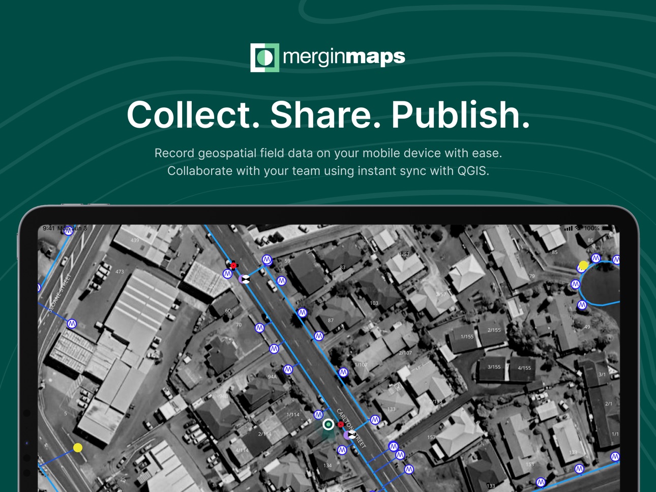
Simplify your field survey by capturing GPS field data on your mobile or tablet. Create mobile forms with the fields you require and invite your survey teams to complete them on their phones or tablets. Captured data, along with their location can be surveyed offline, then synced back to the QGIS in seconds.
Enter your data once, with ease, in the field. Mergin Maps aims to remove the pain of transcribing paper field notes, manually georeferencing photos and transcribing GPS coordinates.
The data you capture in the field survey is shown on a map and can be exported to a wide variety of formats including CSV, Microsoft Excel, ESRI Shapefile, Mapinfo, GeoPackage, PostGIS, AutoCAD DXF, KML and many more.
Mergin Maps Input is an extension of the free and open source GIS software QGIS. It allows you to open, interrogate and edit your QGIS projects on your mobile. Map layers look the same as in QGIS desktop and you can sync your data back and forward with QGIS desktop using the Mergin Maps QGIS plugin.
Mergin Maps supports offline field data capture and can be configured to use either offline or web-based background maps and contextual layers.
Perks of the Mergin Maps sync system:
- No need for cables to get your data on/off your device
- Share projects with others for collaborative working
- Safely work together on the same datasets, even offline
- Updates from different surveyors are intelligently merged
- Push data back from the field in real time
- Version history and cloud-based backup
- Fine-grained access control
- Sync with your PostGIS datasets
Supported field types for forms are:
- Text (single or multi-line)
- Numeric (plain, with +/- buttons or with slider)
- Date / time (with calendar picker)
- Photo
- Checkbox (yes/no values)
- Drop-down with predefined values
- Drop-down with values from another table
Forms can even be configured to perform data validation using custom rules.
Works with device internal GPS receiver and third-party Bluetooth GPS receivers.
Supported field types for forms are:
- Text (single or multi-line)
- Numeric (plain, with +/- buttons or with slider)
- Date / time (with calendar picker)
- Photo
- Checkbox (yes/no values)
- Drop-down with predefined values
- Drop-down with values from another table
Forms can even be configured to perform data validation using custom rules.
Works with device internal GPS receiver and third-party Bluetooth GPS receivers.
Accessibility
ipadiphonemacrealityDevicetvoswatch
Version history 25 versions
Build 884859871v2026.2.02026-04-24 13:48:57
This release brings new filtering feature.
Build 883934928v2026.1.32026-03-31 06:59:18
This release adds fix for critical issue in forms introduced in previous version.
Build 883788155v2026.1.22026-03-26 22:51:56
This version adds fixes to already existing features.
Build 883054697v2026.1.12026-03-05 21:28:26
This release brings various bug fixes.
Build 882420164v2026.1.02026-02-18 11:23:56
This release brings multiple app improvements and bug fixes.
Build 880761520v2025.8.02025-12-18 08:10:54
This release brings multiple app improvements and bug fixes.
Build 879623285v2025.7.02025-11-11 08:21:25
This version brings many visual improvements and bug fixes.
Build 879111673v2025.6.02025-10-23 10:59:14
This version brings photo sketching support, multiple bug fixes and visual improvements.
Build 877254542v2025.5.02025-08-19 13:48:26
Release brings multiple improvements to the app and haptic feedback feature.
Build 876310903v2025.4.12025-08-06 07:49:09
Release brings important bug fixes
Build 876297187v2025.4.02025-07-11 06:53:01
Release brings new features and improvements.
Build 875806920v2025.3.02025-06-24 14:37:37
Release brings new features and improvements, like polygon overlap avoidance.
Build 874653476v2025.2.32025-05-13 10:48:56
This is the last release for devices running iOS 15 or lower. Includes important fixes.
Build 874737772v2025.2.42025-05-13 14:49:54
Reintroduction of multi-feature editing and updated minimal iOS version requirement
Build 874398001v2025.2.22025-04-30 11:32:40
We enhanced user experience during registration and fixed network and gallery form bugs.
Build 874307323v2025.2.12025-04-28 12:07:19
- Updated translations
Build 874121237v2025.2.02025-04-23 17:10:04
The release upgrades QGIS to 3.40, adds multifeature editing, enhances the UX when highlighting features
Build 873148621v2025.1.12025-03-15 06:49:15
- Fix dangling pointer issue
Build 872212410v2025.1.02025-02-04 15:25:14
- Support for editable states and alias expressions for fields
- Improving UX by hiding editing buttons for readers of a project
- Remove deprecated reference to writernames
- Hiding tracking layer while recording
- Retry failed download requests implementation
Build 869953770v2024.5.12024-10-29 01:15:09
Updated translations for multiple languages
Build 869925377v2024.5.02024-10-24 08:07:09
Added measurement tool
Build 869604393v2024.4.12024-10-10 08:05:12
- Fixed app freeze when listing features
- Added information how to capture geometry
Build 869388626v2024.4.02024-10-01 13:09:50
- Optimize WFS layer handling on iOS
- Conditionally sort features list and value relations
- Fix text-wrapping issue in toolbar
- Fix visual problems with split geometry
- Adjust loading page text to respect safe area
- Add loaders to highlights while recording
Build 868070777v2024.3.12024-08-09 07:04:58
- Fix app freeze related to text input
- Fix tab bar issues with multiple tabs
- Fix unsaved changes dialog not displayed when using back button
- Fix wrong evaluation of unique constraint when creating child feature
- Fix crashes related to parseVersion method
- Eliding project's names to the left
- Handling accidental double-taps on buttons
Build 866450789v2024.3.02024-07-12 06:24:53
- Added support for multiple lines in map tip for images
- Added info about available storage when syncing in diagnostic logs
- Reintroduction of centring to GPS when starting to record new feature
- Fixing BusyIndicator position in ProjectList
- Fixing project limit hit problem
- Fixing section headers' wrapping and eliding
- Fixing app freeze when switching pages
- Fixing picture zoom in MMPhotoPreview
- Fixing app freeze in MMFormPage
- Fixing "Unique" and "Enforce Unique constraint" error message
- Fixing photo name expression when it starts with slash
No pricing data captured yet — comparisons appear once the app has paid storefronts or in-app purchases.
Availability 75 of 75 storefronts
| Region | Language | Price | Ratings | Avg | Version |
|---|---|---|---|---|---|
| US | en-US | Free | 18 | 3.7 | 2026.2.0 |
| BR | pt-BR | Free | 2 | 5.0 | 2026.2.0 |
| CO | es-MX | Free | 2 | 5.0 | 2026.2.0 |
| BO | es-MX | Free | 1 | 5.0 | 2026.2.0 |
| CL | es-MX | Free | 1 | 5.0 | 2026.2.0 |
| DO | es-MX | Free | 1 | 5.0 | 2026.2.0 |
| EC | es-MX | Free | 1 | 5.0 | 2026.2.0 |
| MA | en-GB | Free | 1 | 5.0 | 2026.2.0 |
| MX | es-MX | Free | 1 | 5.0 | 2026.2.0 |
| NG | en-GB | Free | 1 | 2.0 | 2026.2.0 |
| TZ | en-GB | Free | 1 | 2.0 | 2026.2.0 |
| AG | en-GB | Free | 0 | — | 2026.2.0 |
| AI | en-GB | Free | 0 | — | 2026.2.0 |
| AO | en-GB | Free | 0 | — | 2026.2.0 |
| AR | es-MX | Free | 0 | — | 2026.2.0 |
| BB | en-GB | Free | 0 | — | 2026.2.0 |
| BF | en-GB | Free | 0 | — | 2026.2.0 |
| BJ | en-GB | Free | 0 | — | 2026.2.0 |
| BS | en-GB | Free | 0 | — | 2026.2.0 |
| BW | en-GB | Free | 0 | — | 2026.2.0 |
| BZ | en-GB | Free | 0 | — | 2026.2.0 |
| CD | en-GB | Free | 0 | — | 2026.2.0 |
| CG | en-GB | Free | 0 | — | 2026.2.0 |
| CI | fr-FR | Free | 0 | — | 2026.2.0 |
| CM | fr-FR | Free | 0 | — | 2026.2.0 |
| CR | es-MX | Free | 0 | — | 2026.2.0 |
| CV | en-GB | Free | 0 | — | 2026.2.0 |
| DM | en-GB | Free | 0 | — | 2026.2.0 |
| DZ | en-GB | Free | 0 | — | 2026.2.0 |
| GA | fr-FR | Free | 0 | — | 2026.2.0 |
| GD | en-GB | Free | 0 | — | 2026.2.0 |
| GH | en-GB | Free | 0 | — | 2026.2.0 |
| GM | en-GB | Free | 0 | — | 2026.2.0 |
| GT | es-MX | Free | 0 | — | 2026.2.0 |
| GW | en-GB | Free | 0 | — | 2026.2.0 |
| GY | en-GB | Free | 0 | — | 2026.2.0 |
| HN | es-MX | Free | 0 | — | 2026.2.0 |
| JM | en-GB | Free | 0 | — | 2026.2.0 |
| KE | en-GB | Free | 0 | — | 2026.2.0 |
| KN | en-GB | Free | 0 | — | 2026.2.0 |
| KY | en-GB | Free | 0 | — | 2026.2.0 |
| LC | en-GB | Free | 0 | — | 2026.2.0 |
| LR | en-GB | Free | 0 | — | 2026.2.0 |
| LY | en-GB | Free | 0 | — | 2026.2.0 |
| MG | en-GB | Free | 0 | — | 2026.2.0 |
| ML | en-GB | Free | 0 | — | 2026.2.0 |
| MS | en-GB | Free | 0 | — | 2026.2.0 |
| MU | en-GB | Free | 0 | — | 2026.2.0 |
| MW | en-GB | Free | 0 | — | 2026.2.0 |
| MZ | en-GB | Free | 0 | — | 2026.2.0 |
| NA | en-GB | Free | 0 | — | 2026.2.0 |
| NE | en-GB | Free | 0 | — | 2026.2.0 |
| NI | es-MX | Free | 0 | — | 2026.2.0 |
| PA | es-MX | Free | 0 | — | 2026.2.0 |
| PE | es-MX | Free | 0 | — | 2026.2.0 |
| PY | es-MX | Free | 0 | — | 2026.2.0 |
| RW | en-GB | Free | 0 | — | 2026.2.0 |
| SC | en-GB | Free | 0 | — | 2026.2.0 |
| SL | en-GB | Free | 0 | — | 2026.2.0 |
| SN | en-GB | Free | 0 | — | 2026.2.0 |
| SR | en-GB | Free | 0 | — | 2026.2.0 |
| ST | en-GB | Free | 0 | — | 2026.2.0 |
| SV | es-MX | Free | 0 | — | 2026.2.0 |
| SZ | en-GB | Free | 0 | — | 2026.2.0 |
| TC | en-GB | Free | 0 | — | 2026.2.0 |
| TD | en-GB | Free | 0 | — | 2026.2.0 |
| TN | en-GB | Free | 0 | — | 2026.2.0 |
| TT | en-GB | Free | 0 | — | 2026.2.0 |
| UG | en-GB | Free | 0 | — | 2026.2.0 |
| UY | en-GB | Free | 0 | — | 2026.2.0 |
| VC | en-GB | Free | 0 | — | 2026.2.0 |
| VE | es-MX | Free | 0 | — | 2026.2.0 |
| VG | en-GB | Free | 0 | — | 2026.2.0 |
| ZM | en-GB | Free | 0 | — | 2026.2.0 |
| ZW | en-GB | Free | 0 | — | 2026.2.0 |
Change log 29 changes · CD
✎
releaseNotes updated
This release brings new filtering feature.
✎
description updated
Simplify your field survey by capturing GPS field data on your mobile or tablet. Create mobile forms with the fields you require and invite your survey teams to
✎
subtitle updated
QGIS field data collection app
✎
name updated
Mergin Maps: QGIS in pocket
◆
Version 2026.2.0 released
This release brings new filtering feature.
◆
Version 2026.1.3 released
This release adds fix for critical issue in forms introduced in previous version.
◆
Version 2026.1.2 released
This version adds fixes to already existing features.
◆
Version 2026.1.1 released
This release brings various bug fixes.
◆
Version 2026.1.0 released
This release brings multiple app improvements and bug fixes.
◆
Version 2025.8.0 released
This release brings multiple app improvements and bug fixes.
◆
Version 2025.7.0 released
This version brings many visual improvements and bug fixes.
◆
Version 2025.6.0 released
This version brings photo sketching support, multiple bug fixes and visual improvements.
◆
Version 2025.5.0 released
Release brings multiple improvements to the app and haptic feedback feature.
◆
Version 2025.4.1 released
Release brings important bug fixes
◆
Version 2025.4.0 released
Release brings new features and improvements.
◆
Version 2025.3.0 released
Release brings new features and improvements, like polygon overlap avoidance.
◆
Version 2025.2.4 released
Reintroduction of multi-feature editing and updated minimal iOS version requirement
◆
Version 2025.2.3 released
This is the last release for devices running iOS 15 or lower. Includes important fixes.
◆
Version 2025.2.2 released
We enhanced user experience during registration and fixed network and gallery form bugs.
◆
Version 2025.2.1 released
- Updated translations
◆
Version 2025.2.0 released
The release upgrades QGIS to 3.40, adds multifeature editing, enhances the UX when highlighting features
◆
Version 2025.1.1 released
- Fix dangling pointer issue
◆
Version 2025.1.0 released
- Support for editable states and alias expressions for fields
- Improving UX by hiding editing buttons for readers of a project
- Remove deprecated reference to writernames
- Hiding tracking layer while recording
- Retry failed download r
◆
Version 2024.5.1 released
Updated translations for multiple languages
◆
Version 2024.5.0 released
Added measurement tool
◆
Version 2024.4.1 released
- Fixed app freeze when listing features
- Added information how to capture geometry
◆
Version 2024.4.0 released
- Optimize WFS layer handling on iOS
- Conditionally sort features list and value relations
- Fix text-wrapping issue in toolbar
- Fix visual problems with split geometry
- Adjust loading page text to respect safe area
- Add loaders to high
◆
Version 2024.3.1 released
- Fix app freeze related to text input
- Fix tab bar issues with multiple tabs
- Fix unsaved changes dialog not displayed when using back button
- Fix wrong evaluation of unique constraint when creating child feature
- Fix crashes related t
◆
Version 2024.3.0 released
- Added support for multiple lines in map tip for images
- Added info about available storage when syncing in diagnostic logs
- Reintroduction of centring to GPS when starting to record new feature
- Fixing BusyIndicator position in Projec