Home › Navigation

 BB
BB
 USen-US
 AGen-GB
 AIen-GB
 AOen-GB
 ARes-MXBBen-GB
 BFen-GB
 BJen-GB
 BOes-MX
 BRpt-BR
 BSen-GB
 BWen-GB
 BZen-GB
 CDen-GB
 CGen-GB
 CIfr-FR
 CLes-MX
 CMfr-FR
 COes-MX
 CRes-MX
 CVen-GB
 DMen-GB
 DOes-MX
 DZen-GB
 ECes-MX
 GAfr-FR
 GDen-GB
 GHen-GB
 GMen-GB
 GTes-MX
 GWen-GB
 GYen-GB
 HNes-MX
 JMen-GB
 KEen-GB
 KNen-GB
 KYen-GB
 LCen-GB
 LRen-GB
 LYen-GB
 MAen-GB
 MGen-GB
 MLen-GB
 MSen-GB
 MUen-GB
 MWen-GB
 MXes-MX
 MZen-GB
 NAen-GB
 NEen-GB
 NGen-GB
 NIes-MX
 PAes-MX
 PEes-MX
 PYes-MX
 RWen-GB
 SCen-GB
 SLen-GB
 SNen-GB
 SRen-GB
 STen-GB
 SVes-MX
 SZen-GB
 TCen-GB
 TDen-GB
 TNen-GB
 TTen-GB
 TZen-GB
 UGen-GB
 UYen-GB
 VCen-GB
 VEes-MX
 VGen-GB
 ZMen-GB
 ZWen-GB
75 of 75 storefronts
Content in en-US
Content in en-US
Information
Preview 2 platforms
iPhone 10 images



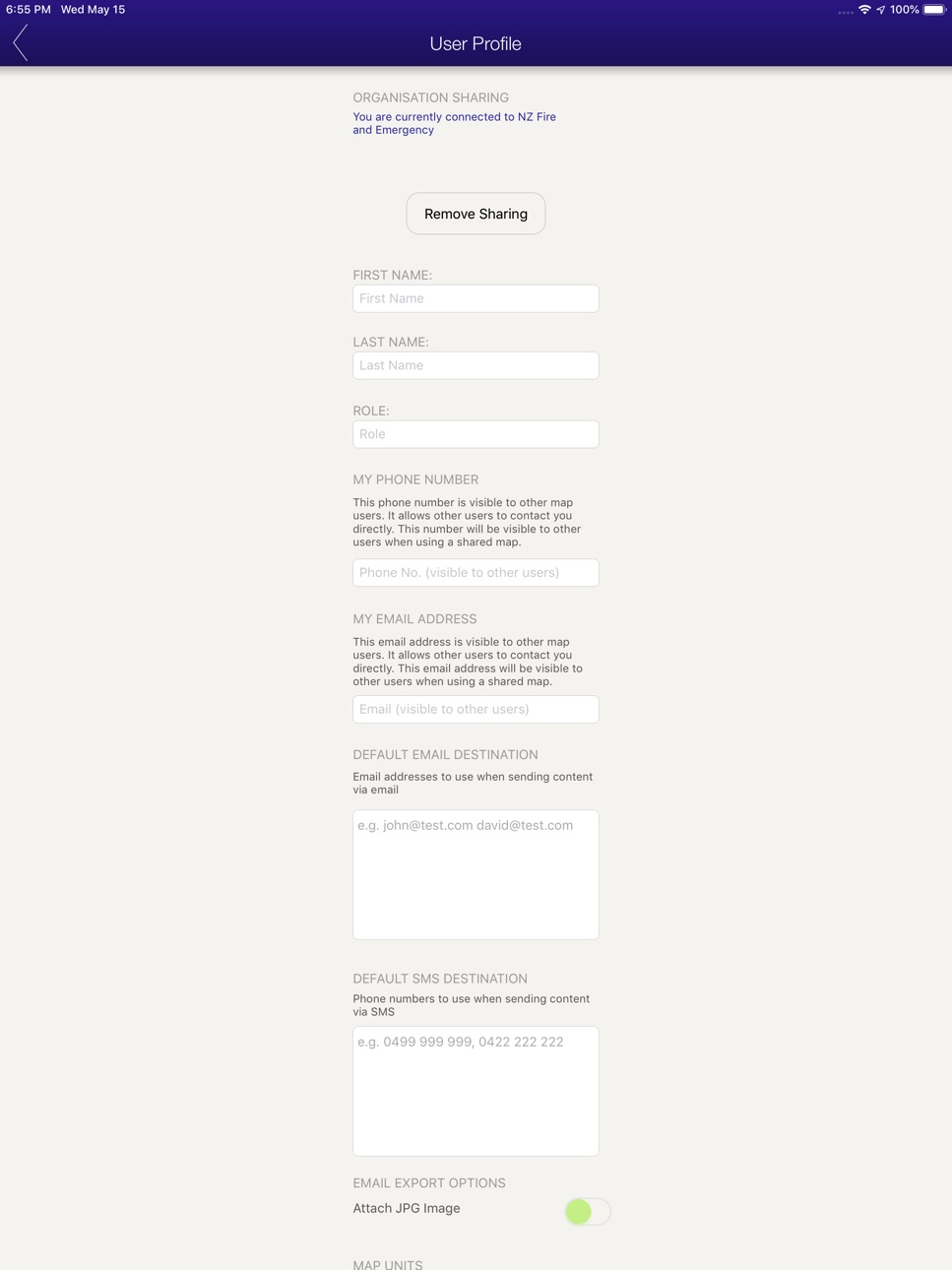
iPad 10 images




What’s New Version 1.382
* Background Location Sharing
* Bug Fixes
Description
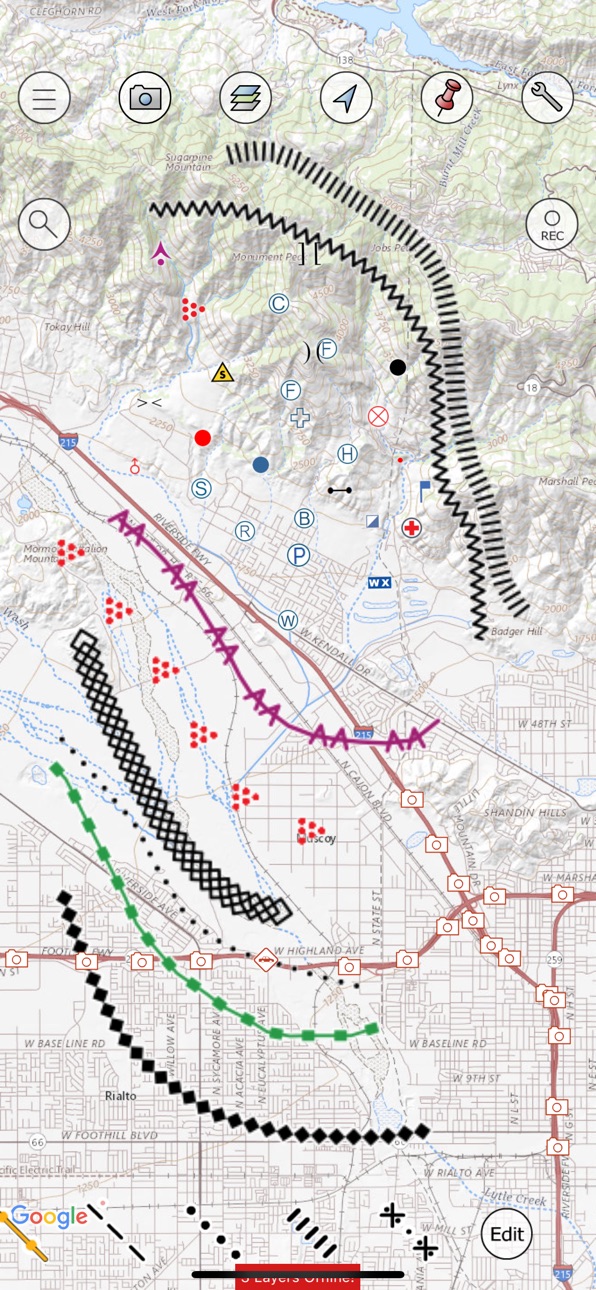
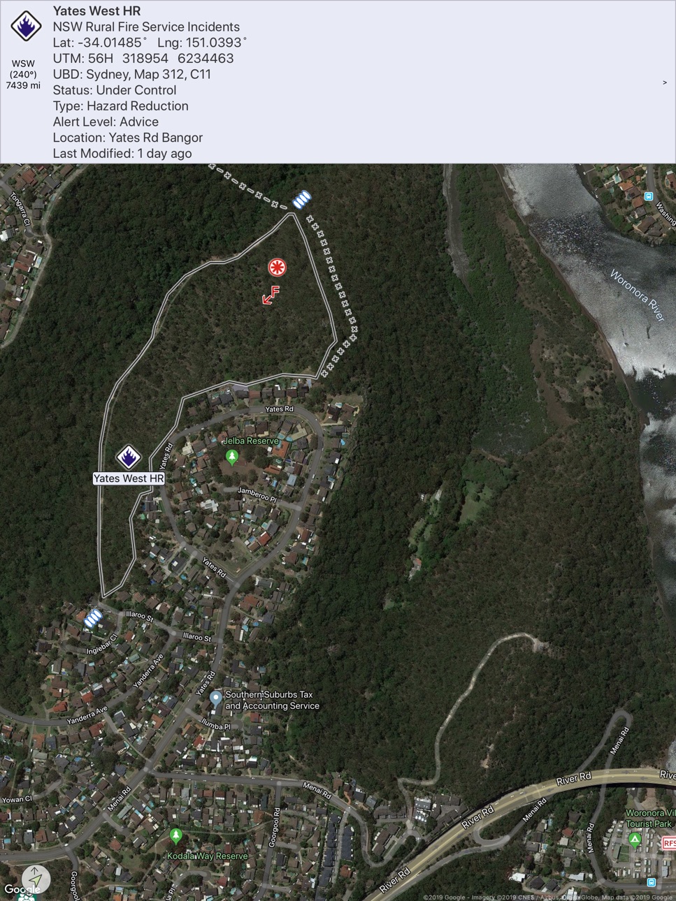
Built by a team of Australian volunteer firefighters, FireMapper is the complete mapping and information sharing solution for first responders, emergency service agencies and public safety organisations. We offer flexible, hosted and integrated solutions, including customisation and customer-specific functionality.
FireMapper includes a rich suite of symbology, including Australasian All Hazards, US PMS 936 symbology and modules focused on wildfire, search and rescue, urban operations and impact assessment.
Missing the capability to easily capture, manage and distribute critical information at incidents? FireMapper Enterprise is a subscription-based app providing real-time mapping, situational awareness, and incident management capabilities. Intuitive, simple and easy-to-use, anyone can get started using FireMapper with just 10 minutes of training.
FireMapper Standard provides a standalone capability without an Enterprise subscription and is also available on the App Store.
Accessibility
ipadiphonemacrealityDevicetvoswatch
Version history 25 versions
Build 887168515v1.3822026-06-21 23:06:35
* Background Location Sharing
* Bug Fixes
Build 886263090v1.3802026-06-01 02:50:42
* Bug Fixes
* Added GeoPackage Export support
* Added Open Location Code (Plus Code) support
Build 885363598v1.3782026-05-08 00:48:06
Bug fixes
Build 885281331v1.3772026-05-06 00:38:45
bug fixes
Build 884757949v1.3752026-04-27 22:55:12
* Added Photo Annotation Support
* Symbology Updates
* Added Map type to create map popup.
* Added MBTile/TPKX/Exploded tiles export formats
* Bug Fixes
Build 880748325v1.3652025-12-17 08:00:05
Bug Fix
Build 880480116v1.3642025-12-09 21:25:15
bug fixes
Build 880132491v1.3632025-11-28 12:19:30
Bug Fix for shared map groups
Build 879439619v1.3622025-11-04 02:59:07
* Bug Fixes* Symbology Changes* InFlight 1.6 support
Build 878517774v1.3602025-10-25 05:52:24
* Added InFlight support
* Bug Fixes
Build 876796483v1.3582025-07-30 08:14:36
* Bug Fixes
Build 876214784v1.3572025-07-09 02:07:06
* FireMapper Forms Support* Bug Fixes
Build 875838320v1.3562025-06-27 00:24:47
* Bug Fixes
Build 875331375v1.3552025-06-11 23:35:33
* Jpg Import Improvements - added support for importing photos from DJI drones with laser range finder info (e.g. M30T).* Bug Fixes
Build 874927513v1.3532025-05-21 22:45:24
* Added External Camera Support - ability to capture photos via an external camera connected via USB on the camera screen on iPad devices. This allows you to capture photos using an external camera such as a web camera/FLIR camera
* Added Camera Zoom Support - added pinch to zoom support on the camera screen.
* Added Photo Preview Zoom Support - added zoom and pan support to the selected photo preview, allowing users to zoom in on shared photos on the map screen.
* Added Overlays Support - GeoPDF can be imported via the FireMapper Portal onto shared maps.
* Bug Fixes
Build 872567287v1.3512025-02-25 04:01:32
* Bug Fixes
Build 872103045v1.3472025-01-30 04:29:27
* Feature Layer URL Support - added support for features on shared feature layers to contain a link to external websites (e.g. Incident Feeds).* Toolbar Improvements - recently used types are added to first group of the toolbar when adding features to the map* Bug Fixes
Build 870249301v1.3452024-11-15 01:02:41
* Bug Fixes
Build 870060026v1.3442024-10-31 02:13:58
-> Added Multi-tasking support for iOS (split screen)
-> Bug Fixes
Build 868058386v1.3292024-10-17 09:30:41
* Added Map Scale - Map scale bar now appears on the map view when zoom in and out on the map.
* Large Display Mode - Added a new large display mode to the user profile screen that allows users to change the size of the buttons on the map view.
* Symbology Changes
* Bug Fixes
Build 865897080v1.3202024-05-15 05:31:42
* Added Agency Name field* Bug fixes for Map Tokens
Build 865618311v1.3182024-05-02 04:43:27
Bug fix for logout issue on older devices
Build 865341592v1.3162024-04-26 05:37:53
Added Single Signon support for logging into FireMapper
Build 862660130v1.3142024-04-12 02:07:52
* Added Map Token Support for editing maps shared by a map token.* Added Support for Multi Profiles & Accounts (login to multiple accounts at the same night, without needing to logout)* New Map Groups on the Main Menu organized by recently opened, incident near me, map types and more.* Optional Read-only/Locked mode for shared maps to prevent accidental edits to shared maps.
Build 862378470v1.3042023-12-27 00:18:42
- bug fixes
No pricing data captured yet — comparisons appear once the app has paid storefronts or in-app purchases.
Availability 75 of 75 storefronts
| Region | Language | Price | Ratings | Avg | Version |
|---|---|---|---|---|---|
| US | en-US | Free | 1 | 5.0 | 1.382 |
| AG | en-GB | Free | 0 | — | 1.382 |
| AI | en-GB | Free | 0 | — | 1.382 |
| AO | en-GB | Free | 0 | — | 1.382 |
| AR | es-MX | Free | 0 | — | 1.382 |
| BB | en-GB | Free | 0 | — | 1.382 |
| BF | en-GB | Free | 0 | — | 1.382 |
| BJ | en-GB | Free | 0 | — | 1.382 |
| BO | es-MX | Free | 0 | — | 1.382 |
| BR | pt-BR | Free | 0 | — | 1.382 |
| BS | en-GB | Free | 0 | — | 1.382 |
| BW | en-GB | Free | 0 | — | 1.382 |
| BZ | en-GB | Free | 0 | — | 1.382 |
| CD | en-GB | Free | 0 | — | 1.382 |
| CG | en-GB | Free | 0 | — | 1.382 |
| CI | fr-FR | Free | 0 | — | 1.382 |
| CL | es-MX | Free | 0 | — | 1.382 |
| CM | fr-FR | Free | 0 | — | 1.382 |
| CO | es-MX | Free | 0 | — | 1.382 |
| CR | es-MX | Free | 0 | — | 1.382 |
| CV | en-GB | Free | 0 | — | 1.382 |
| DM | en-GB | Free | 0 | — | 1.382 |
| DO | es-MX | Free | 0 | — | 1.382 |
| DZ | en-GB | Free | 0 | — | 1.382 |
| EC | es-MX | Free | 0 | — | 1.382 |
| GA | fr-FR | Free | 0 | — | 1.382 |
| GD | en-GB | Free | 0 | — | 1.382 |
| GH | en-GB | Free | 0 | — | 1.382 |
| GM | en-GB | Free | 0 | — | 1.382 |
| GT | es-MX | Free | 0 | — | 1.382 |
| GW | en-GB | Free | 0 | — | 1.382 |
| GY | en-GB | Free | 0 | — | 1.382 |
| HN | es-MX | Free | 0 | — | 1.382 |
| JM | en-GB | Free | 0 | — | 1.382 |
| KE | en-GB | Free | 0 | — | 1.382 |
| KN | en-GB | Free | 0 | — | 1.382 |
| KY | en-GB | Free | 0 | — | 1.382 |
| LC | en-GB | Free | 0 | — | 1.382 |
| LR | en-GB | Free | 0 | — | 1.382 |
| LY | en-GB | Free | 0 | — | 1.382 |
| MA | en-GB | Free | 0 | — | 1.382 |
| MG | en-GB | Free | 0 | — | 1.382 |
| ML | en-GB | Free | 0 | — | 1.382 |
| MS | en-GB | Free | 0 | — | 1.382 |
| MU | en-GB | Free | 0 | — | 1.382 |
| MW | en-GB | Free | 0 | — | 1.382 |
| MX | es-MX | Free | 0 | — | 1.382 |
| MZ | en-GB | Free | 0 | — | 1.382 |
| NA | en-GB | Free | 0 | — | 1.382 |
| NE | en-GB | Free | 0 | — | 1.382 |
| NG | en-GB | Free | 0 | — | 1.382 |
| NI | es-MX | Free | 0 | — | 1.382 |
| PA | es-MX | Free | 0 | — | 1.382 |
| PE | es-MX | Free | 0 | — | 1.382 |
| PY | es-MX | Free | 0 | — | 1.382 |
| RW | en-GB | Free | 0 | — | 1.382 |
| SC | en-GB | Free | 0 | — | 1.382 |
| SL | en-GB | Free | 0 | — | 1.382 |
| SN | en-GB | Free | 0 | — | 1.382 |
| SR | en-GB | Free | 0 | — | 1.382 |
| ST | en-GB | Free | 0 | — | 1.382 |
| SV | es-MX | Free | 0 | — | 1.382 |
| SZ | en-GB | Free | 0 | — | 1.382 |
| TC | en-GB | Free | 0 | — | 1.382 |
| TD | en-GB | Free | 0 | — | 1.382 |
| TN | en-GB | Free | 0 | — | 1.382 |
| TT | en-GB | Free | 0 | — | 1.382 |
| TZ | en-GB | Free | 0 | — | 1.382 |
| UG | en-GB | Free | 0 | — | 1.382 |
| UY | en-GB | Free | 0 | — | 1.382 |
| VC | en-GB | Free | 0 | — | 1.382 |
| VE | es-MX | Free | 0 | — | 1.382 |
| VG | en-GB | Free | 0 | — | 1.382 |
| ZM | en-GB | Free | 0 | — | 1.382 |
| ZW | en-GB | Free | 0 | — | 1.382 |
Change log 29 changes · BB
✎
releaseNotes updated
* Background Location Sharing
* Bug Fixes
✎
description updated
Built by a team of Australian volunteer firefighters, FireMapper is the complete mapping and information sharing solution for first responders, emergency servic
✎
subtitle updated
Digital mapping solution
✎
name updated
FireMapper Enterprise
◆
Version 1.382 released
* Background Location Sharing
* Bug Fixes
◆
Version 1.380 released
* Bug Fixes
* Added GeoPackage Export support
* Added Open Location Code (Plus Code) support
◆
Version 1.378 released
Bug fixes
◆
Version 1.377 released
bug fixes
◆
Version 1.375 released
* Added Photo Annotation Support
* Symbology Updates
* Added Map type to create map popup.
* Added MBTile/TPKX/Exploded tiles export formats
* Bug Fixes
◆
Version 1.365 released
Bug Fix
◆
Version 1.364 released
bug fixes
◆
Version 1.363 released
Bug Fix for shared map groups
◆
Version 1.362 released
* Bug Fixes* Symbology Changes* InFlight 1.6 support
◆
Version 1.360 released
* Added InFlight support
* Bug Fixes
◆
Version 1.358 released
* Bug Fixes
◆
Version 1.357 released
* FireMapper Forms Support* Bug Fixes
◆
Version 1.356 released
* Bug Fixes
◆
Version 1.355 released
* Jpg Import Improvements - added support for importing photos from DJI drones with laser range finder info (e.g. M30T).* Bug Fixes
◆
Version 1.353 released
* Added External Camera Support - ability to capture photos via an external camera connected via USB on the camera screen on iPad devices. This allows you to capture photos using an external camera such as a web camera/FLIR camera
* Added C
◆
Version 1.351 released
* Bug Fixes
◆
Version 1.347 released
* Feature Layer URL Support - added support for features on shared feature layers to contain a link to external websites (e.g. Incident Feeds).* Toolbar Improvements - recently used types are added to first group of the toolbar when adding
◆
Version 1.345 released
* Bug Fixes
◆
Version 1.344 released
-> Added Multi-tasking support for iOS (split screen)
-> Bug Fixes
◆
Version 1.329 released
* Added Map Scale - Map scale bar now appears on the map view when zoom in and out on the map.
* Large Display Mode - Added a new large display mode to the user profile screen that allows users to change the size of the buttons on the map v
◆
Version 1.320 released
* Added Agency Name field* Bug fixes for Map Tokens
◆
Version 1.318 released
Bug fix for logout issue on older devices
◆
Version 1.316 released
Added Single Signon support for logging into FireMapper
◆
Version 1.314 released
* Added Map Token Support for editing maps shared by a map token.* Added Support for Multi Profiles & Accounts (login to multiple accounts at the same night, without needing to logout)* New Map Groups on the Main Menu organized by recently
◆
Version 1.304 released
- bug fixes