Home › Navigation

 US
US
1 of 1 storefronts
Content in en-US
Content in en-US
Information
Apple ID6761448474
Bundle IDcom.arken.ArkenMap
SellerSeller
Min iOS17.0
Min macOS14.0
Device familiesiphone, ipad
Released2026-04-26
Copyright© ArkenDrone
Privacy policyLink ↗
Preview 2 platforms
iPhone 3 images


iPad 1 image

What’s New Version 2.00
Bug Fix: Blue dot in wrong location for some maps.
Description
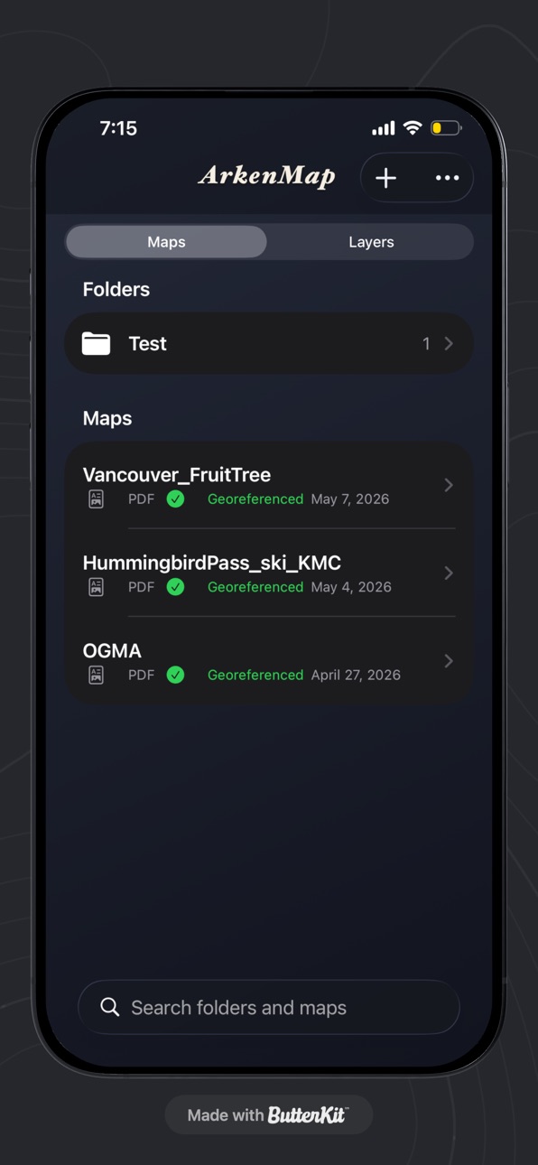
ArkenMap turns georeferenced PDF maps into something you can use outside: open the sheet full screen and see where you are on the map when you allow location access.
What you can do
Import PDF maps from Files or share sheets and keep them in a simple library on your device.
Pan and zoom the PDF with familiar gestures.
Show your position on the map when Location is enabled (while you’re using the app).
Works with PDFs that include georeference / measure information (for example GeoPDF-style GPTS/LPTS metadata).
Designed for real maps
ArkenMap is built for georeferenced PDFs—trail maps, forestry or resource maps, planning PDFs, and other cartography exported with embedded coordinates.
Privacy-minded
Imported PDFs and your library are stored locally on your iPhone or iPad. The app is focused on on-device viewing and positioning, not on uploading your maps to our servers.
Notes:
Accuracy depends on your PDF georeferencing, device GPS, and coordinate system handling in the app. Some datum and projection differences can cause small shifts compared to survey-grade tools.
In-App Purchases US pricing
One-Time Purchases
Unlimited PDF Maps$2.99
Capabilities
In-App Purchases
Accessibility
ipadiphonemacrealityDevicetvoswatch
Version history 12 versions
Build 887868812v2.002026-07-07 23:12:38
Bug Fix: Blue dot in wrong location for some maps.
Build 887612667v1.952026-06-30 19:28:25
Two types of directional arrow indicators options added to the blue location dot.
Build 887348496v1.902026-06-24 15:32:27
Myriad bug fixes. UI/UX improved
Build 886326478v1.802026-06-15 14:44:49
• New topo map coverage across southern Canada, including the BC Southern Interior — tap "Use my location" to find your sheet.
• Calibrate a scanned map by tapping its printed grid corners, for accurate positioning.
• Older maps (NAD27) now line up correctly, with a warning when a map's coordinate system isn't recognized.
• Track recording survives the app closing and resumes automatically — no more lost trips.
• Cleaner lock-screen recording view with a live timer, distance, and point count.
• Copy a pin from one map to another.
• A location icon now marks which maps cover where you are, right in the list.
Plus stability and reliability improvements.
Build 886223258v1.702026-05-28 17:41:22
Dropbox now incorporated for importing maps. Bug fixes, and performance improvements.
Build 886034157v1.602026-05-24 19:57:44
Airdropping enabled for maps and layers. Cursor added to map view.
Build 885761060v1.502026-05-19 04:17:13
Added Freemium use for the app to allow testing before one-time purchase.
Build 885696780v1.302026-05-15 06:18:45
• Pins work better — Easier taps to select pins; smoother dragging on the map.
• Photos on pins — Take pictures with the camera or choose from your library; delete with a quick confirmation.
• Share pins easily — Export pins as KML, or KMZ when you want bundled photos.
• Layers overview — All your pins show in the Layers list so you can find and manage them alongside lines and areas.
• Export lots at once — Select multiple imported KMLs, pins, and drawn lines or areas, then export as KML or KMZ.
Build 885411364v1.202026-05-09 19:13:19
Bug Fixes
Build 885362396v1.112026-05-07 18:57:25
UI/UX Updated
Build 884997879v1.012026-04-29 07:24:43
Updated to allow the importing of KML files.
Build 883998517v1.02026-04-02 20:29:58
Price history by region
Currency
Show
Columns
Search
Availability 1 of 1 storefronts
| Region | Language | Price | Ratings | Avg | Version |
|---|---|---|---|---|---|
| US | en-US | Free | 1 | 5.0 | 2.00 |
Change log 16 changes · US
✎
releaseNotes updated
Bug Fix: Blue dot in wrong location for some maps.
✎
description updated
ArkenMap turns georeferenced PDF maps into something you can use outside: open the sheet full screen and see where you are on the map when you allow location ac
✎
subtitle updated
Use your PDF maps offline
✎
name updated
ArkenMap
◆
Version 2.00 released
Bug Fix: Blue dot in wrong location for some maps.
◆
Version 1.95 released
Two types of directional arrow indicators options added to the blue location dot.
◆
Version 1.90 released
Myriad bug fixes. UI/UX improved
◆
Version 1.80 released
• New topo map coverage across southern Canada, including the BC Southern Interior — tap "Use my location" to find your sheet.
• Calibrate a scanned map by tapping its printed grid corners, for accurate positioning.
• Older maps (NAD27) now
◆
Version 1.70 released
Dropbox now incorporated for importing maps. Bug fixes, and performance improvements.
◆
Version 1.60 released
Airdropping enabled for maps and layers. Cursor added to map view.
◆
Version 1.50 released
Added Freemium use for the app to allow testing before one-time purchase.
◆
Version 1.30 released
• Pins work better — Easier taps to select pins; smoother dragging on the map.
• Photos on pins — Take pictures with the camera or choose from your library; delete with a quick confirmation.
• Share pins easily — Export pins as KML, or KM
◆
Version 1.20 released
Bug Fixes
◆
Version 1.11 released
UI/UX Updated
◆
Version 1.01 released
Updated to allow the importing of KML files.
◆
Version 1.0 released