Home › Navigation

 US
US
1 of 1 storefronts
Content in en-US
Content in en-US
Information
Preview 2 platforms
iPhone 10 images


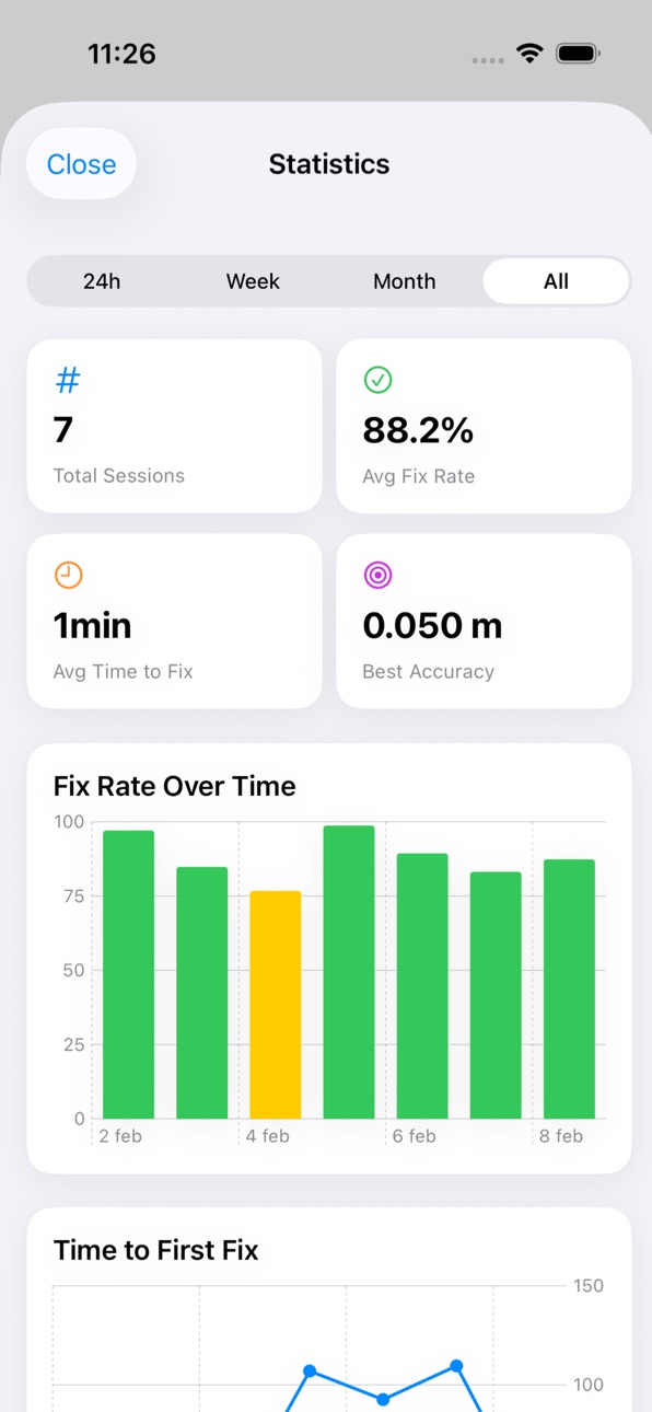


iPad 4 images


What’s New Version 1.1.2
- Improved RTK startup stability on physical iPhone devices.
- More robust real-time NTRIP stream startup and handling.
- Added stronger fallback/redundancy for correction source continuity.
- Better tolerance to RTCM stream format variations.
Description
Welcome to RTKapp
---------------------
Centimeter Precision in your Pocket RTKapp is the ultimate solution for surveyors, engineers, and GNSS enthusiasts who need professional workflows without the burden of desktop software. Connect, record, process, and analyze satellite data directly from your iPhone or iPad in a fast, private, and powerful way.
Powered by the robust RTKLIB engine (Demo5), RTKapp allows you to execute RTK positioning, Post-Processing (PPK/PPP), and raw data conversion in seconds, wrapped in a modern, streamlined interface.
REAL-TIME RTK
----------------
- Total Connectivity: Connect your GNSS receiver via Bluetooth (BLE) or TCP, or get network corrections through the built-in NTRIP Client.
- Live Quality Metrics: Monitor your signal status in real-time with AR ratio, HRMS/VRMS, DOP, SNR (Signal-to-Noise Ratio), and Skyplot views.
- VRS Support: Works seamlessly with Virtual Reference Stations by automatically sending your configured position (GGA) to the caster.
- Transparent Recording: Natively capture and log raw data streams from the Rover, Base, and corrections simultaneously while you measure.
INSTANT POST-PROCESSING
------------------------------
- Load your observation (Rover/Base) and navigation files on the fly.
- Execute kinematic, static, or precise point positioning (PPP) with advanced algorithms.
- Analytical Plotting: Dive deep with E/N/U position graphs, horizontal scatter plots, cycle slip detection, and post-fit phase residuals to ensure maximum survey-grade quality.
FIELD PRO TOOLS
-------------------
- RINEX Converter: Import binary logs from RTCM3 and export them to universal RINEX format with advanced versioning and frequency selections (L1/L2/L5).
- NTRIP Caster Management: Browse sourcetables, save profiles for your favorite VRS networks, and even share data by forwarding corrections via Bluetooth.
- Configuration Profiles: Save your processing settings, elevation masks, and ambiguity resolution parameters into custom profiles for instant field readiness.
LOCAL PRIVACY FIRST
-----------------------
Your data belongs to you. RTKapp processes all positioning locally right on your device. We do not rely on the cloud to calculate your position, we don't track your projects, and all exports to GPX, KML, CSV, or .pos coordinate files are performed purely on-demand.
Master GNSS precision anywhere, no laptop required. Download RTKapp and streamline your data collection and processing today!
Accessibility
ipadiphonemacrealityDevicetvoswatch
Version history 4 versions
Build 887524291v1.1.22026-06-27 18:46:56
- Improved RTK startup stability on physical iPhone devices.
- More robust real-time NTRIP stream startup and handling.
- Added stronger fallback/redundancy for correction source continuity.
- Better tolerance to RTCM stream format variations.
Build 883857949v1.1.12026-03-28 18:50:12
Bug fixes and improvements:
• Fixed buttons not visible in Dark Mode during onboarding demo
• Fixed NTRIP connection status showing "Disconnected" while data is actively flowing
• Fixed Track map zoom resetting every time a new position arrives — you can now pan and zoom freely
• Fixed scatter plot legend colors to match actual RTK fix type colors
• Renamed "Error N/E/U" plot to "Displacement N/E/U" — better reflects real-world use (measuring distances and movements)
• Added pinch-to-zoom on the Displacement time series chart
• Time series charts now scroll to the current moment when opened
• Moved live demo from La Gomera (Canary Islands) to Madrid for more stable RTK convergence
Build 883399845v1.1.02026-03-16 17:30:26
- Interactive guided onboarding with a live RTK demo using real CORS stations — see centimeter
positioning working before you start
- New map button to set your current position as the reference point for error plots
- Post-processing now works exclusively from recorded real-time sessions — file upload removed for a
cleaner mobile workflow
- Location permission status now shown in real time during onboarding (allowed / not allowed)
- Pinch-to-zoom and pan enabled on the demo map
Build 882420843v1.0.12026-02-26 08:05:05
No pricing data captured yet — comparisons appear once the app has paid storefronts or in-app purchases.
Availability 1 of 1 storefronts
| Region | Language | Price | Ratings | Avg | Version |
|---|---|---|---|---|---|
| US | en-US | Free | 0 | — | 1.1.2 |
Change log 8 changes · US
✎
releaseNotes updated
- Improved RTK startup stability on physical iPhone devices.
- More robust real-time NTRIP stream startup and handling.
- Added stronger fallback/redundancy for
✎
description updated
Welcome to RTKapp
---------------------
Centimeter Precision in your Pocket RTKapp is the ultimate solution for surveyors, engineers, and GNSS enthusiasts who n
✎
subtitle updated
GNSS RTK based on RTKLIB
✎
name updated
RTKapp
◆
Version 1.1.2 released
- Improved RTK startup stability on physical iPhone devices.
- More robust real-time NTRIP stream startup and handling.
- Added stronger fallback/redundancy for correction source continuity.
- Better tolerance to RTCM stream format variatio
◆
Version 1.1.1 released
Bug fixes and improvements:
◆
Version 1.1.0 released
- Interactive guided onboarding with a live RTK demo using real CORS stations — see centimeter
positioning working before you start
- New map button to set your current position as the reference point for error plots
- Post-processing n
◆
Version 1.0.1 released