Home › Utilities

 US
US
1 of 1 storefronts
Content in en-US
Content in en-US
Information
Apple ID6758939402
Bundle IDcom.785QHYP7X7.PickMeYR
SellerSeller
Min iOS15.1
Min macOS12.0
Device familiesiphone, ipod
Released2026-02-10
Copyright© 2026 Chris Clark
Privacy policyLink ↗
Preview 1 platform
iPhone 3 images


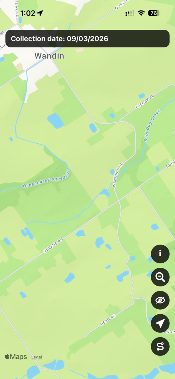
What’s New Version 1.1.5
- Added support for the City of Monash!
- Added options to show/hide specific map overlays
Description
Pick Me displays hard rubbish collection dates for shires in Australia and allows you to keep track of the streets you travel. Currently supported shires are Yarra Ranges, Frankston, Stonnington, and Monash.
Accessibility
ipadiphonemacrealityDevicetvoswatch
Version history 8 versions
Build 887717585v1.1.52026-07-09 21:49:54
- Added support for the City of Monash!
- Added options to show/hide specific map overlays
Build 884808616v1.1.32026-04-22 22:01:18
- Added dates for the Shire of Frankston!
- Huge performance improvement
Build 884078653v1.1.22026-04-03 14:39:22
Simplified Stonnington map to improve performance
Build 883381872v1.1.12026-03-15 00:46:15
- New paths now overwrite old paths rather than adding on top
- GPS jumps should no longer cause aberrant straight lines
- Adjusted path rendering thickness
Previous update:
- Added support for Stonnington!
- Adjusted date zones for Yarra Ranges to align correctly with roads
- Reduced possibility for aberrant straight lines to be drawn after GPS jumps
- Added focus effect when date labels are tapped
- Added clustering for date labels when zoomed out
- Adjusted date colouring/opacity
- Performance/battery improvements
Build 883263459v1.12026-03-14 15:15:50
- Added support for Stonnington!
- Adjusted date zones for Yarra Ranges to align correctly with roads
- Reduced possibility for aberrant straight lines to be drawn after GPS jumps
- Added focus effect when date labels are tapped
- Added clustering for date labels when zoomed out
- Adjusted date colouring/opacity
- Performance/battery improvements
Build 882711283v1.0.22026-02-25 17:52:16
Fixed donation link
Build 882356322v1.0.12026-02-13 10:34:10
Set map display to light mode even when system dark mode is on. Adjusted info page.
Build 882292775v1.02026-02-10 22:16:55
No pricing data captured yet — comparisons appear once the app has paid storefronts or in-app purchases.
Availability 1 of 1 storefronts
| Region | Language | Price | Ratings | Avg | Version |
|---|---|---|---|---|---|
| US | en-US | Free | 0 | — | 1.1.5 |
Change log 11 changes · US
✎
releaseNotes updated
- Added support for the City of Monash!
- Added options to show/hide specific map overlays
✎
description updated
Pick Me displays hard rubbish collection dates for shires in Australia and allows you to keep track of the streets you travel. Currently supported shires are Ya
✎
name updated
Pick Me
◆
Version 1.1.5 released
- Added support for the City of Monash!
- Added options to show/hide specific map overlays
◆
Version 1.1.3 released
- Added dates for the Shire of Frankston!
- Huge performance improvement
◆
Version 1.1.2 released
Simplified Stonnington map to improve performance
◆
Version 1.1.1 released
- New paths now overwrite old paths rather than adding on top
- GPS jumps should no longer cause aberrant straight lines
- Adjusted path rendering thickness
Previous update:
- Added support for Stonnington!
- Adjusted date zones for Yarra
◆
Version 1.1 released
- Added support for Stonnington!
- Adjusted date zones for Yarra Ranges to align correctly with roads
- Reduced possibility for aberrant straight lines to be drawn after GPS jumps
- Added focus effect when date labels are tapped
- Added clu
◆
Version 1.0.2 released
Fixed donation link
◆
Version 1.0.1 released
Set map display to light mode even when system dark mode is on. Adjusted info page.
◆
Version 1.0 released