Home › Navigation

 US
US
1 of 1 storefronts
Content in en-US
Content in en-US
Information
Preview 1 platform
iPhone 10 images


What’s New Version 2.2.0
- Bug fixes and performance improvements
Description
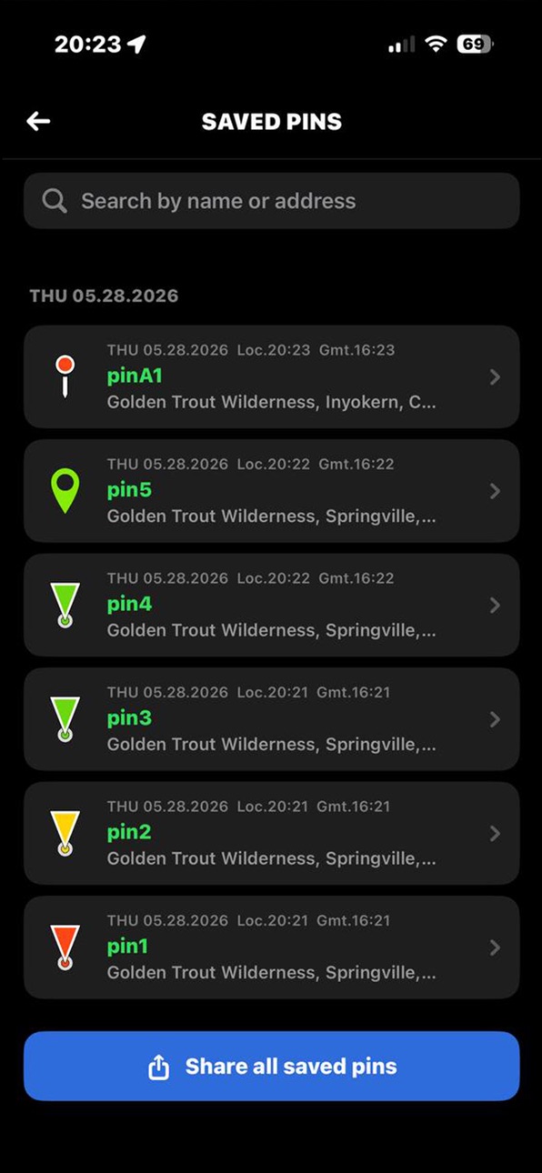
This app provides offline maps with support for satellite, topographic, and standard maps. Download maps by simple grid squares and use them without an internet connection. The built-in MGRS grid offers precise location tracking using the Military Grid Reference System. Key features include offline access and MGRS support for navigation. Perfect for travel, hiking, and fieldwork.
The Military Grid Reference System (MGRS) is the geocoordinate standard used by NATO militaries for geo-referencing, position reporting, and situational awareness during land operations. An MGRS coordinate does not represent a single point, but rather defines a square grid area on the Earth's surface. The location of a specific point is therefore referenced by the MGRS coordinate of the area that contains it. The MGRS is derived from the Universal Transverse Mercator (UTM) and Universal Polar Stereographic (UPS) grid systems and is used as a geocode for the entire Earth.
Examples:
• 18S (Locating a point within the Grid Zone Designation)
• 18SUU (Locating a point within a 100,000-meter square)
• 18SUU80 (Locating a point within a 10,000-meter square)
• 18SUU8401 (Locating a point within a 1,000-meter square)
• 18SUU836014 (Locating a point within a 100-meter square)
To satisfy special needs, a reference can be given to a 10-meter square and a 1-meter square as follows:
• 18SUU83630143 (Locating a point within a 10-meter square)
• 18SUU8362601432 (Locating a point within a 1-meter square)
Subscription Details:
• Payment will be charged to the Apple account at confirmation of purchase.
• Subscription can be managed and auto-renewal turned off in the user's account settings.
• Terms of Use (EULA): https://www.apple.com/legal/internet-services/itunes/dev/stdeula/
• Privacy policy: http://www.alfarays.com/privacy_en.html
In-App Purchases US pricing
Pro Plan Subscription
Monthly$6.99
Capabilities
In-App Purchases
Accessibility
ipadiphonemacrealityDevicetvoswatch
Version history 3 versions
Build 886252513v2.2.02026-05-28 20:37:10
- Bug fixes and performance improvements
Build 883847714v2.12026-03-27 21:22:52
- General bug fixes and improvements
Build 879846629v1.02026-01-20 05:56:35
Price history by region
Currency
Show
Columns
Search
Availability 1 of 1 storefronts
| Region | Language | Price | Ratings | Avg | Version |
|---|---|---|---|---|---|
| US | en-US | Free | 0 | — | 2.2.0 |
Change log 7 changes · US
✎
releaseNotes updated
- Bug fixes and performance improvements
✎
description updated
This app provides offline maps with support for satellite, topographic, and standard maps. Download maps by simple grid squares and use them without an internet
✎
subtitle updated
MGRS Offline Maps & Navigation
✎
name updated
MGRS Offline Map Satellite
◆
Version 2.2.0 released
- Bug fixes and performance improvements
◆
Version 2.1 released
- General bug fixes and improvements
◆
Version 1.0 released