Home › Weather

 US
US
1 of 1 storefronts
Content in en-US
Content in en-US
Information
Preview 2 platforms
iPhone 9 images





iPad 8 images





What’s New Version 1.5.2
- Rotatable map
- Optional "Heading up" mode for live tracking
- Auto follow of the map, when live tracking is activated
- Bug fixes
Description
INTERACTIVE MAP AND UI
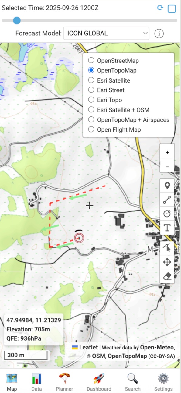
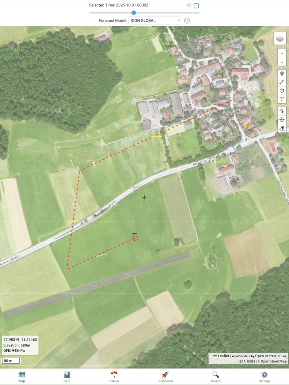
- Map: Various base maps including satellite pictures and airspaces
- Location: Comfortable selection of locations. Different coordinate formats.
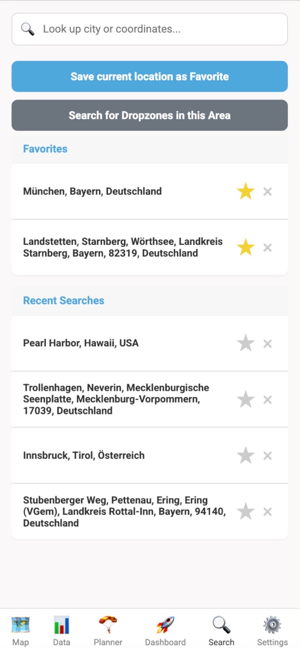
- Location search & favorites: A search panel for finding locations by names or coordinates.
- Map tools: Zoom and measurement tools for distances, radii and bearings
- Offline capability: Map tiles can be cached
WEATHER FORECAST DATA & MODELS
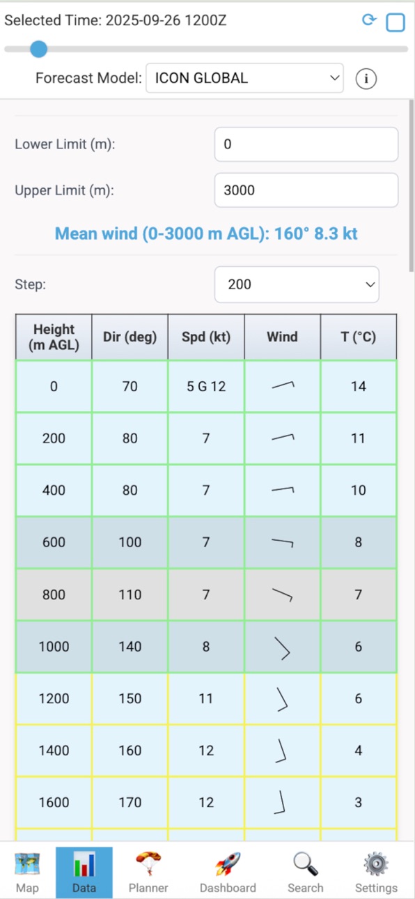
- Data source: Forecast data from OPEN METEO
- Availability of global and regional forecast models
- Time Slider: A time slider to choose hourly forecasts up to 7 days ahead
- Historical Data: Date picker for weather data from the past
- Autoupdate function for the forecasts
- Units: Full control over various units
- Mean wind calculation for customizable layers
PARACHUTING & FLIGHT PLANNING
- Landing Pattern visualization: adjustable landing pattern
- Jump calculation: Visualization of the complete jump from exit to landing
• Exit area
• Canopy flight areas
• Free fall trajectory
- Jump Run Track (JRT): visualization auf der jump run and 2 minute approach
- Cut-Away-Finder: visualization of the pontential landing spot for a cut away canopy
- Track-Upload: import and visualization of GPX-, KML- und FlySight-CSV-Files
- Live-Tracking & Jumpmaster-Line:
• Live-Tracking
• „Jumpmaster-Line“ from live position to the DIP or a manually set High Altitude Release Point (HARP).
ENSEMBLE-FORECAST
- Multi-Modell-Analysis: comparison of various forecast models
- Szenarios:
• All models: Shows exit circles for each chosen model
• Min/Mean/Max Wind: Shows the exit circle for the weakest, strongest and mean wind
• Heatmap: Shows a probability map for the exit area of all chosen models
Accessibility
ipadiphonemacrealityDevicetvoswatch
Version history 8 versions
Build 886787557v1.5.22026-06-10 21:00:04
- Rotatable map
- Optional "Heading up" mode for live tracking
- Auto follow of the map, when live tracking is activated
- Bug fixes
Build 885473360v1.5.12026-05-11 03:09:32
- Radar overlay
- NM for measuring tool and Jump run offset
- Improved error handling
- Significant weather in meteograms
- Improved measuring tool
Build 884126026v1.52026-04-04 19:07:34
- Improved handling for the jumpmaster line
- Nautical miles available for horizontal distances
- Radar layer
Build 883620042v1.42026-03-22 18:04:06
- "Deutsch" available
- Track recording as background process, if location is set to "always"
- Magnetic deviation now available
- Multiple HARP management
- Improved terrain clearance test
Build 882452260v1.32026-02-14 20:16:49
- Landing direction can be locked now
- Height unit "feet" established
- Improved GPX-Export
- Landscape mode available
- Corrected Proxy for ADSB tracking
Build 879682314v1.22025-11-11 18:43:28
- Weather alerts system
- Dark mode available
- Added meteograms
- DZMaster listed as app to open GPX and KML files
- Some additional styling
Build 879176244v1.12025-10-24 09:03:33
- Bug fixes
- ADSB Connector
- Improved time slider
Build 876766126v1.02025-10-08 15:20:04
No pricing data captured yet — comparisons appear once the app has paid storefronts or in-app purchases.
Availability 1 of 1 storefronts
| Region | Language | Price | Ratings | Avg | Version |
|---|---|---|---|---|---|
| US | en-US | Free | 0 | — | 1.5.2 |
Change log 12 changes · US
✎
releaseNotes updated
- Rotatable map
- Optional "Heading up" mode for live tracking
- Auto follow of the map, when live tracking is activated
- Bug fixes
✎
description updated
INTERACTIVE MAP AND UI
- Map: Various base maps including satellite pictures and airspaces
- Location: Comfortable selection of locations. Different coordinate
✎
subtitle updated
Weather data and Jump planner
✎
name updated
DZMaster
◆
Version 1.5.2 released
- Rotatable map
- Optional "Heading up" mode for live tracking
- Auto follow of the map, when live tracking is activated
- Bug fixes
◆
Version 1.5.1 released
- Radar overlay
- NM for measuring tool and Jump run offset
- Improved error handling
- Significant weather in meteograms
- Improved measuring tool
◆
Version 1.5 released
- Improved handling for the jumpmaster line
- Nautical miles available for horizontal distances
- Radar layer
◆
Version 1.4 released
- "Deutsch" available
- Track recording as background process, if location is set to "always"
- Magnetic deviation now available
- Multiple HARP management
- Improved terrain clearance test
◆
Version 1.3 released
- Landing direction can be locked now
- Height unit "feet" established
- Improved GPX-Export
- Landscape mode available
- Corrected Proxy for ADSB tracking
◆
Version 1.2 released
- Weather alerts system
- Dark mode available
- Added meteograms
- DZMaster listed as app to open GPX and KML files
- Some additional styling
◆
Version 1.1 released
- Bug fixes
- ADSB Connector
- Improved time slider
◆
Version 1.0 released