Home › Navigation

 US
US
1 of 1 storefronts
Content in en-US
Content in en-US
Information
Preview 1 platform
iPhone 8 images
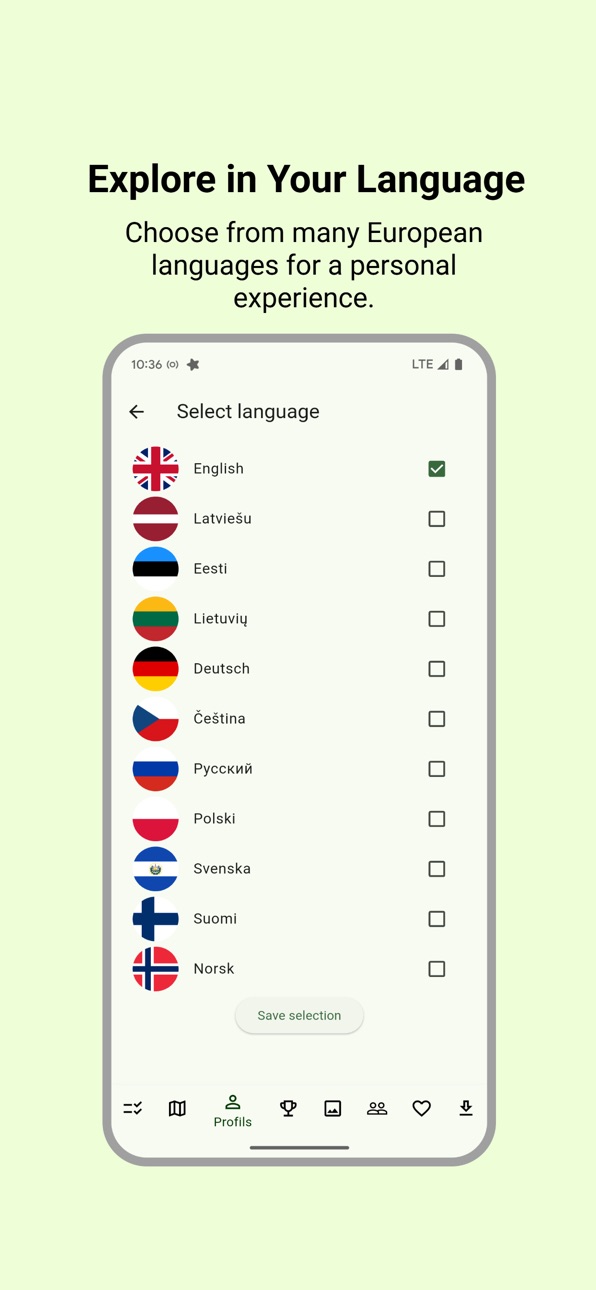


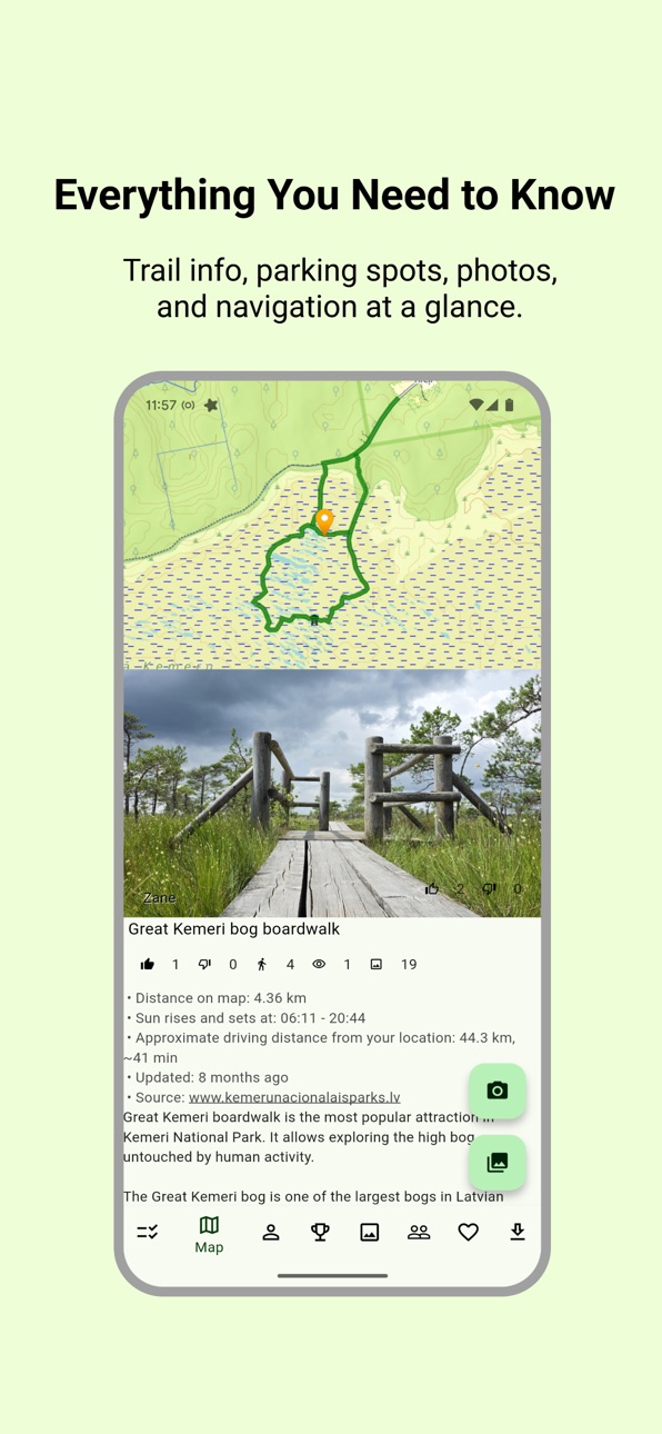
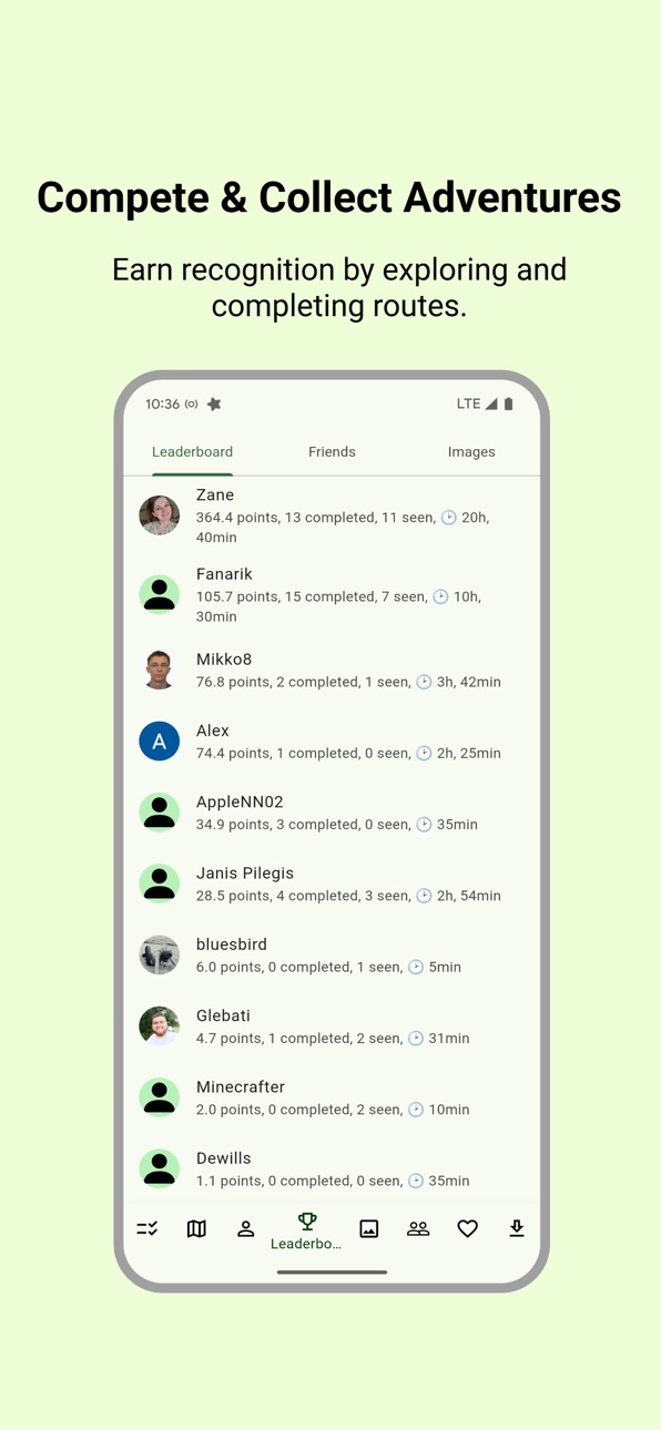


What’s New Version 0.3.1
Object visibility bug fix.
Description
Trail Atlas – Explore Baltics Outdoors
Looking for the ultimate outdoor companion? Whether you’re hiking through forests, biking across long-distance routes, or chasing hidden viewpoints, Trail Atlas helps you explore Baltics outdoors with ease.
Unlike other trail apps, Trail Atlas focuses on official hiking and biking trails, parks, and natural landmarks, so you always know you’re on reliable and curated routes. At the same time, it adds a geocaching-inspired twist: every trail, tower, park, or viewpoint becomes something you can discover, complete, and share.
Why Trail Atlas?
- Official data you can trust – Explore marked hiking and biking trails, parks, nature reserves, towers, viewpoints, and other official outdoor features.
- Works offline anywhere – Download maps, routes, and trail details for full offline use. Perfect for remote areas without signal.
- Geocaching-style challenges – Collect trails and outdoor points by visiting them. Completed routes are tracked in your profile and shown on your map.
- Social exploration – See your friends’ completed routes, share your own adventures, and stay motivated with the leaderboard.
- Track & record your activity – Record your hikes or rides with GPS, save them to your profile, and share with friends.
- Create your own routes – Use the map to plan custom routes, then follow them on your next adventure.
- Export to GPX – Download any route as a GPX file and use it with your GPS device or other mapping apps.
- Wishlist your adventures – Save trails or routes shared by friends to your personal wishlist for later exploration.
- Upload and share photos – Add pictures from your trips, share them with friends, and build a visual story of your outdoor experiences.
All of Baltics, One App
- Trail Atlas isn’t limited to just one region. Our goal is to cover all of Europe with official trail data and detailed topographic maps. Whether you’re planning a short walk near home or a multi-day cycling trip across borders, Trail Atlas is designed to be your go-to companion.
Fair and Fun Competition
- Compete with friends and other explorers on the leaderboard. Your ranking is based on real activity: distance on official trails, time outdoors, and completed objects like viewpoints or towers. It’s fun, fair, and designed to keep you motivated without giving motorized travel an unfair advantage.
Made for All Explorers
Trail Atlas is built for anyone who loves the outdoors:
- Hikers discovering new trails and viewpoints
- Cyclists planning long-distance rides
- Families exploring parks and towers together
- Adventurers who want to track progress and relive their journeys
Why Go Premium?
- Trail Atlas offers a free experience with rich functionality. A premium subscription unlocks additional features, offline downloads at larger scale, and advanced planning tools - perfect for serious explorers who want more control and reliability.
Trail Atlas – your official guide to Baltics outdoors.
Discover, track, and share your adventures. Offline, social, and geocaching-inspired — all in one app.
Capabilities
In-App Purchases
Accessibility
ipadiphonemacrealityDevicetvoswatch
Version history 22 versions
Build 887491693v0.3.12026-06-26 21:25:59
Object visibility bug fix.
Build 883135058v0.3.02026-03-08 17:16:27
Speed and usability improvements
Build 879400774v0.2.82025-11-11 19:58:36
Translation improvements, bug fixes.
Build 878838681v0.2.72025-10-13 06:44:17
Usability improvements and bugfixes
Build 878763372v0.2.62025-10-09 15:05:00
Photo voting view.
Ability to participate in photo contests with photos from any location where the route is recorded.
Bug fixes.
Build 878594745v0.2.52025-10-02 07:51:48
Photo voting view.
Ability to participate in photo contests with photos from any location where the route is recorded.
Bug fixes.
Build 878510202v0.2.42025-09-29 23:21:22
Monthly photo contest and points leader contest.
Possibility to participate in photo contest with photos from any trail.
Route length filtering function.
Modified route page to make it easier to calculate points and access main functions.
Build 878443946v0.2.32025-09-28 02:20:45
Monthly photo contest and points leader contest.
Possibility to participate in photo contest with photos from any trail.
Route length filtering function.
Modified route page to make it easier to calculate points and access main functions.
Build 878231743v0.2.22025-09-19 02:38:59
Ability to add custom routes and waypoints.
User interface improvements.
Build 878165244v0.2.12025-09-17 09:41:21
Ability to add custom routes and waypoints.
User interface improvements.
Build 877971368v0.2.02025-09-09 22:36:46
UX improvements and bugfixes.
Build 877552483v0.1.92025-09-08 14:47:15
Route creation, saving to favorites and saving as GPX
Corrected opening navigation to trails/objects
Correctly turning off GPS when stopping tracking
Improvements in loading and using offline maps
Calculation of travel distance and time from your location
Bug fixes
Build 877481251v0.1.82025-08-25 13:08:38
Route creation, saving to favorites and saving as GPX
Corrected opening navigation to trails/objects
Correctly turning off GPS when stopping tracking
Improvements in loading and using offline maps
Calculation of travel distance and time from your location
Bug fixes
Build 877107195v0.1.62025-08-09 21:04:50
Offline map and objects bug fix, tracking information on screen.
Build 876924194v0.1.52025-08-03 20:59:21
Leaderboard updates, Offline map and objects.
Build 876831609v0.1.42025-07-30 16:13:10
Objects are downloaded for offline along with map base layer.
Build 876599931v0.1.22025-07-22 18:44:57
Calculation of points for the route traveled, leaderboard,
Saving downloaded objects for offline use,
Bug fixes.
Build 876302567v0.1.12025-07-11 06:48:43
Bugfix, Image uploading in background, Feedback form, Satellite map option.
Build 876262300v0.1.02025-07-09 22:23:59
Bugfix, Image uploading in background, Feedback form, Satellite map option.
Build 876050280v0.0.92025-07-02 02:48:56
Bugfix in multiple screens, ability to delete uploaded images, sunrise and sunset time is shown in local time zone.
Build 875882802v0.0.82025-06-25 19:26:37
App feature walkthrough; Different colors of adjacent routes; Better route and object visualization, improved translation.
Build 875256134v0.0.72025-06-16 15:43:10
No pricing data captured yet — comparisons appear once the app has paid storefronts or in-app purchases.
Availability 1 of 1 storefronts
| Region | Language | Price | Ratings | Avg | Version |
|---|---|---|---|---|---|
| US | en-US | Free | 0 | — | 0.3.1 |
Change log 26 changes · US
✎
releaseNotes updated
Object visibility bug fix.
✎
description updated
Trail Atlas – Explore Baltics Outdoors
Looking for the ultimate outdoor companion? Whether you’re hiking through forests, biking across long-distance routes, o
✎
subtitle updated
Official trails & offline maps
✎
name updated
Trail Atlas Baltics
◆
Version 0.3.1 released
Object visibility bug fix.
◆
Version 0.3.0 released
Speed and usability improvements
◆
Version 0.2.8 released
Translation improvements, bug fixes.
◆
Version 0.2.7 released
Usability improvements and bugfixes
◆
Version 0.2.6 released
Photo voting view.
Ability to participate in photo contests with photos from any location where the route is recorded.
Bug fixes.
◆
Version 0.2.5 released
Photo voting view.
Ability to participate in photo contests with photos from any location where the route is recorded.
Bug fixes.
◆
Version 0.2.4 released
Monthly photo contest and points leader contest.
Possibility to participate in photo contest with photos from any trail.
Route length filtering function.
Modified route page to make it easier to calculate points and access main functions.
◆
Version 0.2.3 released
Monthly photo contest and points leader contest.
Possibility to participate in photo contest with photos from any trail.
Route length filtering function.
Modified route page to make it easier to calculate points and access main functions.
◆
Version 0.2.2 released
Ability to add custom routes and waypoints.
User interface improvements.
◆
Version 0.2.1 released
Ability to add custom routes and waypoints.
User interface improvements.
◆
Version 0.2.0 released
UX improvements and bugfixes.
◆
Version 0.1.9 released
Route creation, saving to favorites and saving as GPX
Corrected opening navigation to trails/objects
Correctly turning off GPS when stopping tracking
Improvements in loading and using offline maps
Calculation of travel distance and time
◆
Version 0.1.8 released
Route creation, saving to favorites and saving as GPX
Corrected opening navigation to trails/objects
Correctly turning off GPS when stopping tracking
Improvements in loading and using offline maps
Calculation of travel distance and time fro
◆
Version 0.1.6 released
Offline map and objects bug fix, tracking information on screen.
◆
Version 0.1.5 released
Leaderboard updates, Offline map and objects.
◆
Version 0.1.4 released
Objects are downloaded for offline along with map base layer.
◆
Version 0.1.2 released
Calculation of points for the route traveled, leaderboard,
Saving downloaded objects for offline use,
Bug fixes.
◆
Version 0.1.1 released
Bugfix, Image uploading in background, Feedback form, Satellite map option.
◆
Version 0.1.0 released
Bugfix, Image uploading in background, Feedback form, Satellite map option.
◆
Version 0.0.9 released
Bugfix in multiple screens, ability to delete uploaded images, sunrise and sunset time is shown in local time zone.
◆
Version 0.0.8 released
App feature walkthrough; Different colors of adjacent routes; Better route and object visualization, improved translation.
◆
Version 0.0.7 released