Home › Navigation

 US
US
1 of 1 storefronts
Content in en-US
Content in en-US
Information
Apple ID6745105772
Bundle IDapp.sharpmap
SellerSeller
Min iOS14.0
Min macOS11.0
Device familiesiphone, ipad, ipod
Released2025-05-31
Copyright© 2026 SharpMap
Privacy policyLink ↗
Preview 2 platforms
iPhone 10 images






iPad 4 images


What’s New Version 0.8.2
Added gradients for roads and paths for cyclists, runners, and cross-country skiers.
Description
[COVERAGE CURRENTLY LIMITED TO THE ALPS, CARPATHIANS, AND THE SUDETES]
Hello! We are the Sharpmap team — mountain enthusiasts, rescuers, and guides. Thanks to our extensive mountain experience, we understand exactly what is needed in the outdoors. That’s why we created the map that is precise and tailored to the realities of complex mountain terrain.
This is just the beginning of our journey. We will continue to develop our app, expanding the map coverage and introducing new features to make it more reliable and versatile.
EXPERIENCE TERRAIN LIKE NEVER BEFORE!
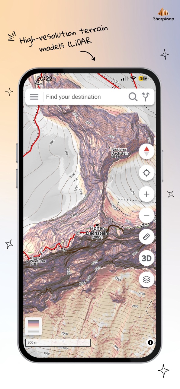
Real mountain detail — visualized through slope, shading, contour lines, and 3D maps — powered by high-resolution LiDAR-based elevation models.
• CUSTOM SLOPE BASELAYER – choose between our unique slope visualization and high-resolution orthophoto imagery.
• MULTIPLE LAYERS – our map supports both 2D and 3D views, and offers interactive layers that let you display only the topographic data you need.
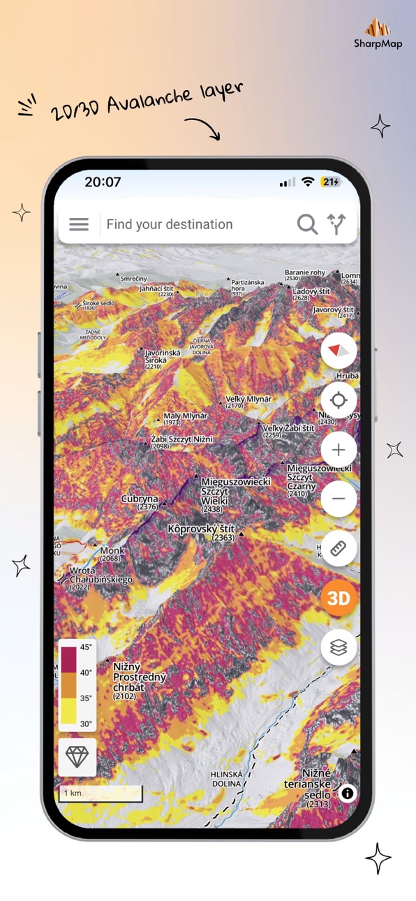
• AVALANCHE ANALYSIS – our accurate slope data is essential for avalanche risk assessment.
• OUTDOOR ACTIVITIES – our app is designed primarily for ski tourers, alpinists, trekkers, mountain bikers, and all mountain adventure enthusiasts.
Accessibility
ipadiphonemacrealityDevicetvoswatch
Version history 13 versions
Build 886589239v0.8.22026-06-11 15:36:05
Added gradients for roads and paths for cyclists, runners, and cross-country skiers.
Build 886218283v0.82026-05-29 13:20:07
- improved climbing and cycling presets
- export routes and measurements to a GPX file
- opening links in the app
- improved user verification
- visual map improvements
Build 885828558v0.7.82026-05-27 11:30:25
- export routes and measurements to a GPX file
- opening links in the app
- improved user verification
- minor preset improvements
- visual map improvements
Build 883835667v0.7.62026-03-27 19:24:04
- fixed a bug related to user verification
- improved 3D map performance
- added terrain analysis tool
- added premium layers
- added photos and links to avalanche bulletins
- refactored map presets
- improved measurement tools
- added north-up lock in 2D mode
- visual improvements
Build 883683643v0.7.52026-03-26 13:47:11
- improved 3D map performance
- added terrain analysis tool
- added premium layers
- added photos and links to avalanche bulletins
- app links now open directly in the app
- refactored map presets
- improved measurement tools
- added north-up lock in 2D mode
- visual improvements
Build 882632893v0.6.32026-02-23 10:43:30
- added new baselayers
- added avalanche slope overlay in 2D mode
- added coordinate support
- improved routing
- added the ability to report errors
Build 881979288v0.6.12026-01-31 06:41:45
- Added simple routing
- Fixed geolocation errors
Build 879950068v0.52025-11-24 08:39:31
- Expanded coverage
- New data types added
- Detailed data for the Tatra Mountains
- Translations added
- GPS functionality upgraded
- Visual upgrade
Build 879370016v0.4.52025-10-31 16:50:43
- Expanded coverage
- New data types added
- Detailed data for the Tatra Mountains
- Translations added
- GPS functionality upgraded
Build 875855944v0.32025-08-06 14:25:58
MVP version with limited functions. Visual updates applied.
Build 875681919v0.2.22025-06-18 19:58:01
MVP version with limited functions. Reported bugs repaired.
Build 875237916v0.22025-06-01 22:45:05
MVP version with limited functions.
Build 874315774v0.12025-05-31 20:24:46
No pricing data captured yet — comparisons appear once the app has paid storefronts or in-app purchases.
Availability 1 of 1 storefronts
| Region | Language | Price | Ratings | Avg | Version |
|---|---|---|---|---|---|
| US | en-US | Free | 0 | — | 0.8.2 |
Change log 17 changes · US
✎
releaseNotes updated
Added gradients for roads and paths for cyclists, runners, and cross-country skiers.
✎
description updated
[COVERAGE CURRENTLY LIMITED TO THE ALPS, CARPATHIANS, AND THE SUDETES]
Hello! We are the Sharpmap team — mountain enthusiasts, rescuers, and guides. Thanks to
✎
subtitle updated
Detailed topographic 3D map
✎
name updated
SharpMap
◆
Version 0.8.2 released
Added gradients for roads and paths for cyclists, runners, and cross-country skiers.
◆
Version 0.8 released
- improved climbing and cycling presets
- export routes and measurements to a GPX file
- opening links in the app
- improved user verification
- visual map improvements
◆
Version 0.7.8 released
- export routes and measurements to a GPX file
- opening links in the app
- improved user verification
- minor preset improvements
- visual map improvements
◆
Version 0.7.6 released
- fixed a bug related to user verification
- improved 3D map performance
- added terrain analysis tool
- added premium layers
- added photos and links to avalanche bulletins
- refactored map presets
- improved measurement tools
- added nort
◆
Version 0.7.5 released
- improved 3D map performance
- added terrain analysis tool
- added premium layers
- added photos and links to avalanche bulletins
- app links now open directly in the app
- refactored map presets
- improved measurement tools
- added north-
◆
Version 0.6.3 released
- added new baselayers
- added avalanche slope overlay in 2D mode
- added coordinate support
- improved routing
- added the ability to report errors
◆
Version 0.6.1 released
- Added simple routing
- Fixed geolocation errors
◆
Version 0.5 released
- Expanded coverage
- New data types added
- Detailed data for the Tatra Mountains
- Translations added
- GPS functionality upgraded
- Visual upgrade
◆
Version 0.4.5 released
- Expanded coverage
- New data types added
- Detailed data for the Tatra Mountains
- Translations added
- GPS functionality upgraded
◆
Version 0.3 released
MVP version with limited functions. Visual updates applied.
◆
Version 0.2.2 released
MVP version with limited functions. Reported bugs repaired.
◆
Version 0.2 released
MVP version with limited functions.
◆
Version 0.1 released