Home › Navigation

 US
US
1 of 1 storefronts
Content in en-US
Content in en-US
Information
Apple ID6743994095
Bundle IDfr.cartoexplorer.app
SellerSeller
Min iOS13.0
Device familiesmac, iphone, ipad, ipod
Released2025-08-01
Copyright© CartoExplorer
Privacy policyLink ↗
Preview 3 platforms
iPhone 5 images


iPad 4 images


Mac 3 images


What’s New Version 26.7.3
Fix:
- crash if a mbtile file is corrupted.
Description
Discover CartoExplorer, the mapping app designed to accompany you on all your outdoor adventures.
Wherever you are, thanks to its wide range of maps (USGS, Europe, worldwide), and whatever your activity (hiking, skiing, cycling…), from planning on your computer to tracking your progress on your mobile, CartoExplorer will quickly become your trusted partner in the field.
Easy to use, CartoExplorer is a complete application that adapts to your needs.
Explore the world with a rich variety of maps.
CartoExplorer provides direct access to a vast library of high-quality base maps tailored for all your exploration and geographic analysis needs:
- USGS Maps (United States): Navigate the vast territories of the U.S. with topographic maps from the United States Geological Survey (USGS).
- IGN Maps (France): Benefit from the precision and detail of the National Institute of Geographic and Forest Information’s maps. Please note that access to certain IGN maps (IGN Maps, Topo25, and OACI) requires a specific subscription.
- SwissTopo Maps (Switzerland): Discover the legendary accuracy of Swiss Federal Office of Topography’s maps.
- IGN Maps (Spain): Explore the Iberian Peninsula with topographic maps from Spain’s National Geographic Institute (IGN).
- World Maps: Travel across the globe with the power of OpenStreetMap and a wide variety of specialized base layers built on its data.
among many others.
CartoExplorer doesn’t just offer exceptional maps. It also provides a suite of intuitive and powerful tools to plan, record, and analyze your activities in the field:
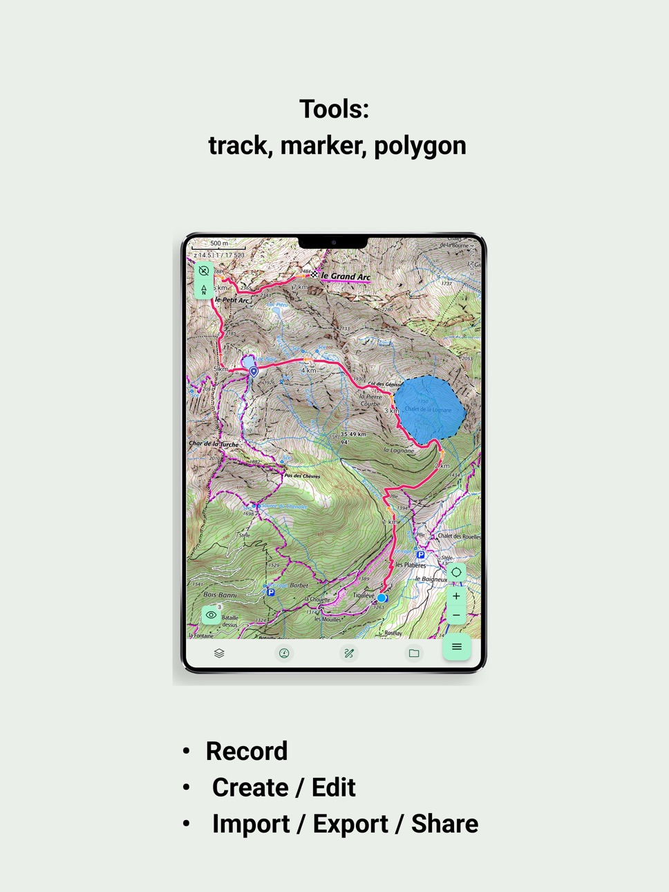
- Create and save tracks: Plan your routes easily directly on the map. Draw paths freehand or follow existing trails. Record your GPS movements in real time, view your track on the map, and monitor key data. Export and share your tracks in GPX format for use on other devices and platforms.
- Follow tracks in real time: Import GPX tracks or select a created route and let CartoExplorer guide you. View your current position on the track and get real-time updates on remaining distance and estimated arrival time.
- Place precise markers: Mark important points of interest on your map — summits, springs, viewpoints, campsites, incidents, and more. Customize markers with colors, names, icons, and descriptions. View GPS coordinates and easily share them with other users.
- Define areas with polygons: Outline specific zones on the map by drawing polygons. Automatically calculate their surface area. Useful for identifying search zones, delimiting plots, or planning operations in targeted territories.
- Manage your offline maps: Never let a lack of internet connection limit your explorations. CartoExplorer offers simple yet powerful offline management: automatic caching of viewed maps and precise offline downloads where you select the exact region you want to store locally.
Some of these features (sharing, tracking, offline mode, etc.) are not available in the free version of the app. Unlock the full potential of CartoExplorer with our Premium subscription (€19.99/year) or Duo subscription (€29.99/year).
In-App Purchases US pricing
CartoExplorer Subscription
Premium · Yearly$17.99
Premium + IGN · Yearly$24.99
Duo + IGN · Yearly$34.99
Capabilities
In-App Purchases
Accessibility
ipadiphonemacrealityDevicetvoswatch
Version history 14 versions
Build 887732562v26.7.32026-07-02 22:19:25
Fix:
- crash if a mbtile file is corrupted.
Build 887645296v26.7.22026-06-30 22:51:53
### Marks
Big evolution for the benchmarks. From the configuration page, the application now manages the entry of all coordinate formats. The format selected in the settings becomes the default format displayed.
### Improvement
- The trace editor retains the configuration of the tool from one edition to another.
- A long press on the screen makes it possible to make invisible all the objects (traces, markers, polygons, sliders, buttons...). They reappear when the support is released.
- A long press on the button that allows to refocus the map now allows cutting the location and thus to make disappear the position marker of the map.
## # Various corrections
* Fixed a bug for MBtiles layers that returned a gray screen.
* Fixed a screen refresh bug when recording trace (the move is again visible and indicated by a stroke).
Build 886516880v26.6.12026-06-04 18:06:53
Version 26.6 - Various fixes and improvements
# Maps
## New layers in the IGN Forestry group:
- Forest Mask V1 2021-2023
- Ancient Forests
- Forest Accessibility SKIDDER
- Forest Accessibility FORWARDER
## New layer in the IGN Relief group:
- Contour Lines
## New DFCI 34 group with associated layers:
- DFCI firefighting tracks
- DFCI tracks (access/route/liaison)
- DFCI support zone tracks
- openDFCI tracks
- openDFCI water points
# Settings
- Added a setting to keep the screen on. A button to control this setting can be added to the real-time data dashboard.
- Added a setting to shift the position cursor downward, allowing more map to be visible in the upper part of the screen. Useful when using the CAP or AZ map orientation modes.
# Miscellaneous
- Added a notification with a progress bar when loading a cache (currently Android only).
- Added altitude for waypoints. From the waypoint block's more menu, it is now possible to pin a waypoint to retrieve its altitude using the Digital Elevation Model.
- Added the full name of objects in the detail sheet for tracks, waypoints and polygons.
- When moving one or more elements, the list of possible destinations is now sorted alphabetically.
- Minor change in custom layers: the gear icon replaces the pencil, and the selection square is moved to the end of the line.
- New unit added: angles. They can be displayed in degrees or milliradians.
- Fixed a bug when importing tracks with only a few timestamped points.
Build 884412671v26.4.42026-04-12 18:19:18
### Version 26.4.0 - MBTiles Import and New Features
## Maps and Markers
- MBTiles Import: Ability to create your own map layers by importing MBTiles files.
- Visual improvements to the compass tool (better distance circles and data visualization).
- Disabled marker reminders upon import.
- Fixed display issues for long text markers.
- Hiding a tracked marker now automatically disables its tracking.
## Tracks and Recording
- Improved elevation profile frame for better data visibility during track editing.
- Track recording now uses the latest filtering algorithm.
- Better visibility of detailed profile info in the track creation tool.
- Hiding a tracked route now automatically disables its tracking.
## Settings and General
- New units: Added the ability to select angle units (degrees, NATO mils) in settings.
- Removed minimum zoom restriction in the cache creation tool.
- Fixed catalog data refresh bug.
- Fixed scale value display.
Build 883022910v26.3.22026-03-04 17:14:17
Version 26.3.0 - Miscellaneous Fixes and Improvements
Maps
- Improved image quality for maps at exact zoom levels.
- Implementation of a new access key for the OACI base layer provided by IGN.
- New overlays for France in the IGN - Foncier section:
- CLPA - Témoignages
- CLPA - Interprétation des phénomènes passés
CLPA = Carte de Localisation des Phénomènes d’Avalanches.
Tracks
- Added the following information to the Details sheet:
- Recording duration (if the track was recorded).
- Pause time calculation.
- Number of points composing the track.
- Improved track data processing.
Settings
- Added a new "Advanced Settings" section.
- Within "CartoExplorer" Advanced Settings, users can now configure the smoothing threshold for elevation gain calculations.
- Direct access to the FAQ.
Improvements
- Folders are now sorted alphabetically.
- Manual caches are now sorted alphabetically.
- Added a specific badge to indicate when the application is paused.
- Optimized the MNTALTI layer for better fluidity and performance.
Bug Fixes
- Disabled "Auto-center on position" when using the "Go to" feature from the catalog.
- Disabled "Auto-center on position" when displaying search results.
- Bug affecting the import of text markers solved.
- Various other minor fixes and stability improvements.
Build 882521642v26.2.22026-02-16 21:28:14
Correction of the IGN layer Traces winter hikes.
Build 882313383v26.2.12026-02-10 23:33:03
### Version 26.2 - Desktop and MNT Editor
- Enhanced trace editor with keyboard shortcuts on Desktop
- Integration of the Digital Terrain Model (MNT)
- Display of altitude at the target
- Various corrections and performance improvements
- Customization of the position target
Build 881220597v26.1.02026-01-05 23:51:19
Improved stability and fixes many bugs.
Build 880158195v25.11.32025-11-28 08:39:43
Version 25.11 - Catalog Redesign and Major Improvements
COMPLETE CATALOG REDESIGN
- Advanced Filter Menu: Filter your data by type (marks, traces, polygons), sort by name or date, and group by category
- Maps and Caches Merged: Maps and Caches menus are now unified for simplified navigation
- Persistent Preferences: Your filter and sort settings are automatically saved
- Integrated Tutorial: Discover new features with a step-by-step guide
CARTOGRAPHIC IMPROVEMENTS
- Maximum zoom extended to level 19 for more detail
- Automatic zoom level saving between sessions
- Fixed Finnish maps
- Better handling of areas without elevation data
TRACES AND NAVIGATION
- Optimized GPX export for Garmin Connect
- Improved display of areas without altitude in profiles
- Option to disable heading line display
- Fixed metadata retrieval during editing
NEW FEATURES
- Biodiv'Sports integration for environmentally responsible activities
- New maps added for 7 new countries: Germany, Spain, Luxembourg, Norway, Austria, Quebec, and Finland
FIXES AND STABILITY
- Automatic catalog refresh after object creation
- Correct cache visibility after GoTo
- Improved permissions and security
- Various user interface fixes
Build 879220004v25.10.22025-10-26 20:01:53
Revolutionary File Import and Management :
- Unified Import System: Complete overhaul for a consistent and simplified import experience
- Enhanced Batch Import: Import multiple files simultaneously with improved stability
- Fixed incorrect file extension issues on Android (no more unwanted `.txt` or `.xml` additions)
Optimized Permissions and Startup :
- Smart location permission management at startup
- Permissions no longer accidentally requested during introduction navigation
- Smoother and more intuitive onboarding experience
- Improved multilingual support for system dialogs on macOS
Stability and Performance :
- Reinforced track simplification algorithm with automated testing
- Fixed elevation issues during track processing
- More reliable recorded track saving
Build 878469030v25.9.92025-09-28 02:56:37
Advanced Customization
- Customize your position cursor color with real-time preview
- Redesigned Settings interface for better ergonomics
Maps and Navigation
- Support for WMS layers to access even more maps
- Added BRGM Geological Map background
- Improved navigation icons (distance traveled, remaining distance)
- Smart target that only displays information (distance, azimuth) when the app receives location data
Advanced Management
- New actions available for multiple selections (show/hide selection)
- Added tooltips for better understanding of functions
- IGNRando archive import to facilitate data recovery
Fixes and Stability
- Resolved trace recording issues
- Improved permission handling across all systems
- Interface optimized for large screens
- Fixed waypoint and trace import errors
- Better offline/online state management
Build 877931672v25.9.12025-09-08 12:38:49
Fixes :
- The track being recorded was no longer displayed.
- Added a clear message about the free trial period to the license overview page.
Build 877196466v25.8.12025-08-13 07:41:02
Features:
- Added a status indicator (offline or connected) in the Settings Account section.
- Added a Contact and Support section in the Settings.
Corrections:
- Bug when loading the license when you are offline.
- Improvement of the GPS noise filtering algorithm at altitudes.
Build 873647337v25.7.02025-08-01 10:33:04
Price history by region
Currency
Show
Columns
Search
Availability 1 of 1 storefronts
| Region | Language | Price | Ratings | Avg | Version |
|---|---|---|---|---|---|
| US | en-US | Free | 0 | — | 26.7.3 |
Change log 18 changes · US
✎
releaseNotes updated
Fix:
- crash if a mbtile file is corrupted.
✎
description updated
Discover CartoExplorer, the mapping app designed to accompany you on all your outdoor adventures.
Wherever you are, thanks to its wide range of maps (USGS, Euro
✎
subtitle updated
Hiking Outdoor Navigation
✎
name updated
CartoExplorer | maps | GPS
◆
Version 26.7.3 released
Fix:
- crash if a mbtile file is corrupted.
◆
Version 26.7.2 released
### Marks
Big evolution for the benchmarks. From the configuration page, the application now manages the entry of all coordinate formats. The format selected in the settings becomes the default format displayed.
### Improvement
- The tra
◆
Version 26.6.1 released
Version 26.6 - Various fixes and improvements
# Maps
## New layers in the IGN Forestry group:
- Forest Mask V1 2021-2023
- Ancient Forests
- Forest Accessibility SKIDDER
- Forest Accessibility FORWARDER
## New layer in the IGN Relief grou
◆
Version 26.4.4 released
### Version 26.4.0 - MBTiles Import and New Features
## Maps and Markers
- MBTiles Import: Ability to create your own map layers by importing MBTiles files.
- Visual improvements to the compass tool (better distance circles and data visual
◆
Version 26.3.2 released
Version 26.3.0 - Miscellaneous Fixes and Improvements
Maps
- Improved image quality for maps at exact zoom levels.
- Implementation of a new access key for the OACI base layer provided by IGN.
- New overlays for France in the IGN - Foncier
◆
Version 26.2.2 released
Correction of the IGN layer Traces winter hikes.
◆
Version 26.2.1 released
### Version 26.2 - Desktop and MNT Editor
- Enhanced trace editor with keyboard shortcuts on Desktop
- Integration of the Digital Terrain Model (MNT)
- Display of altitude at the target
- Various corrections and performance improvements
-
◆
Version 26.1.0 released
Improved stability and fixes many bugs.
◆
Version 25.11.3 released
Version 25.11 - Catalog Redesign and Major Improvements
COMPLETE CATALOG REDESIGN
- Advanced Filter Menu: Filter your data by type (marks, traces, polygons), sort by name or date, and group by category
- Maps and Caches Merged: Maps and Ca
◆
Version 25.10.2 released
Revolutionary File Import and Management :
- Unified Import System: Complete overhaul for a consistent and simplified import experience
- Enhanced Batch Import: Import multiple files simultaneously with improved stability
- Fixed incorrect
◆
Version 25.9.9 released
Advanced Customization
- Customize your position cursor color with real-time preview
- Redesigned Settings interface for better ergonomics
Maps and Navigation
- Support for WMS layers to access even more maps
- Added BRGM Geological Map ba
◆
Version 25.9.1 released
Fixes :
- The track being recorded was no longer displayed.
- Added a clear message about the free trial period to the license overview page.
◆
Version 25.8.1 released
Features:
- Added a status indicator (offline or connected) in the Settings Account section.
- Added a Contact and Support section in the Settings.
Corrections:
- Bug when loading the license when you are offline.
- Improvement of the GPS
◆
Version 25.7.0 released