Home › Utilities

 US
US
1 of 1 storefronts
Content in en-US
Content in en-US
Information
Preview 2 platforms
iPhone 10 images


iPad 5 images



What’s New Version 2.0.8
Bug fixes.
Description
Land Survey is a mobile app that lets you measure areas and distances by placing points directly on Google Maps. Whether you need quick and accurate measurements for land, farmland, building sites, or any other field, you can do it all with just your smartphone -- no complex equipment required.
[Key Features]
▶ Area Survey
• Calculate area in real time by placing polygon vertices on the map one by one.
• Supports over 30 area units including sq m, sq km, ha, ac (acre), pyeong, and more.
• Offers a wide range of historical and traditional units such as arpent, perch, hide, stremma, and dunam.
▶ Distance Survey
• Measure total distance in real time by drawing a path on the map.
• Supports over 30 distance units including m, km, ft, mi, nautical mile (nmi), and more.
• Provides surveying, nautical, and historical units such as chain, link, fathom, furlong, rod, and more.
▶ Multiple Map Styles
• Freely switch between 4 map modes: Normal, Satellite, Hybrid, and Terrain.
▶ Precision Editing
• Drag placed points to freely adjust their positions.
• Select a node and use the on-screen center target for precise positioning.
• Use the GPS current location button to instantly apply your current position as a survey point.
• Edit while referencing a Guide layer, and use the Snapping feature to align precisely to existing points and lines.
• Use the Undo feature to instantly revert mistakes.
▶ Review Mode
• Switch to review mode after editing to view distance labels on each segment.
• Toggle distance label visibility on or off.
▶ Save and Manage
• Save survey results to the Archive with a custom name.
• Load saved survey data anytime to re-edit or review.
• Quickly save or delete individual items with a slide gesture.
▶ File Export and Import
• Export survey data in GeoJSON and KML formats.
• Import GeoJSON and KML files created externally.
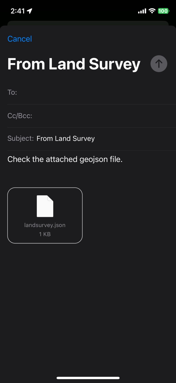
• Send survey data directly via email.
• Export individual items or all data at once.
▶ Location Search
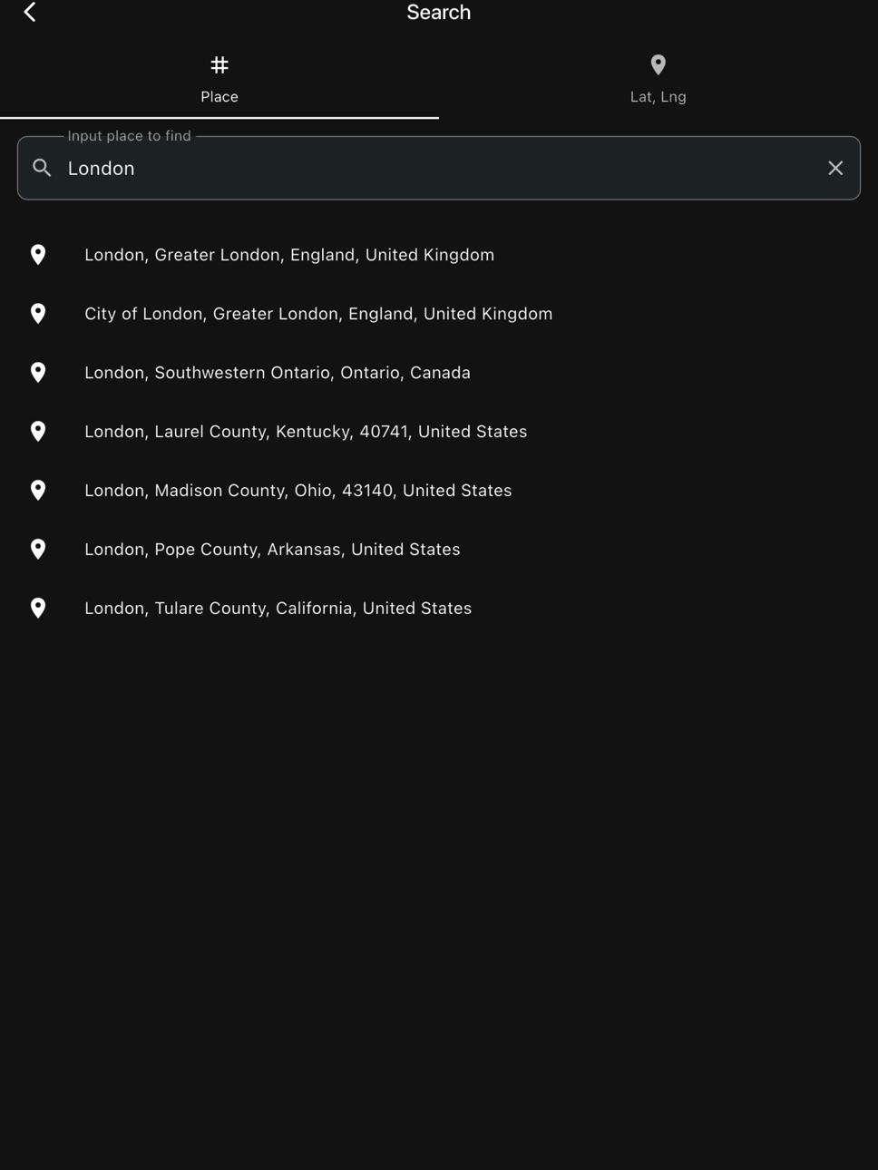
• Place Search: Quickly find a desired location by address or place name.
• Coordinate Input: Enter latitude and longitude directly to navigate to a precise location.
▶ Multi-Language Support
• Supports 7 languages: English, Korean, Japanese, Chinese, Spanish, Hindi, and Arabic.
▶ Theme Settings
• Choose from Light, Dark, and System themes.
▶ Premium Purchase
• A one-time purchase removes all ads and unlocks a seamless experience with all features.
[Recommended For]
• Anyone who wants to quickly check land or real estate area on-site
• Anyone who wants to easily measure farmland, forest, or ranch area
• Anyone who wants to measure the distance of hiking trails, walking paths, or coastlines
• Anyone who needs quick surveying at construction, landscaping, or civil engineering sites
• Anyone who wants to share survey results in GeoJSON/KML or use them in GIS software
Start accurate surveying easily with Land Survey.
Capabilities
In-App Purchases
Accessibility
ipadiphonemacrealityDevicetvoswatch
Version history 23 versions
Build 883142030v2.0.82026-03-12 05:20:59
Bug fixes.
Build 880475267v2.0.72025-12-10 00:14:37
Add link of User Manual.
Build 880007386v2.0.62025-11-24 12:45:57
Bug fix.
Build 879968883v2.0.42025-11-22 01:26:39
- Improved point dragging function.
- Bug fixes.
Build 879908739v2.0.32025-11-20 17:34:31
Improved point dragging function.
Build 878275508v2.0.22025-09-21 03:27:08
Bug fixes.
Build 876153064v2.0.12025-07-07 17:51:47
Bug fixes.
Build 875828425v1.9.62025-06-24 10:11:35
Bug fix.
Build 875678920v1.9.52025-06-18 16:48:46
Bug fix.
Build 875271233v1.9.42025-06-03 18:09:20
UI improvements
Build 875228363v1.9.22025-06-02 23:33:26
Added snapping function
Build 874559788v1.9.12025-05-06 22:28:33
Bug fix.
Build 874310434v1.9.02025-04-28 17:59:51
Add distance label in review mode.
Build 874215942v1.8.92025-04-22 20:54:02
Bug fix & Add purchase menu.
Build 874117057v1.8.72025-04-17 23:27:33
Bug fixed.
Build 874039196v1.8.62025-04-16 02:25:33
Support multi language & color them
Build 873908208v1.8.52025-04-09 22:40:40
Bug fixes.
Build 873803937v1.8.42025-04-06 07:55:16
User Interface improvement.
Build 873661700v1.8.32025-03-31 18:44:08
Improvements in content extraction
Build 873539447v1.8.22025-03-26 13:12:45
Bug fixed.
Build 873215384v1.8.12025-03-13 21:29:21
Bug fix.
Build 872895611v1.1.02025-03-01 20:30:00
Polygon, Polyline input method improvement.
Build 872147030v1.02025-01-31 18:31:16
No pricing data captured yet — comparisons appear once the app has paid storefronts or in-app purchases.
Availability 1 of 1 storefronts
| Region | Language | Price | Ratings | Avg | Version |
|---|---|---|---|---|---|
| US | en-US | Free | 0 | — | 2.0.8 |
Change log 27 changes · US
✎
releaseNotes updated
Bug fixes.
✎
description updated
Land Survey is a mobile app that lets you measure areas and distances by placing points directly on Google Maps. Whether you need quick and accurate measurement
✎
subtitle updated
Area, distance measurement
✎
name updated
Land Survey
◆
Version 2.0.8 released
Bug fixes.
◆
Version 2.0.7 released
Add link of User Manual.
◆
Version 2.0.6 released
Bug fix.
◆
Version 2.0.4 released
- Improved point dragging function.
- Bug fixes.
◆
Version 2.0.3 released
Improved point dragging function.
◆
Version 2.0.2 released
Bug fixes.
◆
Version 2.0.1 released
Bug fixes.
◆
Version 1.9.6 released
Bug fix.
◆
Version 1.9.5 released
Bug fix.
◆
Version 1.9.4 released
UI improvements
◆
Version 1.9.2 released
Added snapping function
◆
Version 1.9.1 released
Bug fix.
◆
Version 1.9.0 released
Add distance label in review mode.
◆
Version 1.8.9 released
Bug fix & Add purchase menu.
◆
Version 1.8.7 released
Bug fixed.
◆
Version 1.8.6 released
Support multi language & color them
◆
Version 1.8.5 released
Bug fixes.
◆
Version 1.8.4 released
User Interface improvement.
◆
Version 1.8.3 released
Improvements in content extraction
◆
Version 1.8.2 released
Bug fixed.
◆
Version 1.8.1 released
Bug fix.
◆
Version 1.1.0 released
Polygon, Polyline input method improvement.
◆
Version 1.0 released