Home › Navigation

 US
US
1 of 1 storefronts
Content in en-US
Content in en-US
Information
Preview 2 platforms
iPhone 10 images


iPad 10 images




What’s New Version 5.14.0
- Save planned routes as tracks
- Follow saved routes
- New map layers added!
- Detailed weather information with several weather forecast models (ECMWF, GFS, ICON, AROME, UKMO, ...), for any place, any elevation!
- Create and share images with the forecast, hourly, daily or both, and the current conditions!
- Create and share your track stats and images to your social media straight from ZENIT Tracks!
Description
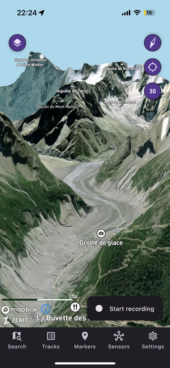
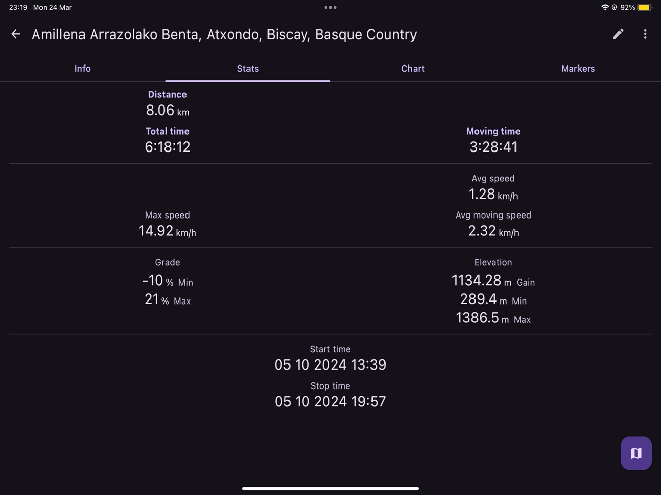
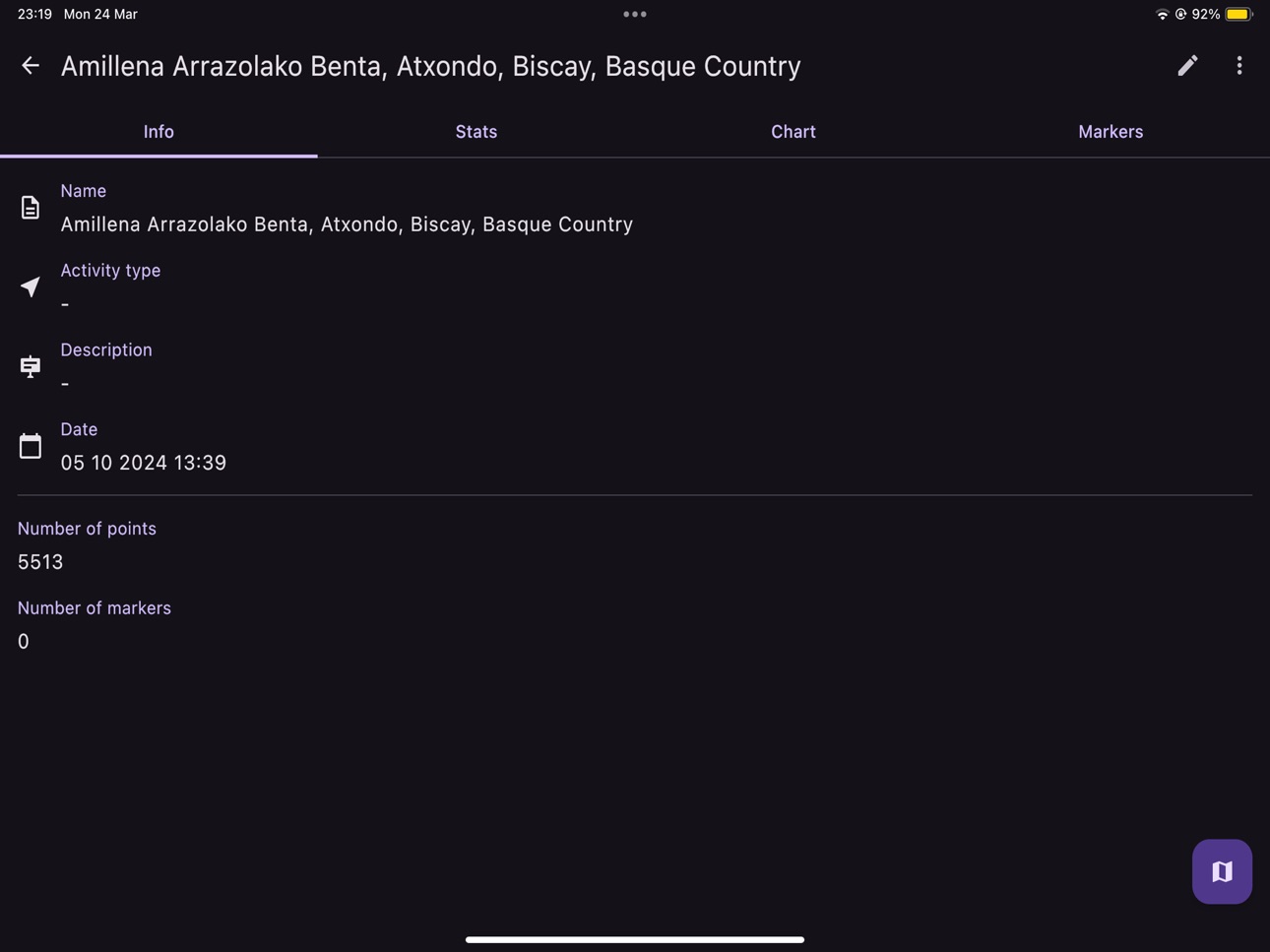
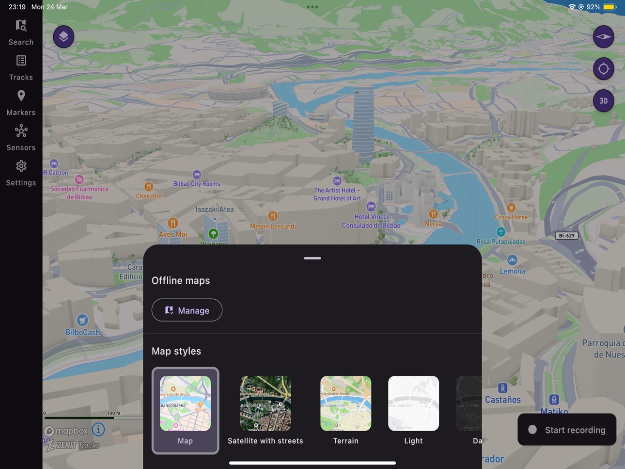
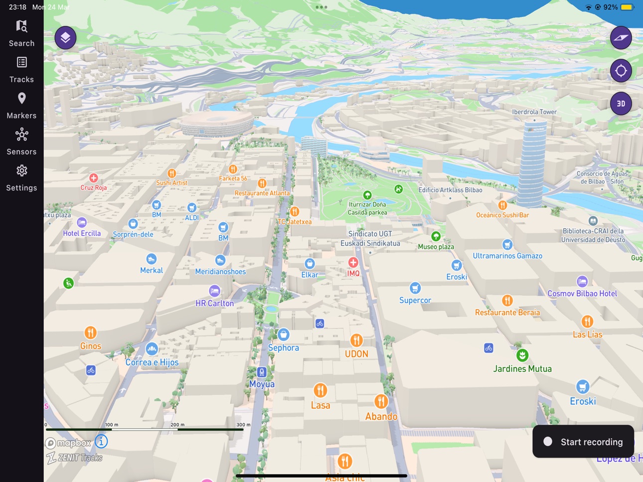
ZENIT Tracks is the tool for route tracking by using the GPS location. You can see your routes plotted in a highly-customizable map and all stats like distance, speed, route gradient are recorded so you can see them as stats or in a beautiful chart
ZENIT Tracks allows to import track files wherever you get them from, from Google Earth, Wikiloc or Strava for example, as it has support for GPX and KML files for GPS tracks and routes
With ZENIT Tracks you can export your tracks, to analyze them in a GPX Viewer, see in Google Earth or share them to networks like Wikiloc or Strava. You can export your recorded tracks as: GPX, KML, CSV or TCX
It also offers a sensor screen, which displays the readings from the various sensors on your device. You can see compass values, GPS status, altitude, GPS coordinates, atmospheric pressure and even the strength of the Earth's magnetic field. It also allows you to check the slope of the terrain you are on, to provide further information when assessing avalanche risk.
In-App Purchases US pricing
ZENIT Tracks - FULL Version Unlock Subscription
ZENIT Tracks - FULL Version · 7 days$1.99
Monthly$3.99
ZENIT Tracks - FULL Version · Yearly$34.99
One-Time Purchases
Full Version Unlock$7.99
Capabilities
In-App Purchases
Accessibility
ipadiphonemacrealityDevicetvoswatch
Version history 17 versions
Build 885172933v5.14.02026-05-15 18:44:14
- Save planned routes as tracks
- Follow saved routes
- New map layers added!
- Detailed weather information with several weather forecast models (ECMWF, GFS, ICON, AROME, UKMO, ...), for any place, any elevation!
- Create and share images with the forecast, hourly, daily or both, and the current conditions!
- Create and share your track stats and images to your social media straight from ZENIT Tracks!
Build 885150144v5.13.72026-05-01 16:17:18
- Now you can save planned routes as tracks
- Now you can follow saved routes (feedback is welcome)
- Several map layers added!
- WEATHER: Add very detailed weather information with several weather forecast models (ECMWF, GFS, ICON, AROME, UKMO, ...), for any place, any elevation!
- WEATHER: You can create and share images with the forecast, hourly, daily or both, as well as the current conditions!
- Added option to set map rotation following the user bearing (press the 'My location' button in the map two times)
- Added option to plan routes with straight lines, useful when no internet connection or in areas without route information
- Added Map Layer legends
Build 884237935v5.12.12026-04-08 18:15:36
- Now you can save planned routes as tracks
- Now you can follow saved routes (feedback is welcome)
- Several map layers added!
Build 883599686v5.10.12026-03-23 22:00:30
- Now you can save planned routes as tracks
- Now you can follow saved routes (feedback is welcome)
- Several map layers added!
Build 881376782v5.9.02026-01-10 23:12:27
Added the Live Map layer for Full Version to see locally updated satellite imagery
Now you can enter GPS (lat,lon) or UTM coordinates in the search screen
Now you can search between your saved tracks in the Tracks screen
Build 880481386v5.8.02025-12-09 21:25:26
Improved the UI in the Map screen and Tracks screen
Fixed bugs
Build 879173027v5.7.12025-10-24 06:45:30
Added the Live Map layer for Full Version to see locally updated satellite imagery
Now you can enter GPS (lat,lon) or UTM coordinates in the search screen
Now you can search between your saved tracks in the Tracks screen
Build 877968400v5.6.12025-09-09 21:32:31
Now you can import tracks from your Suunto account!
Build 876094619v5.5.12025-07-03 09:30:06
Added feature to directly shared tracks, without exporting
Added marker list to place your favourite destinations with the icon you want
Allow opening GPX, KML, KMZ files directly from your file manager or downloads
Allow scale bar in map to be hidden
Add options to track and location detail views
Many error corrections
Build 874926095v5.4.12025-05-21 05:55:37
Added option to sort tracks and markers
Build 874425739v5.3.02025-04-30 18:45:35
Improve and save recent searches for faster finding places
Added 'Sensors' screen to read multiple device sensors
Add Download Offline Maps support
Add Search option
Add long press support in map to get location details (coordinates, elevation, etc)
Add support to save locations as markers
Add 3D buildings to Standard map
Build 873180816v5.2.22025-03-25 08:04:05
Added 'Sensors' screen to read multiple device sensors
Add Download Offline Maps support
Add Search option
Add long press support in map to get location details (coordinates, elevation, etc)
Add support to save locations as markers
Add 3D buildings to Standard map
Build 873161366v5.2.12025-03-12 01:20:58
Added 'Sensors' screen to read multiple device sensors
Added 'Directions' feature (long press a starting point in the map, and press 'Directions'
Added Download Offline Maps support
Improved the way the tracks are shown in the map
Added Search option
Added long press support in map to get location details (coordinates, elevation, etc)
Added support to save locations as markers
Added 3D buildings to Standard map
Improved walk roads and rivers in Satellite map
Performance improvements
Build 872622072v5.1.02025-02-28 09:58:34
Added 'Directions' feature (long press a starting point in the map, and press 'Directions'
Added Download Offline Maps support
Improved the way the tracks are shown in the map
Added Search option
Added long press support in map to get location details (coordinates, elevation, etc)
Added support to save locations as markers
Added 3D buildings to Standard map
Improved walk roads and rivers in Satellite map
Performance improvements
Build 871854782v5.0.102025-01-21 07:19:16
First version released for iOS!
Build 871360093v1.02025-01-18 00:07:52
Build 871842659v5.0.92025-01-18 19:00:22
First version released for iOS!
Price history by region
Currency
Show
Columns
Search
Availability 1 of 1 storefronts
| Region | Language | Price | Ratings | Avg | Version |
|---|---|---|---|---|---|
| US | en-US | Free | 0 | — | 5.14.0 |
Change log 21 changes · US
✎
releaseNotes updated
- Save planned routes as tracks
- Follow saved routes
- New map layers added!
- Detailed weather information with several weather forecast models (ECMWF, GFS, I
✎
description updated
ZENIT Tracks is the tool for route tracking by using the GPS location. You can see your routes plotted in a highly-customizable map and all stats like distance,
✎
subtitle updated
3D Offline Maps & GPS Recorder
✎
name updated
ZENIT Tracks
◆
Version 5.14.0 released
- Save planned routes as tracks
- Follow saved routes
- New map layers added!
- Detailed weather information with several weather forecast models (ECMWF, GFS, ICON, AROME, UKMO, ...), for any place, any elevation!
- Create and share images
◆
Version 5.13.7 released
- Now you can save planned routes as tracks
- Now you can follow saved routes (feedback is welcome)
- Several map layers added!
- WEATHER: Add very detailed weather information with several weather forecast models (ECMWF, GFS, ICON, AROME,
◆
Version 5.12.1 released
- Now you can save planned routes as tracks
- Now you can follow saved routes (feedback is welcome)
- Several map layers added!
◆
Version 5.10.1 released
- Now you can save planned routes as tracks
- Now you can follow saved routes (feedback is welcome)
- Several map layers added!
◆
Version 5.9.0 released
Added the Live Map layer for Full Version to see locally updated satellite imagery
Now you can enter GPS (lat,lon) or UTM coordinates in the search screen
Now you can search between your saved tracks in the Tracks screen
◆
Version 5.8.0 released
Improved the UI in the Map screen and Tracks screen
Fixed bugs
◆
Version 5.7.1 released
Added the Live Map layer for Full Version to see locally updated satellite imagery
Now you can enter GPS (lat,lon) or UTM coordinates in the search screen
Now you can search between your saved tracks in the Tracks screen
◆
Version 5.6.1 released
Now you can import tracks from your Suunto account!
◆
Version 5.5.1 released
Added feature to directly shared tracks, without exporting
Added marker list to place your favourite destinations with the icon you want
Allow opening GPX, KML, KMZ files directly from your file manager or downloads
Allow scale bar i
◆
Version 5.4.1 released
Added option to sort tracks and markers
◆
Version 5.3.0 released
Improve and save recent searches for faster finding places
Added 'Sensors' screen to read multiple device sensors
Add Download Offline Maps support
Add Search option
Add long press support in map to get location details (coordinates, el
◆
Version 5.2.2 released
Added 'Sensors' screen to read multiple device sensors
Add Download Offline Maps support
Add Search option
Add long press support in map to get location details (coordinates, elevation, etc)
Add support to save locations as markers
Add
◆
Version 5.2.1 released
Added 'Sensors' screen to read multiple device sensors
Added 'Directions' feature (long press a starting point in the map, and press 'Directions'
Added Download Offline Maps support
Improved the way the tracks are shown in the map
Added
◆
Version 5.1.0 released
Added 'Directions' feature (long press a starting point in the map, and press 'Directions'
Added Download Offline Maps support
Improved the way the tracks are shown in the map
Added Search option
Added long press support in map to get locat
◆
Version 5.0.10 released
First version released for iOS!
◆
Version 5.0.9 released
First version released for iOS!
◆
Version 1.0 released