Home › Navigation

 US
US
1 of 1 storefronts
Content in en-US
Content in en-US
Information
Preview 2 platforms
iPhone 10 images




iPad 8 images


What’s New Version 4.3
New Features
• Remove speed limit straight from the alert.
Bug Fixes
• Direction arrow stays on a waypoint after validation.
• Direction arrow points the right way in landscape.
• Speed limit warning sound stops cleanly when removed.
• Kilometer breadcrumbs placed reliably and on time.
Description
RallyCAP — Rally Raid Navigation
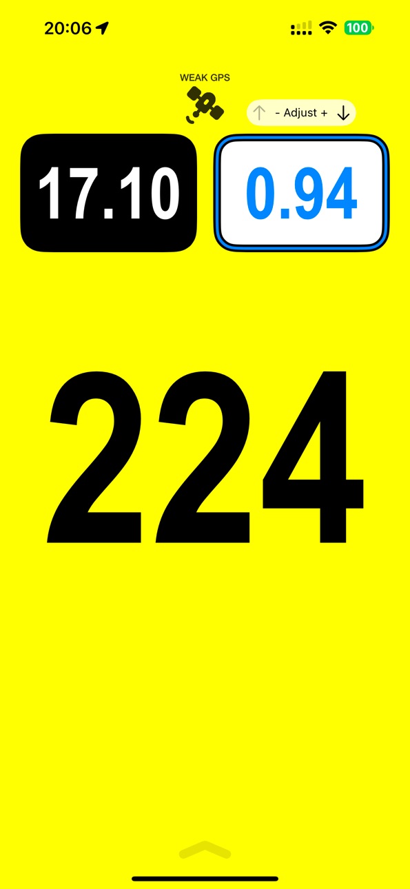
Navigate with confidence. RallyCAP delivers precise CAP heading by combining GPS trajectory and magnetic compass data — accurate no matter how your phone is mounted.
NAVIGATE
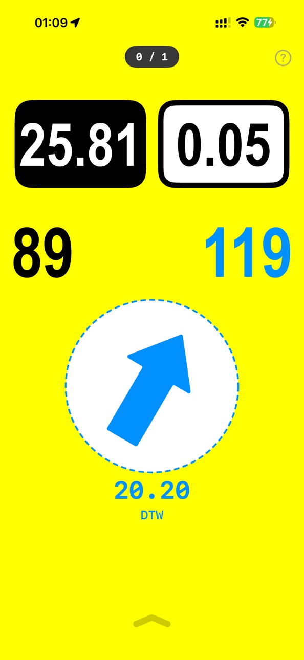
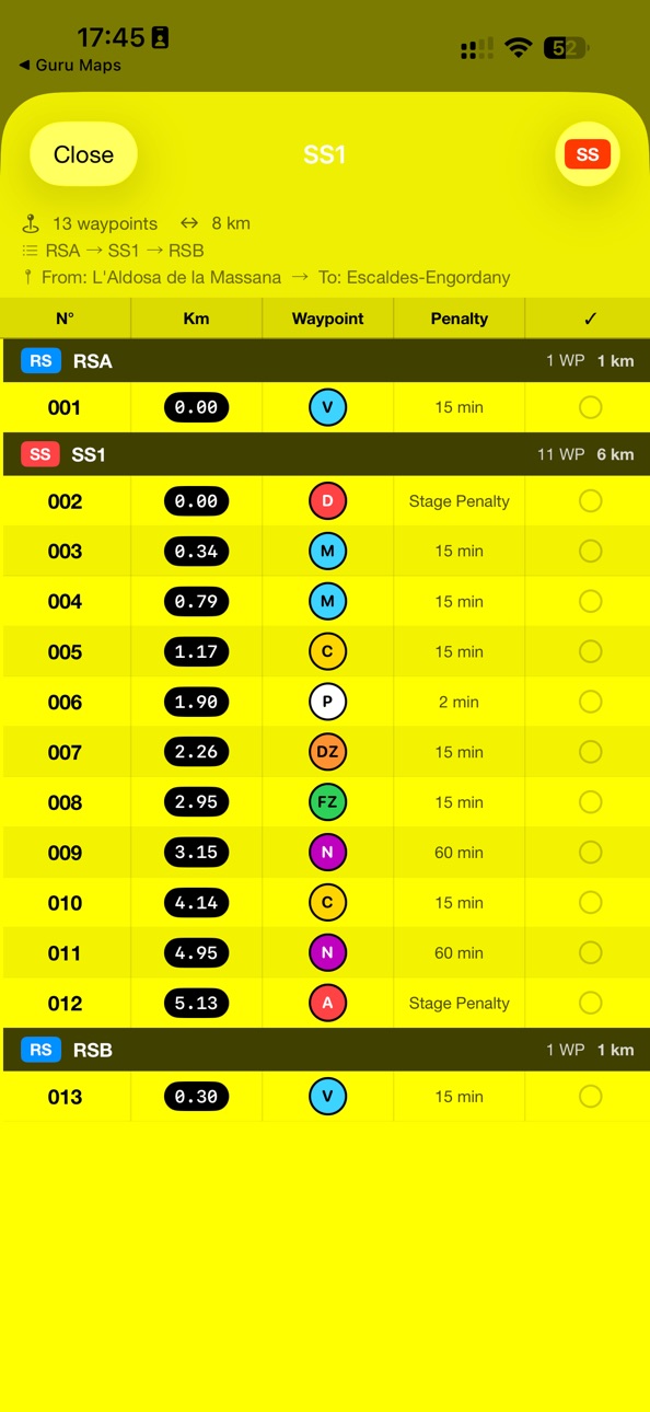
Import GPX roadbooks and follow your route waypoint by waypoint. Automatic validation triggers when you reach each waypoint, even with the screen off. A real-time arrow guides you to the next point with distance and heading at a glance.
STAY LEGAL
Full FIA W2RC speed zone support — DZ, FZ, and combo zones with audio alerts so you never miss a controlled area.
SEE EVERYTHING
Large, high-contrast instruments built for vibration and harsh conditions. Portrait, landscape, CarPlay, and iPad — your data follows you everywhere.
TRACK YOUR RIDE
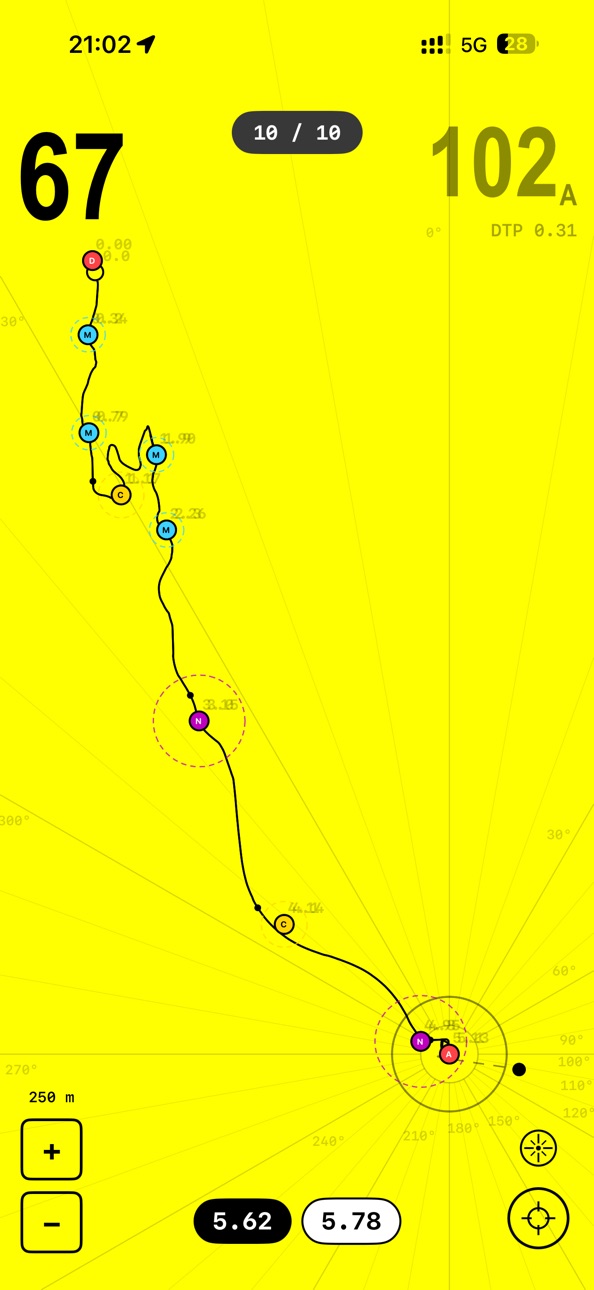
Live GPS trail on the map, speed monitoring with alerts, and a Live Activity widget showing heading and kilometers in real time.
Designed for real rally raid conditions. The perfect training companion for riders and co-drivers preparing for W2RC and national events.
Accessibility
ipadiphonemacrealityDevicetvoswatch
Version history 9 versions
Build 884297659v4.32026-04-09 22:34:14
New Features
• Remove speed limit straight from the alert.
Bug Fixes
• Direction arrow stays on a waypoint after validation.
• Direction arrow points the right way in landscape.
• Speed limit warning sound stops cleanly when removed.
• Kilometer breadcrumbs placed reliably and on time.
Build 884076948v4.22026-04-04 14:50:37
Features
• Bluetooth rally remote support (tap gamepad icon to disable/enable)
• OpenRally GPX compatibility
• Encrypted .cap file import and AirDrop sharing
• Heading direction indicator on map distance ring
• Tap coordinates to copy, long-press elevation for imperial units
Bug Fixes
• Much smoother and more stable CAP heading
• Fixed heading drifting indoors at standstill
• Fixed speed display sticking when stopping
• Fixed elevation showing spike values
• Fixed night mode icon appearing during daytime
• Fixed GPX parsing for non-standard waypoint types
Build 883904752v4.12026-03-31 16:29:06
Features
• Night mode with red-on-black display (tap moon icon after sunset)
• Speed limit gradient background with proximity tick sound
• Compass smoothing and vibration filter for stable heading
• Waypoint approach audio cue on opening radius entry
• Battery protection: GPS auto-stops after 2h in background
• Pull-to-refresh in File Manager
Bug Fixes
• Fixed heading and blue arrow accuracy in landscape mode
• Fixed waypoint validation on app launch
• Fixed file manager share button
• UI and layout improvements
Build 883560348v4.02026-03-27 18:42:49
Features
• Landscape mode support with adaptive layout
• Volume buttons now control Total KM; tap gestures for Partial KM
• Double-tap Total KM for backtrack mode
• Live Activity with accurate heading arrow and KM values
• Redesigned speed zone signs
• Updated help guide
Bug Fixes
• Fixed heading display inconsistencies
• Fixed file manager not refreshing on iPhone
• UI and layout improvements
Build 883523866v3.92026-03-19 15:58:55
New Feature
• Reverse mode: double-tap the center of the total km pill to count kilometers backwards when retracing your route. The pill turns red to indicate subtraction. Double-tap again to resume normal counting.
Bug Fixes
• GPS trail line no longer dashes during normal driving — only in tunnels or dense forest
• Breadcrumb labels no longer leak onto the main screen after dismissing the map
• Fixed double label overlay when validating waypoints
• Blue validation arrow now follows CAP heading instead of phone orientation
• Lock screen and Dynamic Island arrow now correctly points north
Build 883397125v3.82026-03-16 21:26:55
Version 3.8 is a major update with new navigation tools and full FIA regulation support.
LIVE ACTIVITIES
• Lock Screen banner with arrow, total km, partial km, speed, waypoints, and elevation
• Dynamic Island — compact notch shows distance at a glance, expanded view shows full stage data
• Real-time updates while navigating — instantly refreshes when a route is activated
GPX ROADBOOK NAVIGATION
• Import and manage GPX files directly in the app
• Multi-section GPX support with dense track rendering
• Swipe-based UI for browsing waypoints and track sections
• Activate/deactivate routes on the fly
WAYPOINT VALIDATION
• Automatic waypoint validation when entering the defined radius
• Background location tracking — validation works with the screen off
• Missed waypoint alerts with improved UX
• Sequential validation logic for reliable course tracking
DIRECTION ARROW
• Real-time blue arrow overlay pointing to the next waypoint
• Shows Distance to Waypoint (DTW) and Cap to Waypoint (CTW)
• Smooth animated transitions and auto-dismiss on validation
• Map recenters on validated waypoints
FIA W2RC SPEED ZONES
• DZ & FZ (Speed Zone) support
• Waypoint names updated to match official FIA W2RC regulations
• WPC and ASS audio alerts
GPS TRAIL
• Smooth real-time GPS breadcrumb trail on the map
• Stricter dash threshold for cleaner trail rendering
CARPLAY
• Simplified data
SETTINGS & UI
• Redesigned radii settings with FIA-compliant radius
• Keyboard toolbar for numeric input
• Fullscreen scrollable help guide with GPX setup instructions
Build 883126079v3.02026-03-08 18:48:02
Added GPS Tracing with Average CAP
Build 872894915v2.02025-03-02 20:27:32
New features!
- Comprehensive distance tracking with both Total and Partial kilometer counters
- Advanced speed monitoring with configurable maximum speed limit and audio/visual alerts
- Volume button integration for quick partial distance adjustments
- CarPlay support for in-vehicle display
- Multiple font options with easy triple-tap switching
- Enhanced GPS accuracy indicators and coordinate display
- Haptic feedback at cardinal directions
- Landscape and portrait orientation support
Build 862456844v1.02024-02-07 19:36:05
No pricing data captured yet — comparisons appear once the app has paid storefronts or in-app purchases.
Availability 1 of 1 storefronts
| Region | Language | Price | Ratings | Avg | Version |
|---|---|---|---|---|---|
| US | en-US | Free | 0 | — | 4.3 |
Change log 13 changes · US
✎
releaseNotes updated
New Features
• Remove speed limit straight from the alert.
Bug Fixes
• Direction arrow stays on a waypoint after validation.
• Direction arrow points the right
✎
description updated
RallyCAP — Rally Raid Navigation
Navigate with confidence. RallyCAP delivers precise CAP heading by combining GPS trajectory and magnetic compass data — accura
✎
subtitle updated
Heading for Rally Navigation
✎
name updated
RallyCAP
◆
Version 4.3 released
New Features
• Remove speed limit straight from the alert.
Bug Fixes
• Direction arrow stays on a waypoint after validation.
• Direction arrow points the right way in landscape.
• Speed limit warning sound stops cleanly when removed.
• Kil
◆
Version 4.2 released
Features
• Bluetooth rally remote support (tap gamepad icon to disable/enable)
• OpenRally GPX compatibility
• Encrypted .cap file import and AirDrop sharing
• Heading direction indicator on map distance ring
• Tap coordinates to copy, long
◆
Version 4.1 released
Features
• Night mode with red-on-black display (tap moon icon after sunset)
• Speed limit gradient background with proximity tick sound
• Compass smoothing and vibration filter for stable heading
• Waypoint approach audio cue on opening ra
◆
Version 4.0 released
Features
• Landscape mode support with adaptive layout
• Volume buttons now control Total KM; tap gestures for Partial KM
• Double-tap Total KM for backtrack mode
• Live Activity with accurate heading arrow and KM values
• Redesigned speed
◆
Version 3.9 released
New Feature
• Reverse mode: double-tap the center of the total km pill to count kilometers backwards when retracing your route. The pill turns red to indicate subtraction. Double-tap again to resume normal counting.
Bug Fixes
• GPS trail l
◆
Version 3.8 released
Version 3.8 is a major update with new navigation tools and full FIA regulation support.
LIVE ACTIVITIES
• Lock Screen banner with arrow, total km, partial km, speed, waypoints, and elevation
• Dynamic Island — compact notch shows distance
◆
Version 3.0 released
Added GPS Tracing with Average CAP
◆
Version 2.0 released
New features!
- Comprehensive distance tracking with both Total and Partial kilometer counters
- Advanced speed monitoring with configurable maximum speed limit and audio/visual alerts
- Volume button integration for quick partial distance
◆
Version 1.0 released