Home › Productivity

 US
US
1 of 1 storefronts
Content in en-US
Content in en-US
Information
Preview 2 platforms
iPhone 10 images

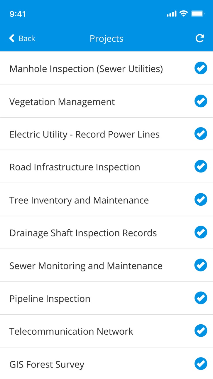


iPad 10 images


What’s New Version 10.6.1
Fixed an issue where records could get stuck in the upload queue on 5G networks. Data now syncs reliably on 5G connections.
Description
GIS Cloud Mobile Data Collection is a solution for recording and updating data in the field with mobile devices in real time, also allowing instant data access from the office. Digitize your workflow and eliminate errors and time-consuming paperwork!
The mobile app enables you to accurately record data, online or offline, by filling in digital custom survey forms. You can create an unlimited number of your own unique forms in the user-friendly form builder, in the connected web app (Mobile Data Collection Portal).
Continue working on your data, edit, share, and collaborate through GIS Cloud powerful web Map Editor app. Find everything you need for your workflow in one platform, no need for integrations.
Collect points, lines, or polygons! Use GPS to capture data on the go, or switch to manual and use pinpoint and drawing tools for even better precision.
Form fields are fully customizable and you can choose from text fields, selects lists, radio buttons, checkboxes, electronic signature, autofill, barcode, photo and audio, hidden fields, and much more. To control data accuracy and eliminate errors, make your form fields required, conditional (dependent on other form fields or data input), or persistent.
Manage your field staff and share projects with custom forms to field workers by assigning them the collect and update permissions, and they can instantly start collecting data in the field.
Simply sign into your GIS Cloud account (or sign up for free) and send collected data directly to your GIS Cloud app in the cloud. Data is immediately represented on a map, just click on any map feature to access collected data. Generate reports from the web app.
Access data through GIS Cloud Map Editor, where you can further edit and style your data, overlay with additional data layers analyze data, share data with colleagues with different permissions to collaborate on projects. You can also export data and much more.
Collect field data and conduct field surveys faster and easier than ever before. Start creating forms in the MDC Portal web app on https://giscloud.com and have your team out and about in a quarter of an hour!
All you need in the field:
- Offline data capture
- Offline maps
- Points, Lines, and Polygons geometry support
- Media (photos & audio) enriched location information
- QR code and barcode support
- Electronic signature
- Dropdowns, lists, input boxes, and comments based on custom forms
- Review data attributes directly in the app
- Search through data on the map
- Control different layers in the map
- Edit existing data
- Listen to audio and view images
- Real-time GPS location
- View and explore maps in the field
Prepare and analyze in the office:
- Cloud-based web apps
- Custom forms designer
- Rich GIS symbology and visualization
- Data editing and exporting
- One-click map and data sharing
- Real-time collaboration
- Map publishing
- Spatial Queries & Analysis
- Account administration
Note! This app will use GPS in the background to give you the most accurate and current location. Continued use of GPS running in the background can dramatically decrease battery life.
If you have any questions or comments, feel free to contact us at support@giscloud.com.
Privacy Policy: https://www.giscloud.com/wp-content/uploads/privacy-policy.html
Terms of Use: https://www.giscloud.com/wp-content/uploads/terms-of-use.html
In-App Purchases US pricing
Subscriptions Subscription
1 month subscription · Monthly$39.99
Capabilities
In-App Purchases
Accessibility
ipadiphonemacrealityDevicetvoswatch
Version history 25 versions
Build 888057045v10.6.12026-07-10 06:08:16
Fixed an issue where records could get stuck in the upload queue on 5G networks. Data now syncs reliably on 5G connections.
Build 886845449v10.6.02026-07-01 08:15:31
*** Introducing.. GIS Cloud AI ***
Build 885066789v10.5.02026-05-05 07:34:54
Updates for supporting the latest iOS version
Build 883713624v9.9.12026-03-25 08:01:47
Fixes login screen input freeze issues
Build 880281648v9.9.02025-12-05 07:25:41
Internal improvements
Build 879212936v9.8.02025-10-27 10:56:26
Internal improvements
Build 876865020v9.7.12025-09-18 07:44:53
Updates:
• Password must contain a minimum of 10 characters and a combination of uppercase, lowercase, numbers, and symbols.
• Application colours updated to be inline with the WCAG requirements
Fixes:
• When editing a video the correct video size is shown for previously uploaded videos
• Info panel is now correctly showing attributes in the case when one of the attributes was called length and had the value of 0
Build 876409295v9.6.12025-07-16 11:14:50
Internal improvements
Build 874522012v9.6.02025-05-06 10:47:55
Fixes:
• Fix displaying validation messages when using combined unique fields
• Enable multiline formatting in group description fields
• Fix labels disappearing when multiple layers are present and switching to offline mode
• Fix audio streaming
• Other internal improvements and updates
Build 872289750v9.5.92025-02-10 10:02:13
We fixed the "Navigate to feature" feature.
Build 870523846v9.5.82024-11-21 09:14:50
Internal improvements
Build 870025764v9.5.72024-10-30 10:17:39
Features:
• form automation
Fixes:
• better tracking of user location
• offline search with special characters
Build 867836612v9.5.62024-07-31 08:10:39
Features:
• navigate to feature for line & polygon layers
• translation updates
Fixes:
• better tracking of user location
Build 864974997v9.5.52024-04-08 08:45:41
Fixes:
• enhanced UX for viewing feature attached media files
• fixed behaviour of the photo quality setting
Build 864021111v9.5.42024-02-27 08:34:57
Fixes:
• offline map search
• locate button behaviour when using pinpoint mode
• group form field translations
• device tracking
Build 863093960v9.5.32024-01-23 11:29:33
Fixes:
• editing features with group form fields
• form field dependencies inside group form fields
Build 862233653v9.5.22023-12-18 10:22:06
New features:
• video recording form item
Build 861643424v9.5.12023-11-27 12:56:10
New features:
• video form items
• form items grouping
• in app purchase
Build 860375687v9.5.02023-10-05 09:16:17
New features:
• updated translations
• better barcode scanning
Issues resolved:
• number field with decimals
• other minor fixes
Build 858905029v9.4.22023-08-03 12:37:28
New features:
• list only editable layers
• update translations
Issues resolved:
• audio recording
• layer list classified raster icons
• other minor fixes
Build 852626463v9.4.12022-10-10 08:35:06
Issues resolved:
• opening a PDF attachment in feature info
• possibility to copy text from feature info
Build 850975775v9.4.02022-07-21 11:55:47
New features:
• improved tracking settings
• possibility to disable editing feature geometry
Issues resolved:
• open street maps basemaps fix
• camera fix
Build 847177636v9.3.02022-02-17 13:23:34
New features:
• collector tracking option
Issues resolved:
• inability to login via Facebook
Build 845708428v9.1.22021-12-06 10:42:24
We made our validity messages more user friendly.
Build 845377435v9.1.12021-11-19 07:21:36
We fixed a bug where users could not edit features although they had feature update permission.
Price history by region
Currency
Show
Columns
Search
Availability 1 of 1 storefronts
| Region | Language | Price | Ratings | Avg | Version |
|---|---|---|---|---|---|
| US | en-US | Free | 41 | 4.8 | 10.6.1 |
Change log 29 changes · US
✎
releaseNotes updated
Fixed an issue where records could get stuck in the upload queue on 5G networks. Data now syncs reliably on 5G connections.
✎
description updated
GIS Cloud Mobile Data Collection is a solution for recording and updating data in the field with mobile devices in real time, also allowing instant data access
✎
subtitle updated
Collect using custom forms
✎
name updated
Mobile Data Collection
◆
Version 10.6.1 released
Fixed an issue where records could get stuck in the upload queue on 5G networks. Data now syncs reliably on 5G connections.
◆
Version 10.6.0 released
*** Introducing.. GIS Cloud AI ***
◆
Version 10.5.0 released
Updates for supporting the latest iOS version
◆
Version 9.9.1 released
Fixes login screen input freeze issues
◆
Version 9.9.0 released
Internal improvements
◆
Version 9.8.0 released
Internal improvements
◆
Version 9.7.1 released
Updates:
• Password must contain a minimum of 10 characters and a combination of uppercase, lowercase, numbers, and symbols.
• Application colours updated to be inline with the WCAG requirements
Fixes:
• When editing a video the corr
◆
Version 9.6.1 released
Internal improvements
◆
Version 9.6.0 released
Fixes:
• Fix displaying validation messages when using combined unique fields
• Enable multiline formatting in group description fields
• Fix labels disappearing when multiple layers are present and switching to offline mode
• Fix a
◆
Version 9.5.9 released
We fixed the "Navigate to feature" feature.
◆
Version 9.5.8 released
Internal improvements
◆
Version 9.5.7 released
Features:
• form automation
Fixes:
• better tracking of user location
• offline search with special characters
◆
Version 9.5.6 released
Features:
• navigate to feature for line & polygon layers
• translation updates
Fixes:
• better tracking of user location
◆
Version 9.5.5 released
Fixes:
• enhanced UX for viewing feature attached media files
• fixed behaviour of the photo quality setting
◆
Version 9.5.4 released
Fixes:
• offline map search
• locate button behaviour when using pinpoint mode
• group form field translations
• device tracking
◆
Version 9.5.3 released
Fixes:
• editing features with group form fields
• form field dependencies inside group form fields
◆
Version 9.5.2 released
New features:
• video recording form item
◆
Version 9.5.1 released
New features:
• video form items
• form items grouping
• in app purchase
◆
Version 9.5.0 released
New features:
• updated translations
• better barcode scanning
Issues resolved:
• number field with decimals
• other minor fixes
◆
Version 9.4.2 released
New features:
• list only editable layers
• update translations
Issues resolved:
• audio recording
• layer list classified raster icons
• other minor fixes
◆
Version 9.4.1 released
Issues resolved:
• opening a PDF attachment in feature info
• possibility to copy text from feature info
◆
Version 9.4.0 released
New features:
• improved tracking settings
• possibility to disable editing feature geometry
Issues resolved:
• open street maps basemaps fix
• camera fix
◆
Version 9.3.0 released
New features:
• collector tracking option
Issues resolved:
• inability to login via Facebook
◆
Version 9.1.2 released
We made our validity messages more user friendly.
◆
Version 9.1.1 released
We fixed a bug where users could not edit features although they had feature update permission.