Home › Navigation

Information
Apple ID622591557
Bundle IDcom.grcad.Egsa87.Topography
SellerSeller
Min iOS16.1
Min macOS13.0
Device familiesiphone, ipad
Released2013-03-25
Copyright© Georgios Graikousis
Privacy policyLink ↗
Preview 2 platforms
iPhone 7 images



iPad 5 images


What’s New Version 5.0
Errors in area calculation for measurements outside the geographic region of Greece have been fixed.
UTM coordinates are now included in both the TXT and DXF export files.
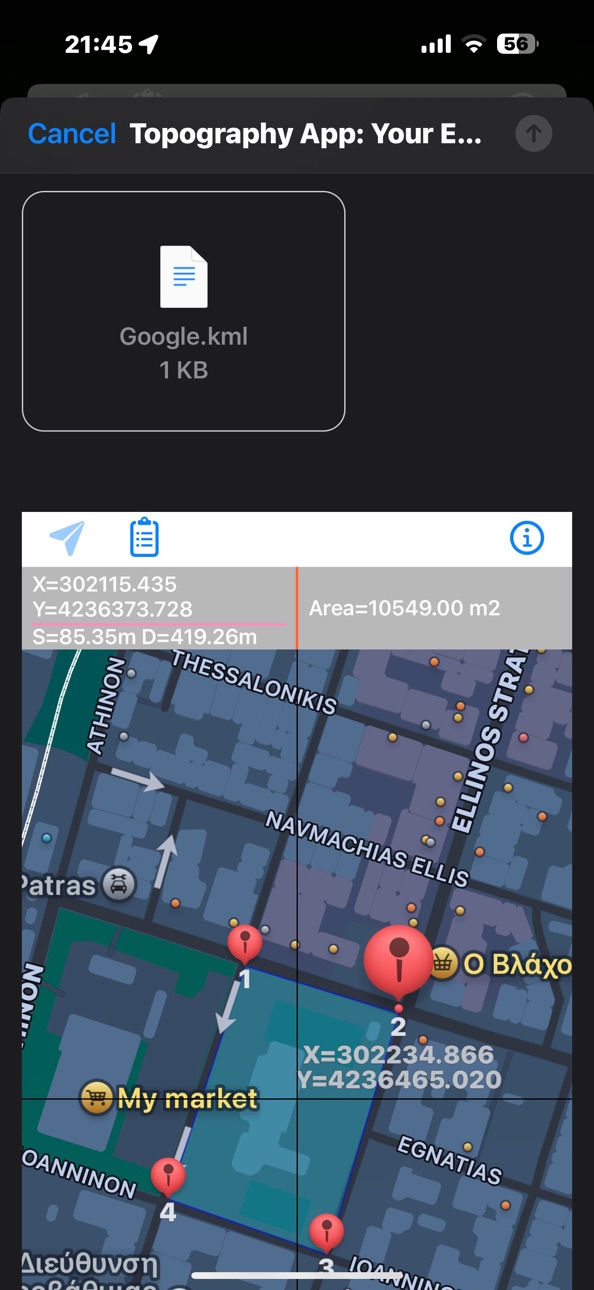
Screenshot export via email has also been added.
Description
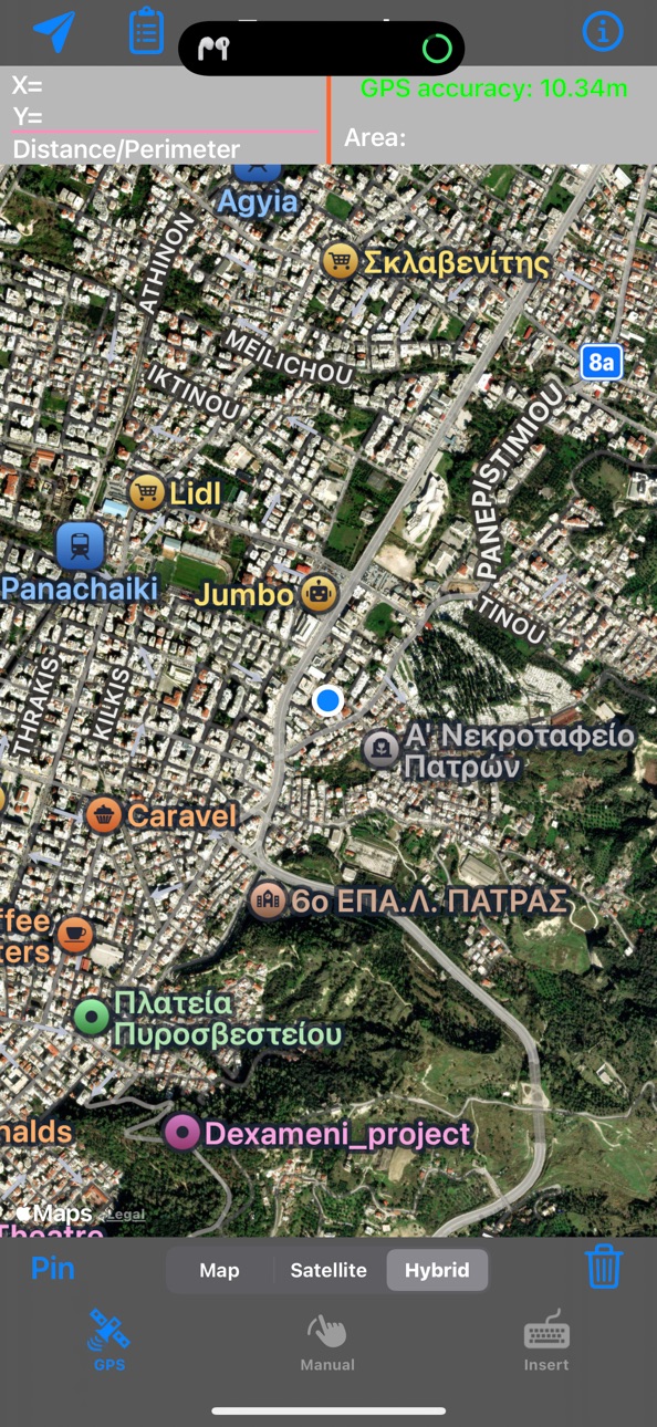
The application is very useful to Civil Engineers, Architects, Surveyors, and those interested in measuring a surface area or converting its coordinates to UTM EGSA87.
This tool enables users to:
1. Convert the coordinates (x,y) to UTM EGSA87 Datum
2. Calculate the area of a polygon in square meters (m2)
3. Send the above measurements by e-mail in [dxf] file format. The dxf file can be opened in a MAC or a PC by any drawing application like Autocad.
4. Send measurements by e-mail in [kml] file format. The kml file can be opened in a MAC or a PC or iPhone by GoogleEarth application.
5. Send measurements by e-mail in [TXT] file format. The text file contains coordinates either in EGSA87 Datum or Latitude and Longitude in decimal degrees or UTM coordinates.
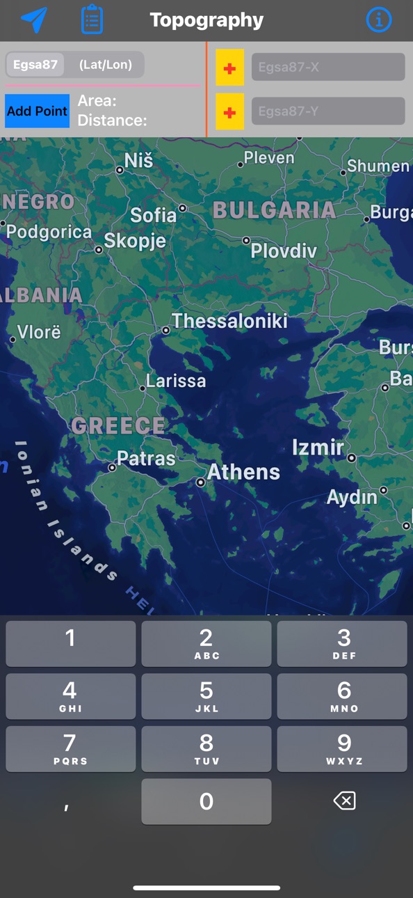
The measurements mentioned above can be provided not only by placing the iPhone in each border of a surface area, but also from distance (when users are on their bed or their sofa). Users may also have their final measurements by entering the coordinates either in EGSA87 Datum or Latitude and Longitude in decimal degrees.
Accessibility
ipadiphonemacrealityDevicetvoswatch
Version history 13 versions
Build 873736928v5.02025-05-03 13:31:12
Errors in area calculation for measurements outside the geographic region of Greece have been fixed.
UTM coordinates are now included in both the TXT and DXF export files.
Screenshot export via email has also been added.
Build 830313451v4.82019-02-16 15:37:51
bug fixed
Build 830267896v4.72019-02-13 15:55:31
bug fixed on insert screen
Build 828718037v4.52018-09-26 16:21:50
Perimeter calculation added
Build 827250700v4.42018-05-23 14:43:40
bug fix
Build 827111740v4.12018-05-15 18:43:59
bugs fix
Build 823805109v42017-09-29 16:53:48
Reprogramming the application to be compatible with the new iOS11
1. NEW user friendly interface
2. Distance measurement between the last two insert points. This measurement is available in all three types of inserting points while using the application.
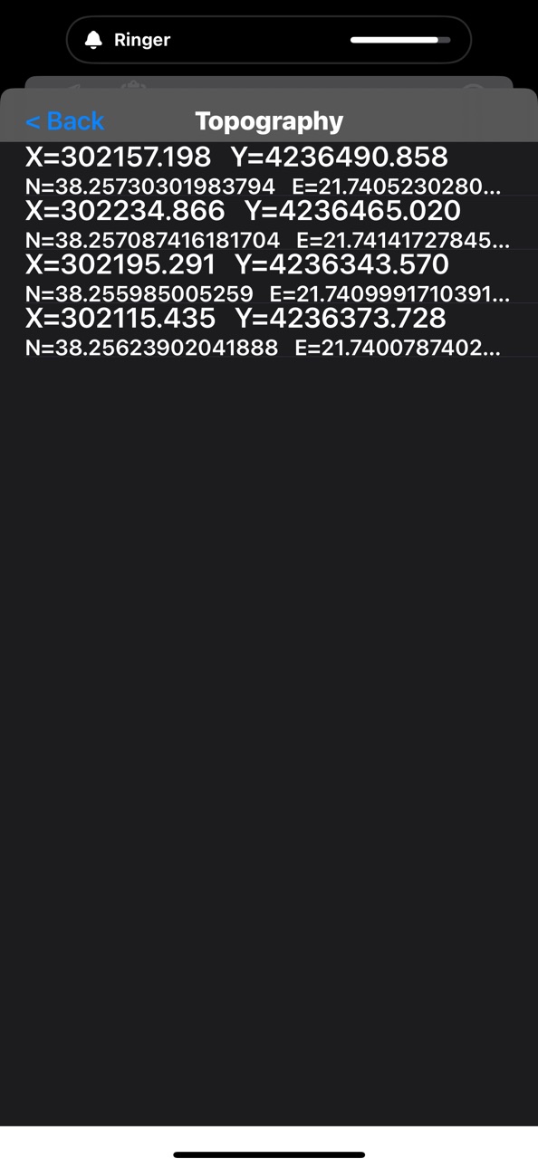
3. NEW VIEW OPTION of the insert points in table view, EGSA 87 Datum and Latitude and Longitude in decimal degrees. This option is available in all three types of inserting points while using the application.
4. Showing the cordinates and the increasing number of insert points SIMPLY by tapping on the pins.
5. NEW NAVIGATION OPTION towards the insert point with the NEW "locate user position" button while using 'Insert" mode
6. Send measurements by e-mail in .txt file format of the EGSA 87 Datum
7. Send measurements by e-mail in .txt file format of the points Latitude and Longitude in decimal degrees
Build 16251633v2.22013-08-22 05:15:49
-bugs fixed
-Location Button added on Manual Screen
-4 inch optimized
Build 15957054v2.12013-07-31 18:30:43
The application is very useful to Civil Engineers, Architects, Surveyors, and those interested in measuring a surface area or converting its coordinates to UTM EGSA87.
This tool enables users to:
1. Convert the coordinates (x,y) to UTM EGSA87 Datum
2. Calculate the area of a polygon in square meters (m2)
3. Send the above measurements by e-mail in [dxf] file format. The dxf file can be opened in a MAC or a PC by any drawing application like Autocad.
4. Send measurements by e-mail in [kml] file format. The kml file can be opened in a MAC or a PC or iPhone by GoogleEarth application.
The measurements mentioned above can be provided not only by placing the iPhone in each border of a surface area, but also from distance (when users are on their bed or their sofa). Users may also have their final measurements by entering the coordinates either in EGSA87 Datum or Latitude or Longitude in decimal degrees.
Minimum OS Requirements: 4.3
------------------------------------------------------------
Version 2.1
Build 15917831v2.02013-07-26 17:23:50
new features.....
bugs fixed
Build 15660121v1.22013-06-25 19:06:27
-bugs fixed
Build 15583752v1.12013-06-15 01:57:01
1. Send measurements by e-mail in [kml] file format. The kml file it can be opened in a MAC or a PC or iPhone by GoogleEarth application.
2. Add Rating button
3. Minimum OS Requirements: 4.3
Build 14757249v1.02013-03-25 20:22:42
Price history by region
Currency
Show
Columns
Search
Availability 9 of 9 storefronts
| Region | Language | Price | Ratings | Avg | Version |
|---|---|---|---|---|---|
 US US | en-US | USD 3.99 | 3 | 2.3 | 5.0 |
 GH GH | en-GB | USD 4.99 | 1 | 4.0 | 5.0 |
 AG AG | en-GB | USD 3.99 | 0 | — | 5.0 |
 DM DM | en-GB | USD 3.99 | 0 | — | 5.0 |
 GM GM | en-GB | USD 3.99 | 0 | — | 5.0 |
 LR LR | en-GB | USD 3.99 | 0 | — | 5.0 |
 OM OM | en-GB | USD 3.99 | 0 | — | 5.0 |
 RW RW | en-GB | USD 3.99 | 0 | — | 5.0 |
 SR SR | en-GB | USD 3.99 | 0 | — | 5.0 |
Change log 16 changes · US
✎
releaseNotes updated
Errors in area calculation for measurements outside the geographic region of Greece have been fixed.
UTM coordinates are now included in both the TXT and DXF ex
✎
description updated
The application is very useful to Civil Engineers, Architects, Surveyors, and those interested in measuring a surface area or converting its coordinates to UTM
✎
name updated
Topography
◆
Version 5.0 released
Errors in area calculation for measurements outside the geographic region of Greece have been fixed.
UTM coordinates are now included in both the TXT and DXF export files.
Screenshot export via email has also been added.
◆
Version 4.8 released
bug fixed
◆
Version 4.7 released
bug fixed on insert screen
◆
Version 4.5 released
Perimeter calculation added
◆
Version 4.4 released
bug fix
◆
Version 4.1 released
bugs fix
◆
Version 4 released
Reprogramming the application to be compatible with the new iOS11
1. NEW user friendly interface
2. Distance measurement between the last two insert points. This measurement is available in all three types of inserting points while using t
◆
Version 2.2 released
-bugs fixed
-Location Button added on Manual Screen
-4 inch optimized
◆
Version 2.1 released
The application is very useful to Civil Engineers, Architects, Surveyors, and those interested in measuring a surface area or converting its coordinates to UTM EGSA87.
This tool enables users to:
1. Convert the coordinates (x,y) to UTM EG
◆
Version 2.0 released
new features.....
bugs fixed
◆
Version 1.2 released
-bugs fixed
◆
Version 1.1 released
1. Send measurements by e-mail in [kml] file format. The kml file it can be opened in a MAC or a PC or iPhone by GoogleEarth application.
2. Add Rating button
3. Minimum OS Requirements: 4.3
◆
Version 1.0 released