Home › Navigation

 US
US
1 of 1 storefronts
Content in en-US
Content in en-US
Information
Apple ID527331816
Bundle IDno.nkgs.Kommunekart
SellerSeller
Min iOS17.6
Min macOS14.6
Device familiesiphone, ipad
Released2012-06-10
Copyright© Norkart AS
Privacy policyLink ↗
Preview 2 platforms
iPhone 5 images


iPad 4 images


What’s New Version 3.0.1
- New darmode map
- Possible to turn off mountain shading
- Always show best aerial phots
- Property boundries is now shown on hybrid map as well
Description
Detailed maps, aerial images and other information, all for free!
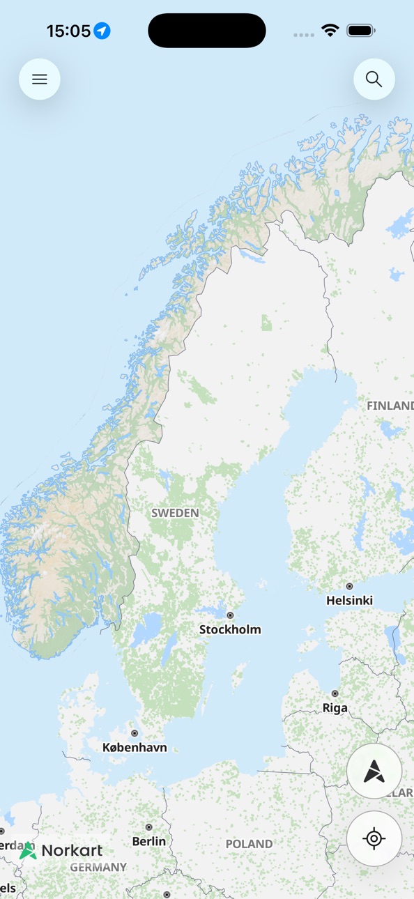
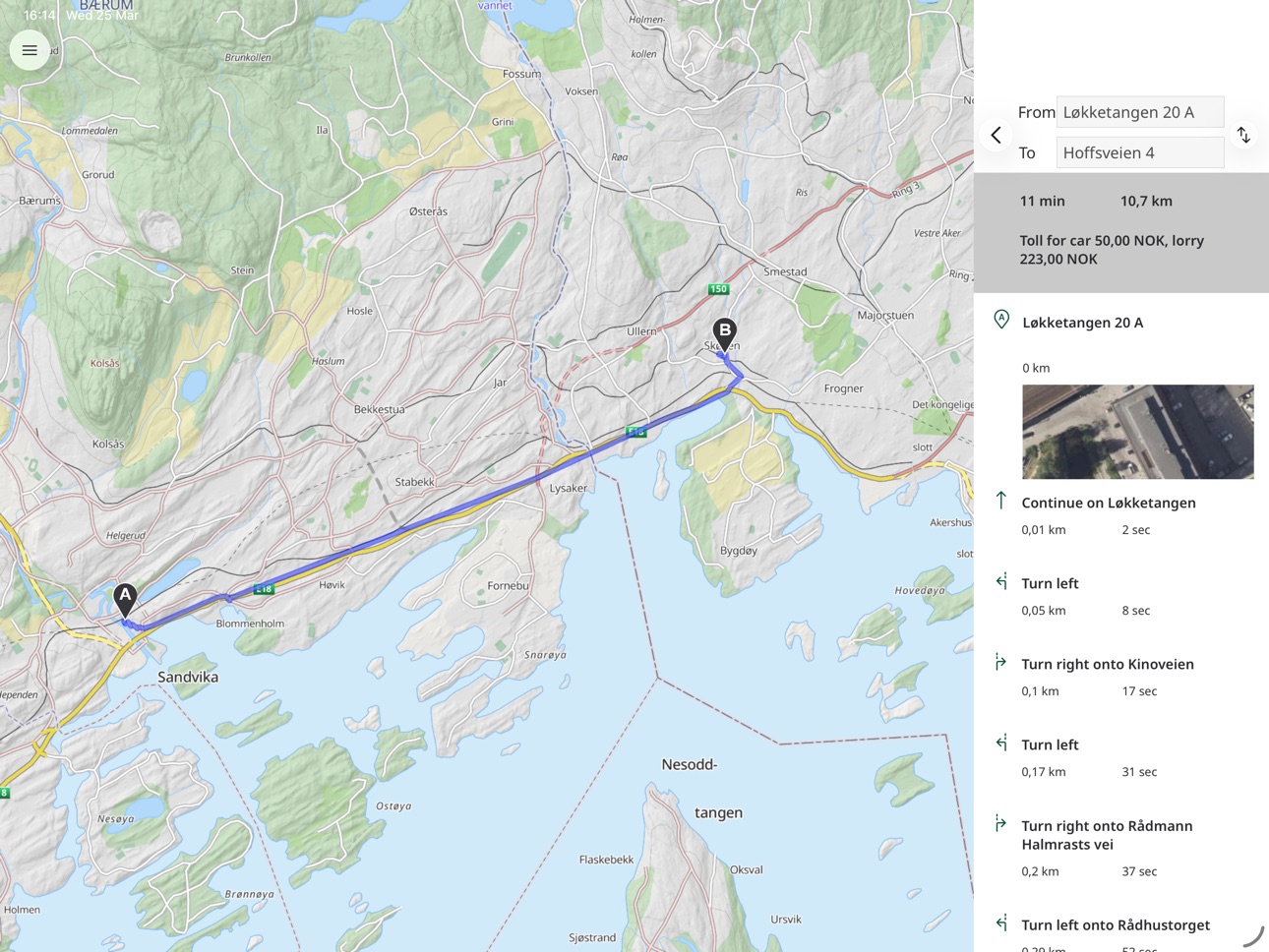
Kommunekart provides you with free, detailed maps and aerial photography for all of Norway, with no daily download limits! In addition you can search for addresses, places and properties all over the country and get a route description with turn-by-turn instructions for getting there.
If you live in one of these forward-looking municipalities, you will also be given access to extra detailed maps for your municipality! For example, you can view zoning plans, property information and approved construction informasjon:
Alstadhaug, Alta, Alvdal, Andøy, Aremark, Askvoll, Askøy, Aukra, Aurland, Austevoll, Austrheim, Balsfjord, Bamble, Bardu, Beiarn, Bergen, Berlevåg, Bindal, Birkenes, Bjerkreim, Bjørnafjorden, Bodø, Bokn, Bremanger, Brønnøy, Bygland, Bykle, Bærum, Bø, Bømlo, Båtsfjord, Deatnu - Tana, Drangedal, Dyrøy, Dønna, Eidfjord, Eidsvoll, Engerdal, Etne, Evje og Hornnes, Farsund, Fauske, Fitjar, Fjaler, Fjord, Flakstad, Flatanger, Flekkefjord, Flå, Folldal, Frøya, Fyresdal, Gáivuotna - Kåfjord, Gamvik, Gildeskål, Giske, Gjerdrum, Gjerstad, Gloppen, Gol, Gran, Grane, Grong, Guovdageaidnu – Kautokeino, Hadsel, Halden, Hamarøy, Hammerfest, Hareid, Harstad, Hasvik, Hattfjelldal, Haugesund, Heim, Hemnes, Hemsedal, Herøy i Møre og Romsdal, Herøy i Nordland, Hitra, Hjelmeland, Hol, Holtålen, Hurdal, Hustadvika, Hyllestad, Hægebostad, Høyanger, Høylandet, Inderøy, Indre Østfold, Iveland, Kárásjohka – Karasjok, Karlsøy, Karmøy, Kinn, Klepp, Kragerø, Kristiansand, Kvinesdal, Kvinnherad, Kviteseid, Kvitsøy, Kvænangen, Larvik, Leirfjord, Levanger, Lierne, Lillesand, Lindesnes, Loppa, Lunner, Lurøy, Luster, Lyngdal, Lyngen, Lærdal, Lødingen, Lørenskog, Marker, Melhus, Meløy, Midt-Telemark, Modum, Molde, Moskenes, Moss, Målselv, Måsøy, Namsos, Namsskogan, Nannestad, Nes, Nesbyen, Nesna, Nissedal, Nittedal, Nome, Nord-Fron, Nordkapp, Nordreisa, Oppdal, Orkland, Os, Overhalla, Porsanger – Porsàngu – Porsanki, Porsgrunn, Rakkestad, Rana, Randaberg, Rauma, Rendalen, Rennebu, Ringebu, Risør, Rælingen, Rødøy, Røros, Røst, Røyrvik, Råde, Saltdal, Samnanger, Sande, Sandnes, Sarpsborg, Sauda, Seljord, Senja, Siljan, Sirdal, Skien, Skiptvet, Skjervøy, Smøla, Snåsa, Sogndal, Sokndal, Sola, Solund, Sortland, Stad, Stavanger, Steinkjer, Stor-Elvdal, Stord, Storfjord, Strand, Stranda, Stryn, Sula, Suldal, Sunnfjord, Sveio, Sømna, Sør-Fron, Sør-Varanger, Sørfold, Sørreisa, Tjeldsund, Tokke, Tolga, Tromsø, Trysil, Tvedestrand, Tynset, Tysnes, Tysvær, Ullensaker, Ullensvang, Ulstein, Ulvik, Unjárga - Nesseby, Utsira, Vadsø, Valle, Vanylven, Vardø, Vefsn, Vegårshei, Vennesla, Verdal, Vestnes, Vestvågøy, Vevelstad, Vik, Vindafjord, Vinje, Volda, Voss, Værøy, Vågan, Våler, Øksnes, Ørsta, Øvre Eiker, Øygarden, Ål, Åmli, Åmot, Årdal, Åseral
Continued use of GPS running in the background can dramatically decrease battery life. You can at any time turn of GPS by using the app's settings.
Accessibility
ipadiphonemacrealityDevicetvoswatch
Version history 25 versions
Build 884892112v3.0.12026-04-25 10:21:31
- New darmode map
- Possible to turn off mountain shading
- Always show best aerial phots
- Property boundries is now shown on hybrid map as well
Build 883590372v3.02026-03-26 16:53:44
We now use our own background maps in Kommunekart, stored in Norway. This gives us more flexibility.
Mountain shading in the background map gives a more vibrant map
New map type "Transparent" to better see the municipalities' own map data
Option to see property boundaries throughout Norway
Many small bugs have been fixed to improve the user experience.
Build 882369360v2.112026-03-06 07:17:11
Bug fixes an iOS 26 adaptions
Build 872290889v2.10.02025-02-06 17:39:57
Fixed a crash when using Stage Manager on iPad
Kommunekart3D now opens with same view as the map
Fetch information from map layers now only fetches info from checked/chosen map layers. Possible to fetch info from remaining map layers
Better contrast in chose map layers window
Build 870669323v2.9.02024-11-26 12:26:06
New visual profile
Updated map engine with better handling of "My location"
Build 867906393v2.8.02024-08-01 19:35:21
Fixed a crash in the municipality list window
Build 866466862v2.7.22024-06-18 07:29:56
Updated map drawing rules
Build 861121716v2.6.02023-10-31 21:01:33
Updated map engine means faster maps.
Fixed an error where the map zoomed to the wrong place on startup
Build 858539697v2.5.12023-07-17 18:27:59
Fixed a crash when highlighting a property
Build 854360191v2.52023-01-13 11:43:48
Map updates
- Faster maps
- More details in background maps
- Greyscale background map
- Prettier orthophotos outside of Norway
Build 849655532v2.42022-06-07 12:32:19
Updated map engine and general improvements
Build 844152046v2.32021-09-16 15:07:48
Removed erroneous error message at startup
Updated map engine
Fixed missing information for some municipalities
Build 835667172v2.22020-05-06 06:48:29
Fixed an error where the current municipality where not updated while moving the map
Map-engine updated
Dark mode
Build 829713441v2.12018-12-21 16:39:28
Updated map library. The app now uses less memory and runs better on older devices.
New search. Search data is now updated nightly.
Now possible to turn on and off display of detailed map layers.
Fixed an error that often lead to crash while paning the map.
Build 825741460v2.02018-01-30 15:03:52
New map engine giving more dynamic maps
Start-up wizard
Support for iPhone X
Build 822670602v1.62017-07-03 11:45:55
Possible to receive notifications from your municipality
Possible to open links shared from kommunekart.com, our web-solution
Build 821348909v1.52017-04-03 09:00:04
New user interface with simplyfied flow
Marking of property geometry on search
Build 817840196v1.4.42016-06-22 17:03:52
En liten feilretting
Build 817266316v1.4.32016-06-20 10:02:27
Rettet en feil som førte til en krasj for noen av våre brukere
Build 812316402v1.4.22015-06-02 19:29:16
Fikset en krasj i ruteplanleggeren
Fikset problemer ved valg av nederste linje i ruteplanlegger
Fikset posisjonering av sider ved blaing i kartinfomasjonsvindu
Fikset plassering av flytende vindu ved rotasjon
Build 811912393v1.4.12015-03-08 16:25:14
Tilpasset iPhone 6 og iPhone 6 Plus
Aktivert rotasjon på iPhone
Lettere å treffe i informasjonsbobla for å få vist mer informasjon
Fikset krasj ved visning av koordinater
Fikset krasj på iPad ved visning av søkeresultater, valg av kartlag og kartinformasjon
Build 811421545v1.42015-02-12 07:44:09
Oppdaterte bakgrunnskart. Heretter vil bakgrunnskart automatisk oppdateres når de foreligger uten å måtte oppdatere appen.
Build 438942634v1.3.52014-03-27 23:40:29
Kan søke på gårds- og bruksnummer (f.eks. 7/17) og finne adressen.
Viser gårds- og bruksnummer for adresser.
Noen mindre justeringer i brukergrensesnittet
Build 251902637v1.3.32014-01-15 09:24:57
Tilpasset GUI til iOS 7.
Vis koordinater ved longpress.
Mindre feilrettelser.
Deltaljerte data for flere kommuner.
Build 16469464v1.3.22013-08-30 02:54:07
Forbedret stabilitiet
No pricing data captured yet — comparisons appear once the app has paid storefronts or in-app purchases.
Availability 1 of 1 storefronts
| Region | Language | Price | Ratings | Avg | Version |
|---|---|---|---|---|---|
| US | en-US | Free | 0 | — | 3.0.1 |
Change log 28 changes · US
✎
releaseNotes updated
- New darmode map
- Possible to turn off mountain shading
- Always show best aerial phots
- Property boundries is now shown on hybrid map as well
✎
description updated
Detailed maps, aerial images and other information, all for free!
Kommunekart provides you with free, detailed maps and aerial photography for all of Norway, wi
✎
name updated
Kommunekart
◆
Version 3.0.1 released
- New darmode map
- Possible to turn off mountain shading
- Always show best aerial phots
- Property boundries is now shown on hybrid map as well
◆
Version 3.0 released
We now use our own background maps in Kommunekart, stored in Norway. This gives us more flexibility.
Mountain shading in the background map gives a more vibrant map
New map type "Transparent" to better see the municipalities' own map data
◆
Version 2.11 released
Bug fixes an iOS 26 adaptions
◆
Version 2.10.0 released
Fixed a crash when using Stage Manager on iPad
Kommunekart3D now opens with same view as the map
Fetch information from map layers now only fetches info from checked/chosen map layers. Possible to fetch info from remaining map layers
Better
◆
Version 2.9.0 released
New visual profile
Updated map engine with better handling of "My location"
◆
Version 2.8.0 released
Fixed a crash in the municipality list window
◆
Version 2.7.2 released
Updated map drawing rules
◆
Version 2.6.0 released
Updated map engine means faster maps.
Fixed an error where the map zoomed to the wrong place on startup
◆
Version 2.5.1 released
Fixed a crash when highlighting a property
◆
Version 2.5 released
Map updates
- Faster maps
- More details in background maps
- Greyscale background map
- Prettier orthophotos outside of Norway
◆
Version 2.4 released
Updated map engine and general improvements
◆
Version 2.3 released
Removed erroneous error message at startup
Updated map engine
Fixed missing information for some municipalities
◆
Version 2.2 released
Fixed an error where the current municipality where not updated while moving the map
Map-engine updated
Dark mode
◆
Version 2.1 released
Updated map library. The app now uses less memory and runs better on older devices.
New search. Search data is now updated nightly.
Now possible to turn on and off display of detailed map layers.
Fixed an error that often lead to crash whi
◆
Version 2.0 released
New map engine giving more dynamic maps
Start-up wizard
Support for iPhone X
◆
Version 1.6 released
Possible to receive notifications from your municipality
Possible to open links shared from kommunekart.com, our web-solution
◆
Version 1.5 released
New user interface with simplyfied flow
Marking of property geometry on search
◆
Version 1.4.4 released
En liten feilretting
◆
Version 1.4.3 released
Rettet en feil som førte til en krasj for noen av våre brukere
◆
Version 1.4.2 released
Fikset en krasj i ruteplanleggeren
Fikset problemer ved valg av nederste linje i ruteplanlegger
Fikset posisjonering av sider ved blaing i kartinfomasjonsvindu
Fikset plassering av flytende vindu ved rotasjon
◆
Version 1.4.1 released
Tilpasset iPhone 6 og iPhone 6 Plus
Aktivert rotasjon på iPhone
Lettere å treffe i informasjonsbobla for å få vist mer informasjon
Fikset krasj ved visning av koordinater
Fikset krasj på iPad ved visning av søkeresultater, valg av kartlag
◆
Version 1.4 released
Oppdaterte bakgrunnskart. Heretter vil bakgrunnskart automatisk oppdateres når de foreligger uten å måtte oppdatere appen.
◆
Version 1.3.5 released
Kan søke på gårds- og bruksnummer (f.eks. 7/17) og finne adressen.
Viser gårds- og bruksnummer for adresser.
Noen mindre justeringer i brukergrensesnittet
◆
Version 1.3.3 released
Tilpasset GUI til iOS 7.
Vis koordinater ved longpress.
Mindre feilrettelser.
Deltaljerte data for flere kommuner.
◆
Version 1.3.2 released
Forbedret stabilitiet