Home › Navigation

Information
Apple ID525299323
Bundle IDcom.gammonapps.landnav
SellerSeller
Min iOS9.0
Min macOS11.0
Device familiesiphone, ipad, ipod
Released2012-05-18
Copyright© Gammon Applications
Privacy policyLink ↗
Preview 2 platforms
iPhone 7 images



iPad 7 images


What’s New Version 2.2
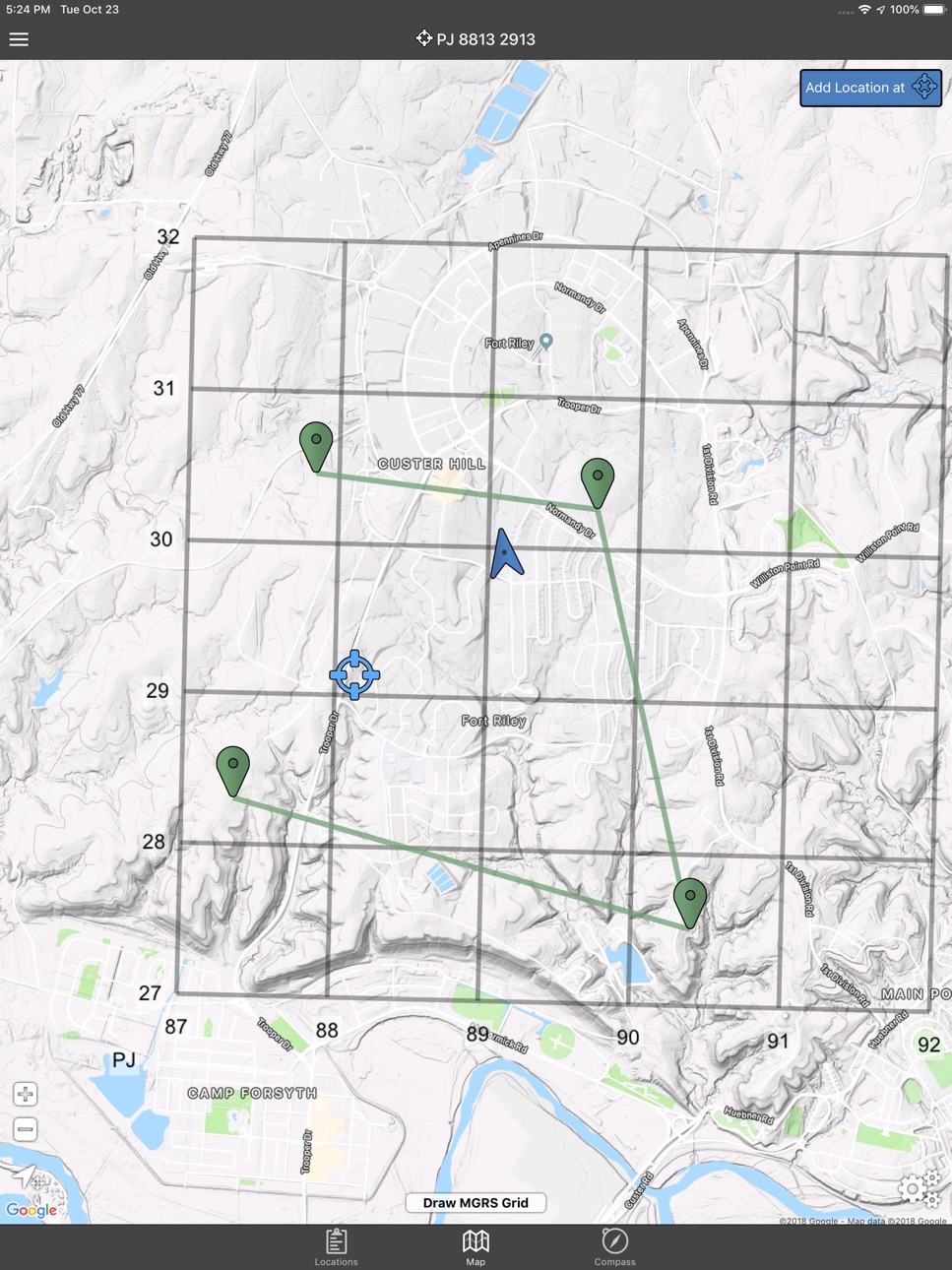
Draw MGRS Grid Overlays anywhere on the map (1000m, 100m)
iOS 12 Optimization
Screen improvements for iPhone X, XS, and XR
Description
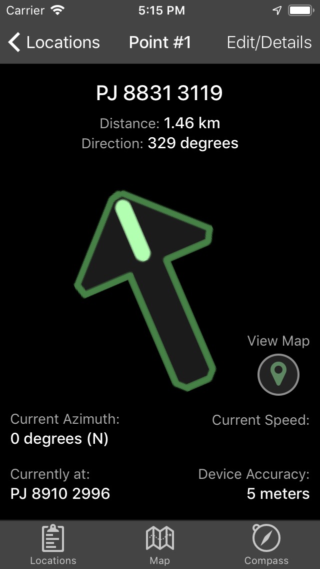
Land Nav Assistant accepts MGRS (Military Grid) or Latitude / Longitude coordinates and visually navigates you to each point.
This app was designed with Army, Marine, and other military personnel in mind. Use it to correct your Land Nav technique by analyzing your pace count and tendency to veer left and right.
Available Input: 8 digit MGRS, 10 digit MGRS, Lat/Lon decimal, Lat/Lon dms, and map input.
Angles: degrees or mils
Distance: meters/km or feet/miles
Speed: kph or mph
Use the simple arrow interface or map to direct you to your locations. Your distance, direction, speed, and bearing are shown as you navigate.
Long-tap anywhere on the map to get the coordinate for that location. Easily add locations via the Map interface.
Plan your course by ordering points, or use the course optimization tool which will help you calculate the shortest path possible!
Get distance/direction between two points by tapping the path drawn between them.
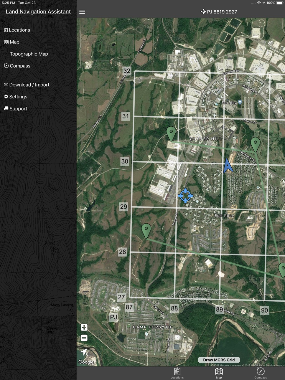
Satellite, Terrain, Road, and basic Topographic maps show you, your locations, and lets you enter in new ones.
Overlay a 1000m or 100m MGRS grid anywhere on the map.
Displays distance/direction from your currentl location to all points, or between any two points.
Download your Locations as a spreadsheet to save anywhere, or to share with anyone you choose.
Import a large set of locations via the web import utility, available at: https://www.gammonapplications.com/land-navigation-services/import
This app uses the Military Grid Reference System (MGRS) and Latitude / Longitude.
Choose to display your locations as MGRS 10-digit, MGRS 8-digit, or LatLon Decimal.
D:M:S can be input in the format DD:MM:SS followed by the appropriate direction (NSWE). Default direction is N, W.
DO NOT use this application while learning Land Navigation. Land Navigation is a valuable skill, and should be mastered before using this application. Do not rely solely on this application for navigation, especially when lost. Always be aware of your surroundings.
Accessibility
ipadiphonemacrealityDevicetvoswatch
Version history 9 versions
Build 828611885v2.22019-04-08 01:01:29
Draw MGRS Grid Overlays anywhere on the map (1000m, 100m)
iOS 12 Optimization
Screen improvements for iPhone X, XS, and XR
Build 823791679v2.12017-09-26 16:37:40
Bug fixes affecting iOS 11
Build 822468324v2.02017-06-14 22:37:33
-Modernized UI
-Improved mapping functionality.
-Edit Details, Reorder Locations
-Course Planning, total distance calculations
-Find any coordinate quickly by touching the map
-Get the Distance/Direction between any two points by touching their connecting path
-More specific Unit of Measure settings
-Path Optimization, tell the app where you want to start and end, and it will find the shortest path
Thank you all for your patience with this upgrade! Please don't hesitate to reach out with questions or suggestions via the app.
Build 593533191v1.82014-06-06 07:47:56
-You can now add locations by touching the Map
-Full compass view
-MGRS points are spaced out for readability
-Import/Share your locations with the new spreadsheet upload utility at https://www.gammonapplications.com/landnavimport/
Build 374252639v1.62014-02-18 01:29:50
-Fixed issue where the last two points on the locations list were hidden off the screen
-Option to display your grids as 8 digit or 10 digit
-Added option for mils under settings
-Increased text sizes to increase readability
-Added option to increase text size even more
Build 103562636v1.32013-11-13 03:05:09
- iPhone 5 Optimization (about time!)
- Modernized Interface
- Additional Satellite Map Functionality
- Export your points to a spreadsheet
- Included a link for help/support
Build 10078790v1.22012-08-23 18:46:53
Degree:Minutes:Seconds input added.
Build 9536671v1.12012-07-31 01:28:23
Version 1.1
-Topographic Map with location overlays
-Latitude/Longitude mode
-Interface improvements
Build 7892044v1.02012-05-18 16:44:17
Price history by region
Currency
Show
Columns
Search
Availability 12 of 12 storefronts
| Region | Language | Price | Ratings | Avg | Version |
|---|---|---|---|---|---|
 US US | en-US | USD 2.99 | 73 | 4.5 | 2.2 |
 NL NL | nl | EUR 2.99 | 1 | 1.0 | 2.2 |
 SA SA | en-GB | SAR 12.99 | 1 | 3.0 | 2.2 |
 AT AT | de-DE | EUR 2.99 | 0 | — | 2.2 |
 BE BE | en-GB | EUR 2.99 | 0 | — | 2.2 |
 BZ BZ | en-GB | USD 2.99 | 0 | — | 2.2 |
 CH CH | de-CH | CHF 3 | 0 | — | 2.2 |
 DK DK | en-GB | DKK 29 | 0 | — | 2.2 |
 GY GY | en-GB | USD 2.99 | 0 | — | 2.2 |
 IL IL | en-GB | ILS 9.9 | 0 | — | 2.2 |
 LU LU | en-GB | EUR 2.99 | 0 | — | 2.2 |
 SL SL | en-GB | USD 2.99 | 0 | — | 2.2 |
Change log 13 changes · US
✎
releaseNotes updated
Draw MGRS Grid Overlays anywhere on the map (1000m, 100m)
iOS 12 Optimization
Screen improvements for iPhone X, XS, and XR
✎
description updated
Land Nav Assistant accepts MGRS (Military Grid) or Latitude / Longitude coordinates and visually navigates you to each point.
This app was designed with Army,
✎
subtitle updated
GPS MGRS & LatLng for Military
✎
name updated
Land Nav Assistant
◆
Version 2.2 released
Draw MGRS Grid Overlays anywhere on the map (1000m, 100m)
iOS 12 Optimization
Screen improvements for iPhone X, XS, and XR
◆
Version 2.1 released
Bug fixes affecting iOS 11
◆
Version 2.0 released
-Modernized UI
-Improved mapping functionality.
-Edit Details, Reorder Locations
-Course Planning, total distance calculations
-Find any coordinate quickly by touching the map
-Get the Distance/Direction between any two points by touching
◆
Version 1.8 released
-You can now add locations by touching the Map
-Full compass view
-MGRS points are spaced out for readability
-Import/Share your locations with the new spreadsheet upload utility at https://www.gammonapplications.com/landnavimport/
◆
Version 1.6 released
-Fixed issue where the last two points on the locations list were hidden off the screen
-Option to display your grids as 8 digit or 10 digit
-Added option for mils under settings
-Increased text sizes to increase readability
-Added option t
◆
Version 1.3 released
- iPhone 5 Optimization (about time!)
- Modernized Interface
- Additional Satellite Map Functionality
- Export your points to a spreadsheet
- Included a link for help/support
◆
Version 1.2 released
Degree:Minutes:Seconds input added.
◆
Version 1.1 released
Version 1.1
-Topographic Map with location overlays
-Latitude/Longitude mode
-Interface improvements
◆
Version 1.0 released