Home › Navigation

 US
US
1 of 1 storefronts
Content in en-US
Content in en-US
Information
Preview 2 platforms
iPhone 5 images



iPad 5 images


What’s New Version 4.9
- Updated list of buildings
- Updated contacts
- Other minor updates and improvements
Description
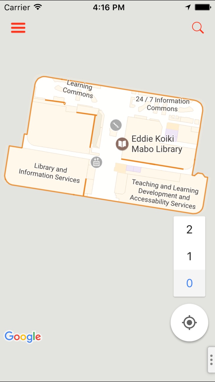
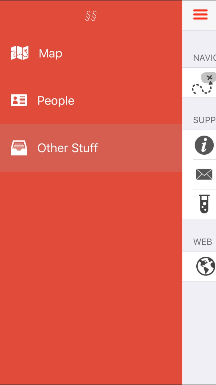
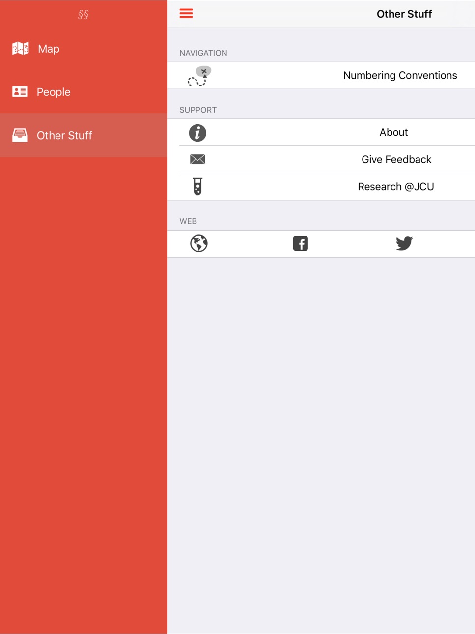
JCUNav helps you easily find your way around James Cook University's Townsville campus. A detailed map shows where buildings are on campus; some buildings even show indoor floor plans. You can easily search for a building by name or number and JCUNav will draw a line to your destination from your current location. JCUNav also provides helpful information on how to interpret building and room numbers at JCU.
In addition to all the above, JCUNav lets you quickly search for staff and faculty members on campus launching a phone call or email with the press of a button.
JCUNav is not officially endorsed by James Cook University.
Accessibility
ipadiphonemacrealityDevicetvoswatch
Version history 19 versions
Build 868839204v4.92024-09-09 14:00:19
- Updated list of buildings
- Updated contacts
- Other minor updates and improvements
Build 821868505v4.82017-04-26 02:08:26
This update from Apple will improve the functionality of this app. No new features are included.
- Updated list of buildings/places.
- Fixed crash on recent version of iOS when searching for a place.
- Fixed crash when directions are unavailable.
- Map now runs at 60fps (smoother) on recent iOS devices.
Build 510142681v4.72014-04-07 01:56:29
- The map now displays in beautiful full screen in iOS 7. We've removed superfluous bars and let the map flow right to the edge of the screen. Particularly useful on smaller screens.
- Fixed an issue where the map could get stuck on the user's current location when trying to pan away.
- Toned down the route to destination line to be thinner.
Build 466452645v4.62014-03-20 23:50:11
Add dynamic compass direction arrow to your location dot to make it easy to see which way you're facing based on the device's sensors.
Build 285322661v4.52014-01-09 12:11:06
- The list of places has been updated to include new places, previously unlisted places and corrections to some existing place names.
- If you search for a place while off campus, the map no longer zooms out to encompass your location and the selected place. Instead, the map just zooms in on the selected place.
- Discussions with the Facilities Management Office (FMO) have been productive and JCUNav is now able to be promoted again through JCU media channels. The section regarding FMO issues has been removed accordingly.
- Some spelling mistakes have been corrected.
Build 81253085v4.42013-10-17 15:06:04
- Overhauled for iOS 7 - every screen has been redesigned.
- Updated logo and launch images.
- Textual advice on navigating inside buildings and the numbering conventions at JCU has been replaced with easy to understand graphics.
Build 19002671v4.32013-09-22 10:08:33
- Adds support for indoor floor plans. At the moment this only covers the library ground floor, but we're working on support for multiple floors and looking to extend coverage to as many buildings as possible. New floor plans will appear automagically as they're added.
- Faster map animations, particularly after selecting a destination where the map position and zoom change.
Build 15854948v4.22013-07-22 04:50:31
- corrects map rotation when the device is in landscape mode
- draws a path to the selected destination as soon as your location becomes available (if it was not already available when the destination was selected)
JCUNav needs your help. The James Cook University Facilities Management Office (FMO) is inhibiting our ability to promote JCUNav to students and staff through JCU media channels as we've done in the past. You can read more about this in the new "Support JCUNav" section available from the left-hand menu of the app. This new support section provides three easy ways you're able to support JCUNav if you've found it useful. These are i) rate the app in the App Store, ii) tell a friend about JCUNav or iii) let JCU's FMO Deputy Director of Planning and Development Matthew Joyce know that you've found JCUNav useful during your time at JCU.
Build 15792810v4.12013-07-16 06:50:37
- Adds building names for several buildings which were missing them
- Improves automatic zooming to fully encompass your location and full path to destination after having selected a place
- Fixes issue with right-hand map options being accessible when not viewing the map
Build 15642671v4.02013-06-27 12:21:19
This new major version introduces a completely new maps and navigation experience. Apple Maps has been swapped out for Google-Maps, allowing us to build on Google-Map's detailed vector imagery of the JCU Townsville campus. Basically this means building outlines, text and paths all scale and rotate beautifully regardless of zoom, tilt or orientation.
We've also added new map options and features. Now, when you select a location, JCUNav will show a detailed path to your destination, rather than a straight line. You can switch between walking and driving directions, and, change the map into satellite view to get a realistic aerial view of the campus. For the time being, you can also turn the old raster map overlay imagery on if you like, though it will likely be disabled at some point in the future. All of these map options are available by pressing the small ellipsis (three dots) button in the bottom right hand corner.
We've also tidied up the user interface in v4.0 and now use a slide in/slide out menu-based system of app navigation. Read more about the changes in JCUNav v4.0 at http://jcunav.blogspot.com.au/.
Build 15554761v3.12013-06-08 04:23:15
- Adds Education Central building
- Updates "Bambin's" to "Green Plate Cafe"
- Improved search results when searching for a place
- Adds links to JCUNav website and social media
- Better looking "My Location" button
- Prettifies a number of other previously neglected areas of the app
- Adds Other usability improvements
- Adds randomized anonymous statistics collection for ~20% of devices (learn more below)
This version of JCUNav anonymously samples device entry/exit on the Townsville campus for approximately 20% of randomly selected devices. This helps estimate what fraction of JCUNav users visit the Townsville campus during the sampling period. For those randomly selected devices, sampling commences the first time JCUNav is launched and concludes approximately 2 weeks thereafter. During this period a small purple outlined location icon may appear in the device toolbar. The sampling procedure has been designed to be both anonymous and highly battery efficient and should have no measurable impact on device performance.
Find out more about the 3.1 release at http://jcunav.blogspot.com.au/
Build 12456859v3.02012-12-03 07:22:54
Brand new feature - people search. Now you can search for JCU staff and faculty members by name to easily get a person's details including email, phone, job description and campus. You can even launch an email or phone call directly from JCUNav, as well as adding a person to your phone's address book.
Build 11999233v2.3.12012-11-18 07:54:59
JCUNav now supports the larger iPhone 5 screen.
Build 10924263v2.32012-10-20 10:30:03
- You can now see the distance to your selected destination, dynamically updated as you move.
Build 8032247v2.22012-05-22 05:45:56
- Food locations are now included in the list of places
- You can now hold touch your finger on a location on the map to get information about that location
Build 7451592v2.12012-04-14 01:07:10
- Added building names
- Improved heading display
- Added note about how to find room numbers
Build 7031275v2.02012-03-24 15:33:30
Completely rewritten to run natively on iOS.
- Substantially faster map manipulation.
- Works offline.
- Faster page transitions.
- Updated map imagery includes icons for places of interest.
- Can now search for a specific building number.
- Native iOS look and feel.
Build 6487201v1.0.12012-02-20 18:51:11
Added heading information, so you can see what direction you're facing. Very useful in figuring out which direction you should be going in.
Build 6077901v1.02012-01-31 18:57:03
No pricing data captured yet — comparisons appear once the app has paid storefronts or in-app purchases.
Availability 1 of 1 storefronts
| Region | Language | Price | Ratings | Avg | Version |
|---|---|---|---|---|---|
| US | en-US | Free | 1 | 5.0 | 4.9 |
Change log 22 changes · US
✎
releaseNotes updated
- Updated list of buildings
- Updated contacts
- Other minor updates and improvements
✎
description updated
JCUNav helps you easily find your way around James Cook University's Townsville campus. A detailed map shows where buildings are on campus; some buildings even
✎
name updated
JCUNav
◆
Version 4.9 released
- Updated list of buildings
- Updated contacts
- Other minor updates and improvements
◆
Version 4.8 released
This update from Apple will improve the functionality of this app. No new features are included.
- Updated list of buildings/places.
- Fixed crash on recent version of iOS when searching for a place.
- Fixed crash when directions are unava
◆
Version 4.7 released
- The map now displays in beautiful full screen in iOS 7. We've removed superfluous bars and let the map flow right to the edge of the screen. Particularly useful on smaller screens.
- Fixed an issue where the map could get stuck on the
◆
Version 4.6 released
Add dynamic compass direction arrow to your location dot to make it easy to see which way you're facing based on the device's sensors.
◆
Version 4.5 released
- The list of places has been updated to include new places, previously unlisted places and corrections to some existing place names.
- If you search for a place while off campus, the map no longer zooms out to encompass your location and
◆
Version 4.4 released
- Overhauled for iOS 7 - every screen has been redesigned.
- Updated logo and launch images.
- Textual advice on navigating inside buildings and the numbering conventions at JCU has been replaced with easy to understand graphics.
◆
Version 4.3 released
- Adds support for indoor floor plans. At the moment this only covers the library ground floor, but we're working on support for multiple floors and looking to extend coverage to as many buildings as possible. New floor plans will appear
◆
Version 4.2 released
- corrects map rotation when the device is in landscape mode
- draws a path to the selected destination as soon as your location becomes available (if it was not already available when the destination was selected)
JCUNav needs your he
◆
Version 4.1 released
- Adds building names for several buildings which were missing them
- Improves automatic zooming to fully encompass your location and full path to destination after having selected a place
- Fixes issue with right-hand map options being a
◆
Version 4.0 released
This new major version introduces a completely new maps and navigation experience. Apple Maps has been swapped out for Google-Maps, allowing us to build on Google-Map's detailed vector imagery of the JCU Townsville campus. Basically this
◆
Version 3.1 released
- Adds Education Central building
- Updates "Bambin's" to "Green Plate Cafe"
- Improved search results when searching for a place
- Adds links to JCUNav website and social media
- Better looking "My Location" button
- Prettifies a numb
◆
Version 3.0 released
Brand new feature - people search. Now you can search for JCU staff and faculty members by name to easily get a person's details including email, phone, job description and campus. You can even launch an email or phone call directly from
◆
Version 2.3.1 released
JCUNav now supports the larger iPhone 5 screen.
◆
Version 2.3 released
- You can now see the distance to your selected destination, dynamically updated as you move.
◆
Version 2.2 released
- Food locations are now included in the list of places
- You can now hold touch your finger on a location on the map to get information about that location
◆
Version 2.1 released
- Added building names
- Improved heading display
- Added note about how to find room numbers
◆
Version 2.0 released
Completely rewritten to run natively on iOS.
- Substantially faster map manipulation.
- Works offline.
- Faster page transitions.
- Updated map imagery includes icons for places of interest.
- Can now search for a specific building num
◆
Version 1.0.1 released
Added heading information, so you can see what direction you're facing. Very useful in figuring out which direction you should be going in.
◆
Version 1.0 released