Home › Travel

 US
US
1 of 1 storefronts
Content in en-US
Content in en-US
Information
Preview 3 platforms
iPhone 5 images



iPad 5 images




Apple Watch 8 images


What’s New Version 12.16.4
* Improved the map display for nearby trails, user trails, community trails, and trail lists, with a refreshed interface and significantly faster loading.
* Fixed several graphical issues introduced with GlassUI.
* Updated the filter interface: the “Quality” filter has been renamed to “Quality Label” (PRO / GUIDE / All).
* Updated and improved translations across all supported languages.
Description
GO AND DISCOVER ALL THE PATHS AROUND THE WORLD FOR FREE
• Record your trails while taking HD and geo-tagged pictures of your adventures.
• Travelled distance, Km-effort, average speed, calories burned, etc.
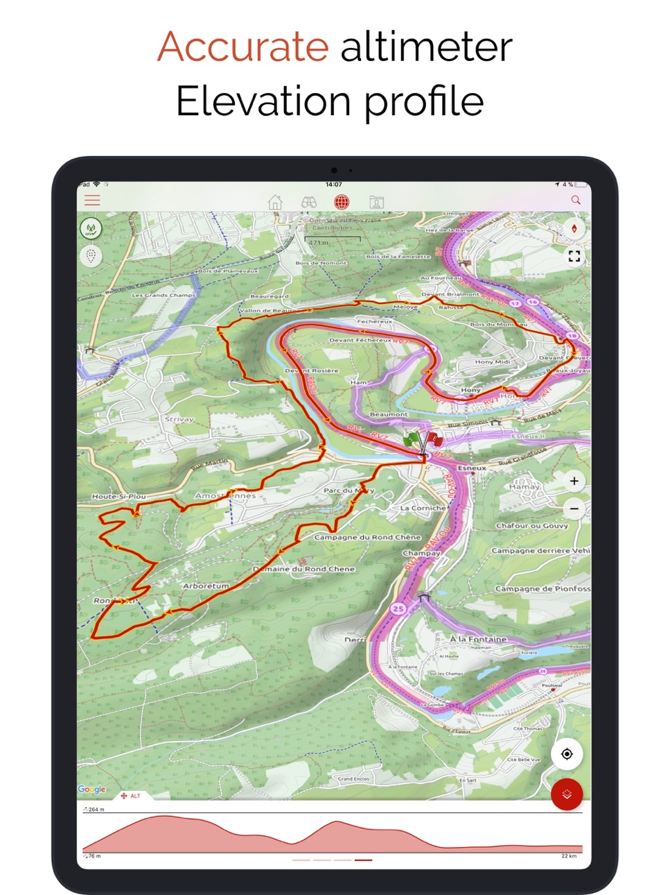
• Accurate altimeter, height differences computing and elevation profile displaying your current location.
• Alarm when you go off the path of the trail being followed. No more need to backtrack!
• Automatic triggering of points of interest with text-to-speech.
• Create a free account and all your data will be available everywhere on every device.
• With our online editor, create your own trails using a Web browser on your PC/Mac and then access them directly from your iPhone to experience them on the ground.
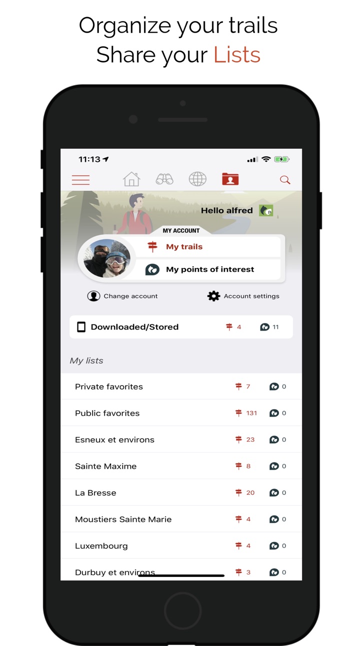
• Sort and classify your trails and points of interest in your own lists.
GO FURTHER AND BECOME A PREMIUM USER!
• Download world topographic maps for offline use.
• Add topographic maps of your choice, from IGN France, IGN / NGI Belgium, IGN Spain, swisstopo, Austria, USA (USGS topographic mapping), Canada (Toporama).
• Discover GR hiking paths, European hiking routes, Santiago de Compostela routes for pilgrims, etc.
• You can also discover all cycling networks: Greenway network in France, Ravel in Belgium, European cycling routes, knot points networks in Flanders and the Netherlands.
• And in winter, discover all the ski slopes with their names.
• Access the public catalogue of trails from SityTrail members and communities.
• Advanced tracking and guiding features with calculation of the remaining distance and time and vocal instructions at intersections.
• Go further and transform your favourite trails into real multimedia guides with text, photos, video links, and share them with the SityTrail community.
• Create your own hiker communities and manage your members and newsfeeds.
• Create trails with our advanced features for trail editing via our website.
• Print trails in PDF format with QR codes. (A4, A3).
• Access geotagged Wikipedia articles from our SityTrip module.
HEALTH KIT INTEGRATION
The application is now compatible with Health Kit : you can add your activity (trail following or recording) to the "Health" app.
AVAILABLE ON APPLE WATCH
Find all the features of SityTrail app on your Apple Watch: follow a trail, record a trail, map, voice guidance, vibrations, alarm when you go off the path, elevation profile, compass, etc.
IMPORTANT INFORMATION
• Some features need an internet connection.
• The prolonged use of GPS can reduce battery levels.
• Our privacy policy is available here: https://connect.geolives.com/j8w7fb0dxb6oqm677674/privacy_policy.html
• Our terms of use are available here: https://www.sitytrail.com/en/wiki/?page=help&content=Terms_Of_Use
INFORMATION FOR IN-APP PURCHASES
• Payment will be charged to your iTunes Account on confirmation of purchase.
• Subscription automatically renews unless auto-renew is turned off at least 24-hours before the end of the current period.
• Your account will be charged for renewal within 24-hours of the end of the current period. The cost of the renewal will be the same as the cost of your initial transaction.
• You can manage your subscriptions and auto-renewal may be turned off by going to your Account Settings after purchase.
In-App Purchases US pricing
SityTrail Full Premium Subscription
Yearly$49.99
SityTrail Premium Croatia Subscription
Yearly$24.99
SityTrail Premium Czech Republic Subscription
Premium Czech Republic · Yearly$24.99
SityTrail Premium Denmark Subscription
Yearly$24.99
SityTrail Premium Estonia Subscription
Yearly$24.99
SityTrail Premium France Subscription
Yearly$24.99
SityTrail Premium Japan Subscription
Yearly$24.99
SityTrail Premium New Zealand Subscription
Yearly$24.99
SityTrail Premium Slovakia Subscription
Yearly$24.99
SityTrail Premium USA Subscription
Yearly$24.99
Capabilities
In-App Purchases
Accessibility
ipadiphonemacrealityDevicetvoswatch
Version history 25 versions
Build 887692125v12.16.42026-07-03 12:36:00
* Improved the map display for nearby trails, user trails, community trails, and trail lists, with a refreshed interface and significantly faster loading.
* Fixed several graphical issues introduced with GlassUI.
* Updated the filter interface: the “Quality” filter has been renamed to “Quality Label” (PRO / GUIDE / All).
* Updated and improved translations across all supported languages.
Build 887444343v12.16.32026-06-26 07:24:19
* Improved the map display for nearby trails, user trails, community trails, and trail lists, with a refreshed interface and significantly faster loading.
* Fixed several graphical issues introduced with GlassUI.
* Updated the filter interface: the “Quality” filter has been renamed to “Quality Label” (PRO / GUIDE / All).
* Updated and improved translations across all supported languages.
Build 880442848v12.16.22025-12-09 08:34:59
- Fixed an issue with trail following in roadbook mode when using a reversed track.
- Track reversal must now be selected when opening the hike.
- Added a new preference to choose whether out-and-back section removal should be enabled by default.
- The “Help / Support” section is accessible again from the main menu.
Build 880264984v12.16.12025-12-03 07:52:51
- Fixed an issue with trail following in roadbook mode when using a reversed track.
- Track reversal must now be selected when opening the hike.
- Added a new preference to choose whether out-and-back section removal should be enabled by default.
Build 878028815v12.16.02025-09-12 02:32:49
- Added an additional setting for trail projection, allowing you to choose whether or not to remove round trips on the route.
- Fixed an issue when opening a hike without trail projection.
- Added the ability to choose the text-to-speech voice in the app settings.
- Optimization for iOS and watchOS 26.
Build 876481340v12.15.152025-07-17 17:31:27
- Projection on ways can now be done without deleting and downloading the trail again.
- UI improvements and bugfixes.
Build 876260376v12.15.142025-07-10 06:02:07
- Added support for Roadbook navigation on Apple Watch.
- Premium members now have access to Roadbook mode. Access was blocked in last update due to a bug.
- UI improvements and bugfixes.
Build 876248903v12.15.132025-07-09 11:34:19
- Added support for Roadbook navigation on Apple Watch.
- Premium members now have access to Roadbook mode. Access was blocked in last update due to a bug.
Build 876185279v12.15.122025-07-07 13:21:34
- Added support for Roadbook navigation on Apple Watch
Build 876029889v12.15.112025-07-01 14:28:33
- Minor bugfixes
- Improved explanation for trail snapping feature.
Build 875695953v12.15.102025-06-18 18:55:08
- The "Roadbook" guidance mode with realistic symbols at intersections is now also available in the SityTrail app.
- Bug fixes and various improvements.
Build 873696670v12.15.92025-04-01 18:50:32
- Option to select which Garmin watch to use when multiple Garmin devices are paired with the iPhone
- Bug fixes and various improvements
Build 872257120v12.15.72025-02-05 12:42:38
- General improvement of trail tracking
- The list of available maps is now automatically updated when a subscription is activated
- Easier reconnection in case of authentication error (after a password change, etc.)
- Ability to identify communities pending validation or deleted
- Bug fixes and various improvements
Build 871778449v12.15.52025-01-15 19:44:11
Several bug fixes and improvements.
Build 871665392v12.15.42025-01-10 14:23:49
Several bug fixes and improvements.
Build 870894938v12.15.32024-12-04 14:34:54
- Compatibility with the SityTrail app for Garmin watches
- Significant optimizations to preserve Apple Watch battery life when following and recording a trail (especially when the watch screen is off or in inactive mode)
- Quick access button to select the map type directly from the map screen
- Several bug fixes and improvements
Build 870837200v12.15.22024-12-02 18:09:33
- Compatibility with the SityTrail app for Garmin watches
- Significant optimizations to preserve Apple Watch battery life when following and recording a trail (especially when the watch screen is off or in inactive mode)
- Quick access button to select the map type directly from the map screen
- Several bug fixes and improvements
Build 870558895v12.15.12024-11-28 08:36:17
- Compatibility with the SityTrail app for Garmin watches
- Significant optimizations to preserve Apple Watch battery life when following and recording a trail (especially when the watch screen is off or in inactive mode)
- Quick access button to select the map type directly from the map screen
- Option to choose, when opening a trail, to project the trail path onto trails and roads (data sourced from OpenStreetMap)
- Several bug fixes and improvements
Build 870501510v12.152024-11-18 14:41:49
- Compatibility with the SityTrail app for Garmin watches
- Significant optimizations to preserve Apple Watch battery life when following and recording a trail (especially when the watch screen is off or in inactive mode)
- Quick access button to select the map type directly from the map screen
- Option to choose, when opening a trail, to project the trail path onto trails and roads (data sourced from OpenStreetMap)
- Several bug fixes and improvements
Build 868893292v12.14.142024-09-12 07:47:33
- Better compatibilty with iOS 18
- Minor bug fixes and improvements
Build 868785839v12.14.132024-09-06 09:34:23
Minor improvements and bug fixes
Build 868746444v12.14.122024-09-05 07:01:11
Minor bugfixes and improvements
Build 867982798v12.14.102024-08-08 07:19:58
- Minor bug fixes
- Improvements in POI and Trails creation UI.
Build 867743304v12.14.92024-07-26 12:40:10
- Points of interest can now be linked to the trail being recorded
- Minor bug fixes
Build 867655600v12.14.82024-07-22 18:18:03
Points of interest can now be linked to the trail being recorded
Price history by region
Currency
Show
Columns
Search
Availability 1 of 1 storefronts
| Region | Language | Price | Ratings | Avg | Version |
|---|---|---|---|---|---|
| US | en-US | Free | 5 | 1.2 | 12.16.4 |
Change log 29 changes · US
✎
releaseNotes updated
* Improved the map display for nearby trails, user trails, community trails, and trail lists, with a refreshed interface and significantly faster loading.
* Fix
✎
description updated
GO AND DISCOVER ALL THE PATHS AROUND THE WORLD FOR FREE
• Record your trails while taking HD and geo-tagged pictures of your adventures.
• Travelled distance,
✎
subtitle updated
Hiking Trail GPS Offline Maps
✎
name updated
SityTrail
◆
Version 12.16.4 released
* Improved the map display for nearby trails, user trails, community trails, and trail lists, with a refreshed interface and significantly faster loading.
* Fixed several graphical issues introduced with GlassUI.
* Updated the filter interf
◆
Version 12.16.3 released
* Improved the map display for nearby trails, user trails, community trails, and trail lists, with a refreshed interface and significantly faster loading.
* Fixed several graphical issues introduced with GlassUI.
* Updated the filter interf
◆
Version 12.16.2 released
- Fixed an issue with trail following in roadbook mode when using a reversed track.
- Track reversal must now be selected when opening the hike.
- Added a new preference to choose whether out-and-back section removal should be enabled by de
◆
Version 12.16.1 released
- Fixed an issue with trail following in roadbook mode when using a reversed track.
- Track reversal must now be selected when opening the hike.
- Added a new preference to choose whether out-and-back section removal should be enabled by de
◆
Version 12.16.0 released
- Added an additional setting for trail projection, allowing you to choose whether or not to remove round trips on the route.
- Fixed an issue when opening a hike without trail projection.
- Added the ability to choose the text-to-speech vo
◆
Version 12.15.15 released
- Projection on ways can now be done without deleting and downloading the trail again.
- UI improvements and bugfixes.
◆
Version 12.15.14 released
- Added support for Roadbook navigation on Apple Watch.
- Premium members now have access to Roadbook mode. Access was blocked in last update due to a bug.
- UI improvements and bugfixes.
◆
Version 12.15.13 released
- Added support for Roadbook navigation on Apple Watch.
- Premium members now have access to Roadbook mode. Access was blocked in last update due to a bug.
◆
Version 12.15.12 released
- Added support for Roadbook navigation on Apple Watch
◆
Version 12.15.11 released
- Minor bugfixes
- Improved explanation for trail snapping feature.
◆
Version 12.15.10 released
- The "Roadbook" guidance mode with realistic symbols at intersections is now also available in the SityTrail app.
- Bug fixes and various improvements.
◆
Version 12.15.9 released
- Option to select which Garmin watch to use when multiple Garmin devices are paired with the iPhone
- Bug fixes and various improvements
◆
Version 12.15.7 released
- General improvement of trail tracking
- The list of available maps is now automatically updated when a subscription is activated
- Easier reconnection in case of authentication error (after a password change, etc.)
- Ability to identify c
◆
Version 12.15.5 released
Several bug fixes and improvements.
◆
Version 12.15.4 released
Several bug fixes and improvements.
◆
Version 12.15.3 released
- Compatibility with the SityTrail app for Garmin watches
- Significant optimizations to preserve Apple Watch battery life when following and recording a trail (especially when the watch screen is off or in inactive mode)
- Quick access but
◆
Version 12.15.2 released
- Compatibility with the SityTrail app for Garmin watches
- Significant optimizations to preserve Apple Watch battery life when following and recording a trail (especially when the watch screen is off or in inactive mode)
- Quick access but
◆
Version 12.15.1 released
- Compatibility with the SityTrail app for Garmin watches
- Significant optimizations to preserve Apple Watch battery life when following and recording a trail (especially when the watch screen is off or in inactive mode)
- Quick access but
◆
Version 12.15 released
- Compatibility with the SityTrail app for Garmin watches
- Significant optimizations to preserve Apple Watch battery life when following and recording a trail (especially when the watch screen is off or in inactive mode)
- Quick access but
◆
Version 12.14.14 released
- Better compatibilty with iOS 18
- Minor bug fixes and improvements
◆
Version 12.14.13 released
Minor improvements and bug fixes
◆
Version 12.14.12 released
Minor bugfixes and improvements
◆
Version 12.14.10 released
- Minor bug fixes
- Improvements in POI and Trails creation UI.
◆
Version 12.14.9 released
- Points of interest can now be linked to the trail being recorded
- Minor bug fixes
◆
Version 12.14.8 released
Points of interest can now be linked to the trail being recorded