Home › Utilities

 US
US
1 of 1 storefronts
Content in en-US
Content in en-US
Information
Preview 2 platforms
iPhone 5 images


iPad 5 images




What’s New Version 1.11.3
- Bug fixes
Description
marXact is a young Dutch company founded to make centimeter-accurate measuring solutions easy and affordable for anyone who knows how to use a smartphone.
Next to the UNI-GR2 RTK GNSS Receiver, UNI-Cloud environment, UNI-RTK Premium correction data marXact now introduces the easiest surveying app - UNI-Collect.
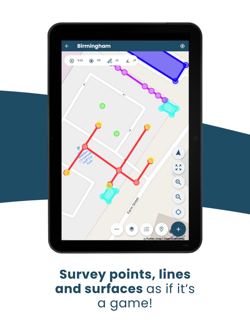
UNI-Collect lets anyone easily survey any object, sync that data to the UNI-Cloud, and generate project data in multiple formats such as AutoCAD DWG or CSV files. After importing your data, UNI-Collect will also let you stake out any object with ease.
Features:
- Point surveying
- Polyline surveying
- Polygon surveying
- Offset point surveying
- Point stake-out
- Polyline stake-out
- Polygon stake-out
- Polyline offset
- Polygon offset
- Extend polyline
- Extend polygon
- Data stored in layers with unlimited attributes
- Live UNI-Cloud synchronization
- UNI-Cloud backup
- UNI-Cloud API connection to get the data in your own GIS tooling
- WMS/WFS background layers
- Remote assistance from our UNI-Support team
- Location input; UNI-GR1 / GR2
- Location input; Bluetooth NMEA 3d party GNSS receiver
- Location input; Internal device location
- Export: DXF/DWG/CSV/GeoJSON/LandXML
- Import: DXF/DWG/CSV/GeoJSON/LandXML
- Survey in any CRS system
- UNI-Machine Control
And much more!
Accessibility
ipadiphonemacrealityDevicetvoswatch
Version history 25 versions
Build 888095689v1.11.32026-07-10 16:55:29
- Bug fixes
Build 887895099v1.11.22026-07-06 21:31:28
Shape info panel now remembers which tabs were open.
Bulk actions in the project photo gallery (select all,re-upload,share).
Reworked the upload-photo popup UI.
Grid downloads now resume after an internet hiccup.
Bug fixes and stability improvements.
Toggle tooltips per map layer.
Build 886432311v1.11.12026-06-02 22:28:45
- Bug fixes
- Stability improvements
Build 886229935v1.11.02026-05-28 18:54:25
- Bug fixes
- Quality of life improvements
Build 886169029v1.10.62026-05-27 00:20:20
- Bug fixes and stability improvements
Build 886162870v1.10.52026-05-26 18:51:42
- Stability improvements
Build 885972751v1.10.42026-05-21 22:36:50
- Bug fixes and stability improvements
Build 885152265v1.10.22026-05-01 19:23:01
- Resolved an issue that caused the app cache to grow excessively large
Build 884012277v1.10.12026-04-01 18:23:43
- Stability improvements
Build 882779548v1.9.142026-02-27 08:47:17
Features:
- Background layer interactivity: you can now stake out points with, and directly inspect, objects in background layer imports
- EXIF data is now added to photos taken with UNI-Collect
Improvements:
- Improved extending polylines and polygons beyond first extended point: extension will now continue after last extended point
- Stability improvements
Build 880951795v1.9.132025-12-24 09:35:51
- Fixed UNI connection issue on newer iOS 26 versions
Build 880764461v1.9.122025-12-18 08:58:24
- Improved sync stability and performance
- Added sorting layer attributes
- Improved big projects loading times
- Various fixes
Build 879780964v1.9.112025-11-17 06:03:37
- Improved sync performance.
- Improved performance when downloading grid files.
- Improved experience for surveying shapes across multi-attribute layers.
Build 879580054v1.9.102025-11-08 00:35:27
- Fixed issues with polyline and polygon stakeout not working as intended
Build 878953908v1.9.82025-10-15 12:24:09
- Fixed an issue where some projects would not load in the overview
Build 878887277v1.9.72025-10-13 11:15:16
- Fix for background layers not being rendered on the map.
Build 878703838v1.9.52025-10-07 18:10:18
- Fix regarding generating sync reports.
Build 878532248v1.9.42025-10-01 00:44:59
- Fixed an issue with project syncing.
Build 878430081v1.9.32025-09-27 21:03:44
- Bug fix for generating sync report.
Build 878265213v1.9.12025-09-22 03:08:37
- Added support for attaching photos to objects.
- Added support for creating and attaching LIDAR scans to objects.
- Updating syncing performance by enabling project based syncing.
- Bug fixes and small improvments
Build 878328128v1.9.22025-09-22 23:07:04
- Removed any role permission restrictions for users to perform 3D scans and create photos.
Build 878200797v1.8.42025-09-18 09:34:20
- Fixes an issue with sync report not generating.
Build 877769445v1.8.32025-09-02 16:32:56
- Fix for project not loading after a failed sync
Build 877345831v1.8.22025-08-18 23:48:23
- Fixed issues with logging into the app.
Build 877158153v1.8.12025-08-12 18:00:52
- Bug fix for login issue
No pricing data captured yet — comparisons appear once the app has paid storefronts or in-app purchases.
Availability 1 of 1 storefronts
| Region | Language | Price | Ratings | Avg | Version |
|---|---|---|---|---|---|
| US | en-US | Free | 0 | — | 1.11.3 |
Change log 29 changes · US
✎
releaseNotes updated
- Bug fixes
✎
description updated
marXact is a young Dutch company founded to make centimeter-accurate measuring solutions easy and affordable for anyone who knows how to use a smartphone.
Next
✎
subtitle updated
Surveying for non-surveyors
✎
name updated
UNI-Collect
◆
Version 1.11.3 released
- Bug fixes
◆
Version 1.11.2 released
Shape info panel now remembers which tabs were open.
Bulk actions in the project photo gallery (select all,re-upload,share).
Reworked the upload-photo popup UI.
Grid downloads now resume after an internet hiccup.
Bug fixes and stability imp
◆
Version 1.11.1 released
- Bug fixes
- Stability improvements
◆
Version 1.11.0 released
- Bug fixes
- Quality of life improvements
◆
Version 1.10.6 released
- Bug fixes and stability improvements
◆
Version 1.10.5 released
- Stability improvements
◆
Version 1.10.4 released
- Bug fixes and stability improvements
◆
Version 1.10.2 released
- Resolved an issue that caused the app cache to grow excessively large
◆
Version 1.10.1 released
- Stability improvements
◆
Version 1.9.14 released
Features:
- Background layer interactivity: you can now stake out points with, and directly inspect, objects in background layer imports
- EXIF data is now added to photos taken with UNI-Collect
Improvements:
- Improved extending polylines
◆
Version 1.9.13 released
- Fixed UNI connection issue on newer iOS 26 versions
◆
Version 1.9.12 released
- Improved sync stability and performance
- Added sorting layer attributes
- Improved big projects loading times
- Various fixes
◆
Version 1.9.11 released
- Improved sync performance.
- Improved performance when downloading grid files.
- Improved experience for surveying shapes across multi-attribute layers.
◆
Version 1.9.10 released
- Fixed issues with polyline and polygon stakeout not working as intended
◆
Version 1.9.8 released
- Fixed an issue where some projects would not load in the overview
◆
Version 1.9.7 released
- Fix for background layers not being rendered on the map.
◆
Version 1.9.5 released
- Fix regarding generating sync reports.
◆
Version 1.9.4 released
- Fixed an issue with project syncing.
◆
Version 1.9.3 released
- Bug fix for generating sync report.
◆
Version 1.9.2 released
- Removed any role permission restrictions for users to perform 3D scans and create photos.
◆
Version 1.9.1 released
- Added support for attaching photos to objects.
- Added support for creating and attaching LIDAR scans to objects.
- Updating syncing performance by enabling project based syncing.
- Bug fixes and small improvments
◆
Version 1.8.4 released
- Fixes an issue with sync report not generating.
◆
Version 1.8.3 released
- Fix for project not loading after a failed sync
◆
Version 1.8.2 released
- Fixed issues with logging into the app.
◆
Version 1.8.1 released
- Bug fix for login issue