Home › Utilities

 US
US
USen-US ITit
ITit CAen-CA
 ESes-ES
 NOen-GB
 AEen-GB
 ALen-GB
 ATde-DE
 AUen-AU
 BAen-GB
 BEen-GB
 BGen-GB
 BHen-GB
 BYen-GB
 CHde-CH
 CYen-GB
 CZen-GB
 DEde-DE
 DKen-GB
 EEen-GB
 EGen-GB
 FIen-GB
 FRfr-FR
 GBen-GB
 GRen-GB
 HRen-GB
 HUen-GB
 IEen-GB
 ILen-GB
 JOen-GB
 KWen-GB
 LBen-GB
 LTen-GB
 LUen-GB
 LVen-GB
 MDen-GB
 MEen-GB
 MKen-GB
 MTen-GB
 NLnl
NLnl NZen-AU
 OMen-GB
 PLen-GB
 PTpt-PT
 QAen-GB
 ROen-GB
 RSen-GB
 RUru
RUru SAen-GB
 SEsv
SEsv SIen-GB
 SKen-GB
 TRen-GB
 UAen-GB
 XKen-GB
55 of 55 storefronts
Content in en-US
Content in en-US
Information
Preview 2 platforms
iPhone 7 images

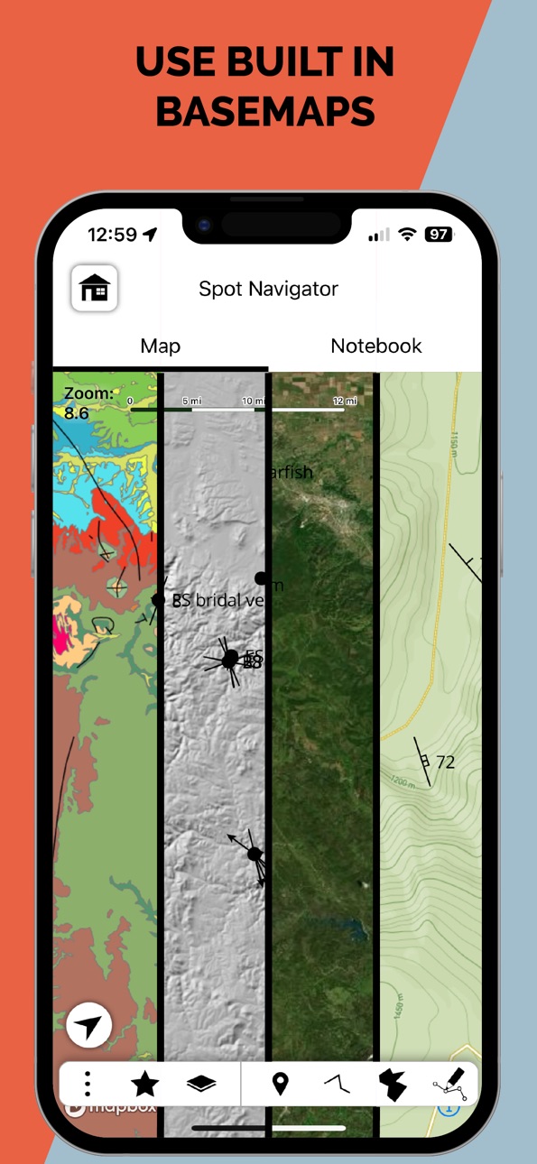
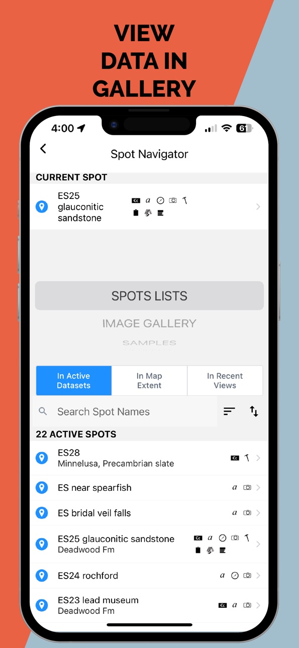
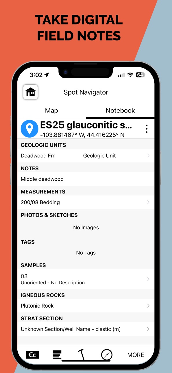


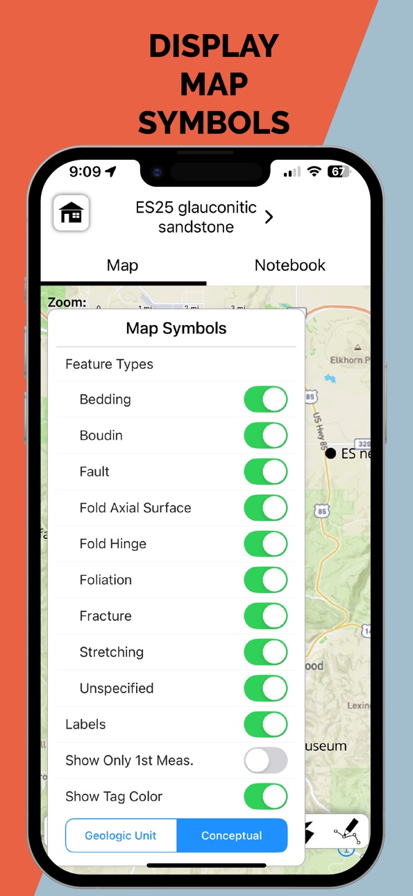
iPad 9 images






What’s New Version 2.29.6
Bug fix with keyboard avoidance when user is filling out a form in a modal.
Description
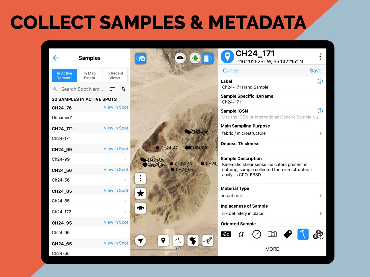
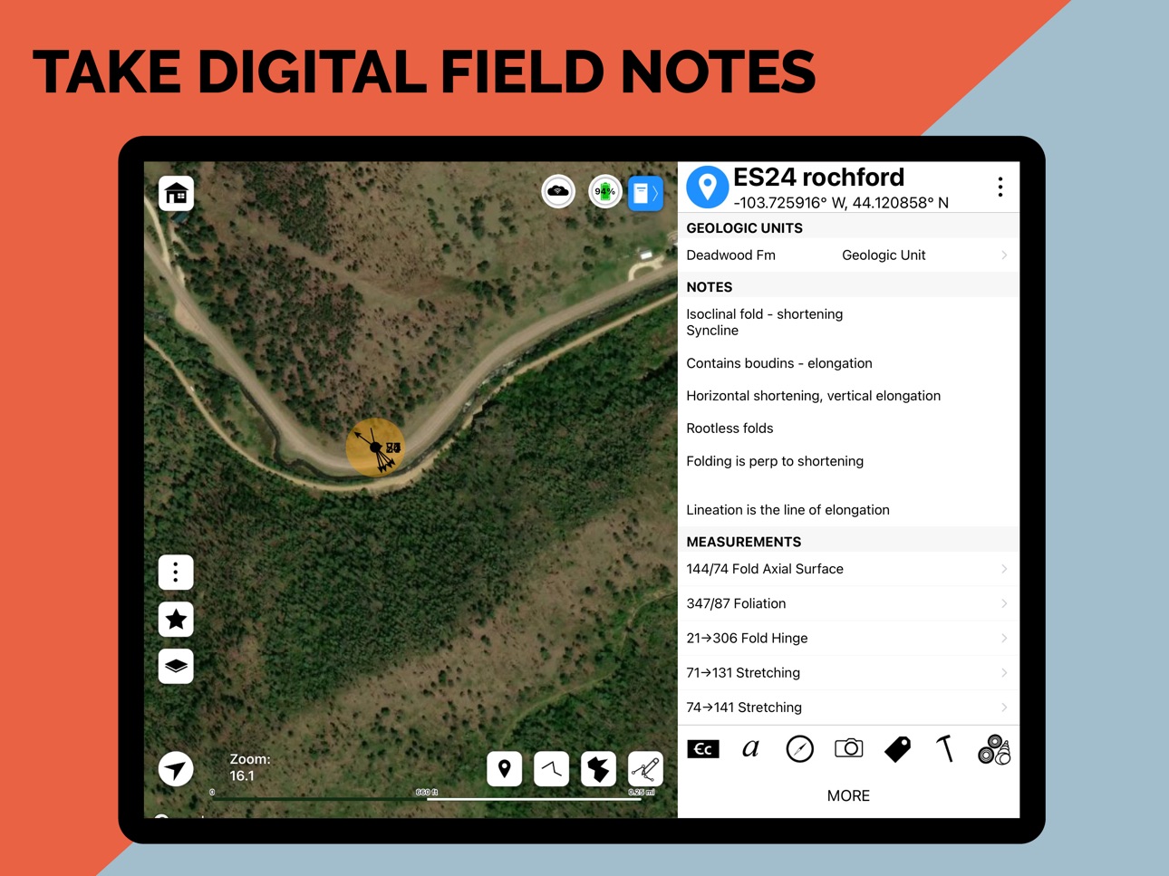
StraboField is a powerful, all-in-one mobile app designed to streamline your geological fieldwork. Record observations, capture photos and sketches, collect orientation data, create geologic maps and stratigraphic sections — all from a single, map-centered platform.
Easily collect spatially referenced data using point, line, or polygon-based Spots. Work across multiple scales using nested Spots and high-resolution image basemaps. Designed by geologists, for geologists, StraboField supports workflows across subdisciplines including structural geology, sedimentology, petrology, volcanology, and geomorphology.
** Key Features: **
* Capture field data with photos, sketches, and notes
* Collect georeferenced orientation and spatial data
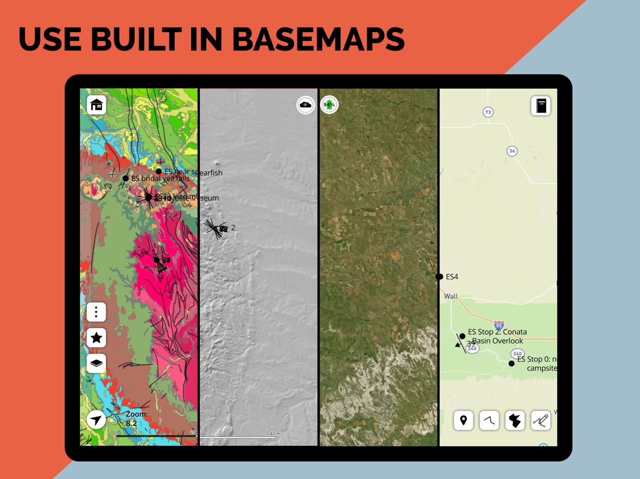
* Use custom or built-in basemaps offline
* Create multi-scale observations with nested Spots
* Organize and back up data locally or to StraboSpot.org
* StraboField is fully functional offline, making it ideal for remote fieldwork. Once online, your data can be synced to the StraboSpot digital data system at StraboSpot.org — an open- source platform supported by the National Science Foundation.
Accessibility
ipadiphonemacrealityDevicetvoswatch
Version history 25 versions
Build 887754627v2.29.62026-07-02 23:59:32
Bug fix with keyboard avoidance when user is filling out a form in a modal.
Build 887501299v2.29.52026-06-27 00:53:34
Minor bug fixes copying a spot, word edits and updates to compass orientation lock
Build 886749298v2.29.42026-06-10 02:48:02
Bug fixes for image deletion and sketch
Build 886695221v2.29.32026-06-09 16:53:08
• QAQC: Run QAQC button is now hidden for read-only projects and datasets, preventing accidental edits (testing only)
• Modals now consistently show a close button whenever a cancel button is visible
• Fixed a bug where a missing server image could cause a crash
• Updated QAQC icons for a cleaner look (testing only)
• Bug fixes and stability improvements
Build 886164673v2.28.42026-05-26 21:47:41
New Features
Photo Compass Data - Photos now capture view azimuth and plunge angle at the moment they are taken, giving your images richer spatial context tied to your field measurements.
Scale Bar Unit Toggle - Switch the map scale bar between metric and imperial units directly from the map actions modal.
Selective Backup - Choose exactly what to include when backing up a project: images, offline tile caches, and custom maps can now be backed up or excluded individually.
Tags and Geologic Units - Searching, sorting, an filtering are added (including Temporal sort for Geologic Units).
Temporal Sort for Geologic Units - Geologic Units pages now sort by geologic age, with support for age modifier fields.
Dike as a Planar Orientation Type - "Dike" is now available as an option in planar orientation forms.
Tappable Empty State Text - Empty list placeholders in the Notebook (e.g., "No Measurements") are now tappable and navigate directly to where you can add data.
Bug Fixes
Fixed a long-standing issue where photos taken in portrait orientation on iOS were saved rotated 90°.
Increased the network timeout from 60 seconds to 5 minutes to prevent false timeout errors when uploading large projects.
More details are available at https://github.com/StraboSpot/StraboField/releases
Build 885267933v2.27.102026-05-09 10:19:26
Modal UI Refinements. See changlelog at https://github.com/StraboSpot/StraboField/releases/tag/v2.27.10
Build 885228059v2.27.72026-05-04 17:27:42
Bug fix with images and Tephra page.
Build 884913857v2.27.52026-04-26 05:51:35
v2.27.5: Enhanced Tagging & Keyboard Layout Fixes. See https://github.com/StraboSpot/StraboField/releases
Build 884388407v2.26.32026-04-11 15:35:23
Strat Section: Drag and reorder intervals directly in the column view. Snaplines now show directional arrows for clearer visual guidance. Added top-down column support for core section type.
Tags & Geologic Units: Import tags and geologic units from JSON files. Back up tags and geologic units independently from your main project backup.
Map: Symbol icons now appear in the Map Symbols overlay.
Bug fixes: Improved keyboard handling on measurement forms fixed form reset behavior on sample save, and resolved a web platform data-loading issue.
Build 884297869v2.25.62026-04-08 22:43:28
Small bug fixes. See https://github.com/StraboSpot/StraboField/releases/tag/v2.25.6 for more detail.
Build 883859334v2.25.52026-03-28 18:48:11
Small bug fixes with image uploads. See change logs at https://github.com/StraboSpot/StraboField/releases
Build 883312733v2.25.42026-03-17 18:16:26
New Features
- Tephra Page — The Tephra data entry page is now live and available to all users.
- Tag Color Improvements — Tag colors are now displayed on the map for all tag types, not just Conceptual Tags. You can also enter tag colors using RGB or hex values for precise
color matching.
- Tag & Geologic Unit Lists — Color swatches now appear alongside tags and geologic units in list views for quick visual reference.
- Offline Maps — A scale indicator is now shown in the zoom level picker when downloading offline map tiles.
- Notebook Quick Actions — Geography, Metadata, and Close Notebook options have been added to the Spot/Sample Actions menu for faster navigation.
- Smarter Forms — Fields that are no longer relevant are automatically cleared when a controlling field value changes, keeping your data clean.
Performance
- Significantly reduced map re-renders for smoother panning and zooming, especially on projects with many spots.
- Improved rendering performance in the spots list and tag-related views.
- Fixed a performance issue in Nesting where thumbnail loading caused the entire page to re-render.
Bug Fixes
- Fixed invisible features when using image basemaps.
- Fixed missing point symbology on the web version after map load.
- Fixed map overlay tiles displaying at incorrect resolution.
- Fixed vertex dragging crash on edited geometries.
- Improved date field validation and date picker behavior.
- Fixed form initialization that could clear default values when switching spots.
- Fixed Strat Section intervals not validating correctly in the Add Interval modal.
- Fixed copying a spot incorrectly including its strat section reference.
- Fixed attributes being reordered unexpectedly when saving.
- Improved error messaging when a project fails to load.
- Fixed guest mode incorrectly showing content that should be hidden.
- Improved microsite download experience: progress overlay appears immediately, the OK button is disabled during download, and the project name is shown in the success d.
message.
- Fixed the information icon alignment in forms on web.
Build 880617588v2.23.92025-12-13 00:51:47
Minor bug fixes. See releases at https://github.com/StraboSpot/StraboField/releases/tag/v2.23.9
Build 880529992v2.23.82025-12-10 21:45:38
Bug fixes and file reorganization. See changelog at https://github.com/StraboSpot/StraboField/releases/tag/v2.23.8
Build 879781733v2.23.72025-11-14 23:58:02
Version 2.23.7 - Bug Fixes
This update fixes technical issues from version 2.23.6 to improve app stability and performance.
What's Fixed:
• Resolved build system issues that could affect app stability
• Fixed image viewer compatibility on web platform
• Improved error reporting reliability
• General performance and stability improvements
We recommend all users update to this version for the best experience.
Build 879344922v2.23.62025-11-12 21:48:13
Enhanced Template Management
- Create custom project templates directly from the app
- View and manage all your templates in one place
- Delete templates you no longer need with improved validation
- Better template structure handling and organization
Improved Image Functionality
- Zoom and pan functionality for detailed image inspection
- Fixed close button behavior for improved navigation
- Enhanced image viewing experience across all platforms
Map Enhancements
- Added zoom controls for easier map navigation
- Improved map layer overlay with responsive sizing
- Draw geometry controls now accessible from Home Menu
- Quick-access toggles for switching drawing modes
IGSN and SESAR Sample Improvements
- Support for LineString geometry in sample submissions
- Enhanced coordinate mapping and validation
- Improved user code handling and dependency tracking
- Better handling of Point geometry in sample data
- Refined upload flow and conditions
Location and GPS
- Extended location timeout to 3 minutes for improved accuracy
- Configurable geolocation timeout settings in Preferences
- Better GPS fix reliability in challenging field conditions
User Interface Refinements
- Improved switch controls with better scaling on iOS
- Enhanced layout consistency across sign-in and testing screens
- Better alignment and spacing throughout the app
- Responsive design improvements for various screen sizes
- Refined map layer overlay dimensions
Performance and Stability
- Updated error tracking and diagnostics capabilities
- Improved code organization and efficiency
- Enhanced data validation and error handling
- Better memory management
- Optimized rendering performance
Developer Tools
- Added comprehensive schema documentation
- Improved development workflow tools
- Enhanced testing capabilities in development mode
- Better debugging support
Bug Fixes
- Fixed target dataset handling
- Corrected various coordinate mapping issues
- Resolved template deletion edge cases
- Fixed measurement page scrolling behavior
- Prevented deletion of unsaved features
- Corrected method naming and improved code clarity
Build 879100603v2.23.22025-10-22 07:30:50
New Features:
Earthquakes Feature Now Live - The Earthquakes feature has moved out of testing and is now fully available to all users
Bug Fixes:
Notes Template Fixed - Resolved an issue with the Notes template that was causing problems for users
Improvements:
Enhanced Templates - Templates now support customizable height and appearance settings for better flexibility
UI Refinements - Improved text sizing and spacing in various interface elements for better readability
Performance Optimizations - Various under-the-hood improvements to make the app run more smoothly
Build 878969767v2.23.12025-10-17 16:34:48
What's New in v2.23.0
NEW FEATURES
• Read-Only Datasets - Protect important data from accidental changes
• Compass Calibration Alerts - Get notified on iOS when calibration is needed for accurate measurements
• Location Service Alerts - Clear guidance when GPS is needed for magnetic declination
• Home Menu Search - Quickly find what you need with new search functionality
• Recent Spots - See your most recent spots right in the Notebook
IMPROVEMENTS
• Fixed project download issue that could change your active dataset settings
• Pressable labels in choice lists for easier selection
• Updated terminology: "Active" is now "Visible" for clarity
• Improved dialog consistency throughout the app
• Better layout on small screens with smart modal closing
BUG FIXES
• Fixed strike calculations for dip directions
• Resolved profile image saving issues
• Fixed measurement fields in templates
• Corrected spot display in read-only datasets
• Guest mode now warns before deleting data
PERFORMANCE
• Better keyboard handling on all platforms
• Streamlined code for faster response times
This update includes 102 improvements across 6 releases (v2.22.0 - v2.23.0) to make StraboSpot more reliable and
easier to use!
Build 877694623v2.20.12025-08-31 10:31:11
Bug fixes and refactors: https://github.com/StraboSpot/StraboField/releases/
Build 877068378v2.19.42025-08-08 16:55:06
Bug fixes, updates, and some new features added. See release changelog for details.
https://github.com/StraboSpot/StraboField/releases
Build 875833803v2.18.52025-06-24 15:50:01
Minor bug fixes (https://github.com/StraboSpot/StraboField/releases/tag/v2.18.5)
Build 875576209v2.18.42025-06-14 17:49:52
Minor bug fix with Viewing documents on iPhones and maps in the Map Layers.
Build 875546999v2.18.32025-06-13 07:58:29
Bug fixes and web updates. Please visit https://github.com/StraboSpot/StraboField/releases/tag/v2.18.3 fro changelog.
Build 874941015v2.18.22025-06-05 22:52:55
Added IGSN integration and new Reports page!
Package updates and bug fixes.
Full changelogs can be found at https://github.com/StraboSpot/StraboField/releases
Build 872239314v2.12.192025-02-05 01:49:12
Custom map bug fixes
https://github.com/StraboSpot/StraboSpot2/releases/tag/v2.12.19
No pricing data captured yet — comparisons appear once the app has paid storefronts or in-app purchases.
Availability 55 of 55 storefronts
| Region | Language | Price | Ratings | Avg | Version |
|---|---|---|---|---|---|
| US | en-US | Free | 19 | 4.5 | 2.29.6 |
| IT | it | Free | 3 | 3.7 | 2.29.6 |
| CA | en-CA | Free | 2 | 5.0 | 2.29.6 |
| ES | es-ES | Free | 1 | 5.0 | 2.29.6 |
| NO | en-GB | Free | 1 | 5.0 | 2.29.6 |
| AE | en-GB | Free | 0 | — | 2.29.6 |
| AL | en-GB | Free | 0 | — | 2.29.6 |
| AT | de-DE | Free | 0 | — | 2.29.6 |
| AU | en-AU | Free | 0 | — | 2.29.6 |
| BA | en-GB | Free | 0 | — | 2.29.6 |
| BE | en-GB | Free | 0 | — | 2.29.6 |
| BG | en-GB | Free | 0 | — | 2.29.6 |
| BH | en-GB | Free | 0 | — | 2.29.6 |
| BY | en-GB | Free | 0 | — | 2.29.6 |
| CH | de-CH | Free | 0 | — | 2.29.6 |
| CY | en-GB | Free | 0 | — | 2.29.6 |
| CZ | en-GB | Free | 0 | — | 2.29.6 |
| DE | de-DE | Free | 0 | — | 2.29.6 |
| DK | en-GB | Free | 0 | — | 2.29.6 |
| EE | en-GB | Free | 0 | — | 2.29.6 |
| EG | en-GB | Free | 0 | — | 2.29.6 |
| FI | en-GB | Free | 0 | — | 2.29.6 |
| FR | fr-FR | Free | 0 | — | 2.29.6 |
| GB | en-GB | Free | 0 | — | 2.29.6 |
| GR | en-GB | Free | 0 | — | 2.29.6 |
| HR | en-GB | Free | 0 | — | 2.29.6 |
| HU | en-GB | Free | 0 | — | 2.29.6 |
| IE | en-GB | Free | 0 | — | 2.29.6 |
| IL | en-GB | Free | 0 | — | 2.29.6 |
| JO | en-GB | Free | 0 | — | 2.29.6 |
| KW | en-GB | Free | 0 | — | 2.29.6 |
| LB | en-GB | Free | 0 | — | 2.29.6 |
| LT | en-GB | Free | 0 | — | 2.29.6 |
| LU | en-GB | Free | 0 | — | 2.29.6 |
| LV | en-GB | Free | 0 | — | 2.29.6 |
| MD | en-GB | Free | 0 | — | 2.29.6 |
| ME | en-GB | Free | 0 | — | 2.29.6 |
| MK | en-GB | Free | 0 | — | 2.29.6 |
| MT | en-GB | Free | 0 | — | 2.29.6 |
| NL | nl | Free | 0 | — | 2.29.6 |
| NZ | en-AU | Free | 0 | — | 2.29.6 |
| OM | en-GB | Free | 0 | — | 2.29.6 |
| PL | en-GB | Free | 0 | — | 2.29.6 |
| PT | pt-PT | Free | 0 | — | 2.29.6 |
| QA | en-GB | Free | 0 | — | 2.29.6 |
| RO | en-GB | Free | 0 | — | 2.29.6 |
| RS | en-GB | Free | 0 | — | 2.29.6 |
| RU | ru | Free | 0 | — | 2.29.6 |
| SA | en-GB | Free | 0 | — | 2.29.6 |
| SE | sv | Free | 0 | — | 2.29.6 |
| SI | en-GB | Free | 0 | — | 2.29.6 |
| SK | en-GB | Free | 0 | — | 2.29.6 |
| TR | en-GB | Free | 0 | — | 2.29.6 |
| UA | en-GB | Free | 0 | — | 2.29.6 |
| XK | en-GB | Free | 0 | — | 2.29.6 |
Change log 29 changes · US
✎
releaseNotes updated
Bug fix with keyboard avoidance when user is filling out a form in a modal.
✎
description updated
StraboField is a powerful, all-in-one mobile app designed to streamline your geological fieldwork. Record observations, capture photos and sketches, collect ori
✎
subtitle updated
Formally StraboSpot2
✎
name updated
StraboField
◆
Version 2.29.6 released
Bug fix with keyboard avoidance when user is filling out a form in a modal.
◆
Version 2.29.5 released
Minor bug fixes copying a spot, word edits and updates to compass orientation lock
◆
Version 2.29.4 released
Bug fixes for image deletion and sketch
◆
Version 2.29.3 released
• QAQC: Run QAQC button is now hidden for read-only projects and datasets, preventing accidental edits (testing only)
• Modals now consistently show a close button whenever a cancel button is visible
• Fixed a bug where a missing server ima
◆
Version 2.28.4 released
New Features
Photo Compass Data - Photos now capture view azimuth and plunge angle at the moment they are taken, giving your images richer spatial context tied to your field measurements.
Scale Bar Unit Toggle - Switch the map scale bar be
◆
Version 2.27.10 released
Modal UI Refinements. See changlelog at https://github.com/StraboSpot/StraboField/releases/tag/v2.27.10
◆
Version 2.27.7 released
Bug fix with images and Tephra page.
◆
Version 2.27.5 released
v2.27.5: Enhanced Tagging & Keyboard Layout Fixes. See https://github.com/StraboSpot/StraboField/releases
◆
Version 2.26.3 released
Strat Section: Drag and reorder intervals directly in the column view. Snaplines now show directional arrows for clearer visual guidance. Added top-down column support for core section type.
Tags & Geologic Units: Import tags and geologic
◆
Version 2.25.6 released
Small bug fixes. See https://github.com/StraboSpot/StraboField/releases/tag/v2.25.6 for more detail.
◆
Version 2.25.5 released
Small bug fixes with image uploads. See change logs at https://github.com/StraboSpot/StraboField/releases
◆
Version 2.25.4 released
New Features
◆
Version 2.23.9 released
Minor bug fixes. See releases at https://github.com/StraboSpot/StraboField/releases/tag/v2.23.9
◆
Version 2.23.8 released
Bug fixes and file reorganization. See changelog at https://github.com/StraboSpot/StraboField/releases/tag/v2.23.8
◆
Version 2.23.7 released
Version 2.23.7 - Bug Fixes
This update fixes technical issues from version 2.23.6 to improve app stability and performance.
What's Fixed:
• Resolved build system issues that could affect app stability
• Fixed image viewer compati
◆
Version 2.23.6 released
Enhanced Template Management
- Create custom project templates directly from the app
- View and manage all your templates in one place
- Delete templates you no longer need with improved validation
- Better template structure hand
◆
Version 2.23.2 released
New Features:
Earthquakes Feature Now Live - The Earthquakes feature has moved out of testing and is now fully available to all users
Bug Fixes:
Notes Template Fixed - Resolved an issue with the Notes template that was causing problems
◆
Version 2.23.1 released
What's New in v2.23.0
NEW FEATURES
• Read-Only Datasets - Protect important data from accidental changes
• Compass Calibration Alerts - Get notified on iOS when calibration is needed for accurate measurements
• Location Service A
◆
Version 2.20.1 released
Bug fixes and refactors: https://github.com/StraboSpot/StraboField/releases/
◆
Version 2.19.4 released
Bug fixes, updates, and some new features added. See release changelog for details.
https://github.com/StraboSpot/StraboField/releases
◆
Version 2.18.5 released
Minor bug fixes (https://github.com/StraboSpot/StraboField/releases/tag/v2.18.5)
◆
Version 2.18.4 released
Minor bug fix with Viewing documents on iPhones and maps in the Map Layers.
◆
Version 2.18.3 released
Bug fixes and web updates. Please visit https://github.com/StraboSpot/StraboField/releases/tag/v2.18.3 fro changelog.
◆
Version 2.18.2 released
Added IGSN integration and new Reports page!
Package updates and bug fixes.
Full changelogs can be found at https://github.com/StraboSpot/StraboField/releases
◆
Version 2.12.19 released
Custom map bug fixes
https://github.com/StraboSpot/StraboSpot2/releases/tag/v2.12.19