Home › Business

 US
US
1 of 1 storefronts
Content in en-US
Content in en-US
Information
Preview 1 platform
iPhone 10 images






What’s New Version 3.7.12
- Improved stability and bug fixes.
Description
The Fycelium mobile application gives you the freedom to synchronize field operation to more precise and less hassles with centrally managed fiber network model, no matter where you are or when you work. The Fycelium helps to keeps everyone on the most up-to-date fiber network model, work synchronized with all team members, track availability and assigned services, manage job with tasks and authorization, track work progress and status, manage network rollout acceptance and estimate cost and generate BOM, all from the convenience of your mobile device.
Features:
• Field Discovery
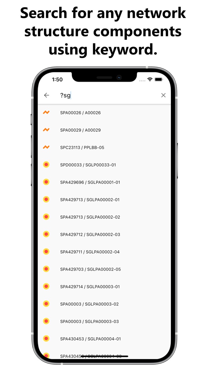
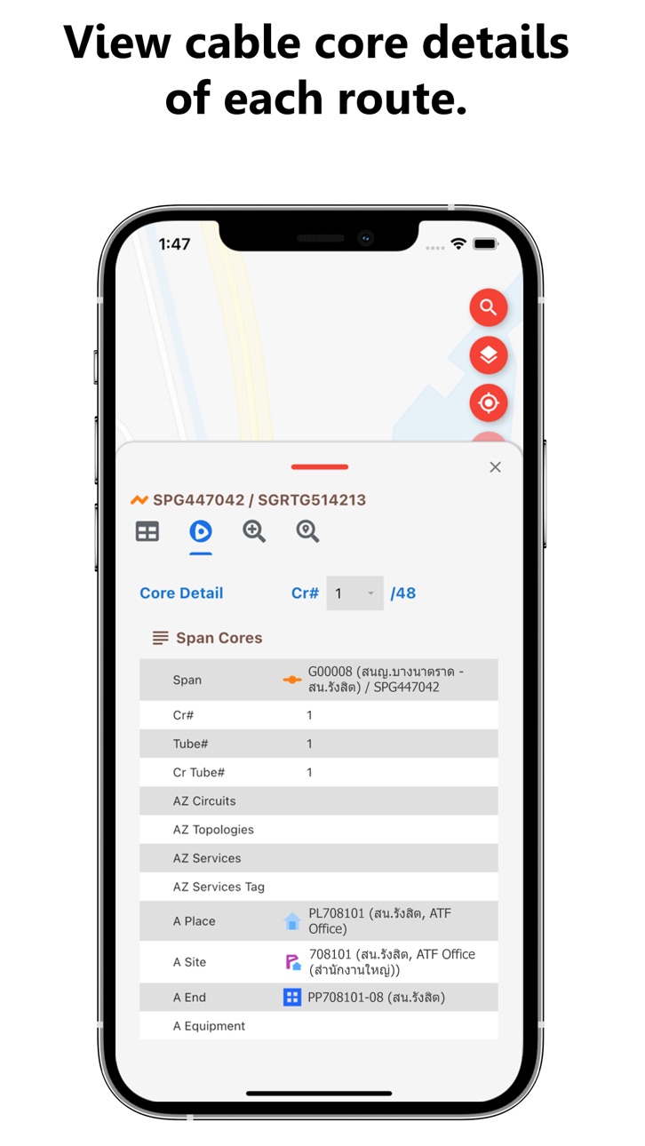
Visualize network structures geographically in map view. Find and view fiber cable and other network elements detailed attributes. Inspect fiber cores, trace cores, trace distance, view active services and underlying customers.
• Field Insight
Explore how network elements connected altogether in schematic view. Get insight of network capacity, utilization, activities, and incidents interactively from dashboard.
• Field Survey
Collect geographical coordinates, routes, and regions. Capture photo. Create redlines for further convert to network elements as designed.
• Field Recovery
Get notified upon the incident. Find the fiber-cut position on the map view. Assess the impact of disruption. Perform necessary data updates such as splice, replace the cable.
• Field Rollout
Reserve a service port to create new installation services.
Accessibility
ipadiphonemacrealityDevicetvoswatch
Version history 18 versions
Build 870860583v3.7.122024-12-04 00:45:11
- Improved stability and bug fixes.
Build 869886766v3.7.112024-10-25 06:04:14
New
- Support Project structure.
Fixed
- Improve performance for core trace.
- Fixed a bug that session terminate after using application.
Build 864493315v3.7.102024-03-18 10:06:51
1. Support show/hide link between equipments.
Build 864321163v3.7.92024-03-11 02:24:53
1. Support utilization map style.
2. Support account structure.
3. Fixed bugs.
Build 861740874v3.7.82023-11-27 17:03:08
- Improve performance.
- Fixed bugs.
Build 858417311v3.7.72023-07-14 07:43:35
- Support schematic view of service.
- Support display of structure on map by current location only.
Build 856659439v3.7.62023-04-26 06:54:38
- Support attach photo into structure.
Build 855183681v3.7.52023-02-26 08:23:27
- Improve performance.
Build 851572881v3.7.42022-11-16 10:07:29
Fixed
- Lots of general fixes and improvement
Build 846084723v3.7.32022-01-12 20:04:39
Fixed
- Fixed an issue capacity and incident styles of network structures.
- Fixed an issue fullscreen mode of dashboard and schematic.
- Can't find network structure from QR code menu.
- Fixed an issue the map layer transparency wasn't displayed correctly.
- Unable to display splice closure properties without splice data.
- Unable to display patch panel properties without connection data.
- Fixed an issue where the search menu didn't work in some cases.
Build 844768419v3.7.22021-11-15 16:26:24
Fixed
- Fixed an issue where showing a fiber cable properties wouldn't set the marker position correctly.
- Fixed an issue remember dim value of default map.
- The application doesn't show splice closure on the map.
- Show the symbol of search nearby function by network type.
- The application doesn't show coordinate on properties page.
- Fixed an issue of display dashboard.
Changed
- Display size of structures on map by zoom level.
- Update default filter of incident list.
- Add process indicator to dashboard, attachment and schematic view.
- Improved the user interface of segment, patch panel, splice closure and topology properties.
New
- Support schematic view of topology and patch panel.
- Support patch cord structure on search nearby function.
- Support navigate to network structure.
- Add reload function to dashboard and schematic view.
Build 844140890v3.7.12021-09-23 21:34:55
- Added support for sign-out.
- Fixed an issue default workspace of network data.
- Fixed an issue current location.
- Fixed a crash that some users tracking location when auto capture location of survey route feature.
- Fixed the way of selecting network structure on the map to make it easier to use.
Build 844092225v1.2.22021-09-15 14:47:56
- We fixed some bugs related to user profiles.
- We fixed some bugs related to properties of network structure.
- We have improved the search nearby network structure experience.
- We have improved the survey features.
- We have improved the measure length and area features.
- We have improved the new structures e.g. service, topology, job, incident etc.
Build 841075895v1.2.12021-09-12 20:41:43
We've updated the application to fix some issues and add new features.
Build 840456626v1.1.32021-02-12 15:30:41
We've updated the application to fix some issue and make features load faster.
Build 840296630v1.1.22021-02-01 19:47:50
- Improved the speed of displaying maps when updating information from FSM web.
- Improved the rendering of maps to be faster and more beautiful.
- Fixed numerical input fields.
Build 838560441v1.1.12021-01-03 15:42:00
- Support the display of Redline on the map.
- Support the display of Redline properties.
- Fix display problems of Cable properties.
- Fix unit of trace distance.
- Improved the display of items on the map.
- Improved the ability to change the host address.
- Improved to display features based on user licenses.
Build 838130086v1.0.92020-10-15 22:25:12
No pricing data captured yet — comparisons appear once the app has paid storefronts or in-app purchases.
Availability 1 of 1 storefronts
| Region | Language | Price | Ratings | Avg | Version |
|---|---|---|---|---|---|
| US | en-US | Free | 0 | — | 3.7.12 |
Change log 22 changes · US
✎
releaseNotes updated
- Improved stability and bug fixes.
✎
description updated
The Fycelium mobile application gives you the freedom to synchronize field operation to more precise and less hassles with centrally managed fiber network model
✎
subtitle updated
Fiber Network Management
✎
name updated
Fycelium
◆
Version 3.7.12 released
- Improved stability and bug fixes.
◆
Version 3.7.11 released
New
- Support Project structure.
Fixed
- Improve performance for core trace.
- Fixed a bug that session terminate after using application.
◆
Version 3.7.10 released
1. Support show/hide link between equipments.
◆
Version 3.7.9 released
1. Support utilization map style.
2. Support account structure.
3. Fixed bugs.
◆
Version 3.7.8 released
- Improve performance.
- Fixed bugs.
◆
Version 3.7.7 released
- Support schematic view of service.
- Support display of structure on map by current location only.
◆
Version 3.7.6 released
- Support attach photo into structure.
◆
Version 3.7.5 released
- Improve performance.
◆
Version 3.7.4 released
Fixed
- Lots of general fixes and improvement
◆
Version 3.7.3 released
Fixed
- Fixed an issue capacity and incident styles of network structures.
- Fixed an issue fullscreen mode of dashboard and schematic.
- Can't find network structure from QR code menu.
- Fixed an issue the map layer transparency wasn't dis
◆
Version 3.7.2 released
Fixed
- Fixed an issue where showing a fiber cable properties wouldn't set the marker position correctly.
- Fixed an issue remember dim value of default map.
- The application doesn't show splice closure on the map.
- Show the symbol of sea
◆
Version 3.7.1 released
- Added support for sign-out.
- Fixed an issue default workspace of network data.
- Fixed an issue current location.
- Fixed a crash that some users tracking location when auto capture location of survey route feature.
- Fixed the way of se
◆
Version 1.2.2 released
- We fixed some bugs related to user profiles.
- We fixed some bugs related to properties of network structure.
- We have improved the search nearby network structure experience.
- We have improved the survey features.
- We have improved th
◆
Version 1.2.1 released
We've updated the application to fix some issues and add new features.
◆
Version 1.1.3 released
We've updated the application to fix some issue and make features load faster.
◆
Version 1.1.2 released
- Improved the speed of displaying maps when updating information from FSM web.
- Improved the rendering of maps to be faster and more beautiful.
- Fixed numerical input fields.
◆
Version 1.1.1 released
- Support the display of Redline on the map.
- Support the display of Redline properties.
- Fix display problems of Cable properties.
- Fix unit of trace distance.
- Improved the display of items on the map.
- Improved the ability to change
◆
Version 1.0.9 released