Home › Navigation

Argo Navigation: Boat GPS, Map
Marine Charts, Weather & Tides
 US
US
1 of 1 storefronts
Content in en-US
Content in en-US
Information
Preview 2 platforms
iPhone 8 images



iPad 8 images




What’s New Version 3.7.2
- Updated Robert's Jon Boat record attempt page
- Added NOAA Recommended Track line
- Simplified group posting
- Other small fixes and improvements
Description
Get Out on the Water with Argo – Your Ultimate Boat Navigation Sidekick
Whether you’re exploring new waters, cruising with friends, or chasing sunsets, you deserve a smarter, simpler way to navigate. That’s where Argo Navigation’s charts, GPS and trip planning tools come in.
Argo Navigation is an all-in-one boating app that helps you plan trips, navigate confidently, discover new places, and connect with fellow boaters.
Think of Argo Navigation like your best boating buddy who always knows the best dock bars, keeps you out of nautical mishaps, and never asks for gas money. And never forgets his chart either.
- Why Argo Navigation? -
Let’s be honest: most marine chartplotters and other GPS software are either clunky, confusing, or so expensive you feel like you’re buying the boat all over again. And marine charts are slow to update. Not Argo Navigation.
- Effortless Marine Navigation, Charts and GPS -
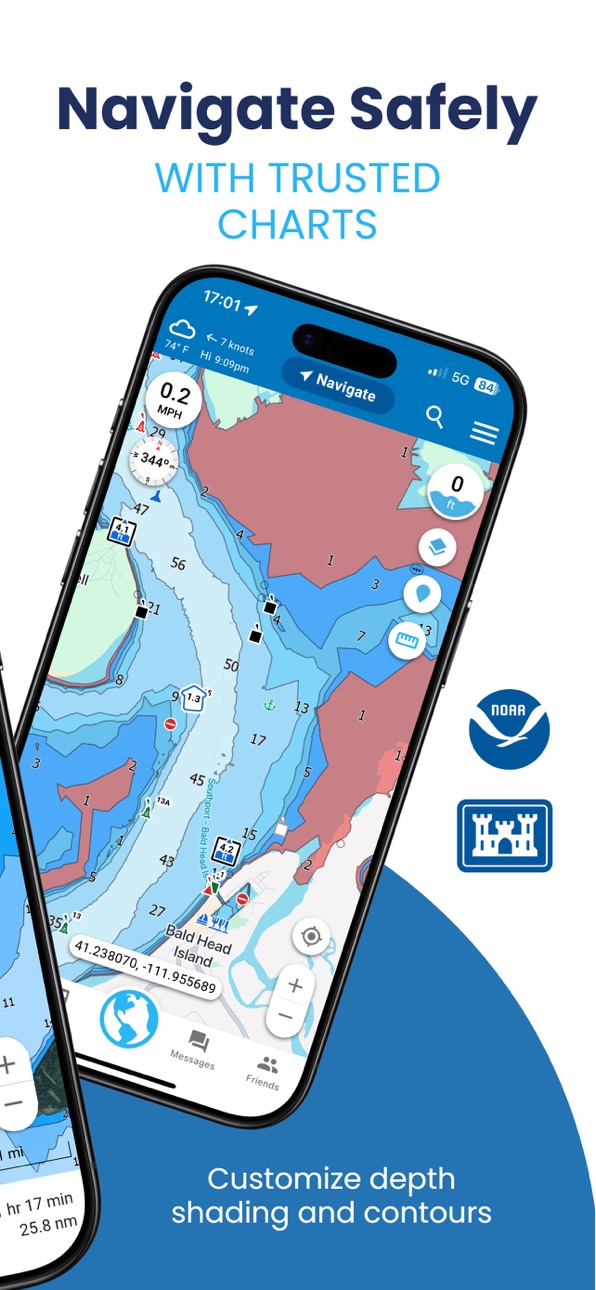
Plot nautical routes directly on Argo Navigation’s map and enable GPS tracking with just a few taps. We include up-to-date NOAA charts and Army Corps of Engineers data covering the US, Canada, and the Caribbean, including coastal areas and many inland lakes.
- Plan Boat Trips with Confidence -
Hidden anchorages, waterfront restaurants, or the nearest fuel dock? Argo Navigation’s boating map has it all, plus reviews and tips from other boaters.
- See Marine Weather, Tides, Currents, and More -
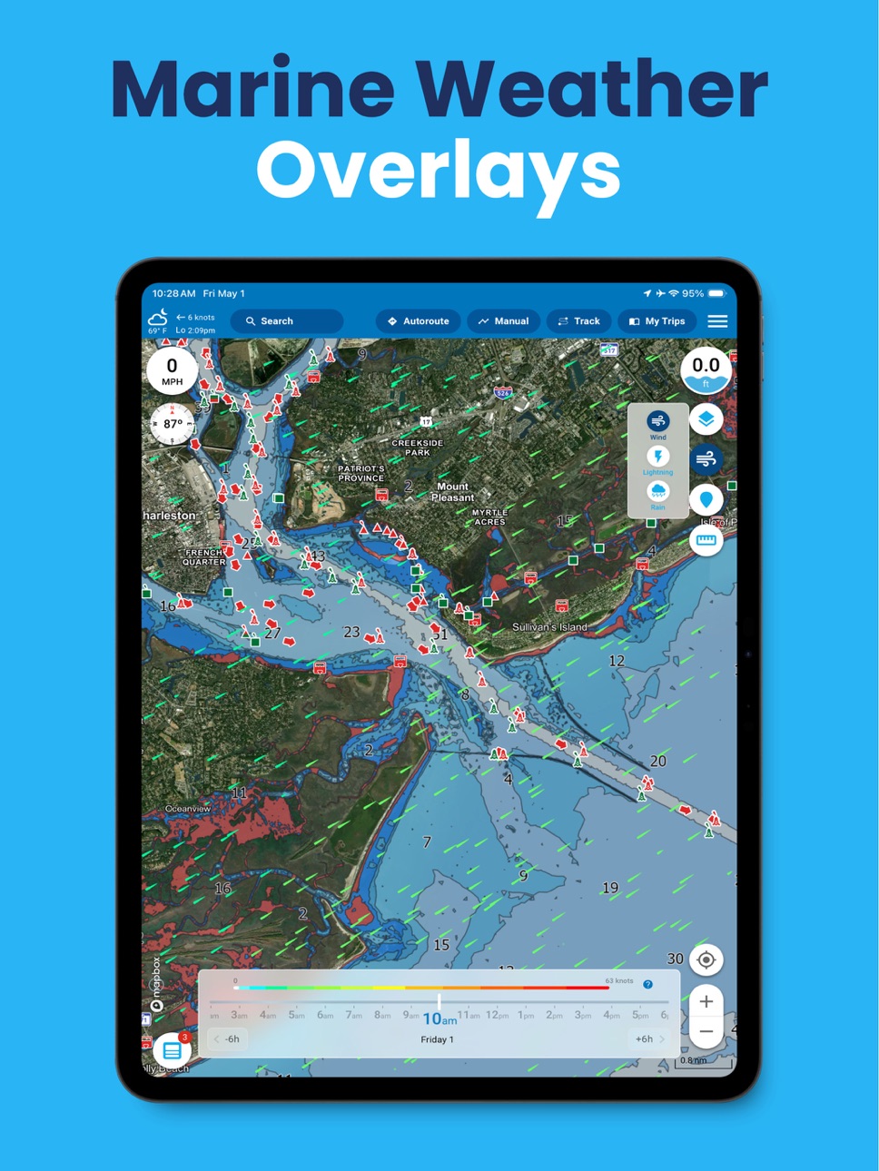
Overlay NOAA weather and wind on your boating map, and analyze marine forecasts well into the future. See tides, currents, temperature, wave height, and wave period across the US, Canada, and the Caribbean.
- Stay Connected to Your Boat Club or Community -
Share voyages, swap boating tips, and see where fellow boaters are cruising. With Argo, the sea feels a little smaller and a lot more fun.
- What’s Included with Argo Navigation: -
• Unlimited Charts: Access charts for the US, Canada, and the Caribbean, including coastal areas, the ICW, inland lakes, and rivers.
• Interactive Nautical Map: Find marinas, anchorages, boat ramps, restaurants, dock bars, and more.
• Voyage Logbook: Plan, save, and relive your voyages with detailed logs and trip memories.
• Real-Time Local Knowledge: Crowdsourced hazard reports, depth updates, reviews, and insider nautical tips from boaters like you.
• Community: See where fellow boaters are cruising and plan trips together.
And yes, all of that is really free.
- Go Beyond Free with Argo Navigation Premium -
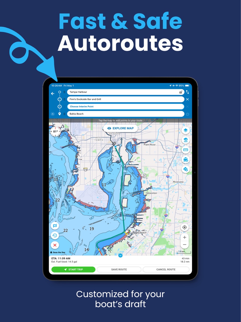
• Smart Routes: Autoroute around hazards and shallow waters. Routes are tailored to your boat’s draft and height.
• Offline Charts: Download offline charts and routes before leaving the dock so you can navigate confidently when cell service disappears.
• 7-Day Weather Forecasts: Tides, currents, wind, rain, lightning, temperature, wave height, and period.
• Custom Depth Contours: Adjust contour depths and colors to visualize safer waters and identify ideal fishing areas.
• Sync with Your Chartplotter: Import and export GPX files for easy navigation.
• Multi-Vessel Support: Manage routes and logs for all your vessels.
- What Boaters Are Saying -
“This app is a game-changer. I absolutely love it. A must-have for every boater—and it’s FREE!”
“Argo has completely changed my boating experience! It’s user-friendly, well-designed, and incredibly helpful.”
- Your Next Boating Voyage Starts Here -
Ready to navigate smarter and explore farther?
Download Argo Navigation today and see why thousands of boaters have chosen Argo for navigation.
Have you tried Navionics, Wavve Boating, or another boat navigation app? Many boaters have switched to Argo for a simpler, more modern way to navigate.
Download Argo Navigation for free. Start your next voyage today.
Follow Us on Instagram, Facebook, Twitter: @argonavigation
Learn more at www.argonav.io
In-App Purchases US pricing
Argo Canada Charts Subscription
Monthly Canada Charts · Monthly 14-day free trial$2.99
Yearly 14-day free trial$9.99
Argo Premium Subscription
Yearly 14-day free trial$39.99
Monthly · Monthly 14-day free trial$6.99
Capabilities
In-App Purchases
Accessibility
ipadiphonemacrealityDevicetvoswatch
Version history 25 versions
Build 888144697v3.7.22026-07-12 00:47:34
- Updated Robert's Jon Boat record attempt page
- Added NOAA Recommended Track line
- Simplified group posting
- Other small fixes and improvements
Build 888073360v3.7.12026-07-10 09:46:58
- Updated Robert's Jon Boat record attempt page
- Updated killer whale restricted zones
- Many small fixes and improvements
Build 887812936v3.7.02026-07-04 21:11:17
- Follow Robert's attempt at beating his record to complete the Great Loop!
- Fixes for tablets and other improvements
Build 887718276v3.6.52026-07-02 22:20:11
Stability and bug-fix release.
What's new in 3.6:
- Redesigned UI for Tablets.
- Smoother user icon movement
- Improve visibility of boater icons on the map
- Added navigation aid search (mile markers, buoys, beacons, current/tide stations)
Build 887489344v3.6.42026-06-26 23:00:28
Stability and bug-fix release.
What's new in 3.6:
- Redesigned UI for Tablets.
- Smoother user icon movement
- Improve visibility of boater icons on the map
- Added navigation aid search (mile markers, buoys, beacons, current/tide stations)
Build 887200297v3.6.32026-06-24 20:11:39
- OnBouy docks and moorings added
- Tablet UI Updates: Export GPX and Search
- Minor Improvements and bug fixes
What's new in 3.6:
- Redesigned UI for Tablets.
- Smoother user icon movement
- Improve visibility of boater icons on the map
- Added navigation aid search (mile markers, buoys, beacons, current/tide stations)
- Limited initial search results on map to current zoom level
- Increased marker sizes relative to your general accessibility font size settings
Build 886798498v3.6.22026-06-12 16:16:42
- App stability release with bug fixes.
What's new in 3.6:
- Redesigned UI for Tablets. It's still in Beta, please report if any issues
- Smoother user icon movement
- Improve visibility of boater icons on the map
- Added navigation aid search (mile markers, buoys, beacons, current/tide stations)
- Limited initial search results on map to current zoom level
- Increased marker sizes relative to your general accessibility font size settings
Build 886678925v3.6.12026-06-08 22:12:02
- App stability release with bug fixes.
What's new in 3.6:
- Redesigned UI for Tablets. It's still in Beta, please report if any issues
- Smoother user icon movement
- Improve visibility of boater icons on the map
- Added navigation aid search (mile markers, buoys, beacons, current/tide stations)
- Limited initial search results on map to current zoom level
- Increased marker sizes relative to your general accessibility font size settings
Build 886541174v3.6.02026-06-05 00:28:31
- Redesigned UI for Tablets. It's still in Beta, please report if any issues
- Smoother user icon movement
- Improve visibility of boater icons on the map
- Added navigation aid search (mile markers, buoys, beacons, current/tide stations)
- Limited initial search results on map to current zoom level
- Search increased marker sizes relative to your general accessibility font size settings
- Bug fixes and minor improvements
Build 885979964v3.5.32026-05-22 14:13:21
App stability release with bug fixes.
Build 885548162v3.5.22026-05-17 13:25:02
App stability release with bug fixes.
Build 885529366v3.5.12026-05-12 00:02:24
Patch release with bug fixes.
New in 3.5:
- Dynamic depth numbers to improve visualization and distribution; no longer rotate with the map
- Displaying restricted areas on the chart
Build 885355218v3.5.02026-05-08 09:13:06
- Dynamic depth numbers to improve visualization and distribution; no longer rotate with the map
- Displaying restricted areas on the chart
- Several bug fixes
Build 885001165v3.4.02026-04-29 11:58:24
- Added route info along segments of the route
- Added recommended tracks for the inland rivers
- Now displaying red shading for restricted areas avoided by autorouting
- New look for My Trips with thumbnails
- Several bug fixes.
Build 884650356v3.3.02026-04-19 14:05:27
- New Weather Overlays for Rain and Lightning with 1-hour forecast
- Improved Wind Overlay with 72-hour forecast controls and Beaufort scale for colors
- Long press on the map now displays wind data for that specific location
- Added a shortcut to set map icons as route waypoints simply by a long press on the icons
- Other minor improvements and bug fixes
Build 884503197v3.2.22026-04-14 18:31:42
Fixes issues for premium users.
Build 884408402v3.2.12026-04-11 20:38:31
App stability release with bug fixes.
Build 884064263v3.2.02026-04-08 14:29:28
- New Onboarding and step-by-step Tutorials
- Improved chart downloads for larger areas
- Added toggle to turn all Places and Nav Aids on/off under Map Options
- Added option to reduce points and split files when exporting to GPX for tracks.
- Several minor bug fixes.
Build 883856633v3.1.12026-03-28 17:07:47
- Adds Bob423 Tracks to the map - toggle them on or off in Map Options
- Adds NOAA RNC Map Type - check Map Options
- Improved app stability and bug fixes
Build 883645344v3.1.02026-03-24 22:07:44
- New Wind overlay with color-coded intensity levels (premium feature)
- Now more easily get search results with all ratings
- Minor improvements and bug fixes
Build 882956895v3.0.12026-03-03 12:07:07
- Patch release for fixing some regressions from 3.0 major release.
Argo 3.0: New map engine, updated from Google Maps to Mapbox:
- Faster scrolling
- Less CPU and GPU usage
- Less battery consumption
- Nicer look, with a cleaner map
- New improved 3D map view
- New view added: Monochrome
Build 882986595v3.0.22026-03-03 21:31:04
- Patch release for fixing some regressions from 3.0 major release.
- Fix for sign-up issue.
Argo 3.0: New map engine, updated from Google Maps to Mapbox:
- Faster scrolling
- Less CPU and GPU usage
- Less battery consumption
- Nicer look, with a cleaner map
- New improved 3D map view
- New view added: Monochrome
Build 882298503v3.0.02026-02-24 15:50:40
New map engine, updated from Google Maps to Mapbox:
- Faster scrolling
- Less CPU and GPU usage
- Less battery consumption
- Nicer look, with a cleaner map
- New improved 3D map view
- New view added: Monochrome
Added Yacht Device as a NMEA integration option
Fixed boater icons so appearing real-time
Other minor fixes and improvements
Build 882236319v2.17.02026-02-09 12:20:12
- Export routes to LOOKOUT devices (from My Trips)
- Improved alerts for route issues, like low bridges along the route or low-depth
- Several small improvements and bug fixes
Build 881855067v2.16.12026-01-27 12:02:13
- Social Feed redesign, consolidating friend, group, and ambassador posts, with better filtering and search
- Easier way to share places with Friends and Groups
- Easier way to add pins to your Groups
- Option to change the density of the depth numbers on the map (Map Options -> Depth Number Style)
- Minor improvements and bug fixes
Price history by region
Currency
Show
Columns
Search
Availability 1 of 1 storefronts
| Region | Language | Price | Ratings | Avg | Version |
|---|---|---|---|---|---|
| US | en-US | Free | 6.1k | 4.9 | 3.7.2 |
Change log 29 changes · US
✎
releaseNotes updated
- Updated Robert's Jon Boat record attempt page
- Added NOAA Recommended Track line
- Simplified group posting
- Other small fixes and improvements
✎
description updated
Get Out on the Water with Argo – Your Ultimate Boat Navigation Sidekick
Whether you’re exploring new waters, cruising with friends, or chasing sunsets, you des
✎
subtitle updated
Marine Charts, Weather & Tides
✎
name updated
Argo Navigation: Boat GPS, Map
◆
Version 3.7.2 released
- Updated Robert's Jon Boat record attempt page
- Added NOAA Recommended Track line
- Simplified group posting
- Other small fixes and improvements
◆
Version 3.7.1 released
- Updated Robert's Jon Boat record attempt page
- Updated killer whale restricted zones
- Many small fixes and improvements
◆
Version 3.7.0 released
- Follow Robert's attempt at beating his record to complete the Great Loop!
- Fixes for tablets and other improvements
◆
Version 3.6.5 released
Stability and bug-fix release.
What's new in 3.6:
- Redesigned UI for Tablets.
- Smoother user icon movement
- Improve visibility of boater icons on the map
- Added navigation aid search (mile markers, buoys, beacons, current/tide stations
◆
Version 3.6.4 released
Stability and bug-fix release.
What's new in 3.6:
- Redesigned UI for Tablets.
- Smoother user icon movement
- Improve visibility of boater icons on the map
- Added navigation aid search (mile markers, buoys, beacons, current/tide stations
◆
Version 3.6.3 released
- OnBouy docks and moorings added
- Tablet UI Updates: Export GPX and Search
- Minor Improvements and bug fixes
What's new in 3.6:
- Redesigned UI for Tablets.
- Smoother user icon movement
- Improve visibility of boater icons on the map
◆
Version 3.6.2 released
- App stability release with bug fixes.
What's new in 3.6:
- Redesigned UI for Tablets. It's still in Beta, please report if any issues
- Smoother user icon movement
- Improve visibility of boater icons on the map
- Added navigation aid se
◆
Version 3.6.1 released
- App stability release with bug fixes.
What's new in 3.6:
- Redesigned UI for Tablets. It's still in Beta, please report if any issues
- Smoother user icon movement
- Improve visibility of boater icons on the map
- Added navigation aid se
◆
Version 3.6.0 released
- Redesigned UI for Tablets. It's still in Beta, please report if any issues
- Smoother user icon movement
- Improve visibility of boater icons on the map
- Added navigation aid search (mile markers, buoys, beacons, current/tide stations)
-
◆
Version 3.5.3 released
App stability release with bug fixes.
◆
Version 3.5.2 released
App stability release with bug fixes.
◆
Version 3.5.1 released
Patch release with bug fixes.
New in 3.5:
- Dynamic depth numbers to improve visualization and distribution; no longer rotate with the map
- Displaying restricted areas on the chart
◆
Version 3.5.0 released
- Dynamic depth numbers to improve visualization and distribution; no longer rotate with the map
- Displaying restricted areas on the chart
- Several bug fixes
◆
Version 3.4.0 released
- Added route info along segments of the route
- Added recommended tracks for the inland rivers
- Now displaying red shading for restricted areas avoided by autorouting
- New look for My Trips with thumbnails
- Several bug fixes.
◆
Version 3.3.0 released
- New Weather Overlays for Rain and Lightning with 1-hour forecast
- Improved Wind Overlay with 72-hour forecast controls and Beaufort scale for colors
- Long press on the map now displays wind data for that specific location
- Added a sho
◆
Version 3.2.2 released
Fixes issues for premium users.
◆
Version 3.2.1 released
App stability release with bug fixes.
◆
Version 3.2.0 released
- New Onboarding and step-by-step Tutorials
- Improved chart downloads for larger areas
- Added toggle to turn all Places and Nav Aids on/off under Map Options
- Added option to reduce points and split files when exporting to GPX for tracks
◆
Version 3.1.1 released
- Adds Bob423 Tracks to the map - toggle them on or off in Map Options
- Adds NOAA RNC Map Type - check Map Options
- Improved app stability and bug fixes
◆
Version 3.1.0 released
- New Wind overlay with color-coded intensity levels (premium feature)
- Now more easily get search results with all ratings
- Minor improvements and bug fixes
◆
Version 3.0.2 released
- Patch release for fixing some regressions from 3.0 major release.
- Fix for sign-up issue.
Argo 3.0: New map engine, updated from Google Maps to Mapbox:
- Faster scrolling
- Less CPU and GPU usage
- Less battery consumption
- Nicer look,
◆
Version 3.0.1 released
- Patch release for fixing some regressions from 3.0 major release.
Argo 3.0: New map engine, updated from Google Maps to Mapbox:
- Faster scrolling
- Less CPU and GPU usage
- Less battery consumption
- Nicer look, with a cleaner map
- New
◆
Version 3.0.0 released
New map engine, updated from Google Maps to Mapbox:
- Faster scrolling
- Less CPU and GPU usage
- Less battery consumption
- Nicer look, with a cleaner map
- New improved 3D map view
- New view added: Monochrome
Added Yacht Device as a NM
◆
Version 2.17.0 released
- Export routes to LOOKOUT devices (from My Trips)
- Improved alerts for route issues, like low bridges along the route or low-depth
- Several small improvements and bug fixes
◆
Version 2.16.1 released
- Social Feed redesign, consolidating friend, group, and ambassador posts, with better filtering and search
- Easier way to share places with Friends and Groups
- Easier way to add pins to your Groups
- Option to change the density of the d