Home › Navigation

 US
US
1 of 1 storefronts
Content in en-US
Content in en-US
Information
Preview 2 platforms
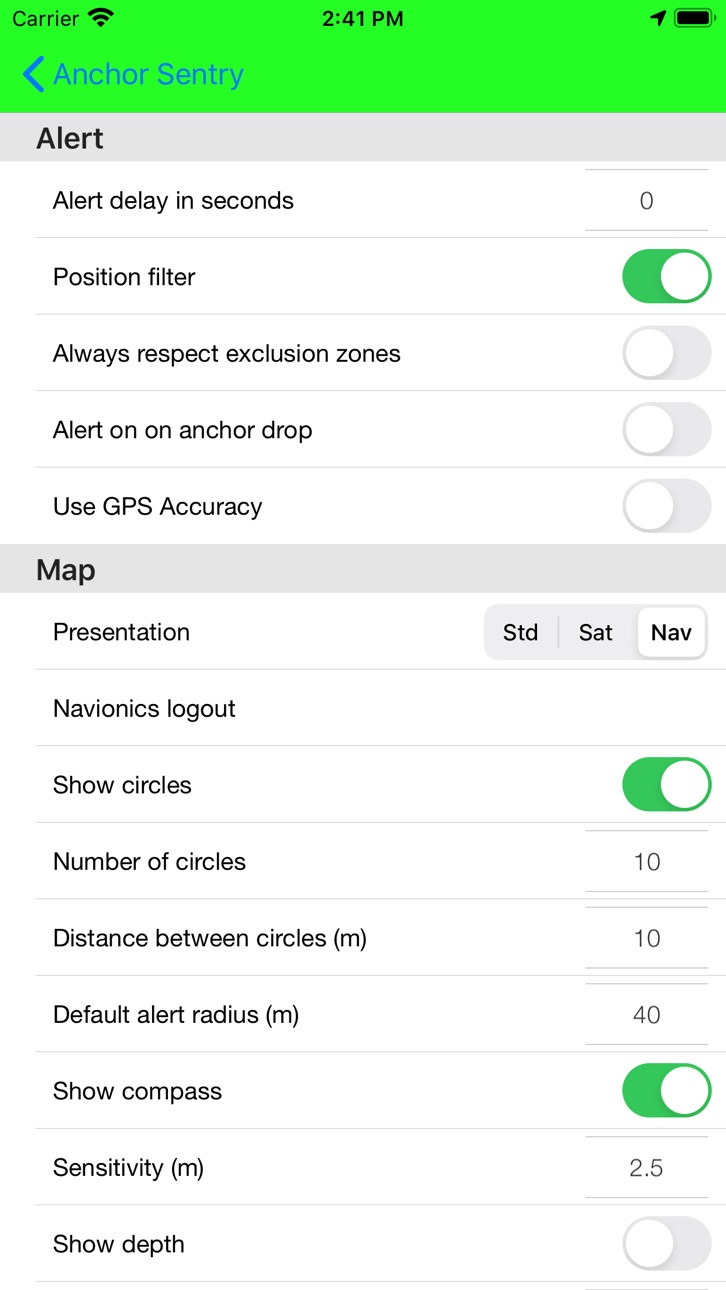
iPhone 3 images


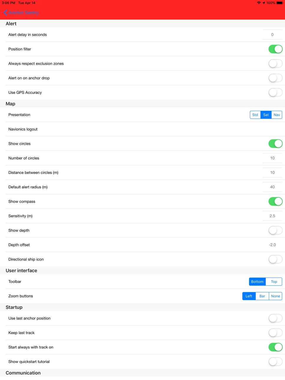
iPad 3 images


What’s New Version 2.11.2
- Improved import/export compatibility for exclusion zones after the Posidonia changes and fixed imports of exports that contain no place images.
- Fixed a possible crash when drawing map overlays such as distance circles and tracks. All positions and radii are now validated before they are passed to the map.
- Fixed a memory leak that made the distance circles consume more and more memory with every position update.
- Distance and radius inputs in the anchor dialog are now limited to their valid range.
- Track drawing on the map was moved completely to the main thread to prevent rare, sporadic crashes.
- Fixed a possible crash on iOS 18 when a dialog was presented while another dialog was still opening or closing. Dialogs now wait until the previous one has finished instead of being lost or crashing the app.
- The alarm circle, shore circle, anchor and anchor places can now be grabbed on the map at any zoom level. The touch tolerance scales with the zoom level instead of being a fixed distance in meters.
Description
Anchor Sentry is an app to monitor the ship's position at anchor and inform the skipper when the anchor is dragging and thus the ship leaves the setup perimeter.
Features:
- Show current position on GoogleMaps map or Navionics map (To gain
access to Navionics maps from this application, users with an active Navionics
subscription in the Navionics Boating application must register with their Navionics
credentials)
- Distance circles to help finding a good anchor position
- Drop anchor by tapping on map or by position or by bearing and distance
- Can be used for anchoring with shore lines by watching the heading rather than the position
- Tracks can be saves as GPX file for later processing
- Option to set up prohibited zones which will trigger an alert when entered. These can be used indepent of the anchor state
- Runs in the background even while other apps are used
- Unique sync functionality which allows to pair two or more devices together to see the ships position even while out to shore for dinner
- Barograph function included
- Display real echo sounder data from a providing NMEA server
- Optional compass overlay to help finding the bearing to the anchor
- Option to show current position visible to friends and family on the Anchor Sentry website
- Proximity alert between ships both using Anchor Sentry. To get warned when your neighbours anchor is dragging.
- Automatic anchoring feature
- Display maximum swinging circle
- Save favorite anchoring places with pictures
- Several setup options to customize your app
Accessibility
ipadiphonemacrealityDevicetvoswatch
Version history 25 versions
Build 887884429v2.11.22026-07-06 21:29:21
- Improved import/export compatibility for exclusion zones after the Posidonia changes and fixed imports of exports that contain no place images.
- Fixed a possible crash when drawing map overlays such as distance circles and tracks. All positions and radii are now validated before they are passed to the map.
- Fixed a memory leak that made the distance circles consume more and more memory with every position update.
- Distance and radius inputs in the anchor dialog are now limited to their valid range.
- Track drawing on the map was moved completely to the main thread to prevent rare, sporadic crashes.
- Fixed a possible crash on iOS 18 when a dialog was presented while another dialog was still opening or closing. Dialogs now wait until the previous one has finished instead of being lost or crashing the app.
- The alarm circle, shore circle, anchor and anchor places can now be grabbed on the map at any zoom level. The touch tolerance scales with the zoom level instead of being a fixed distance in meters.
Build 887340878v2.11.12026-06-24 16:59:49
- Restored the warning dialog when location permission is insufficient, for example when it is not set to "Always".
- Added an optional position accuracy filter that ignores positions above a configurable accuracy limit and can warn about poor GPS reception.
- Stopping a triggered anchor alarm is now more reliable. When an alarm is acknowledged from the notification, it will not immediately start again while the boat is still outside the alarm circle. A new alarm can only be triggered after the position was back in the safe area first.
Build 886463992v2.112026-06-03 17:23:09
- Added a new optional setting Show picker in dialog to choose between the previous in-cell pickers scrolling to change values in the settings and a larger picker dialog.
- Added dedicated position filter settings (master filter, speed filter, distance filter, distance threshold and time delay) in a separate filter settings page.
- Updated position processing to use the new filter options for speed and distance jump handling.
- Added Posidonia support in exclusion zones: Posidonia polygons can now be downloaded from Spanish authority data for the currently visible sea area and stored as zones.
- Posidonia zones are shown on the map for orientation but do not trigger alarms.
- Mirroring: Fixed a connection recovery issue when switching from onboard Wi-Fi to cellular data (e.g. LTE). The receiver now reconnects the WebSocket link more reliably.
- Proximity alert/mirroring: When transmission is stopped while the server connection remains active for the proximity alert, the connection is now kept in proxy mode correctly and no longer restarts normal transmitting after a later reconnect.
Build 885908263v2.10.22026-05-20 18:49:48
- Fixed a cause for possible false alerts while the ship is being nearly stationary.
Build 885490302v2.10.12026-05-11 22:34:36
- Fixed an GPS update problem when the ship was nearly stationary. If you still encounter problems after the fix try setting Sensitivity to 0.0.
- Fixed a problem with location data via NMEA where a premature decimal rounding caused precision loss.
- Adjusted the App startup to be compatible with future iOS Version.
Build 884321805v2.102026-04-09 21:56:25
- The position update monitoring from the last update has been removed again, as restarting the location service when position data was missing caused undesirable side effects.
- The stability of network communication with the server has been improved, so that mirroring and the proximity alarm should now work more reliably even with Starlink. Please let me know if there are further issues.
- The watchdog logic implemented in the last version does not require an internet connection anymore and runs locally. It is active only while the app is in the background.
- When the app starts, it is now checked wether the location permission for the app is set to "Always", as otherwise stable background operation is not possible.
- Improved the memory management so that the app is less likely to be terminated by the iOS when it requires a lot of memory.
- If you have "Disable screen lock" enabled in the settings, there will be now a new button on the main screen that let you adjust the brightness of the mainscreen. Leaving the main screen or triggering an alert will reset the brightness to the default value.
- There is now a FAQ (frequently asked questions) for the App. It is accesible from the manual via the link there.
Build 883304553v2.92026-03-12 23:49:07
- Added an error message when you try to send a mail from within the app and the Apple Mail app is not configured.
- Added an mail button to the system log viewer to mail the log to the support if Apple Mail app is configured.
- Changed the function of the share button in the system log viewer to call the actual share system and not sending a mail directly. So you can share the log with the support in the way you prefer most.
- If you have enabled the setting to clear old and remote tracks, it will now only clear tracks older than 24 hours, independent of distance.
- There are now some safety features that can warn you about unexpected app crashes, app terminated by iOS or missing location updates. Please see Settings->Administration->Safety and the help there. Please make sure you have read and understood the implications of using these functions.
Build 882745751v2.8.82026-02-24 20:41:33
- Fixed a potential crash when switching unit to feet and adjusting distance rings in the settings.
Build 881421251v2.8.72026-01-13 00:13:21
- You can no longer create an empty exclusion zone. An exclusion zone must consist of several points. Just activating the add zone command and tapping on the screen once will do nothing and reset the command. You have to actually move your finger some way to get a valid exclusion zone.
- Increased the sensitivity for selecting a favorite anchoring place on the map through touch slightly.
Build 877611086v2.8.62025-08-27 11:22:59
- Toggling the compass rose will now take immediately effect and not longer only after the next screen update.
- A missing custom sound file no longer causes a crash while showing the error message about the missing sound file.
- Most function buttons on the receiving device of a mirroring are now blocked. They are available again after ending the mirroring.
Build 874335802v2.8.52025-04-28 16:56:31
- Mirroring: Receiving can no longer be activated when the receiving device is anchoring. This caused quite some problems with the server connection as sender and receiver were suddenly the same. Also, switching off receiver mode will now raise anchor on the receiving device else you would not be able to activate receiving again.
Build 872877582v2.8.42025-02-28 14:09:58
- You can now configure an additional circle in the settings to watch the distance to shore for regions where anchoring too close to a shore is restricted. You can set the color for this new ring in the new Color Settings page, where you also can change some other colors.
- The recorded track can now be shown in 4 different colors, depending how old the trackpoints are. So e.g. the most recent 30 minutes of the track will be in yellow, while older trackpoints will be shown in a different color. The colors (iOS 14+ required) and the time thresholds can be edited (iOS 14+ required) in the new Color Settings page, where you can also disable this feature.
Build 866250018v2.8.32024-05-28 08:03:59
- Fixed a problem with TCP connection to NMEA server.
Build 865910438v2.8.22024-05-14 09:37:39
- Fixed a communication problem on iOS version older than 17.0 leading to a crash.
- Added a crash reporting tool. You can disable sending crash reports in the settings, but I urge you not to do so. After all I cannot fix bugs if I don't know of them.
Build 865772615v2.8.12024-05-08 15:33:23
The barometer will now work again in iOS 17.4 and later. Because of privacy changes in iOS 17.4 barometric data are bow tied to Motion and Fitness. In order to make it work you have to enable Fitnesstracking in your devices privacy settings under "Motion and Fitness". After restarting Anchor Sentry you have to go there again and enable Anchor Sentry, which will now have its own entry there, to access the data.
Build 859852020v2.82023-09-13 10:45:26
- Compass reading of the device is not correctly shown in top right corner of the map.
- Boat vector while moving is now also displayed on the Navionics map.
- Improved the user feedback when downloading Navionics maps for offline use.
- Navionics maps now recognize the selected unit (feet or meter) for displaying depths.
- Navionics user can now set some chart options like in the Boating App. For this the "Navionics login" entry in the settings has been replaced with a "Navionics settings" entry. The former "Navionics login" you will find within the new settings page.
- Auto anchoring now uses the NMEA heading if available.
- Added the device distance from bow to the ship data settings. This is the same value as in the auto anchoring settings. If enabled in the ship data settings this distance will used to adjust the anchoring position when droping the anchor as well as the alert radius.
Build 859124993v2.7.12023-08-14 07:52:14
- Fixed a false error message when registering an userid
Build 858751077v2.72023-07-27 08:22:59
- The option to keep track upon app start has been removed. Current track data will now always be kept. Instead there is now the option (enabled by default) to delete track points that are more than 1 nm away from the current location upon app start. Please keep in mind that having to many track data saved may adversely effect the apps performance.
- There is now a new button in the toolbar to show your boats swinging circle on the map in addition to the alert circle, based on actual chain length and depth. See the help for more details.
- You can now attach pictures to stored anchoring places.
- Systemlog entries are now deleted after 5 days.
Build 858209437v2.62023-07-03 13:49:22
- Bearing and distance as well as the most recent GPS update time are now correctly displayed when the app is brought to the foreground.
- The graphics on the map shouldn't spontaneously vanish any longer.
- New experimental feature: Automatic anchoring. The App will drop the anchor automatically as soon as certain conditions are met. Please check the corresponding help page in the settings. This is an experimental feature still in development. Please let me now your experience with it.
Build 857415803v2.5.12023-05-29 20:33:03
- There is now a confirmation dialog for raising the anchor and disarming the alert. You can switch off these dialogs in the settings.
- For better readability activated buttons now have a green background. This applies only to the 3D button style.
- Mirroring: Fixed a problem that the receiver could not reestablish the connection once terminated.
Build 853516942v2.52022-11-23 13:22:11
- Perimeter alert, proximity alert and battery alert can now configured to use different sounds.
- Added the possibility to use custom alarm sounds.
- Distances can now also been shown in feet instead of meter. See Settings.
- Added a contact form in the Settings.
- There is a new style for the main buttons that you may find more intuitive than the old style. If you prefer the old style you can switch to it in the Settings.
- Anchoring using the position dialog now works correctly at southern latitudes and western longitudes.
- Anchor Sentry uses now Critical Alerts. Critical Alerts will play even when the device is muted or set to not disturb. The next time you toggle alert on, you will be asked to allow Critical Alerts. You can disable this feature in the settings.
Build 850097173v2.4.62022-06-13 19:10:55
- Fixed a color problem with the titlebar in iOS 15+.
- Using the bearing/distance part of the anchoring dialog, once you start entering values manually in the bearing field, the compass updates will be suspended.
- Other ships at anchor (on the server) no longer trigger a proximity alert if the last position update from the ship is older than 2 hours. It is then assumed that that ship left without properly raising anchor within the app.
Build 848970503v2.4.52022-05-10 20:48:14
- Fixed a problem in iOS 15 with not coloring the titlebar when anchoring and arming the alert.
Build 848882750v2.4.42022-05-07 12:22:55
- After the first installation of the app on a device all subsequent installations on other devices which are signed in to the same iCloud account will share the user id of the first device unless the user changed it. So the mirrorfunction is now ready to run out of the box.
- Added a new option in the settings to use the last distance and perimeter radius when dropping anchor via the anchoring dialog.
Build 844020541v2.4.32021-09-08 20:42:32
- A device can no longer be set to transmit while not anchored.
- Sending a device to receive while the device you anchored with is not already transmitting will automatically the anchoring device to transmit, provided it has the proximity alert active.
- Terminating the app for any reasons will now remove the device as active device from the server after 5 minutes.
- The receiver will now also show the transmission time of the data if it differs from the receiving time.
- General improvements on communication stability and recovery.
- Automatic screen locking can now be disabled in the settings.
Price history by region
Currency
Show
Columns
Search
Availability 1 of 1 storefronts
| Region | Language | Price | Ratings | Avg | Version |
|---|---|---|---|---|---|
| US | en-US | USD 3.99 | 4 | 4.0 | 2.11.2 |
Change log 28 changes · US
✎
releaseNotes updated
- Improved import/export compatibility for exclusion zones after the Posidonia changes and fixed imports of exports that contain no place images.
- Fixed a poss
✎
description updated
Anchor Sentry is an app to monitor the ship's position at anchor and inform the skipper when the anchor is dragging and thus the ship leaves the setup perimeter
✎
name updated
Anchor Sentry
◆
Version 2.11.2 released
- Improved import/export compatibility for exclusion zones after the Posidonia changes and fixed imports of exports that contain no place images.
- Fixed a possible crash when drawing map overlays such as distance circles and tracks. All po
◆
Version 2.11.1 released
- Restored the warning dialog when location permission is insufficient, for example when it is not set to "Always".
- Added an optional position accuracy filter that ignores positions above a configurable accuracy limit and can warn about p
◆
Version 2.11 released
- Added a new optional setting Show picker in dialog to choose between the previous in-cell pickers scrolling to change values in the settings and a larger picker dialog.
- Added dedicated position filter settings (master filter, speed filt
◆
Version 2.10.2 released
- Fixed a cause for possible false alerts while the ship is being nearly stationary.
◆
Version 2.10.1 released
- Fixed an GPS update problem when the ship was nearly stationary. If you still encounter problems after the fix try setting Sensitivity to 0.0.
- Fixed a problem with location data via NMEA where a premature decimal rounding caused precisi
◆
Version 2.10 released
- The position update monitoring from the last update has been removed again, as restarting the location service when position data was missing caused undesirable side effects.
- The stability of network communication with the server has be
◆
Version 2.9 released
- Added an error message when you try to send a mail from within the app and the Apple Mail app is not configured.
- Added an mail button to the system log viewer to mail the log to the support if Apple Mail app is configured.
- Changed the
◆
Version 2.8.8 released
- Fixed a potential crash when switching unit to feet and adjusting distance rings in the settings.
◆
Version 2.8.7 released
- You can no longer create an empty exclusion zone. An exclusion zone must consist of several points. Just activating the add zone command and tapping on the screen once will do nothing and reset the command. You have to actually move your
◆
Version 2.8.6 released
- Toggling the compass rose will now take immediately effect and not longer only after the next screen update.
- A missing custom sound file no longer causes a crash while showing the error message about the missing sound file.
- Most funct
◆
Version 2.8.5 released
- Mirroring: Receiving can no longer be activated when the receiving device is anchoring. This caused quite some problems with the server connection as sender and receiver were suddenly the same. Also, switching off receiver mode will now r
◆
Version 2.8.4 released
- You can now configure an additional circle in the settings to watch the distance to shore for regions where anchoring too close to a shore is restricted. You can set the color for this new ring in the new Color Settings page, where you al
◆
Version 2.8.3 released
- Fixed a problem with TCP connection to NMEA server.
◆
Version 2.8.2 released
- Fixed a communication problem on iOS version older than 17.0 leading to a crash.
- Added a crash reporting tool. You can disable sending crash reports in the settings, but I urge you not to do so. After all I cannot fix bugs if I don't kn
◆
Version 2.8.1 released
The barometer will now work again in iOS 17.4 and later. Because of privacy changes in iOS 17.4 barometric data are bow tied to Motion and Fitness. In order to make it work you have to enable Fitnesstracking in your devices privacy settings
◆
Version 2.8 released
- Compass reading of the device is not correctly shown in top right corner of the map.
- Boat vector while moving is now also displayed on the Navionics map.
- Improved the user feedback when downloading Navionics maps for offline use.
- Na
◆
Version 2.7.1 released
- Fixed a false error message when registering an userid
◆
Version 2.7 released
- The option to keep track upon app start has been removed. Current track data will now always be kept. Instead there is now the option (enabled by default) to delete track points that are more than 1 nm away from the current location upon
◆
Version 2.6 released
- Bearing and distance as well as the most recent GPS update time are now correctly displayed when the app is brought to the foreground.
- The graphics on the map shouldn't spontaneously vanish any longer.
- New experimental feature: Automa
◆
Version 2.5.1 released
- There is now a confirmation dialog for raising the anchor and disarming the alert. You can switch off these dialogs in the settings.
- For better readability activated buttons now have a green background. This applies only to the 3D butto
◆
Version 2.5 released
- Perimeter alert, proximity alert and battery alert can now configured to use different sounds.
- Added the possibility to use custom alarm sounds.
- Distances can now also been shown in feet instead of meter. See Settings.
- Added a conta
◆
Version 2.4.6 released
- Fixed a color problem with the titlebar in iOS 15+.
- Using the bearing/distance part of the anchoring dialog, once you start entering values manually in the bearing field, the compass updates will be suspended.
- Other ships at anchor (o
◆
Version 2.4.5 released
- Fixed a problem in iOS 15 with not coloring the titlebar when anchoring and arming the alert.
◆
Version 2.4.4 released
- After the first installation of the app on a device all subsequent installations on other devices which are signed in to the same iCloud account will share the user id of the first device unless the user changed it. So the mirrorfunction
◆
Version 2.4.3 released
- A device can no longer be set to transmit while not anchored.
- Sending a device to receive while the device you anchored with is not already transmitting will automatically the anchoring device to transmit, provided it has the proximity