Home › Navigation

Information
Preview 2 platforms
iPhone 8 images




iPad 2 images


What’s New Version 1.6.7
This version contains minor fixes.
Description
Loisto Mariner is the best companion to boater: tools for navigation, weather forecast and identifying of other boats with Automatic Identification System (AIS) are always in your pocket!
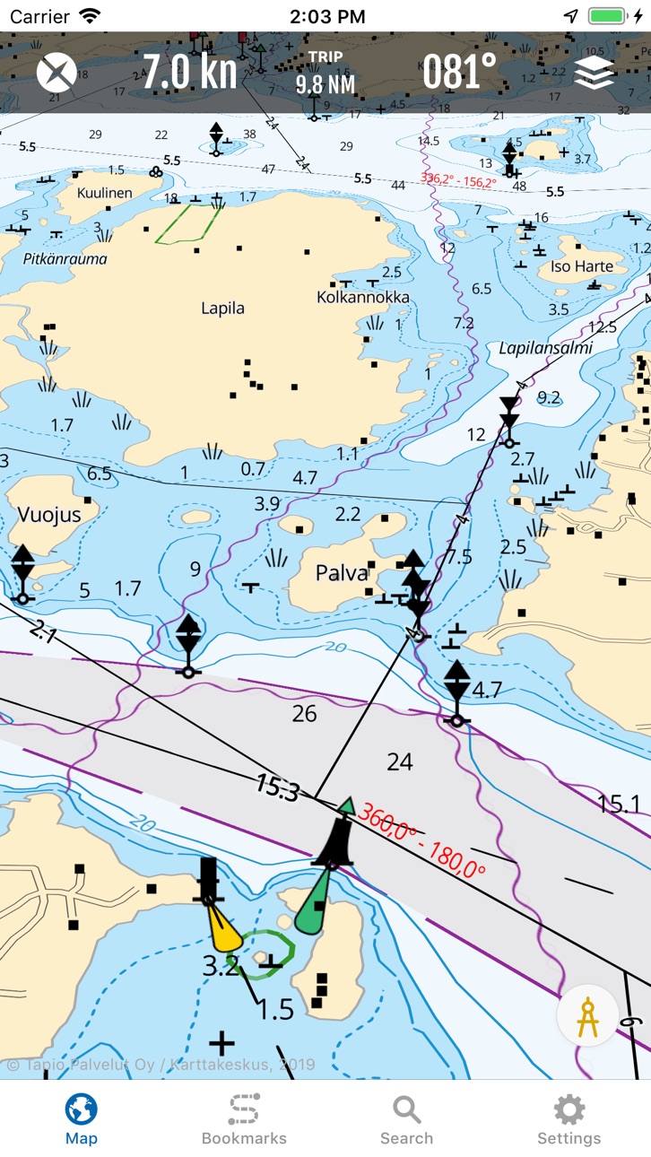
Navigate easily with the Finnish nautical map or hike with the precise topographical maps.
Loisto Mariner takes you where ever you want to get:
• Find your destination with the advanced location search provided by the National Land Survey of Finland.
• Enjoy boating also on the lake area – the nautical chart covers Finland’s inland waters like Lake Saimaa.
• Navigate on Finland’s marine area with familiar Finnish nautical charts.
• Hike with the precise topographical maps.
• Plan your routes on land and in the sea.
• Check the weather forecast and find a place to rest from a guest harbor.
** The clearest and highest quality maps of Finland on the same app. **
The nautical charts and topographical maps are precise and in vector format. The nautical charts of the app are based on the material of the Finnish Transport Infrastructure Agency.
The general nautical charts cover Åland, Archipelago, Gulf of Finland and Lake Saimaa. The topographical map is based on the most accurate material from National Land Survey of Finland.
The combined view of the topographical map and nautical charts is even more detailed.
You can use the maps also offline. Save the offline maps to your device and plan routes and navigate successfully, where ever you may roam.
** The advanced search covers thousands of locations. **
Navigate precisely to the destination. The search function of this app you can find the right places. The index is based on the location database of the National Land Survey of Finland.
** The AIS data helps you to identify other boats. **
See the maps from the bird’s-eye view (3D) and you can easily get a quick glance of your route.
With the compass tool, you can measure distances and directions while navigating. Your track will be visualized on the map as a clearly distinguishable line. You can decide the length of the direction vector from the settings.
** Plan routes and save your favorite locations. **
Measure the distances between places, the length of the route and duration of the trip. You can easily save your favorite spots on the map.
** Stop by at the guest harbor. **
The app helps you to find the guest harbor along the Finnish coastline and on the lakeside. The services of the harbors are listed. The information is provided by Suomen Vierassatamat Ltd.
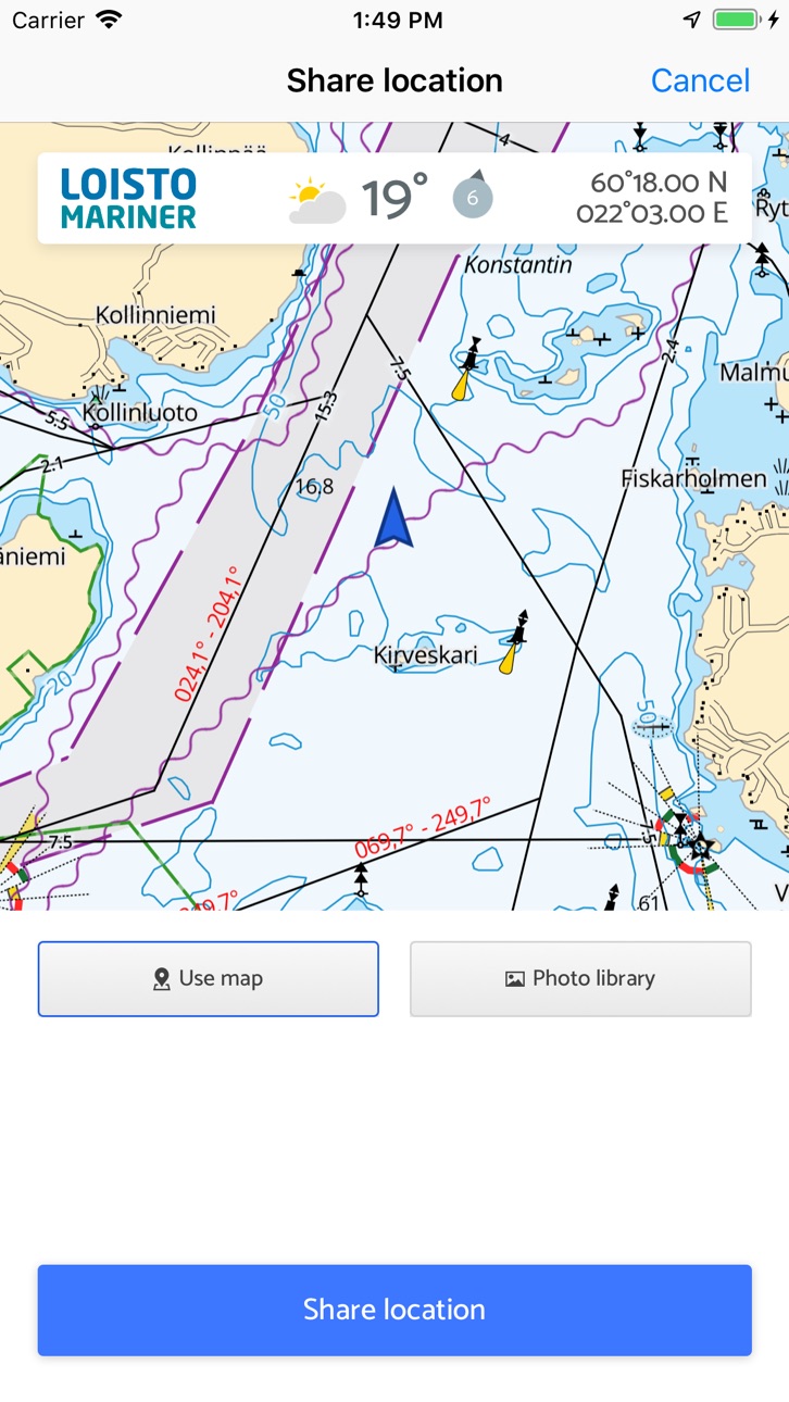
** Share your location and the spectacular view! **
You can share your location straight from the app to your favorite social media services. Choose one of your own images or a screenshot from the map to be shared.
You can start sharing by long pressing your location icon on the map.
** Reliable weather forecast always at hand. **
The local weather forecast is provided by the Finnish Meteorological Institute. Up-to-date weather forecast requires that your device is online.
** The yearly subscription fee is only 34,99 €. Start now navigating with Loisto Mariner! **
The subscription period is 12 months from the purchase. The price includes all map updates and app updates.
Payment will be charged to iTunes Account at confirmation of purchase. Subscription automatically renews unless auto-renew is turned off at least 24-hours before the end of the current period.
Account will be charged for renewal within 24-hours prior to the end of the current period, and identify the cost of the renewal.
Subscriptions may be managed by the user and auto-renewal may be turned off by going to the user’s Account Settings after purchase.
The terms of use and the privacy policy can be found on https://tapio.fi/loisto-mariner-tietosuojalauseke/
In-App Purchases US pricing
Maps Subscription
Loisto Mariner · Yearly 7-day free trial$29.99
Capabilities
In-App Purchases
Accessibility
ipadiphonemacrealityDevicetvoswatch
Version history 25 versions
Build 880605991v1.6.72026-01-15 06:23:39
This version contains minor fixes.
Build 875713772v1.6.62025-06-25 04:39:34
Updated sea charts.
Build 866934561v1.6.52024-06-24 17:08:01
Nautical charts updated. Some bugs fixed.
Build 857949151v1.6.32023-06-22 12:06:11
New additions include the introductions of 501 destinations across the Gulf of Finland, Archipelago Sea and Åland Islands that are sure to pique the interest of recreational boaters. We also present 250 different fishing spots. Fishing spots for catching specific species of fish (pike, zander, perch, sea trout) are presented separately.
Nautical charts updated. Some bugs fixed.
Build 857093019v1.6.2.22023-05-16 13:14:06
This version contains small bug fixes.
Build 856827630v1.6.22023-05-07 04:00:33
This version contains minor fixes
Build 856652627v1.6.12023-04-25 12:38:37
This version contains minor fixes
Build 855705934v1.6.02023-03-23 12:31:17
Approach charts for ports are presented as new information under ports of call.
Import and export of destinations enables transferring destination points, routes and traces from and to another device (GPX import and export function). The import function can be used to transfer material in GPX file format from external sources to Loisto Mariner. The export function can be used to transfer destinations to other systems as well as to backup and restore information in case of a reinstall.
Build 850307834v1.5.92022-06-24 21:00:12
Locations of 303 septic stations and 2400 launching ramps are included and can be viewed on the map interface. The tracing and trace recording actions have been improved.
The nautical charts and topographic maps have been updated. The source of nautical charts is now Traficom's S-57 material. The combined nautical chart and topographic map shows more comprehensive terrain data than before. In inland waters, the quantity of boat passages and fairway markers has been increased in areas outside the scope of the S-57 material and included is a greater number of depth contour data for lakes.
Fairway information is now available on the following lakes: Kivijärvi (Luumäki, Lemi), Pyhäjärvi in Karelia (Kitee, Parikkala), Pyhäjärvi (Säkylä), Lokka Reservoir and Porttipahta Reservoir, Kiantajärvi, Rautavesi-Kulovesi, Ontojärvi, Kyrösjärvi, Keurusselkä, Pyhäjärvi in Iitti and Kimola Canal. After the map update, the signing of boat passages is partly missing in the Pohjois-Konnevesi area.
Build 848187538v1.5.82022-06-02 03:36:59
Locations of 303 septic stations and 2400 launching ramps are included and can be viewed on the map interface. The tracing and trace recording actions have been improved.
The nautical charts and topographic maps have been updated. The source of nautical charts is now Traficom's S-57 material. The combined nautical chart and topographic map shows more comprehensive terrain data than before. In inland waters, the quantity of boat passages and fairway markers has been increased in areas outside the scope of the S-57 material and included is a greater number of depth contour data for lakes.
Fairway information is now available on the following lakes: Kivijärvi (Luumäki, Lemi), Pyhäjärvi in Karelia (Kitee, Parikkala), Pyhäjärvi (Säkylä), Lokka Reservoir and Porttipahta Reservoir, Kiantajärvi, Rautavesi-Kulovesi, Ontojärvi, Kyrösjärvi, Keurusselkä, Pyhäjärvi in Iitti and Kimola Canal. After the map update, the signing of boat passages is partly missing in the Pohjois-Konnevesi area.
Build 847298140v1.5.02022-03-01 07:50:27
Nautical charts and topographic maps updated. Traficom's S-57 data has been changed to the source of nautical charts. The combined nautical and topographic map provides more comprehensive terrain data. In inland waters, the number of inland waterways and fairway signs has been increased in areas outside the S-57 dataset, and more information on the depth curves of lakes is included.
Navigational line information is now also available e.g. from the following lakes: Kivijärvi (Luumäki, Lemi), Karelia Pyhäjärvi (Kitee, Parikkala), Pyhäjärvi (Säkylä), Lokka and Porttipahta lakes, Kiantajärvi, Rautavesi-Kulovesi, Ontojärvi, Kyrösjärvi, Keurusselkä, Pyhäjärvi (Iitti), Kimola canal. After the map update, the nautical markers of the boat lanes is partially missing from the North Konnevesi area.
Some of the new inland waterways will only be shown in the combined nautical and terrain map view (the most accurate zoom levels).
Build 840546302v1.4.32021-02-22 06:51:53
Small improvements.
Build 835146479v1.4.22020-03-18 06:00:34
Bugfixes.
Build 832363656v1.4.12019-08-14 11:55:44
Small improvements.
Build 831815826v1.4.02019-06-27 21:09:04
Pieniä parannuksia.
Build 831287418v1.3.02019-05-22 10:24:51
Nyt voit jakaa sijaintisi näppärästi suoraan sovelluksesta sosiaalisen median kanaviin! Kerro ystävillesi, miten huikeissa maisemissa liikut. Onko kesän ihanin helle vai ihan karmea myrsky? Sano kaikki yhdellä kertaa!
• Voit jakaa itse ottamasi kuvan tai karttakuvan.
• Jaettavaan kuvaan tulevat mukaan säätiedot ja sijaintikoordinaatit.
• Toiminto käynnistyy, kun napautat oman sijaintisi ikonia kartalla.
Build 830958443v1.2.32019-04-15 05:45:44
Loisto Mariner on kumppanisi vesille ja maastoon:
• Löydä kohteesi kattavan Maanmittauslaitoksen nimistöhaun avulla.
• Tunnista alueella liikkuvat laivat AIS-tiedoista.
• Helposti erottuva reitin jälkipiirto tukee navigointia.
• Mittaa etäisyyksiä ja suuntia harppitoiminnolla.
Build 830782727v1.2.22019-04-05 08:28:38
Loisto Mariner on kumppanisi vesille ja maastoon:
• Löydä kohteesi kattavan Maanmittauslaitoksen nimistöhaun avulla.
• Tunnista alueella liikkuvat laivat AIS-tiedoista.
• Helposti erottuva reitin jälkipiirto tukee navigointia.
• Mittaa etäisyyksiä ja suuntia harppitoiminnolla.
Build 830206895v1.1.02019-02-06 19:17:17
Uusi päivitys tuo Marineriin toivottuja ominaisuuksia:
- Harppityökalulla mittaat etäisyyksiä merellä
- AIS-toiminnolla näet lähistöllä liikkuvat laivat ja niiden tiedot
Build 827875367v1.0.72018-07-20 10:30:05
Lisätty muistutus Offline-karttojen päivittymisestä. Korjattu offline-karttojen käsittelyssä tapahtuva kaatuminen.
Kiitos kun käytät Loisto Marineria!
Build 826679446v1.0.52018-04-16 05:51:48
- Korjattu tietyillä laitteilla esiintynyt kaatumisongelma
Build 826479538v1.0.42018-04-11 12:12:30
- Korjattu ongelma karttojen lataukseen liittyen
Build 825024705v1.0.32017-11-29 18:38:40
- Korjauksia sovelluksen käynnistyksessä esiintyneisiin ongelmiin
Build 824979663v1.0.22017-11-28 03:01:14
- Korjauksia sovelluksen käynnistyksessä esiintyneisiin ongelmiin
Build 824470005v1.0.12017-11-18 01:31:12
Versio 1.0.1:
- Korjattu ongelma sovelluksen avaamisessa offline-tilassa
Price history by region
Currency
Show
Columns
Search
Availability 27 of 27 storefronts
| Region | Language | Price | Ratings | Avg | Version |
|---|---|---|---|---|---|
 AF AF | en-GB | Free | 0 | — | 1.6.7 |
 AT AT | de-DE | Free | 0 | — | 1.6.7 |
 BE BE | en-GB | Free | 0 | — | 1.6.7 |
 BM BM | en-GB | Free | 0 | — | 1.6.7 |
 BO BO | es-MX | Free | 0 | — | 1.6.7 |
 CG CG | en-GB | Free | 0 | — | 1.6.7 |
 CH CH | de-CH | Free | 0 | — | 1.6.7 |
 CI CI | fr-FR | Free | 0 | — | 1.6.7 |
 CM CM | fr-FR | Free | 0 | — | 1.6.7 |
 CR CR | es-MX | Free | 0 | — | 1.6.7 |
 EC EC | es-MX | Free | 0 | — | 1.6.7 |
 LK LK | en-GB | Free | 0 | — | 1.6.7 |
 LU LU | en-GB | Free | 0 | — | 1.6.7 |
 ME ME | en-GB | Free | 0 | — | 1.6.7 |
 MR MR | en-GB | Free | 0 | — | 1.6.7 |
 NL NL | nl | Free | 0 | — | 1.6.7 |
 NP NP | en-GB | Free | 0 | — | 1.6.7 |
 PA PA | es-MX | Free | 0 | — | 1.6.7 |
 PE PE | es-MX | Free | 0 | — | 1.6.7 |
 PT PT | pt-PT | Free | 0 | — | 1.6.7 |
 PY PY | es-MX | Free | 0 | — | 1.6.7 |
 SN SN | en-GB | Free | 0 | — | 1.6.7 |
 TR TR | en-GB | Free | 0 | — | 1.6.7 |
 US US | en-US | Free | 0 | — | 1.6.7 |
 UY UY | en-GB | Free | 0 | — | 1.6.7 |
 VE VE | es-MX | Free | 0 | — | 1.6.7 |
 XK XK | en-GB | Free | 0 | — | 1.6.7 |
Change log 29 changes · US
✎
releaseNotes updated
This version contains minor fixes.
✎
description updated
Loisto Mariner is the best companion to boater: tools for navigation, weather forecast and identifying of other boats with Automatic Identification System (AIS)
✎
subtitle updated
Navigation and maps.
✎
name updated
Loisto Mariner
◆
Version 1.6.7 released
This version contains minor fixes.
◆
Version 1.6.6 released
Updated sea charts.
◆
Version 1.6.5 released
Nautical charts updated. Some bugs fixed.
◆
Version 1.6.3 released
New additions include the introductions of 501 destinations across the Gulf of Finland, Archipelago Sea and Åland Islands that are sure to pique the interest of recreational boaters. We also present 250 different fishing spots. Fishing spot
◆
Version 1.6.2.2 released
This version contains small bug fixes.
◆
Version 1.6.2 released
This version contains minor fixes
◆
Version 1.6.1 released
This version contains minor fixes
◆
Version 1.6.0 released
Approach charts for ports are presented as new information under ports of call.
Import and export of destinations enables transferring destination points, routes and traces from and to another device (GPX import and export function). The
◆
Version 1.5.9 released
Locations of 303 septic stations and 2400 launching ramps are included and can be viewed on the map interface. The tracing and trace recording actions have been improved.
The nautical charts and topographic maps have been updated. The sou
◆
Version 1.5.8 released
Locations of 303 septic stations and 2400 launching ramps are included and can be viewed on the map interface. The tracing and trace recording actions have been improved.
The nautical charts and topographic maps have been updated. The sou
◆
Version 1.5.0 released
Nautical charts and topographic maps updated. Traficom's S-57 data has been changed to the source of nautical charts. The combined nautical and topographic map provides more comprehensive terrain data. In inland waters, the number of inland
◆
Version 1.4.3 released
Small improvements.
◆
Version 1.4.2 released
Bugfixes.
◆
Version 1.4.1 released
Small improvements.
◆
Version 1.4.0 released
Pieniä parannuksia.
◆
Version 1.3.0 released
Nyt voit jakaa sijaintisi näppärästi suoraan sovelluksesta sosiaalisen median kanaviin! Kerro ystävillesi, miten huikeissa maisemissa liikut. Onko kesän ihanin helle vai ihan karmea myrsky? Sano kaikki yhdellä kertaa!
• Voit jakaa itse ott
◆
Version 1.2.3 released
Loisto Mariner on kumppanisi vesille ja maastoon:
• Löydä kohteesi kattavan Maanmittauslaitoksen nimistöhaun avulla.
• Tunnista alueella liikkuvat laivat AIS-tiedoista.
• Helposti erottuva reitin jälkipiirto tukee navigointia.
• Mittaa etäi
◆
Version 1.2.2 released
Loisto Mariner on kumppanisi vesille ja maastoon:
• Löydä kohteesi kattavan Maanmittauslaitoksen nimistöhaun avulla.
• Tunnista alueella liikkuvat laivat AIS-tiedoista.
• Helposti erottuva reitin jälkipiirto tukee navigointia.
• Mittaa etäi
◆
Version 1.1.0 released
Uusi päivitys tuo Marineriin toivottuja ominaisuuksia:
- Harppityökalulla mittaat etäisyyksiä merellä
- AIS-toiminnolla näet lähistöllä liikkuvat laivat ja niiden tiedot
◆
Version 1.0.7 released
Lisätty muistutus Offline-karttojen päivittymisestä. Korjattu offline-karttojen käsittelyssä tapahtuva kaatuminen.
Kiitos kun käytät Loisto Marineria!
◆
Version 1.0.5 released
- Korjattu tietyillä laitteilla esiintynyt kaatumisongelma
◆
Version 1.0.4 released
- Korjattu ongelma karttojen lataukseen liittyen
◆
Version 1.0.3 released
- Korjauksia sovelluksen käynnistyksessä esiintyneisiin ongelmiin
◆
Version 1.0.2 released
- Korjauksia sovelluksen käynnistyksessä esiintyneisiin ongelmiin
◆
Version 1.0.1 released
Versio 1.0.1:
- Korjattu ongelma sovelluksen avaamisessa offline-tilassa