Home › Weather

 US
US
1 of 1 storefronts
Content in en-US
Content in en-US
Information
Preview 3 platforms
iPhone 10 images




iPad 10 images


Apple Watch 10 images


What’s New Version 50.010141
- Live Alerts – Tropical Cyclones and CAP Alerts for current and chosen locations
- My Alerts – new AQI and Pollen types; view all active alerts in one list
- Layer description tooltips
- Wind Trajectories – last settings remembered on device
- Home button now respects your zoom preferences
- Tons of other fixes
Description
A UNIQUE WEATHER FORECAST VISUALISATION
While most weather forecasting apps rely solely on free global models, Windy has gone a step further by investing heavily in the most accurate weather models available, always at the highest possible resolution, to deliver you the most accurate forecasts in the world.
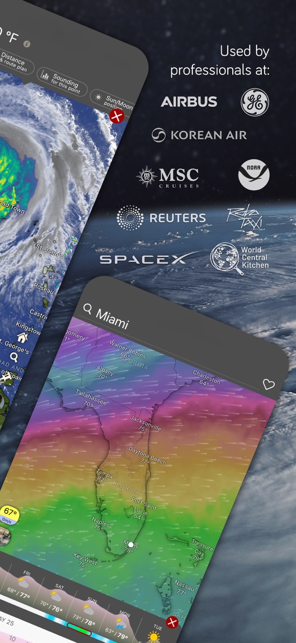
LIVE WEATHER APP - WEATHER RADAR & SATELLITE
(Now with Precipitation Type & Lightning tracker)
Radar is a highly valued tool for weather forecasting. To provide you with the most accurate radar imagery, we constantly expand our resources so that rain, snow, and storms don't catch you by surprise.
Trusted radar sources include NOAA, Met Office, Météo France, DWD, JMA, IMD, BoM & more.
The global satellite composite is created from NOAA, EUMETSAT & Himawari data.
MORE THAN 50 WEATHER MAPS
- Rain radar, Satellite and a unique combined layer of Radar & Satellite images (blue, infrared, visible)
- Hurricane tracker, Weather warnings & Extreme forecast
- Wind forecast: Wind speed, Wind gusts & Accumulation, models comparison, data from live Weather stations
- Temperature: Humidity, Pressure, Dew point, live data from Weather stations
- Rain: Thunder & storms, Rain accumulation, Thunderstorms, Precipitation type, CAPE-index
- Aviation: Clouds, Cloud tops, Cloud base, Visibility (LIFR, IFR, MVFR, VFR), Fog, Icing, Clear air turbulence, Thermals, Freezing altitude
- Marine Forecast: Waves, Swell, Wave power, Tide forecast, Currents, Sea temperature
- Solar activity: Solar power, UV index, Wet-bulb temperature
- Snow: Snow depth, New snow, Snow density
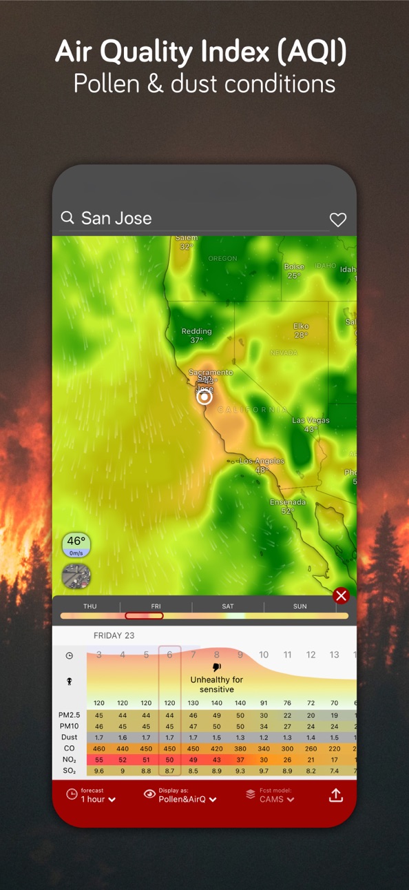
- Air Quality: Air Quality Index (AQI) with Pollen (CAMS), NO2, PM 2.5, Aerosol, SO2, Ozone layer, Surface ozone, CO concentration, Dust mass
- Soil moisture, Moisture anomaly, Drought intensity, Fire Danger, Fuel moisture
MORE THAN 15 WEATHER MODELS
Global weather models:
- meteoblue - AI forecast
- ECMWF
- GFS by NOAA
- ICON by DWD
Local weather models:
- HRRR by NOAA
- NAM by NOAA
- HRDPS by MSC
- ICON-EU by DWD
- ICON-D2 by DWD
- UKV by Met Office
- AROME-HD by Météo France
- ALADIN by CHMI
- NEMS by meteoblue
- MSM by JMA
- ACCESS-C by BoM
LIVE RAIN, STORM ALERTS & CUSTOM WEATHER ALERTS
Want to know before the storm hits near you while you hike, bike or spend time outdoors? You can now access live weather alerts or set up your custom weather alert for wind, sunshine, or new snow.
HURRICANE TRACKER FOR STORM TRACKING
With Windy's hurricane tracker, you can track the past and projected path of a hurricane or a storm. Windy doesn't rely on just one hurricane model, but will give you all the forecasts available for a storm or hurricane.
WINDY MADE FOR PILOTS
- 16 altitude levels from the surface to 13.5km/FL450
- 50k+ Airports searchable by ICAO and IATA, including runway info, decoded & raw METAR, TAF & NOTAMs
- Detailed Airgram and Meteogram: temperature and dew point, wind speed and wind gusts, pressure, precipitation, altitude cloud cover, freezing altitude
- Thermals forecast
- Route planner
WINDY MADE FOR OUTDOOR SPORTS, SURF & BOATING
- 67K+ global webcams
- Summer & winter outdoor topographic maps by Mapy.com
- 4.5K+ Surfing spots
- 12.1K+ Paragliding spots
- 4.3K+ Kiting spots
- Boating tide forecast
- Sun & Moon tracker
- Plugins with buoy data
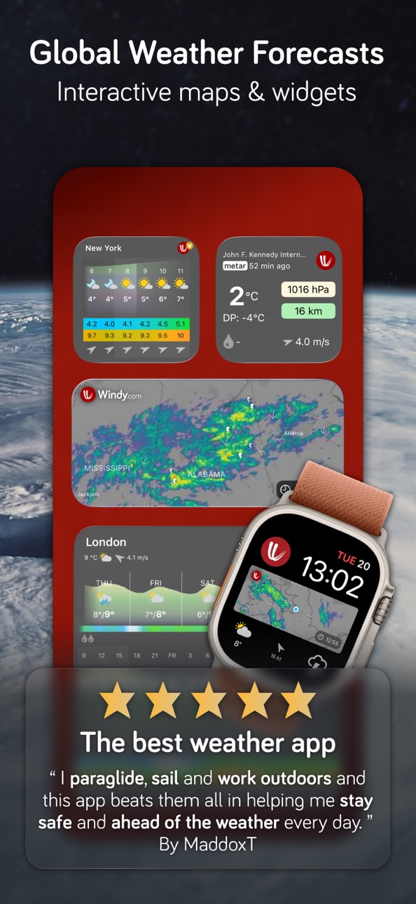
WINDY AS A WEATHER WIDGET ON YOUR DEVICE
Get the weather now on your iPhone, MacOS, iPad, CarPlay & Apple Watch, from forecast, Radar, METAR, Weather stations & Wind, ready for your travels and outdoor sports.
WINDY PREMIUM — FORECAST LIKE A PRO
- 1-hour & 15-day outlook with 4–6× daily updates
- Radar/Satellite 24h loops & 1-year archives
- More maps (Tide Forecast)
- Model comparison to find the best model
Terms of Use: https://account.windy.com/agreements/windy-terms-of-use
Privacy Policy: https://account.windy.com/agreements/windy-privacy-policy
GET IN TOUCH
Join us on social media or at community.windy.com to discuss weather-related topics, report bugs, or suggest a new feature. Contact us directly at info@windy.com.
In-App Purchases US pricing
Windy Premium Subscription
Subscription$29.99
Yearly$24.99
Monthly$2.99
Donate to keep us going Subscription
Donate 3 EUR/USD a month · Monthly$2.99
Donate 6 EUR/USD a month · Monthly$5.49
One-Time Purchases
Donate approx 5 EUR/USD$4.99
Donate approx 10 EUR/USD$9.99
Donate approx 20 EUR/USD$19.99
Donate approx 50 EUR/USD$49.99
Capabilities
In-App Purchases
Accessibility
ipadiphonemacrealityDevicetvoswatch
Version history 25 versions
Build 886849568v50.0101412026-06-15 11:24:27
- Live Alerts – Tropical Cyclones and CAP Alerts for current and chosen locations
- My Alerts – new AQI and Pollen types; view all active alerts in one list
- Layer description tooltips
- Wind Trajectories – last settings remembered on device
- Home button now respects your zoom preferences
- Tons of other fixes
Build 885510493v50.0100342026-06-10 08:27:59
- Live Alerts – Tropical Cyclones and CAP Alerts for current and chosen locations
- My Alerts – new AQI and Pollen types; view all active alerts in one list
- Layer description tooltips
- Wind Trajectories – last settings remembered on device
- Home button now respects your zoom preferences
- Tons of other fixes
Build 884288844v50.0002222026-05-11 06:56:25
- Avalanche Danger - new layer with official bulletins
- Wind Trajectories - new plugin for wind and wildfire smoke trajectories
- Passage Planner - new plugin with isochrone routing for sailors
- AROME forecast model now updates 8× a day (Windy Premium)
- Webcam playback up to 7× faster (Windy Premium)
- Sharper search and new geographic labels covering islands, peninsulas, and more
- New radars in Tenerife and Salamanca, Spain
- Tons of other fixes
Build 883507895v49.0101112026-03-24 07:59:49
• Faster, smoother performance powered by new Leaflet GL technology
• Windy Plugins now available on iPhone and iPad
• Expanded Airport POIs with enhanced METAR, TAF & NOTAM information
• Windy Premium: Faster Route Planner via ICAO/IATA search in the Search tab
• High-resolution local models added to widgets (iPhone, iPad, macOS, CarPlay)
• New precipitation type toggle in Settings
• Unified Dark Mode across the app, plus stability improvements and bug fixes
Build 882109794v49.0001012026-02-18 11:25:30
• Faster, smoother performance powered by new Leaflet GL technology
• Windy Plugins now available on iPhone and iPad
• Expanded Airport POIs with enhanced METAR, TAF & NOTAM information
• Windy Premium: Faster Route Planner via ICAO/IATA search in the Search tab
• High-resolution local models added to widgets (iPhone, iPad, macOS, CarPlay)
• New precipitation type toggle in Settings
• Unified Dark Mode across the app, plus stability improvements and bug fixes
Build 881914804v48.0102712026-02-03 09:56:44
- Precipitation type is included in the Weather Radar layer
- Wave energy metric is now available both as a new layer and in the detail of the forecast (Waves & Tides)
- Lightning strikes and Flow vectors are now visible on the Weather Radar and Satellite widgets
- Sun and Moon position for any place on the map
- Better weather radar coverage in India and newly added South Africa, Lesotho, Eswatini, Mauritius
- Faster forecast model switching is now available under the pin icon in the mobile version
- And tons of other improvements and bug fixes
Build 881425437v48.0100602026-01-28 05:58:01
- Precipitation type is included in the Weather Radar layer
- Wave energy metric is now available both as a new layer and in the detail of the forecast (Waves & Tides)
- Lightning strikes and Flow vectors are now visible on the Weather Radar and Satellite widgets
- Sun and Moon position for any place on the map
- Better weather radar coverage in India and newly added South Africa, Lesotho, Eswatini, Mauritius
- Faster forecast model switching is now available under the pin icon in the mobile version
- And tons of other improvements and bug fixes
Build 880777503v48.0005532026-01-12 08:11:11
- Precipitation type is included in the Weather Radar layer
- Wave energy metric is now available both as a new layer and in the detail of the forecast (Waves & Tides)
- Lightning strikes and Flow vectors are now visible on the Weather Radar and Satellite widgets
- Sun and Moon position for any place on the map
- Better weather radar coverage in India and newly added South Africa, Lesotho, Eswatini, Mauritius
- Faster forecast model switching is now available under the pin icon in the mobile version
- And tons of other improvements and bug fixes
Build 879551635v48.0004442025-12-17 17:52:21
- Precipitation type is included in the Weather Radar layer
- Wave energy metric is now available both as a new layer and in the detail of the forecast (Waves & Tides)
- Lightning strikes and Flow vectors are now visible on the Weather Radar and Satellite widgets
- Sun and Moon position for any place on the map
- Better weather radar coverage in India and newly added South Africa, Lesotho, Eswatini, Mauritius
- Faster forecast model switching is now available under the pin icon in the mobile version
- And tons of other improvements and bug fixes
Build 879392312v47.0201222025-11-03 08:13:21
- Pollen & Air Quality: Check air pollution levels directly in Point Forecast
- Satellite History (Premium): View satellite imagery up to 24h back (previously 12h)
- Search Bar Redesign: Faster, cleaner, and easier to use
- Radar+ & Satellite UI: Improved visuals and smoother interaction
- And tons of other improvements and bug fixes
Build 878757087v47.0201212025-10-30 08:53:47
- Pollen & Air Quality: Check air pollution levels directly in Point Forecast
- Satellite History (Premium): View satellite imagery up to 24h back (previously 12h)
- Search Bar Redesign: Faster, cleaner, and easier to use
- Radar+ & Satellite UI: Improved visuals and smoother interaction
- And tons of other improvements and bug fixes
Build 878235873v47.0104172025-10-06 09:26:04
- Pollen & Air Quality: Check air pollution levels directly in Point Forecast
- Satellite History (Premium): View satellite imagery up to 24h back (previously 12h)
- Search Bar Redesign: Faster, cleaner, and easier to use
- Radar+ & Satellite UI: Improved visuals and smoother interaction
- And tons of other improvements and bug fixes
Build 876971114v47.0103142025-09-18 07:21:48
- Pollen & Air Quality: Check air pollution levels directly in Point Forecast
- Satellite History (Premium): View satellite imagery up to 24h back (previously 12h)
- Search Bar Redesign: Faster, cleaner, and easier to use
- Radar+ & Satellite UI: Improved visuals and smoother interaction
- And tons of other improvements and bug fixes
Build 876071444v46.0100022025-08-04 07:10:25
- Storm Alerts: Get notified when lightning strikes near you
- Heavy Rain Alerts: Radar-based notifications for severe rain
- Weather Stations for WatchOS: Your favourites, now on your wrist
- Weather Station Widgets: Quick access to local conditions
- Radar Coverage Expansion: More regions now supported
- CAP Alerts included in Weather detail and Homepage
- Custom Dew Point Scale: Personalize colour scale for dew point
- Seamless Zoom: Smoother satellite and Radar+ transitions
- And tons of other improvements and bug fixes
Build 875560330v46.0004942025-06-19 14:05:55
- Storm Alerts: Get notified when lightning strikes near you
- Heavy Rain Alerts: Radar-based notifications for severe rain
- Weather Stations for WatchOS: Your favourites, now on your wrist
- Weather Station Widgets: Quick access to local conditions
- Radar Coverage Expansion: More regions now supported
- CAP Alerts included in Weather detail and Homepage
- Custom Dew Point Scale: Personalize colour scale for dew point
- Seamless Zoom: Smoother satellite and Radar+ transitions
- And tons of other improvements and bug fixes
Build 873490088v45.0103622025-04-15 13:02:03
- New premium App Icon
- A tons of fixes
Build 872996937v45.006552025-03-10 11:13:58
NEW
- VFR Airspace Map under Airports POI
- Easily migrate favorites to alerts
- Compare 15-day forecasts across models
IMPROVED
- Optimized Radar+ for better performance and lower memory usage
- View model elevation in forecast detail
- Hurricane Tracker layer in the menu
- Create alerts directly from webcams
- Set more elaborate thresholds for rain and snow alerts
- Faster Radar+ animation loading
- More notification settings for better customization
- Select soundings for favorite locations (desktop only)
FIXED
- Improved visibility of latitude/longitude grid
- Custom layer colors now update instantly after login
- Search now works with special characters and diacritics
- More accurate min/max temperature display on small
- Notifications now correctly open detailed views
- Soundings and radiosondes now open properly
Build 872001542v44.0103382025-01-26 07:36:44
New
- Enhanced 15-day ECMWF model
- Enhanced 15-day GFS model
- Hi-Res ACCESS-C model for Australia (1.5km resolution)
- Satellite extrapolation for 1-hour (in Radar+ layer)
- New Notification section for all alerts
- New GUI of favorite items
Improved
- Added visibility layer for ACCESS model
- An alert can be added without adding a favorite item
- Each favorite item allows multiple alerts
- An airport can be displayed on the map (in airport detail)
- Airports plugin now includes "nearest METARs"
- Added radar coverage in Tonga
Build 871916919v44.0103342025-01-23 09:30:46
New
- Enhanced 15-day ECMWF model
- Enhanced 15-day GFS model
- Hi-Res ACCESS-C model for Australia (1.5km resolution)
- Satellite extrapolation for 1-hour (in Radar+ layer)
- New Notification section for all alerts
- New GUI of favorite items
Improved
- Added visibility layer for ACCESS model
- An alert can be added without adding a favorite item
- Each favorite item allows multiple alerts
- An airport can be displayed on the map (in airport detail)
- Airports plugin now includes "nearest METARs"
- Added radar coverage in Tonga
Build 871319179v44.01.02312024-12-23 09:23:56
New
- Enhanced 15-day ECMWF model
- Enhanced 15-day GFS model
- Hi-Res ACCESS-C model for Australia (1.5km resolution)
- Satellite extrapolation for 1-hour (in Radar+ layer)
- New Notification section for all alerts
- New GUI of favorite items
Improved
- Added visibility layer for ACCESS model
- An alert can be added without adding a favorite item
- Each favorite item allows multiple alerts
- An airport can be displayed on the map (in airport detail)
- Airports plugin now includes "nearest METARs"
- Added radar coverage in Tonga
Build 871228636v44.01.0292024-12-18 18:10:12
New
- Enhanced 15-day ECMWF model
- Enhanced 15-day GFS model
- Hi-Res ACCESS-C model for Australia (1.5km resolution)
- Satellite extrapolation for 1-hour (in Radar+ layer)
- New Notification section for all alerts
- New GUI of favorite items
Improved
- Added visibility layer for ACCESS model
- An alert can be added without adding a favorite item
- Each favorite item allows multiple alerts
- An airport can be displayed on the map (in airport detail)
- Airports plugin now includes "nearest METARs"
- Added radar coverage in Tonga
Build 870786554v44.0000242024-12-05 07:51:53
New
- Enhanced 15-day ECMWF model
- Enhanced 15-day GFS model
- Hi-Res ACCESS-C model for Australia (1.5km resolution)
- Satellite extrapolation for 1-hour (in Radar+ layer)
- New Notification section for all alerts
- New GUI of favorite items
Improved
- Added visibility layer for ACCESS model
- An alert can be added without adding a favorite item
- Each favorite item allows multiple alerts
- An airport can be displayed on the map (in airport detail)
- Airports plugin now includes "nearest METARs"
- Added radar coverage in Tonga
Build 869430707v43.0004052024-10-16 16:50:08
- Extended 15-day forecast by AIFS
- New Radar+ layer
- New Street-Level Heat Maps by meteoblue
- New hi-res model HRDPS (Canada and northern US)
- New hi-res Aladin model from CHMI
Build 869133953v43.0003032024-09-20 05:12:43
- Extended 15-day forecast by AIFS
- New Radar+ layer
- New Street-Level Heat Maps by meteoblue
- New hi-res model HRDPS (Canada and northern US)
- New hi-res Aladin model from CHMI
Build 869092621v43.0003022024-09-18 19:23:23
- Extended 15-day forecast by AIFS
- New Radar+ layer
- New Street-Level Heat Maps by meteoblue
- New hi-res model HRDPS (Canada and northern US)
- New hi-res Aladin model from CHMI
Price history by region
Currency
Show
Columns
Search
Availability 1 of 1 storefronts
| Region | Language | Price | Ratings | Avg | Version |
|---|---|---|---|---|---|
| US | en-US | Free | 77.2k | 4.8 | 50.010141 |
Change log 29 changes · US
✎
releaseNotes updated
- Live Alerts – Tropical Cyclones and CAP Alerts for current and chosen locations
- My Alerts – new AQI and Pollen types; view all active alerts in one list
- L
✎
description updated
A UNIQUE WEATHER FORECAST VISUALISATION
While most weather forecasting apps rely solely on free global models, Windy has gone a step further by investing heavil
✎
subtitle updated
NOAA Weather Radar & Hurricane
✎
name updated
Windy.com
◆
Version 50.010141 released
- Live Alerts – Tropical Cyclones and CAP Alerts for current and chosen locations
- My Alerts – new AQI and Pollen types; view all active alerts in one list
- Layer description tooltips
- Wind Trajectories – last settings remembered on devi
◆
Version 50.010034 released
- Live Alerts – Tropical Cyclones and CAP Alerts for current and chosen locations
- My Alerts – new AQI and Pollen types; view all active alerts in one list
- Layer description tooltips
- Wind Trajectories – last settings remembered on devi
◆
Version 50.000222 released
- Avalanche Danger - new layer with official bulletins
- Wind Trajectories - new plugin for wind and wildfire smoke trajectories
- Passage Planner - new plugin with isochrone routing for sailors
- AROME forecast model now updates 8× a day (
◆
Version 49.010111 released
• Faster, smoother performance powered by new Leaflet GL technology
• Windy Plugins now available on iPhone and iPad
• Expanded Airport POIs with enhanced METAR, TAF & NOTAM information
• Windy Premium: Faster Route Planner via ICAO/IATA se
◆
Version 49.000101 released
• Faster, smoother performance powered by new Leaflet GL technology
• Windy Plugins now available on iPhone and iPad
• Expanded Airport POIs with enhanced METAR, TAF & NOTAM information
• Windy Premium: Faster Route Planner via ICAO/IATA se
◆
Version 48.010271 released
- Precipitation type is included in the Weather Radar layer
- Wave energy metric is now available both as a new layer and in the detail of the forecast (Waves & Tides)
- Lightning strikes and Flow vectors are now visible on the Weather Rada
◆
Version 48.010060 released
- Precipitation type is included in the Weather Radar layer
- Wave energy metric is now available both as a new layer and in the detail of the forecast (Waves & Tides)
- Lightning strikes and Flow vectors are now visible on the Weather Rada
◆
Version 48.000553 released
- Precipitation type is included in the Weather Radar layer
- Wave energy metric is now available both as a new layer and in the detail of the forecast (Waves & Tides)
- Lightning strikes and Flow vectors are now visible on the Weather Rada
◆
Version 48.000444 released
- Precipitation type is included in the Weather Radar layer
- Wave energy metric is now available both as a new layer and in the detail of the forecast (Waves & Tides)
- Lightning strikes and Flow vectors are now visible on the Weather Rada
◆
Version 47.020122 released
- Pollen & Air Quality: Check air pollution levels directly in Point Forecast
- Satellite History (Premium): View satellite imagery up to 24h back (previously 12h)
- Search Bar Redesign: Faster, cleaner, and easier to use
- Radar+ & Satelli
◆
Version 47.020121 released
- Pollen & Air Quality: Check air pollution levels directly in Point Forecast
- Satellite History (Premium): View satellite imagery up to 24h back (previously 12h)
- Search Bar Redesign: Faster, cleaner, and easier to use
- Radar+ & Satelli
◆
Version 47.010417 released
- Pollen & Air Quality: Check air pollution levels directly in Point Forecast
- Satellite History (Premium): View satellite imagery up to 24h back (previously 12h)
- Search Bar Redesign: Faster, cleaner, and easier to use
- Radar+ & Satell
◆
Version 47.010314 released
- Pollen & Air Quality: Check air pollution levels directly in Point Forecast
- Satellite History (Premium): View satellite imagery up to 24h back (previously 12h)
- Search Bar Redesign: Faster, cleaner, and easier to use
- Radar+ & Satelli
◆
Version 46.010002 released
- Storm Alerts: Get notified when lightning strikes near you
- Heavy Rain Alerts: Radar-based notifications for severe rain
- Weather Stations for WatchOS: Your favourites, now on your wrist
- Weather Station Widgets: Quick access to local
◆
Version 46.000494 released
- Storm Alerts: Get notified when lightning strikes near you
- Heavy Rain Alerts: Radar-based notifications for severe rain
- Weather Stations for WatchOS: Your favourites, now on your wrist
- Weather Station Widgets: Quick access to local
◆
Version 45.010362 released
- New premium App Icon
- A tons of fixes
◆
Version 45.00655 released
NEW
- VFR Airspace Map under Airports POI
- Easily migrate favorites to alerts
- Compare 15-day forecasts across models
IMPROVED
- Optimized Radar+ for better performance and lower memory usage
- View model elevation in forecast detail
-
◆
Version 44.010338 released
New
- Enhanced 15-day ECMWF model
- Enhanced 15-day GFS model
- Hi-Res ACCESS-C model for Australia (1.5km resolution)
- Satellite extrapolation for 1-hour (in Radar+ layer)
- New Notification section for all alerts
- New GUI of favori
◆
Version 44.010334 released
New
- Enhanced 15-day ECMWF model
- Enhanced 15-day GFS model
- Hi-Res ACCESS-C model for Australia (1.5km resolution)
- Satellite extrapolation for 1-hour (in Radar+ layer)
- New Notification section for all alerts
- New GUI of favori
◆
Version 44.01.0231 released
New
- Enhanced 15-day ECMWF model
- Enhanced 15-day GFS model
- Hi-Res ACCESS-C model for Australia (1.5km resolution)
- Satellite extrapolation for 1-hour (in Radar+ layer)
- New Notification section for all alerts
- New GUI of favori
◆
Version 44.01.029 released
New
- Enhanced 15-day ECMWF model
- Enhanced 15-day GFS model
- Hi-Res ACCESS-C model for Australia (1.5km resolution)
- Satellite extrapolation for 1-hour (in Radar+ layer)
- New Notification section for all alerts
- New GUI of favori
◆
Version 44.000024 released
New
- Enhanced 15-day ECMWF model
- Enhanced 15-day GFS model
- Hi-Res ACCESS-C model for Australia (1.5km resolution)
- Satellite extrapolation for 1-hour (in Radar+ layer)
- New Notification section for all alerts
- New GUI of favori
◆
Version 43.000405 released
- Extended 15-day forecast by AIFS
- New Radar+ layer
- New Street-Level Heat Maps by meteoblue
- New hi-res model HRDPS (Canada and northern US)
- New hi-res Aladin model from CHMI
◆
Version 43.000303 released
- Extended 15-day forecast by AIFS
- New Radar+ layer
- New Street-Level Heat Maps by meteoblue
- New hi-res model HRDPS (Canada and northern US)
- New hi-res Aladin model from CHMI
◆
Version 43.000302 released
- Extended 15-day forecast by AIFS
- New Radar+ layer
- New Street-Level Heat Maps by meteoblue
- New hi-res model HRDPS (Canada and northern US)
- New hi-res Aladin model from CHMI