Home › Reference

 US
US
1 of 1 storefronts
Content in en-US
Content in en-US
Information
Preview 2 platforms
iPhone 7 images


iPad 8 images





What’s New Version 6.5
Fixed pin location error for irregular shaped polygons.
Description
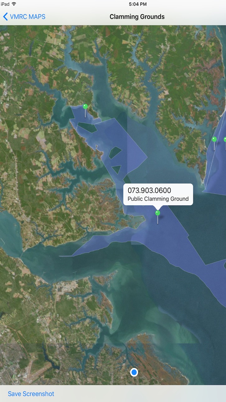
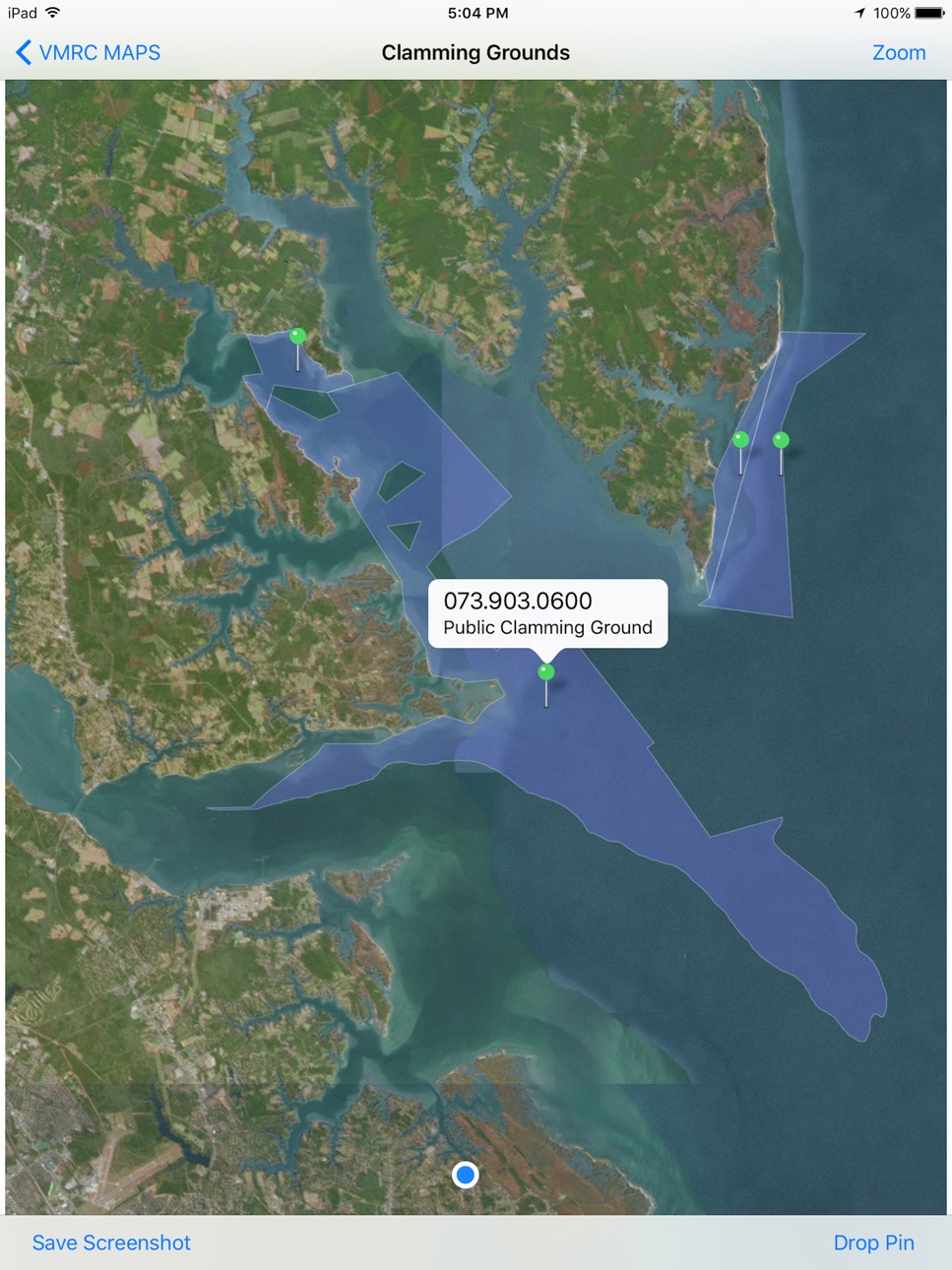
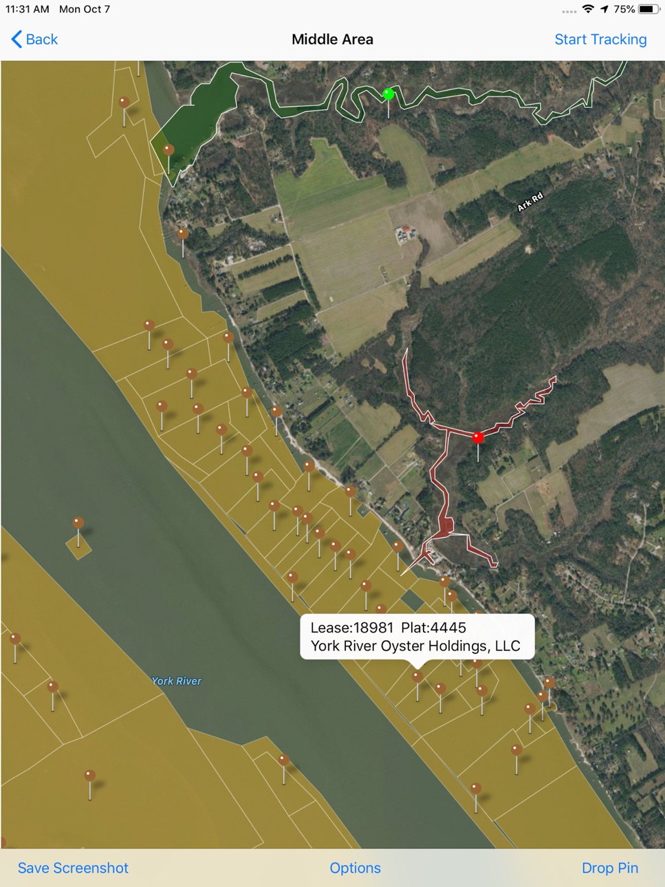
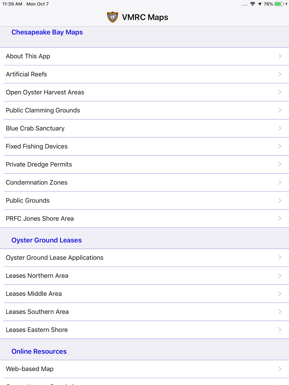
This app is intended to be used as an aid in locating your position relative to the areas displayed on the map. Mapped areas include private oyster ground leases, oyster ground applications, fixed fishing devices, public clamming grounds, and the blue crab sanctuary. The accuracy of your reported location on the map varies due to many factors, but it is generally expected to locate your position within 50 feet of your actual location (for gps equipped devices). This app will work without a cellular or wireless connection. When your device is connected to a network, the app will download our map data every five days to ensure your maps are relatively current even without a network connection; if your phone does have an active network connection the app will use the most current map data we have posted.
As with all Commission GIS data this standard disclaimer applies: this GIS data is not guaranteed to be accurate and complete at any given time. It is the individual's responsibility to adhere to all regulations while harvesting and navigating with the aid of this app. Not all areas such as navigable channels, restricted buffer zones or condemnation zones may appear on the map you are viewing. Although it is expected that the data will be used for regulatory and permitting processes, any user of this data should verify their use of the data with Marine Resources Commission and/or VDH Division of Shellfish Sanitation staff before taking action or otherwise using the data to make decisions, particularly when related to regulatory and permitting processes, or any other legal action. Note that the use of data pins to provide simple feature attribute data can, for some features be difficult to interpret, please use the Web-based map in this app under Online Resources or the VMRC Chesapeake Bay map (https://webapps.mrc.virginia.gov/public/maps/chesapeakebay_map.php) to see more specific data related to the GIS layers presented by this app.
Accessibility
ipadiphonemacrealityDevicetvoswatch
Version history 25 versions
Build 886948975v6.52026-06-14 23:22:47
Fixed pin location error for irregular shaped polygons.
Build 879312810v6.42025-10-29 18:28:52
Minor bug fixes.
Build 878671324v6.32025-10-06 20:41:23
Gill Net Management Areas and PRFC Management Areas.
Build 878546098v6.22025-10-01 01:35:33
minor bug fixes
Build 878465396v6.12025-09-29 07:08:23
PRFC Management Areas was expanded to include the entire Potomac River.
Build 876784087v6.02025-07-29 09:49:49
Sturgeon Bycatch Reduction Areas was added. Little Creek Restricted Areas was renamed to Restricted Areas and will include additional restricted areas in the future.
Build 871536047v5.02025-01-14 09:49:37
Added Harvest Reporting Areas to aid commercial harvesters with identifying correct waterbody reporting codes for mandatory reporting. Added VDH growing areas to aid in shellfish reporting. Fixed minor bugs.
Build 871525222v4.92025-01-04 00:43:04
Added Harvest Reporting Areas to aid commercial harvesters with identifying correct waterbody reporting codes for mandatory reporting. Added VDH growing areas to aid in shellfish reporting. Fixed minor bugs.
Build 871485754v4.82025-01-02 17:26:28
Mandatory Harvest Reporting Areas map layer has been added. Helps to determine correct waterbody to report for your commercial harvest in Virginia. Also added Virginia Department of Health (VDH) Growing Areas to identify shellfish harvest locations.
Build 868191027v4.72024-08-14 16:34:51
Added the Hampton Roads Management Area.
Build 852865289v4.62022-10-19 22:06:36
Added new map layer for Underwater Exploration Exclusions zones.
Build 845749691v4.52021-12-06 19:05:50
Added Virginia Beach Shrimp Trawl Harvest Area.
Build 844388785v4.42021-09-29 20:29:41
The Jones Shore Management Area in the Potomac River has new seasons for 2021-22.
Build 834368660v4.32020-01-15 21:18:19
minor bug fixes
Build 833082806v4.22019-10-09 02:45:24
minor bug fixes
Build 833063834v4.12019-10-08 16:51:02
minor bug fixes
Build 828901933v4.02018-10-12 16:16:18
Increased compatibility to all devices running iOS 10 or higher. New in this version is the Potomac River Fisheries Commission (PRFC) Jones Shore Management Area and Virginia's Public Oyster Grounds map overlays. The condemnation zone data is provided by the Virginia Department of Health, Division of Shellfish Sanitation.
Build 828813542v3.92018-10-05 14:50:51
New in this version is the Potomac River Fisheries Commission (PRFC) Jones Shore Management Area and Virginia's Public Oyster Grounds map overlays. The condemnation zone data is provided by the Virginia Department of Health, Division of Shellfish Sanitation.
Build 823930103v3.72017-10-07 01:07:20
When tracking is enabled, map orientation will change as the user's heading changes. Also, user now will be able to adjust zoom level while tracking. The condemnation zone data is provided by the Virginia Department of Health, Division of Shellfish Sanitation.
Build 823849977v3.62017-09-29 20:28:06
Minor bug fixes for iOS 11. Ability to switch between magnetic heading and true heading. The condemnation zone data is provided by the Virginia Department of Health, Division of Shellfish Sanitation.
Build 823779051v3.52017-09-25 18:47:22
Maps will load faster. Added App Options screen to set preferred map type and download map overlays on demand. The condemnation zone data is provided by the Virginia Department of Health, Division of Shellfish Sanitation.
Build 823701519v3.42017-09-19 00:28:36
You can now track your location on the new Condemnation Zone Map. The condemnation zone data is generously provided by the Virginia Department of Health, Division of Shellfish Sanitation.
Build 821988639v3.32017-05-02 22:28:43
Private grounds dredge permits map has been added. Speed and heading are now easier to read.
Build 821582108v3.22017-04-03 19:26:07
Speed and heading has been added to the maps.
Build 821167267v3.12017-03-03 17:25:30
Updated About This App screen.
No pricing data captured yet — comparisons appear once the app has paid storefronts or in-app purchases.
Availability 1 of 1 storefronts
| Region | Language | Price | Ratings | Avg | Version |
|---|---|---|---|---|---|
| US | en-US | Free | 11 | 4.6 | 6.5 |
Change log 29 changes · US
✎
releaseNotes updated
Fixed pin location error for irregular shaped polygons.
✎
description updated
This app is intended to be used as an aid in locating your position relative to the areas displayed on the map. Mapped areas include private oyster ground lease
✎
subtitle updated
Chesapeake Bay
✎
name updated
VMRC Maps
◆
Version 6.5 released
Fixed pin location error for irregular shaped polygons.
◆
Version 6.4 released
Minor bug fixes.
◆
Version 6.3 released
Gill Net Management Areas and PRFC Management Areas.
◆
Version 6.2 released
minor bug fixes
◆
Version 6.1 released
PRFC Management Areas was expanded to include the entire Potomac River.
◆
Version 6.0 released
Sturgeon Bycatch Reduction Areas was added. Little Creek Restricted Areas was renamed to Restricted Areas and will include additional restricted areas in the future.
◆
Version 5.0 released
Added Harvest Reporting Areas to aid commercial harvesters with identifying correct waterbody reporting codes for mandatory reporting. Added VDH growing areas to aid in shellfish reporting. Fixed minor bugs.
◆
Version 4.9 released
Added Harvest Reporting Areas to aid commercial harvesters with identifying correct waterbody reporting codes for mandatory reporting. Added VDH growing areas to aid in shellfish reporting. Fixed minor bugs.
◆
Version 4.8 released
Mandatory Harvest Reporting Areas map layer has been added. Helps to determine correct waterbody to report for your commercial harvest in Virginia. Also added Virginia Department of Health (VDH) Growing Areas to identify shellfish harvest
◆
Version 4.7 released
Added the Hampton Roads Management Area.
◆
Version 4.6 released
Added new map layer for Underwater Exploration Exclusions zones.
◆
Version 4.5 released
Added Virginia Beach Shrimp Trawl Harvest Area.
◆
Version 4.4 released
The Jones Shore Management Area in the Potomac River has new seasons for 2021-22.
◆
Version 4.3 released
minor bug fixes
◆
Version 4.2 released
minor bug fixes
◆
Version 4.1 released
minor bug fixes
◆
Version 4.0 released
Increased compatibility to all devices running iOS 10 or higher. New in this version is the Potomac River Fisheries Commission (PRFC) Jones Shore Management Area and Virginia's Public Oyster Grounds map overlays. The condemnation zone data
◆
Version 3.9 released
New in this version is the Potomac River Fisheries Commission (PRFC) Jones Shore Management Area and Virginia's Public Oyster Grounds map overlays. The condemnation zone data is provided by the Virginia Department of Health, Division of Sh
◆
Version 3.7 released
When tracking is enabled, map orientation will change as the user's heading changes. Also, user now will be able to adjust zoom level while tracking. The condemnation zone data is provided by the Virginia Department of Health, Division of
◆
Version 3.6 released
Minor bug fixes for iOS 11. Ability to switch between magnetic heading and true heading. The condemnation zone data is provided by the Virginia Department of Health, Division of Shellfish Sanitation.
◆
Version 3.5 released
Maps will load faster. Added App Options screen to set preferred map type and download map overlays on demand. The condemnation zone data is provided by the Virginia Department of Health, Division of Shellfish Sanitation.
◆
Version 3.4 released
You can now track your location on the new Condemnation Zone Map. The condemnation zone data is generously provided by the Virginia Department of Health, Division of Shellfish Sanitation.
◆
Version 3.3 released
Private grounds dredge permits map has been added. Speed and heading are now easier to read.
◆
Version 3.2 released
Speed and heading has been added to the maps.
◆
Version 3.1 released
Updated About This App screen.