Home › Utilities

 US
US
1 of 1 storefronts
Content in en-US
Content in en-US
Information
Preview 2 platforms
iPhone 5 images


iPad 5 images


What’s New Version 2.22
- Bug Fix
Description
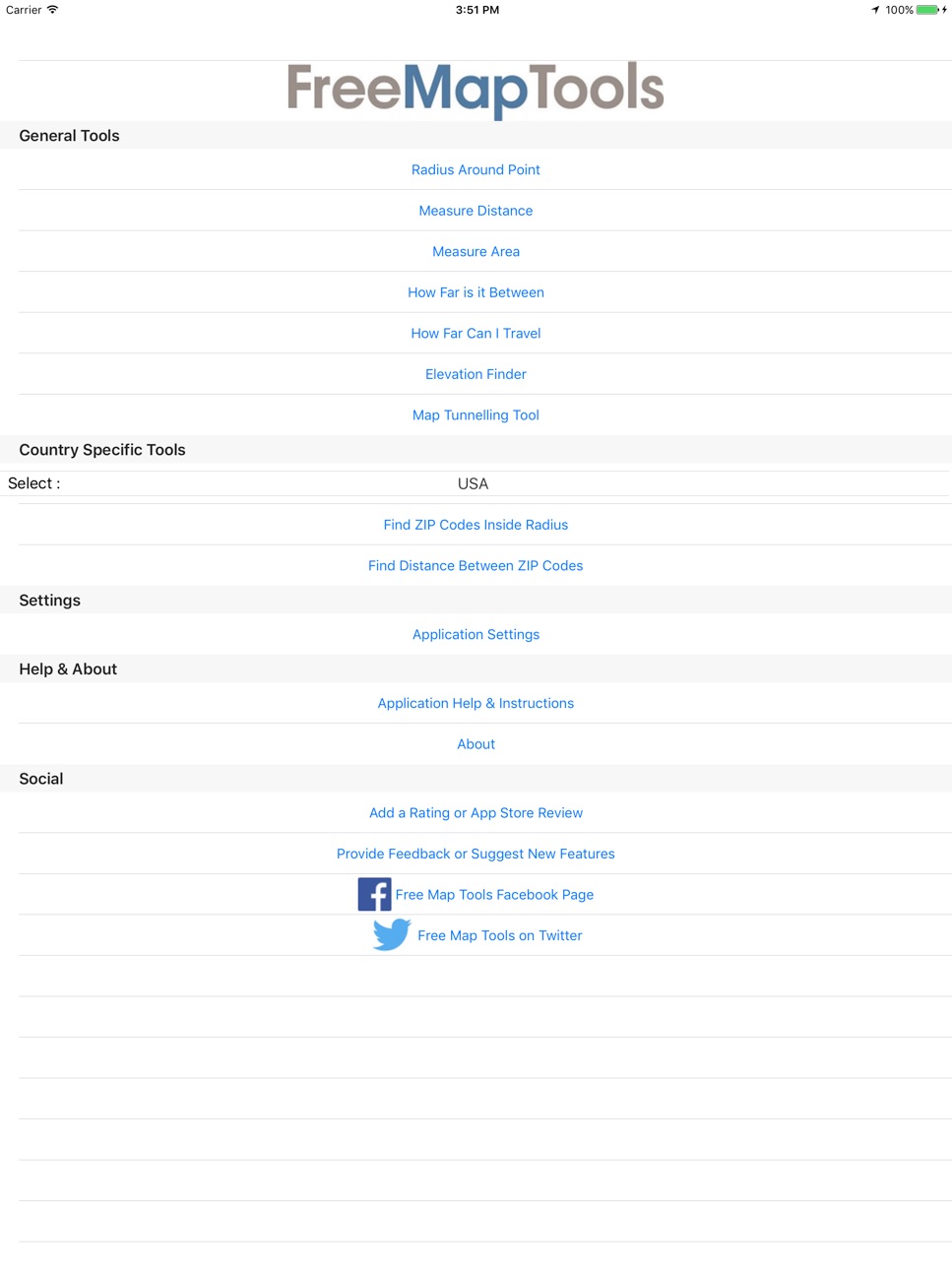
Free Map Tools is a collection of tools based on maps. These tools allow you to perform various functions for a wide range of applications. You can measure distances and areas. You can also send or share the map as an image to indicate the area, route or radius you have plotted.
The Radius Around Point tool lets you plot a distance radius on a map. You specify the centre point, the radius and other features such as colour. You can then visualise the radius to see the area covered.
The Measure Distance tool lets you plot a route on a map and find out the distance covered in various units. It also uses your GPS sensor to plot the route automatically.
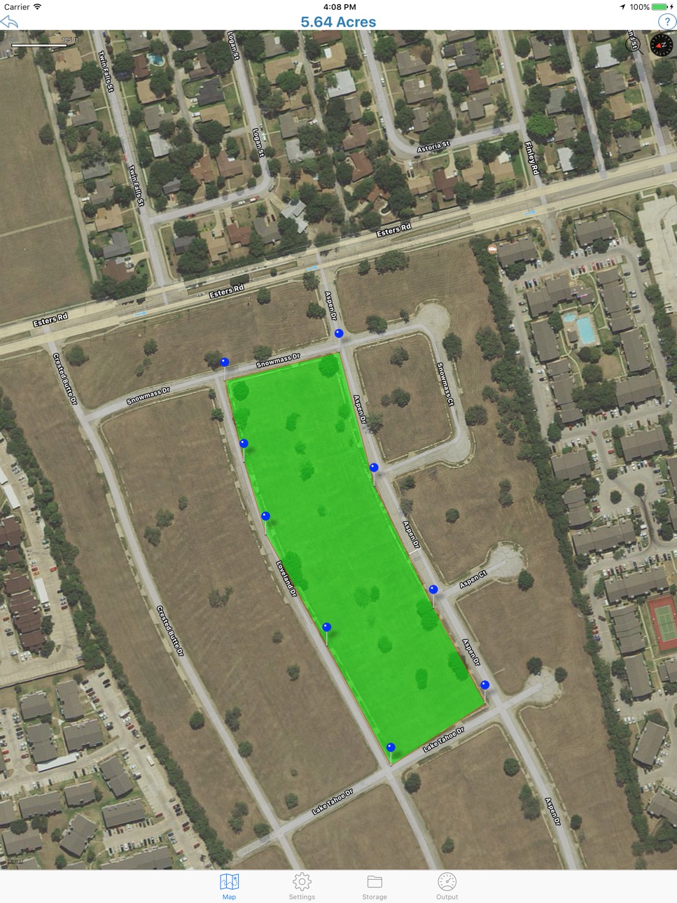
The Area Calculator Tool lets you draw an area on the map and find the measurement of the area enclosed.
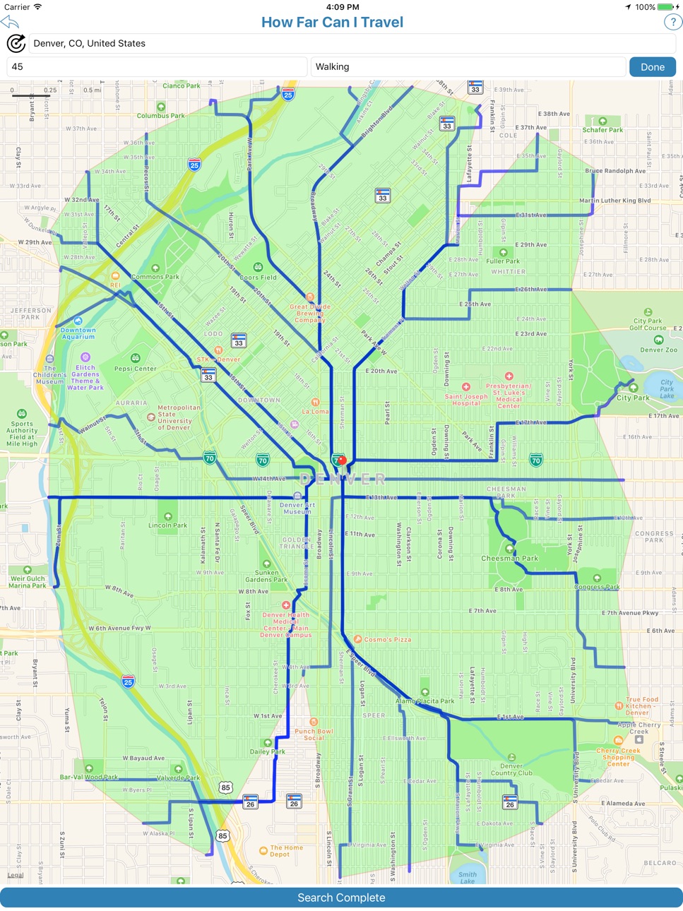
The Find How Far I Can Travel tool will show how far you can drive or walk within a set time. For example, how far can I get if I drive for 60 minutes from my current location.
How Far is it Between allows you to find the road and crow-flies distance between 2 addresses. It also shows both routes on the map.
The Map Tunnelling Tool allows you to find out where on the globe your antipodal point is. You can also find the antipode of any custom location.
Country Specific Tools
———————————————-
For the following countries:
∙USA
∙UK
You can use the following tools:
∙The zip/postcodes found inside a radius
∙The distance between two zip/postcodes
Accessibility
ipadiphonemacrealityDevicetvoswatch
Version history 25 versions
Build 876238346v2.222025-07-09 08:34:17
- Bug Fix
Build 876013006v2.212025-07-01 08:58:03
UI Updates
Build 875983313v2.202025-06-30 08:47:42
UI Updates
Build 862728388v2.192024-01-08 00:10:20
Bug fix for crash on How Far Is It Between Page
Build 862697998v2.182024-01-05 16:24:37
- Bug Fixes
Build 839780095v2.172021-01-01 07:05:38
Bug Fixes
Build 836822625v2.162020-07-21 01:37:45
Bug Fix : Issue with display on some picker controls
Build 836086315v2.152020-05-25 09:25:40
- UI Updates
- Bug Fixes
Build 836016059v2.142020-05-21 09:48:54
Bug fixes on the settings screen
UI Updates
Build 836006085v2.132020-05-18 18:23:13
- Bug Fix : Crash when typing name for saving (fixed)
- Updates to the sizing of pages for the tools
Build 835957064v2.122020-05-16 13:13:26
Support for iOS 13
Build 829183788v2.112018-11-07 18:02:59
Bug Fixes
Build 827842606v2.102018-07-12 00:43:58
- Due to an increase in back-end service charges, we can no longer offer the Elevation Finder tool on Free Map Tools iOS app. It will be available (for now) on the Pro Map Tools app
- Bug Fixes
Build 824216954v2.92017-10-31 22:22:12
- New Tool - Draw on Map - Draw and mark-up a map quickly to remember or highlight a location. This can then be shared with others
- UI Updates
- Bug Fixes
Build 824107515v2.82017-10-22 20:19:38
- Bug Fixes
- Performance Improvements
Build 823949963v2.72017-10-09 19:38:40
- Bug Fixes
Build 823908776v2.62017-10-08 17:56:42
- Added country specific options for Australia
- Bug Fixes
Build 823189635v2.52017-08-05 18:29:48
- Bug Fixes
Build 822923126v2.42017-07-17 21:01:57
- New option to export a KML file from Measure Distance and Measure Area tools
- New option to export a GPX file from Measure Distance tool
- Performance Improvements
Build 822788501v2.32017-07-05 13:30:37
- Feet added as a unit for Radius Around Point
- General Bug Fixes
Build 821610963v2.12017-06-27 13:42:22
New application setting to allow elevation units to be set and stored
Feet added as a unit of distance
Bug Fix - Loading old radius data caused a crash
Build 821465129v2.02017-03-28 00:09:45
New Tool - How Far Can I Travel - For example show how far you can drive or walk within a set time. For example, how far can I get if I drive for 60 minutes from my current location.
Main Menu Options Rearranged so the most used tools are listed first
Radius Around Point Tool now uses geodesic paths to produce more realistic results with large scale radius
Search for location icon on map no longer appears on top of compass icon
Bug Fixes to Elevation Finder Tool
Updates to help content
Build 821133421v1.212017-03-01 20:19:49
- Address autocomplete enabled for various tools
- Address search enabled on Measure Distance and Measure Area tools from the map
- Bug Fixes
Build 821056614v1.202017-02-23 18:26:21
New Country Specific Tools:
- Find Postcodes / ZIP codes inside radius
- Find Distance between Postcodes / ZIP codes
Currently available for UK and USA but more countries to follow soon.
Build 820799173v1.192017-02-03 22:45:42
• Bug Fixes
• Updates to UI
No pricing data captured yet — comparisons appear once the app has paid storefronts or in-app purchases.
Availability 1 of 1 storefronts
| Region | Language | Price | Ratings | Avg | Version |
|---|---|---|---|---|---|
| US | en-US | Free | 61 | 4.0 | 2.22 |
Change log 29 changes · US
✎
releaseNotes updated
- Bug Fix
✎
description updated
Free Map Tools is a collection of tools based on maps. These tools allow you to perform various functions for a wide range of applications. You can measure dist
✎
subtitle updated
Measure Area, Distance & More
✎
name updated
Free Map Tools
◆
Version 2.22 released
- Bug Fix
◆
Version 2.21 released
UI Updates
◆
Version 2.20 released
UI Updates
◆
Version 2.19 released
Bug fix for crash on How Far Is It Between Page
◆
Version 2.18 released
- Bug Fixes
◆
Version 2.17 released
Bug Fixes
◆
Version 2.16 released
Bug Fix : Issue with display on some picker controls
◆
Version 2.15 released
- UI Updates
- Bug Fixes
◆
Version 2.14 released
Bug fixes on the settings screen
UI Updates
◆
Version 2.13 released
- Bug Fix : Crash when typing name for saving (fixed)
- Updates to the sizing of pages for the tools
◆
Version 2.12 released
Support for iOS 13
◆
Version 2.11 released
Bug Fixes
◆
Version 2.10 released
- Due to an increase in back-end service charges, we can no longer offer the Elevation Finder tool on Free Map Tools iOS app. It will be available (for now) on the Pro Map Tools app
- Bug Fixes
◆
Version 2.9 released
- New Tool - Draw on Map - Draw and mark-up a map quickly to remember or highlight a location. This can then be shared with others
- UI Updates
- Bug Fixes
◆
Version 2.8 released
- Bug Fixes
- Performance Improvements
◆
Version 2.7 released
- Bug Fixes
◆
Version 2.6 released
- Added country specific options for Australia
- Bug Fixes
◆
Version 2.5 released
- Bug Fixes
◆
Version 2.4 released
- New option to export a KML file from Measure Distance and Measure Area tools
- New option to export a GPX file from Measure Distance tool
- Performance Improvements
◆
Version 2.3 released
- Feet added as a unit for Radius Around Point
- General Bug Fixes
◆
Version 2.1 released
New application setting to allow elevation units to be set and stored
Feet added as a unit of distance
Bug Fix - Loading old radius data caused a crash
◆
Version 2.0 released
New Tool - How Far Can I Travel - For example show how far you can drive or walk within a set time. For example, how far can I get if I drive for 60 minutes from my current location.
Main Menu Options Rearranged so the most used tools are
◆
Version 1.21 released
- Address autocomplete enabled for various tools
- Address search enabled on Measure Distance and Measure Area tools from the map
- Bug Fixes
◆
Version 1.20 released
New Country Specific Tools:
- Find Postcodes / ZIP codes inside radius
- Find Distance between Postcodes / ZIP codes
Currently available for UK and USA but more countries to follow soon.
◆
Version 1.19 released
• Bug Fixes
• Updates to UI